View on map
© MapLibre | OpenStreetMap contributors
1%
2%
4%
6%
8%
10%
12%
15%
20%

San Nicolas de Bujaruelo from Torla

0 reviews | Elevation profile | 3 photos
This climb is partly on a gravel surface, but can be ridden with a road bike.
Tips nearby
San Nicolas de Bujaruelo from Torla
transparant thumb
transparant thumb
transparant thumb
transparant thumb
transparant thumb
Your achievable time
Calculating based on your best performances...
Relaxed
Maximum
W/kg
W/kg
W/kg
Analyze your climbing performance
Detailed insight into your climbing performance & automatically check off climbs
Based on your best performances.
Your best attempt:
Number of attempts:
Elevation profile San Nicolas de Bujaruelo from Torla
paved
gravel
paved
gravel

Statistics

Difficulty points 262
Length 5.2 mi
Average gradient 4%
Steepest segment 11.7%
Total ascent 1106 ft

Short recap

Gravel
#88 toughest climb of Aragon
Feedback about this climb?
Show climbs nearby Export to GPS device

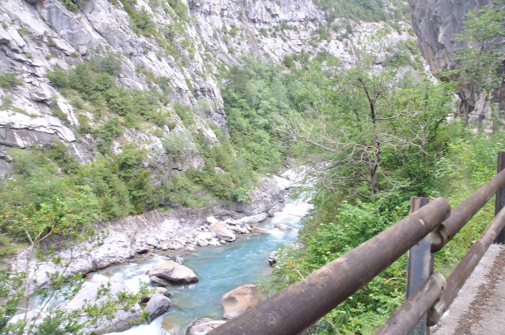
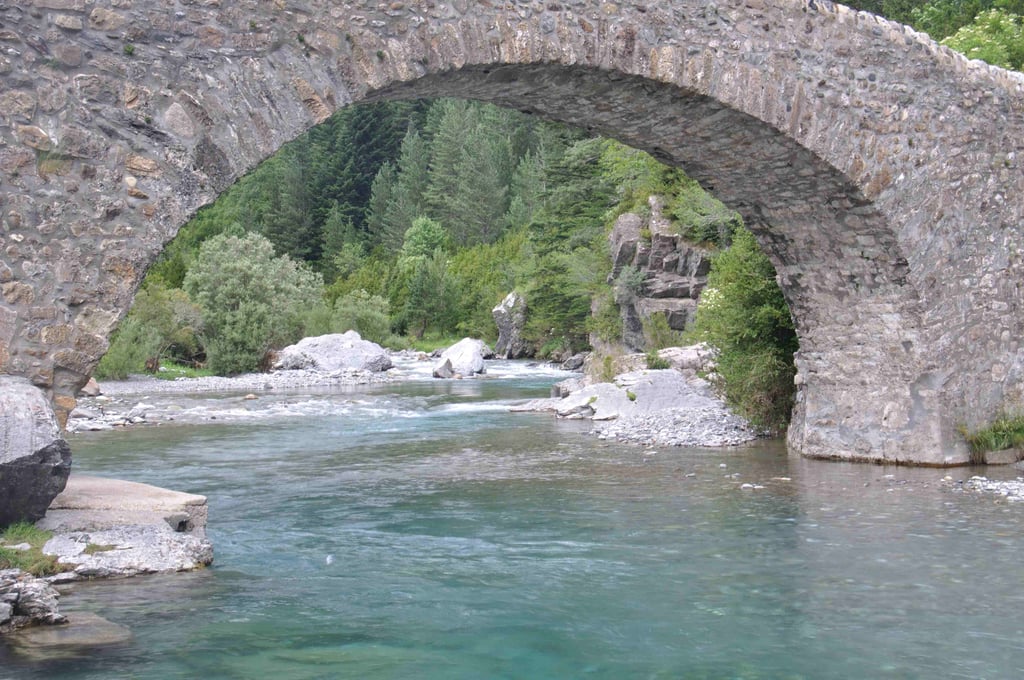
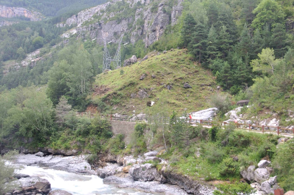
San Nicolas de Bujaruelo from Torla is a climb in the region Spanish Pyrenees. It is 5.2 mi long and bridges 1106 ft of vertical ascent with an average gradient of 4%, resulting in a difficulty score of 262. The top of the ascent is located at 4432 ft above sea level. Climbfinder users shared 0 reviews of this climb and uploaded 3 photos.

Road names: Carretera de Ordesa, Puente de los Navarros, Camino Valle de Bujaruelo & Puente de Santa Elena

Photos (3)

San Nicolas de Bujaruelo from Torla
transparant thumb
transparant thumb
transparant thumb

Your uploads (max 4)

Welcome! Please activate your account if you would like to share something. Look for the verification email in your inbox.

If you want to upload your photos, you need to create an account. It only takes 1 minute and it's completely free.

  • Receive free climbfinder goodies for your reviews & photos.
  • Create a bucket list and check off conquered climbs.
  • Add missing climbs.
Continue with GoogleContinue with Google Continue with FacebookContinue with Facebook Continue with AppleContinue with Apple Sign up with email
By signing up you agree to our terms of service and confirm that you have read our privacy & content policy.

Reviews (0)

5.0
4.0
3.0
2.0
1.0

Climbing times

5 mph 01:02:45
7 mph 00:44:25
9 mph 00:34:37
12 mph 00:26:00

Road surface condition

0% 0% 0%
Based on 0 votes
Share your knowledge. What was the road condition during your ascent?

Traffic

0% 0% 0%
Based on 0 votes
Your experience counts. How much traffic did you encounter during the climb?

Frequently Asked Questions

You don't need special gearing for San Nicolas de Bujaruelo from Torla. The slope isn't long or steep enough to require much shifting down. You can conquer this climb on power alone. However, a compact gearing system with a smallest front chainring of 34 and largest rear sprocket of 28 or 30 is always nice if you enjoy cycling uphill. This helps maintain a smooth cadence.

San Nicolas de Bujaruelo from Torla is a 3rd-category climb. Almost anyone can handle this climb, as long as you have a bike with climbing gears. If you have little training, you will probably need to shift down significantly. For experienced riders, San Nicolas de Bujaruelo from Torla is not a problem.

San Nicolas de Bujaruelo from Torla is 5.2 mi long.

The average gradient of San Nicolas de Bujaruelo from Torla is 4%.

San Nicolas de Bujaruelo from Torla has a steepest segment with an average gradient of 11.7%.

The summit of San Nicolas de Bujaruelo from Torla is at 4432 ft.

At a slow pace of 5 mph, it takes about 01:02:45 to climb San Nicolas de Bujaruelo from Torla. At 7 mph the time is 00:44:25, and at 9 mph 00:34:37. For the fastest cyclists, 00:26:00 is an achievable time.

San Nicolas de Bujaruelo from Torla is located in the region Aragon in Spain.

This page is better in the app

Climbfinder app
Climbfinder
(Free)
Open