View on map
© MapLibre | OpenStreetMap contributors
1%
2%
4%
6%
8%
10%
12%
15%
20%

Saint Sauveur from Saint André d'Embrun

4.0
1 review/story | Elevation profile | 5 photos
In some places the road surface of this climb is bad, but it can be ridden with a road bike.
Tips nearby
Saint Sauveur from Saint André d'Embrun
transparant thumb
transparant thumb
transparant thumb
Your achievable time
Calculating based on your best performances...
Relaxed
Maximum
W/kg
W/kg
W/kg
Analyze your climbing performance
Detailed insight into your climbing performance & automatically check off climbs
Based on your best performances.
Your best attempt:
Number of attempts:
Elevation profile Saint Sauveur from Saint André d'Embrun
paved
bad road

Statistics

Difficulty points 230
Length 5.7 mi
Average gradient 3.8%
Steepest segment 10.4%
Total ascent 1138 ft

Short recap

Beautiful scenery
Hidden gem
6 hairpin turns
Bad road
#100 most elevation gain of Serre Ponçon
#53 longest climb of Hautes Alpes
Feedback about this climb?
Show climbs nearby Export to GPS device

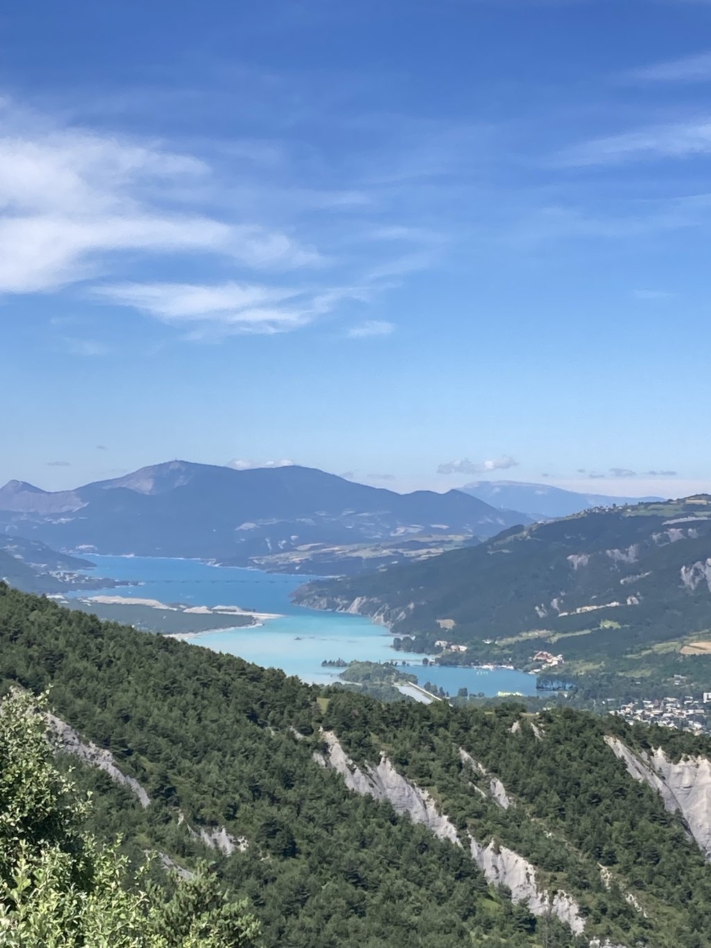
Saint Sauveur from Saint André d'Embrun is a climb in the region Serre Ponçon. It is 5.7 mi long and bridges 1138 ft of vertical ascent with an average gradient of 3.8%, resulting in a difficulty score of 230. The top of the ascent is located at 3986 ft above sea level. Climbfinder users shared 1 review/story of this climb and uploaded 5 photos.

Road names: D39 & D39a

4.0 by aaabbb
This is an automatic translation, the original language is: French.
Clearly worth the effort. There are several sections with views everywhere, including a river crossing. Watch out for blind bends on the descent.... read more

Photos (5)

Saint Sauveur from Saint André d'Embrun
transparant thumb

Your uploads (max 4)

Welcome! Please activate your account if you would like to share something. Look for the verification email in your inbox.

If you want to upload your photos, you need to create an account. It only takes 1 minute and it's completely free.

  • Receive free climbfinder goodies for your reviews & photos.
  • Create a bucket list and check off conquered climbs.
  • Add missing climbs.
Continue with GoogleContinue with Google Continue with FacebookContinue with Facebook Continue with AppleContinue with Apple Sign up with email
By signing up you agree to our terms of service and confirm that you have read our privacy & content policy.

Reviews (1)

5.0
4.0
3.0
2.0
1.0
aaabbb
1 y 4.0 via the Climbfinder app
This is an automatic translation, the original language is: French. Show original

Clearly worth the effort. There are several sections with views everywhere, including a river crossing. Watch out for blind bends on the descent.

Ça vaut clairement le coup. En plusieurs partie avec des vues partout et notamment la traversée d’une rivière. Attention dans la descente aux virages sans visibilité.

Saint Sauveur from Saint André d'Embrun
Dashboard

Climbing times

5 mph 01:09:08
7 mph 00:48:56
9 mph 00:38:08
12 mph 00:28:39

Road surface condition

0% 0% 0%
Based on 0 votes
Share your knowledge. What was the road condition during your ascent?

Traffic

0% 0% 0%
Based on 0 votes
Your experience counts. How much traffic did you encounter during the climb?

Frequently Asked Questions

Saint Sauveur can be cycled from 2 sides. Saint Sauveur from Embrun is the most popular side, but the summit can also be reached via Saint Sauveur from Saint André d'Embrun.

You don't need special gearing for Saint Sauveur from Saint André d'Embrun. The slope isn't long or steep enough to require much shifting down. You can conquer this climb on power alone. However, a compact gearing system with a smallest front chainring of 34 and largest rear sprocket of 28 or 30 is always nice if you enjoy cycling uphill. This helps maintain a smooth cadence.

Saint Sauveur from Saint André d'Embrun is a 3rd-category climb. Almost anyone can handle this climb, as long as you have a bike with climbing gears. If you have little training, you will probably need to shift down significantly. For experienced riders, Saint Sauveur from Saint André d'Embrun is not a problem.

Saint Sauveur from Saint André d'Embrun is 5.7 mi long.

The average gradient of Saint Sauveur from Saint André d'Embrun is 3.8%.

Saint Sauveur from Saint André d'Embrun has a steepest segment with an average gradient of 10.4%.

The summit of Saint Sauveur from Saint André d'Embrun is at 3986 ft.

At a slow pace of 5 mph, it takes about 01:09:08 to climb Saint Sauveur from Saint André d'Embrun. At 7 mph the time is 00:48:56, and at 9 mph 00:38:08. For the fastest cyclists, 00:28:39 is an achievable time.

Saint Sauveur from Saint André d'Embrun is located in the region Hautes Alpes in France.

This page is better in the app

Climbfinder app
Climbfinder
(Free)
Open