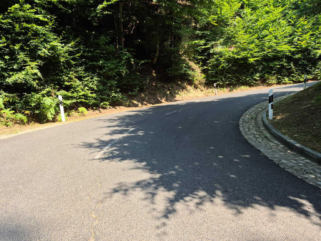
| 1 hairpin turn |
| #100 toughest climb of Luxembourg |
| #16 most elevation gain of Gutland |
| #31 longest climb of Gutland |
| #60 average steepest climb of Gutland |
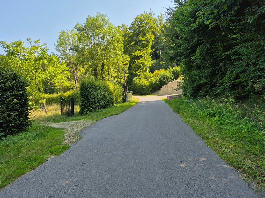
Rue de la Forêt via Rue des Sources is a climb in the region Luxembourg plateau. It is 1.6 mi long and bridges 548 ft of vertical ascent with an average gradient of 6.3%, resulting in a difficulty score of 143. The top of the ascent is located at 1312 ft above sea level. Climbfinder users shared 1 review/story of this climb and uploaded 9 photos.
Road names: Rue de la Forêt Verte, Rue des Sources & CR 124
4.0 by elbowboyThis is an automatic translation, the original language is: German.Coming from Steinsel via Heisdorf, the entrance is in a residential area with little traffic. The road here is excellent. My system measured up to 11.5% here. Then it flattens out a little until shortly before the junction with the 124, where another 11% comes together. From here, the road deteriorates slightly but is still easy to cycle on. It is a dead end for motorised traffic, so there is not much going on. The hairpin bend in the forest is beautiful and very pleasant to ride. At the top... read more

Welcome! Please activate your account if you would like to share something. Look for the verification email in your inbox.
If you want to upload your photos, you need to create an account. It only takes 1 minute and it's completely free.
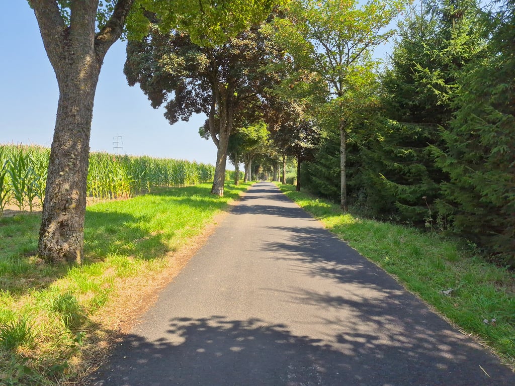
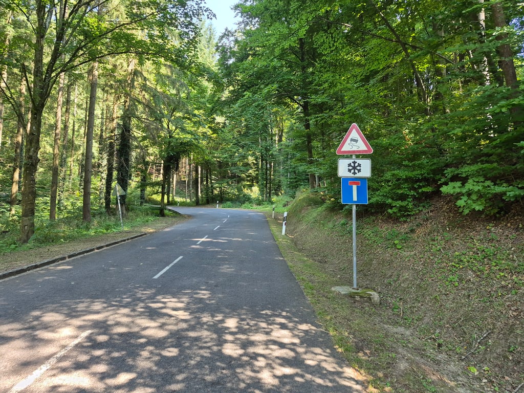
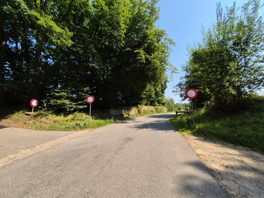
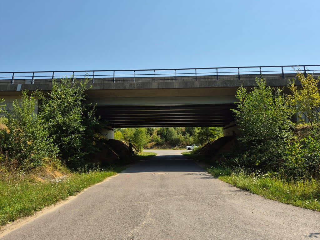
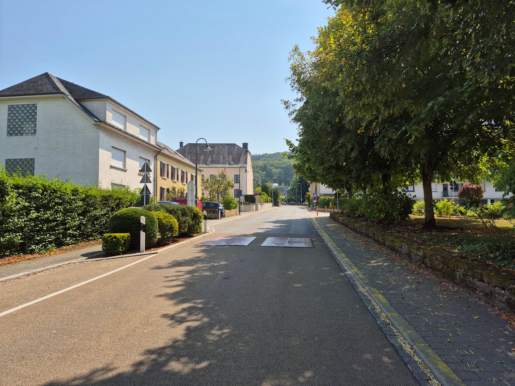
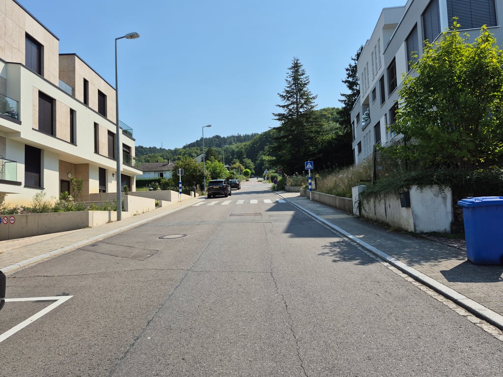
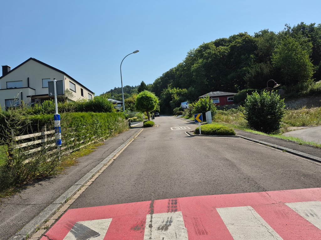
Coming from Steinsel via Heisdorf, the entrance is in a residential area with little traffic. The road here is excellent. My system measured up to 11.5% here. Then it flattens out a little until shortly before the junction with the 124, where another 11% comes together. From here, the road deteriorates slightly but is still easy to cycle on. It is a dead end for motorised traffic, so there is not much going on. The hairpin bend in the forest is beautiful and very pleasant to ride. At the top, the road passes under the motorway for bicycles and runs alongside the motorway for a while until you turn into a beautiful avenue towards Asselscheuer
Der Einstieg liegt, von Steinsel kommend über Heisdorf in einem wenig befahrenen Wohngebiet. Hier ist die Straße exzellent. Bis 11.5% hat mein System hier gemessen. Dann flach es etwas ab, bis kurz vor der Einmündung auf die 124, wo nochmals 11% zusammenkommen. Ab hier wird die Straße etwas schlechter aber immer noch gut befahrbar. Für Autoverkehr ist es eine Sackgasse, entsprechend ist wenig los. Die Serpentine im Wald ist wunderschön und sehr angenehm zu fahren. Oben geht es dann für Fahrräder unter der Autobahn hindurch und ein wenig an der Autobahn entlang bis man in eine sehr schöne Allee Richtung Asselscheuer einbiegt
| 5 mph | 00:19:51 |
| 7 mph | 00:14:03 |
| 9 mph | 00:10:57 |
| 12 mph | 00:08:13 |
This page is better in the app