Rue de l'Aiglon from Terlincthun is a climb in the region Caps et Marais d'Opale. It is 0.5 mi long and bridges 118 ft of vertical ascent with an average gradient of 4.4%, resulting in a difficulty score of 21. The top of the ascent is located at 292 ft above sea level. Climbfinder users shared 2 reviews of this climb and uploaded 10 photos.
Road names: Rue de l'Aiglon (D96E1)
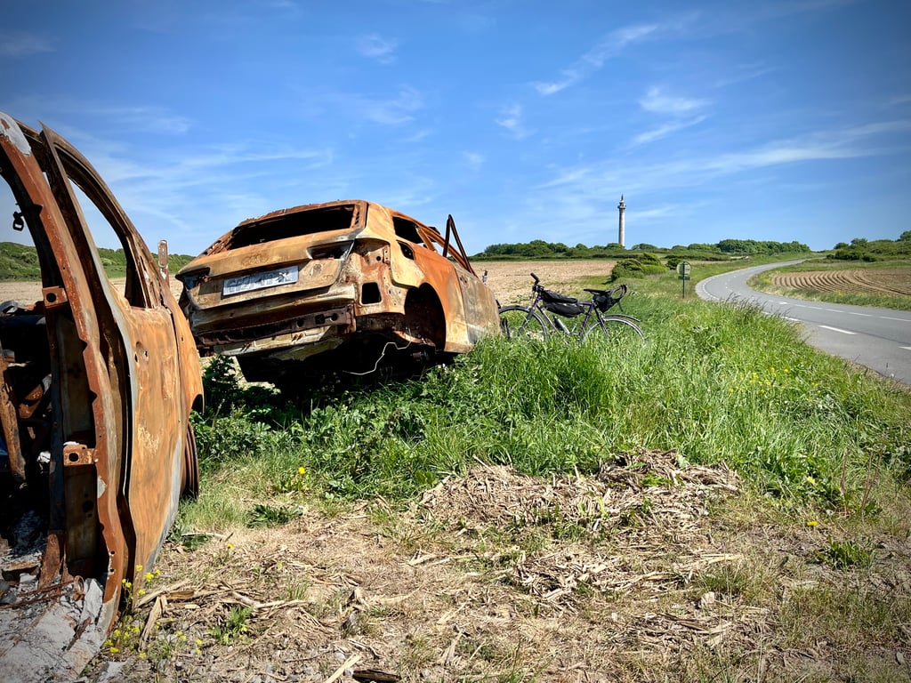
2.0 by CromagnonThis is an automatic translation, the original language is: French.Everything has been described perfectly by Léon. I would add that on windy days, it blows hard. And I wonder why nobody makes those two burnt-out cars in front of the cemetery disappear. The cycling effort is wise. The road is heavily used. A strange grey bunker near the finish.... read more

Welcome! Please activate your account if you would like to share something. Look for the verification email in your inbox.
If you want to upload your photos, you need to create an account. It only takes 1 minute and it's completely free.
Everything has been described perfectly by Léon. I would add that on windy days, it blows hard. And I wonder why nobody makes those two burnt-out cars in front of the cemetery disappear. The cycling effort is wise.
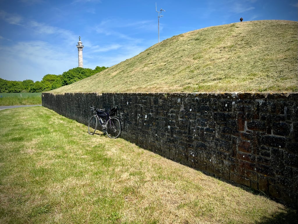
The road is heavily used. A strange grey bunker near the finish.
Tout a été parfaitement décrit par Léon. J’ajoute que les jours de vent, ça souffle fort. Et je me demande pourquoi personne ne fait disparaître ces deux bagnoles calcinées devant le cimetière. L’effort cycliste est sage.
La route est très utilisée. Un étrange gros bunker proche de l’arrivée.
La colonne est plus saisissante « de dos ».
Not too difficult hill leading to the higher parts of Boulogne-sur-Mer. A short steep bend makes it a bit difficult. The parking lot of a large supermarket chain marks the top. From there you have a clear view on the sea.
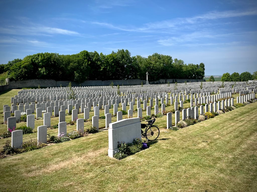
Along the way you pass a British military cemetery with victims from the First World War. Just past the top, turning left (the Route du Chemin Vert), you come to the Colonne de la Grande Armée in honour of Napoleon. This column was built in honor of Napoleon's visit to the city in 1804. A salient detail here is that Napoleon's back was turned to the sea and thus the enemy England.
The climb can be used to enter the city, but also to make a connection from the coast to the hills around Rupembert.
Niet al te lastige heuvel leidend naar de hogere delen van Boulogne-sur-Mer. Een korte steile knik maakt het even lastig. De parkeerplaats van een grote supermarkt keten markeert de top. Daarvandaan heb je uiteraard uitzicht op zee.
Onderweg passeer je een Brits militaire begraafplaats met slachtoffers uit de 1ste wereldoorlog. Net voorbij de top afslaand naar links (de Route du Chemin Vert) kom je bij de Colonne de la Grande Armée ter ere van Napoleon. Deze zuil werd gebouwd ter ere van het bezoek van Napoleon aan de stad in 1804. Saillant detail hierbij is dat Napoleon met de rug naar de zee is toegekeerd en daarmee de vijand Engeland.
De klim kan gebruikt worden om de stad in te rijden, maar juist ook om van de kust de verbinding te maken met de heuvels rondom Rupembert.
| 5 mph | 00:06:07 |
| 7 mph | 00:04:20 |
| 9 mph | 00:03:22 |
| 12 mph | 00:02:32 |
This page is better in the app