View on map
© MapLibre | OpenStreetMap contributors
1%
2%
4%
6%
8%
10%
12%
15%
20%

Rozengaerden via Billen

3.0
2 reviews | Elevation profile | 7 photos
Tips nearby
Rozengaerden via Billen
transparant thumb
Your achievable time
Calculating based on your best performances...
Relaxed
Maximum
W/kg
W/kg
W/kg
Analyze your climbing performance
Detailed insight into your climbing performance & automatically check off climbs
Based on your best performances.
Your best attempt:
Number of attempts:
Elevation profile Rozengaerden via Billen

Statistics

Difficulty points 38
Length 0.6 mi
Average gradient 5.4%
Steepest segment 9.4%
Total ascent 184 ft

Short recap

Hidden gem
#21 toughest climb of Belgium Limburg
#29 most elevation gain of Belgium Limburg
#22 longest climb of Voer-Region
#59 average steepest climb of Belgium Limburg
Feedback about this climb?
Show climbs nearby Export to GPS device

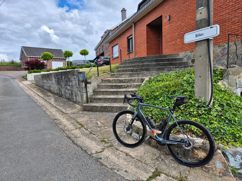
Rozengaerden via Billen is a climb in the region Voer-Region. It is 0.6 mi long and bridges 184 ft of vertical ascent with an average gradient of 5.4%, resulting in a difficulty score of 38. The top of the ascent is located at 860 ft above sea level. Climbfinder users shared 2 reviews of this climb and uploaded 7 photos.

Road names: Billen & Rozengaerden
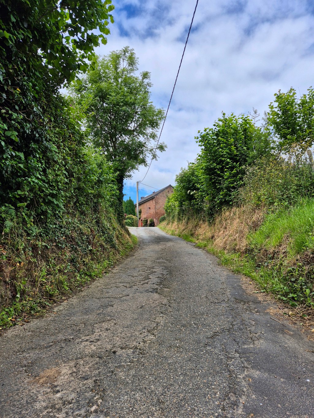
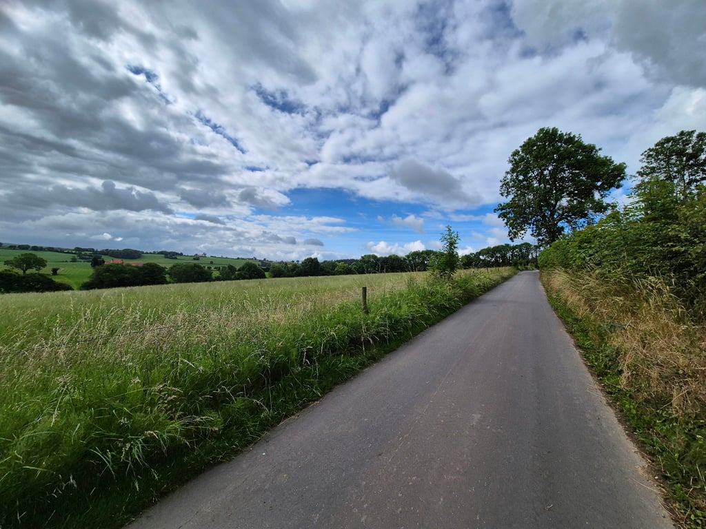
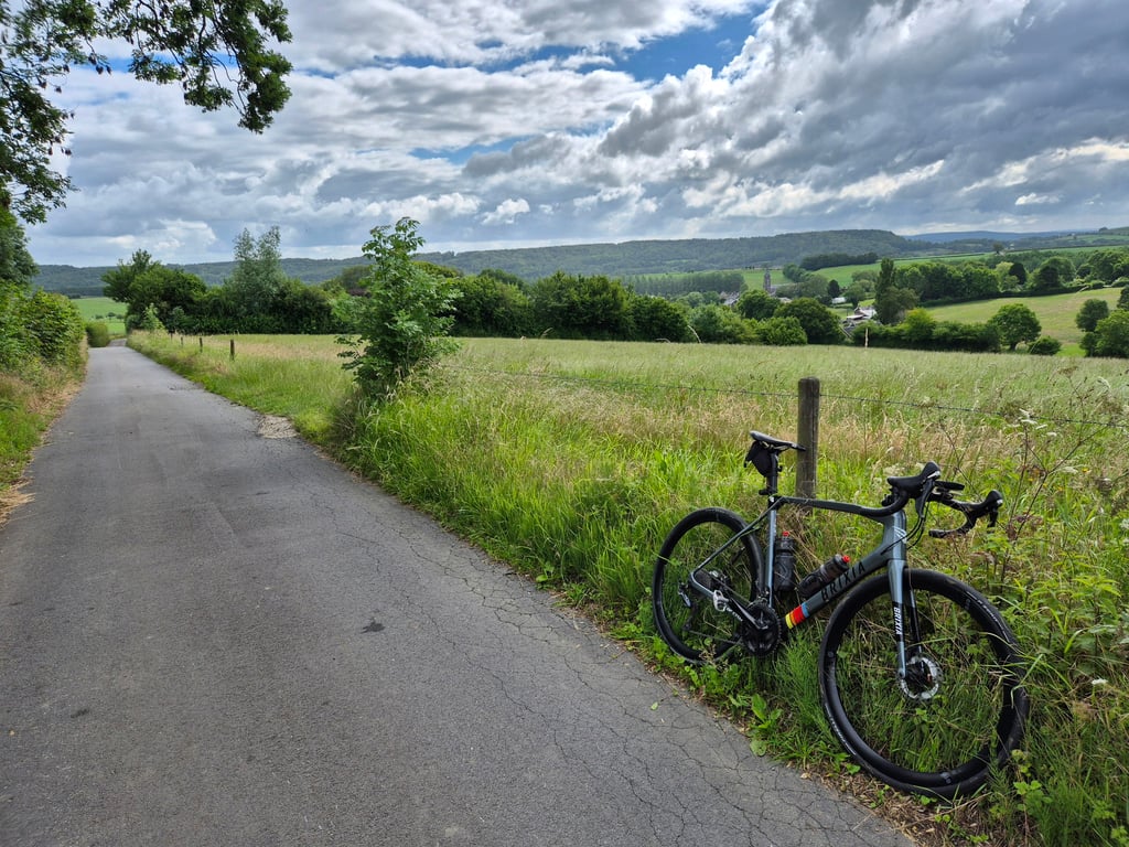
3.0 by Fedor
This is an automatic translation, the original language is: Dutch.
In the beginning very briefly uphill after which downhill follows. After the bench the first really climbing part which lasts until after the turn to the left. Then it hates quiet further up until the end what rises again a little more. In the second part, beautiful views to the rear (especially towards Remersdaal). Narrow quiet road with moderate asphalt but there is a good strip to cycle on. Agricultural environment.... read more

Photos (7)

Rozengaerden via Billen
transparant thumb
transparant thumb
transparant thumb
transparant thumb
transparant thumb

Your uploads (max 4)

Welcome! Please activate your account if you would like to share something. Look for the verification email in your inbox.

If you want to upload your photos, you need to create an account. It only takes 1 minute and it's completely free.

  • Receive free climbfinder goodies for your reviews & photos.
  • Create a bucket list and check off conquered climbs.
  • Add missing climbs.
Continue with GoogleContinue with Google Continue with FacebookContinue with Facebook Continue with AppleContinue with Apple Sign up with email
By signing up you agree to our terms of service and confirm that you have read our privacy & content policy.

Reviews (2)

5.0
4.0
3.0
2.0
1.0
BikerJohan
1 y 3.0
This is an automatic translation, the original language is: Dutch. Show original

One of three options to go up through the built-up area of Remersdaal to the N-648. Just a nice little climb and outside the village straight through meadows with varying gradients.

Een van de drie mogelijkheden om via de bebouwing van Remersdaal omhoog te gaan naar de N-648. Gewoon een lekker klimmetje en buiten het dorp dwars door de weilanden met wisselende stijgingspercentages.

Dashboard
Fedor
4 y 3.0
This is an automatic translation, the original language is: Dutch. Show original

In the beginning very briefly uphill after which downhill follows. After the bench the first really climbing part which lasts until after the turn to the left. Then it hates quiet further up until the end what rises again a little more. In the second part, beautiful views to the rear (especially towards Remersdaal). Narrow quiet road with moderate asphalt but there is a good strip to cycle on. Agricultural environment.

In het begin heel kort even omhoog waarna afdaling volgt. Na het bankje het eerste echt klimmende gedeelte wat duurt tot na de bocht naar links. Daarna haat het rustiger verder omhoog tot het eind wat weer iets meer stijgt. In het tweede gedeelte mooie uitzichten naar achteren (vooral richting Remersdaal). Smalle rustige weg met matig asfalt maar er zit wel een goede strook om over te fietsen. Agrarische omgeving.

Rozengaerden via Billen
Dashboard

Climbing times

5 mph 00:07:45
7 mph 00:05:29
9 mph 00:04:16
12 mph 00:03:13

Road surface condition

0% 0% 0%
Based on 0 votes
Share your knowledge. What was the road condition during your ascent?

Traffic

0% 0% 0%
Based on 0 votes
Your experience counts. How much traffic did you encounter during the climb?

Frequently Asked Questions

Rozengaerden can be cycled from 5 sides. Kultjen from Remersdaal is the most popular side, but the summit can also be reached via Magnebos, Rozengaerden via Pontus, Rozengaerden via Born & Rozengaerden via Billen.

You don't need special gearing for Rozengaerden via Billen. The slope isn't long or steep enough to require much shifting down. You can conquer this climb on power alone. However, a compact gearing system with a smallest front chainring of 34 and largest rear sprocket of 28 or 30 is always nice if you enjoy cycling uphill. This helps maintain a smooth cadence.

Rozengaerden via Billen falls into the 5th category. With good fitness, you can ride it up with speed and power. If you have less training, shift down and climb smoothly.

Rozengaerden via Billen is 0.6 mi long.

The average gradient of Rozengaerden via Billen is 5.4%.

Rozengaerden via Billen has a steepest segment with an average gradient of 9.4%.

The summit of Rozengaerden via Billen is at 860 ft.

At a slow pace of 5 mph, it takes about 00:07:45 to climb Rozengaerden via Billen. At 7 mph the time is 00:05:29, and at 9 mph 00:04:16. For the fastest cyclists, 00:03:13 is an achievable time.

Rozengaerden via Billen is located in the region Voer-Region in Belgium.

This page is better in the app

Climbfinder app
Climbfinder
(Free)
Open