View on map
© MapLibre | OpenStreetMap contributors
1%
2%
4%
6%
8%
10%
12%
15%
20%

Au Lilas via Route de la Gimone

3.0
1 review/story | Elevation profile | 2 photos
Tips nearby
Au Lilas via Route de la Gimone
transparant thumb
transparant thumb
transparant thumb
transparant thumb
transparant thumb
transparant thumb
Your achievable time
Calculating based on your best performances...
Relaxed
Maximum
W/kg
W/kg
W/kg
Analyze your climbing performance
Detailed insight into your climbing performance & automatically check off climbs
Based on your best performances.
Your best attempt:
Number of attempts:
Elevation profile Au Lilas via Route de la Gimone

Statistics

Difficulty points 42
Length 1.3 mi
Average gradient 3.5%
Steepest segment 8.4%
Total ascent 249 ft
Feedback about this climb?
Show climbs nearby Export to GPS device

Au Lilas via Route de la Gimone is a climb in the region Gers. It is 1.3 mi long and bridges 249 ft of vertical ascent with an average gradient of 3.5%, resulting in a difficulty score of 42. The top of the ascent is located at 758 ft above sea level. Climbfinder users shared 1 review/story of this climb and uploaded 2 photos.

Road names: Route de la Gimone & Route de la Marcaoue
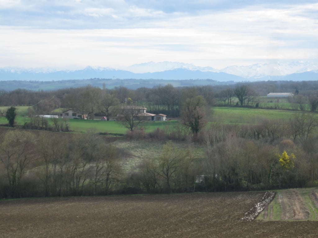
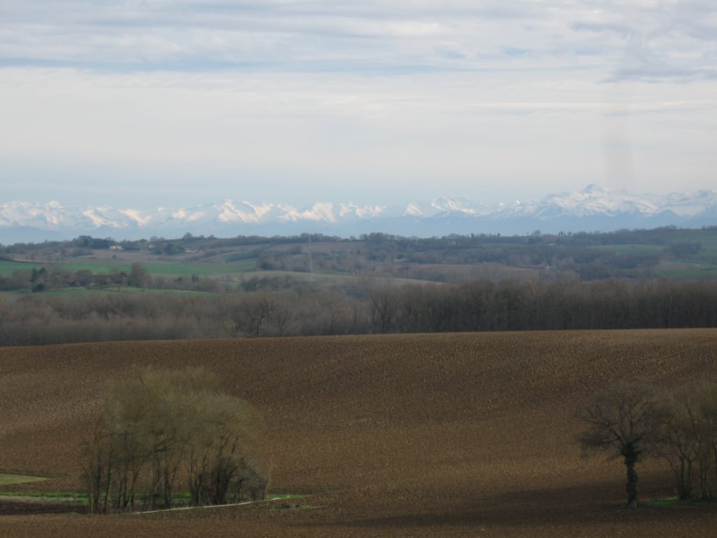
This is an automatic translation, the original language is: French.
It's quite a long climb, quite steep at first, then with a dip and then steep again. I recommend this climb because the scenery at the top is magnificent, especially if you're lucky enough to see the Pyrenees.... read more

Photos (2)

Au Lilas via Route de la Gimone
transparant thumb
transparant thumb
transparant thumb
transparant thumb

Your uploads (max 4)

Welcome! Please activate your account if you would like to share something. Look for the verification email in your inbox.

If you want to upload your photos, you need to create an account. It only takes 1 minute and it's completely free.

  • Receive free climbfinder goodies for your reviews & photos.
  • Create a bucket list and check off conquered climbs.
  • Add missing climbs.
Continue with GoogleContinue with Google Continue with FacebookContinue with Facebook Continue with AppleContinue with Apple Sign up with email
By signing up you agree to our terms of service and confirm that you have read our privacy & content policy.

Reviews (1)

5.0
4.0
3.0
2.0
1.0
Antoine_Forcellini
1 y 3.0 00:10:00 (8.1 mph)
This is an automatic translation, the original language is: French. Show original

It's quite a long climb, quite steep at first, then with a dip and then steep again. I recommend this climb because the scenery at the top is magnificent, especially if you're lucky enough to see the Pyrenees.

Côte assez longue, assez raide au début puis en faux-plat montant puis à nouveau raide. Je recommande cette ascension car le paysage en haut est magnifique surtout si vous avez la chance de voir les Pyrénées.

Au Lilas via Route de la Gimone
Dashboard

Climbing times

5 mph 00:16:14
7 mph 00:11:29
9 mph 00:08:57
12 mph 00:06:43

Road surface condition

100% 0% 0%
Based on 1 vote
Share your knowledge. What was the road condition during your ascent?

Traffic

100% 0% 0%
Based on 1 vote
Your experience counts. How much traffic did you encounter during the climb?

Frequently Asked Questions

Au Lilas can be cycled from 3 sides. Au Lilas via Route de la Gimone is the most popular side, but the summit can also be reached via Côte de Montiron via Route du Village & Route de la Marcaoue.

You don't need special gearing for Au Lilas via Route de la Gimone. The slope isn't long or steep enough to require much shifting down. You can conquer this climb on power alone. However, a compact gearing system with a smallest front chainring of 34 and largest rear sprocket of 28 or 30 is always nice if you enjoy cycling uphill. This helps maintain a smooth cadence.

Au Lilas via Route de la Gimone falls into the 5th category. With good fitness, you can ride it up with speed and power. If you have less training, shift down and climb smoothly.

Au Lilas via Route de la Gimone is 1.3 mi long.

The average gradient of Au Lilas via Route de la Gimone is 3.5%.

Au Lilas via Route de la Gimone has a steepest segment with an average gradient of 8.4%.

The summit of Au Lilas via Route de la Gimone is at 758 ft.

At a slow pace of 5 mph, it takes about 00:16:14 to climb Au Lilas via Route de la Gimone. At 7 mph the time is 00:11:29, and at 9 mph 00:08:57. For the fastest cyclists, 00:06:43 is an achievable time.

Au Lilas via Route de la Gimone is located in the region Gers in France.

This page is better in the app

Climbfinder app
Climbfinder
(Free)
Open