Tips nearby


| 12 hairpin turns |
| #58 toughest climb of Provence-Alpes-Côte d'Azur |
| #54 most elevation gain of Provence-Alpes-Côte d'Azur |
| #87 longest climb of Provence-Alpes-Côte d'Azur |
| #96 average steepest climb of Serre Ponçon |
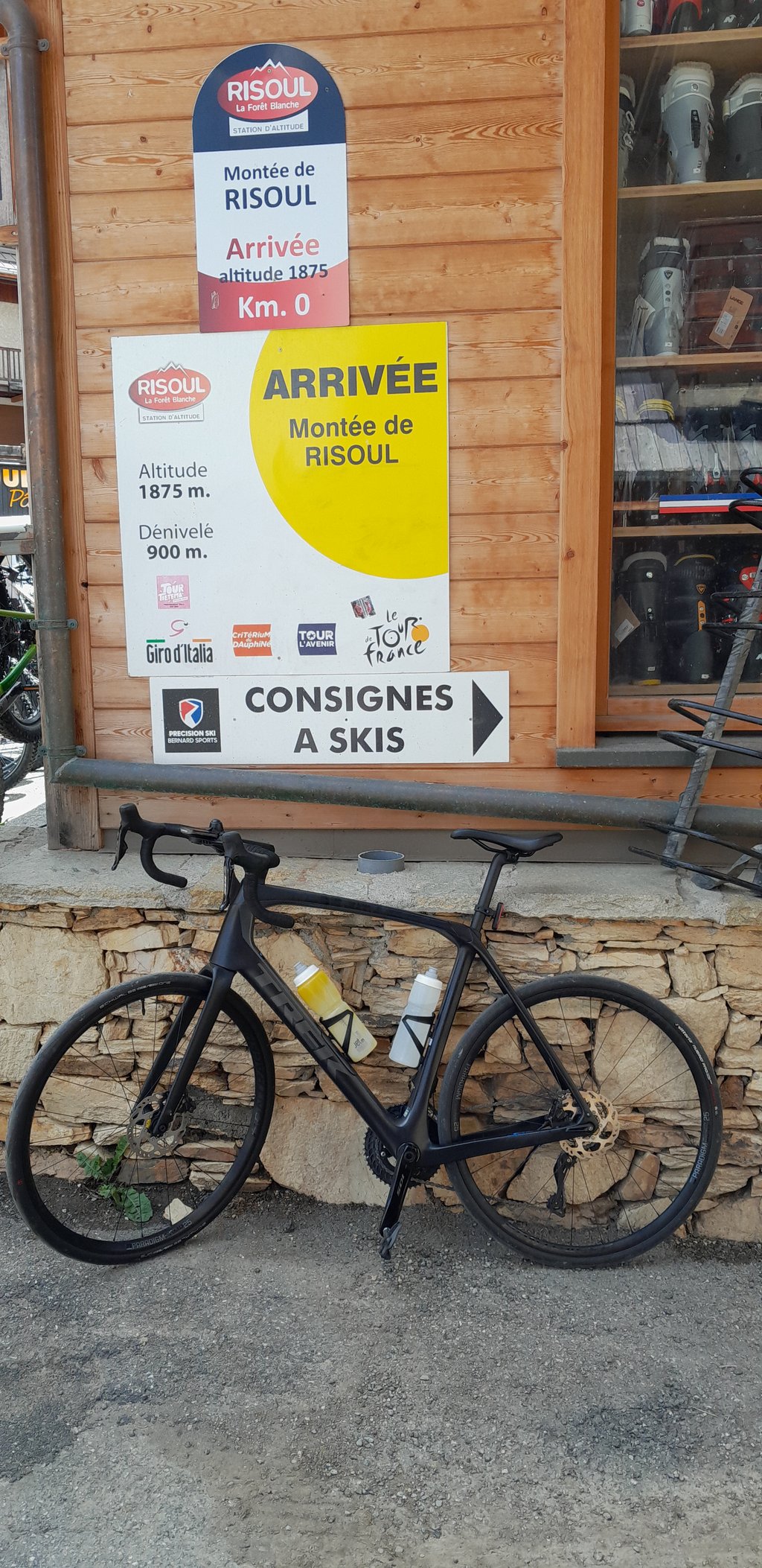
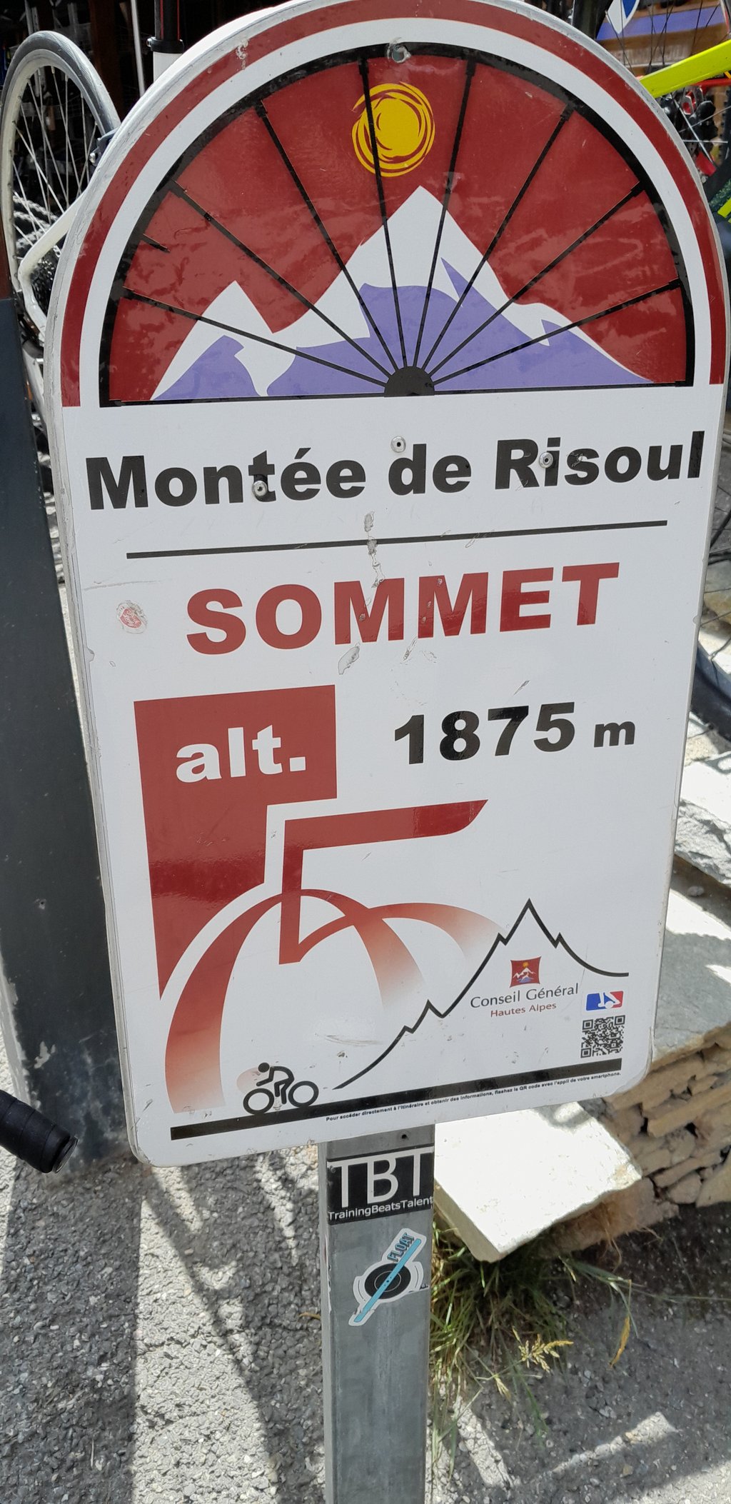
Risoul via Le Plan de Phazy is a climb in the region Briançon. It is 8.6 mi long and bridges 3097 ft of vertical ascent with an average gradient of 6.8%, resulting in a difficulty score of 689. The top of the ascent is located at 6076 ft above sea level. Climbfinder users shared 2 reviews of this climb and uploaded 6 photos.
Road names: D 86 & D 186
3.0 by hj85This is an automatic translation, the original language is: Dutch.Reasonable climb from Guillestre, which is doable for the experienced cyclist. Road surface is fine, had little traffic. At the top it takes a while to find the end point, which is unfortunately tied to a sports shop in a shopping street. You can refuel just fine in the village. Descent is always nice, not really very long stretches unfortunately. Because of the trees, you can't really catch a nice view. Anyway, nice climb also thanks to the curves, which have been given names of famous cyc... read more
Welcome! Please activate your account if you would like to share something. Look for the verification email in your inbox.
If you want to upload your photos, you need to create an account. It only takes 1 minute and it's completely free.
Reasonable climb from Guillestre, which is doable for the experienced cyclist. Road surface is fine, had little traffic. At the top it takes a while to find the end point, which is unfortunately tied to a sports shop in a shopping street. You can refuel just fine in the village. Descent is always nice, not really very long stretches unfortunately. Because of the trees, you can't really catch a nice view. Anyway, nice climb also thanks to the curves, which have been given names of famous cyclists. You can plan this climb nicely to do longer rides and climbs later in the holidays. I myself combined it with Champcella and Reotier, very nice area for cycling
Redelijke klim vanuit Guillestre, welke goed te doen is voor de geoefende fietser. Wegdek is prima, weinig verkeer gehad. Boven is het even zoeken naar het eindpunt, deze is helaas vastgezet aan een sportwinkel in een winkelstraat. Je kan in het dorp even prima bijtanken. Afdaling is altijd lekker, niet echt hele lange stukken helaas. Door de bomen kun je niet echt een mooi uitzicht pakken. Maar goed, leuke klim ook dankzij de bochten, die namen hebben gekregen van bekende wielrenners. Je kan deze klim mooi inplannen om later in de vakantie langere ritten en beklimmingen te doen. Zelf heb ik hem gecombineerd met Champcella en Reotier, erg mooi gebied om te fietsen
The best way to climb to Risoul. The first part of the climb is quiet and scenically beautiful. you climb through pretty hamlets and along a narrow road before ending up on Risoul's monotonous road. The recommendation is actually to go straight after that too :-) and take the steep variant!
De mooiste manier om naar Risoul te klimmen. Het eerste deel van de klim is rustig en landschappelijk mooi. je klimt door mooie gehuchtjes en over een smalle weg voordat je op de monotone weg van Risoul terecht komt. De aanrader is eigenlijk om daarna ook rechtdoor te gaan :-) en de steile variant te nemen!
| 5 mph | 01:44:15 |
| 7 mph | 01:13:48 |
| 9 mph | 00:57:31 |
| 12 mph | 00:43:12 |
This page is better in the app