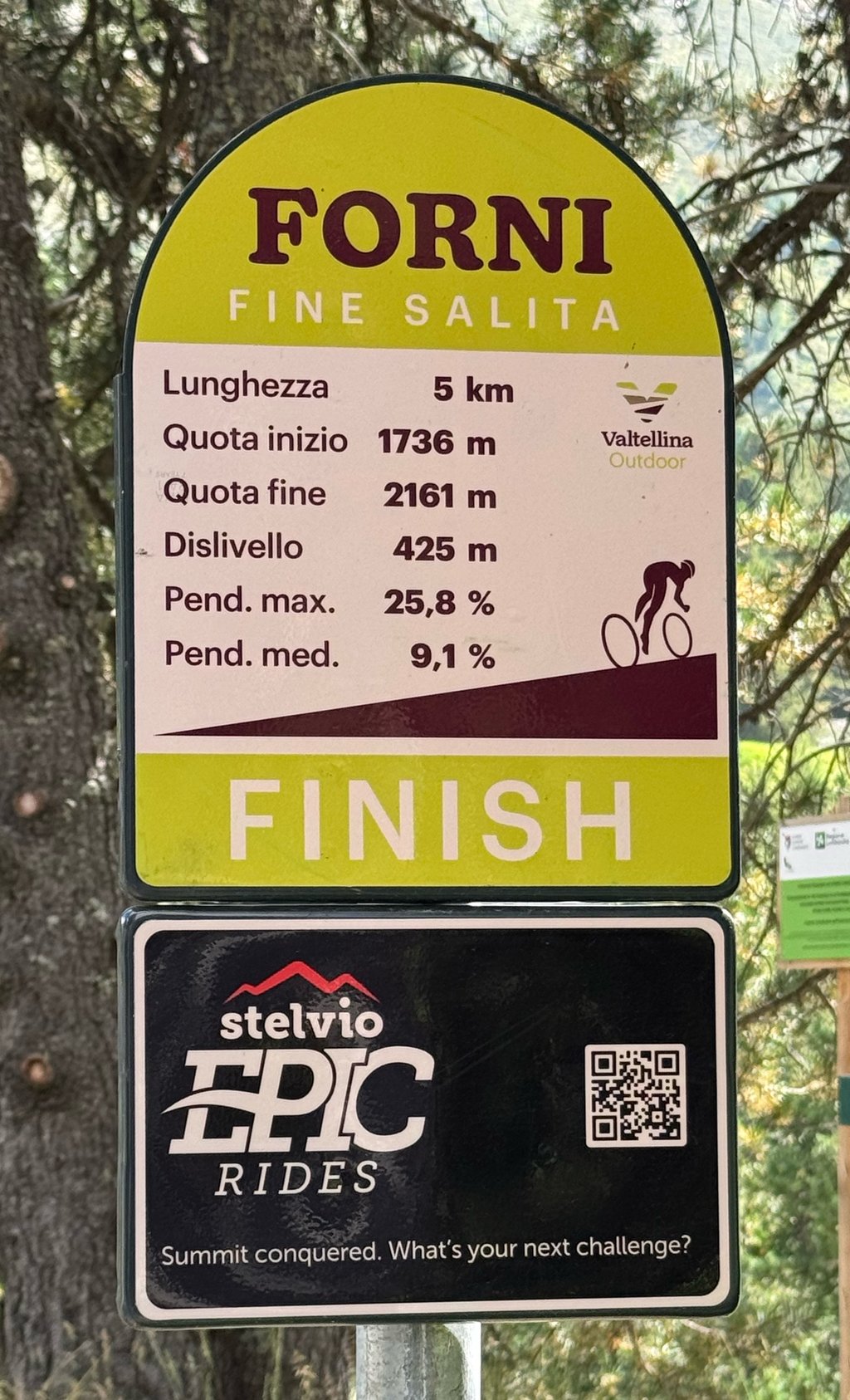
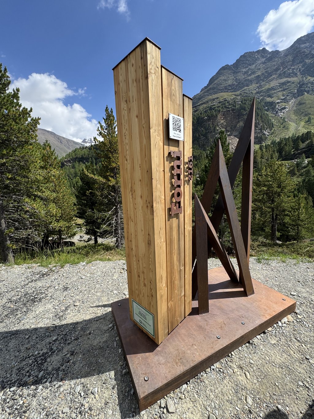
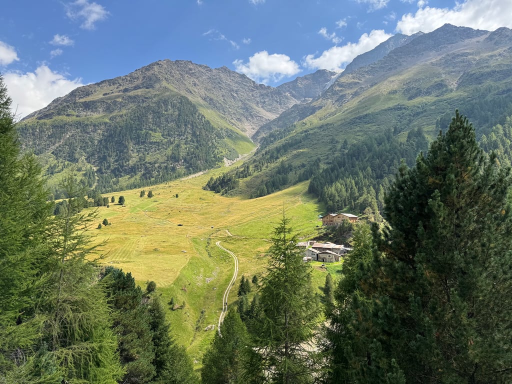
Rifugio Forni from Bormio is a climb in the region Sondrio. It is 10.6 mi long and bridges 3117 ft of vertical ascent with an average gradient of 5.5%, resulting in a difficulty score of 803. The top of the ascent is located at 7067 ft above sea level. Climbfinder users shared 4 reviews of this climb and uploaded 8 photos.
Road names: Strada Provinciale del Passo Gavia & Via Forni
3.0 by maxrol20This is an automatic translation, the original language is: Italian.Beautiful and hard from Santa Caterina onwards. In my opinion it is absurd to consider it as a climb that starts in Bormio. This climb with its own character begins at the bottom of the Santa Caterina plain. There are also special signs only from there on.... read more

Welcome! Please activate your account if you would like to share something. Look for the verification email in your inbox.
If you want to upload your photos, you need to create an account. It only takes 1 minute and it's completely free.
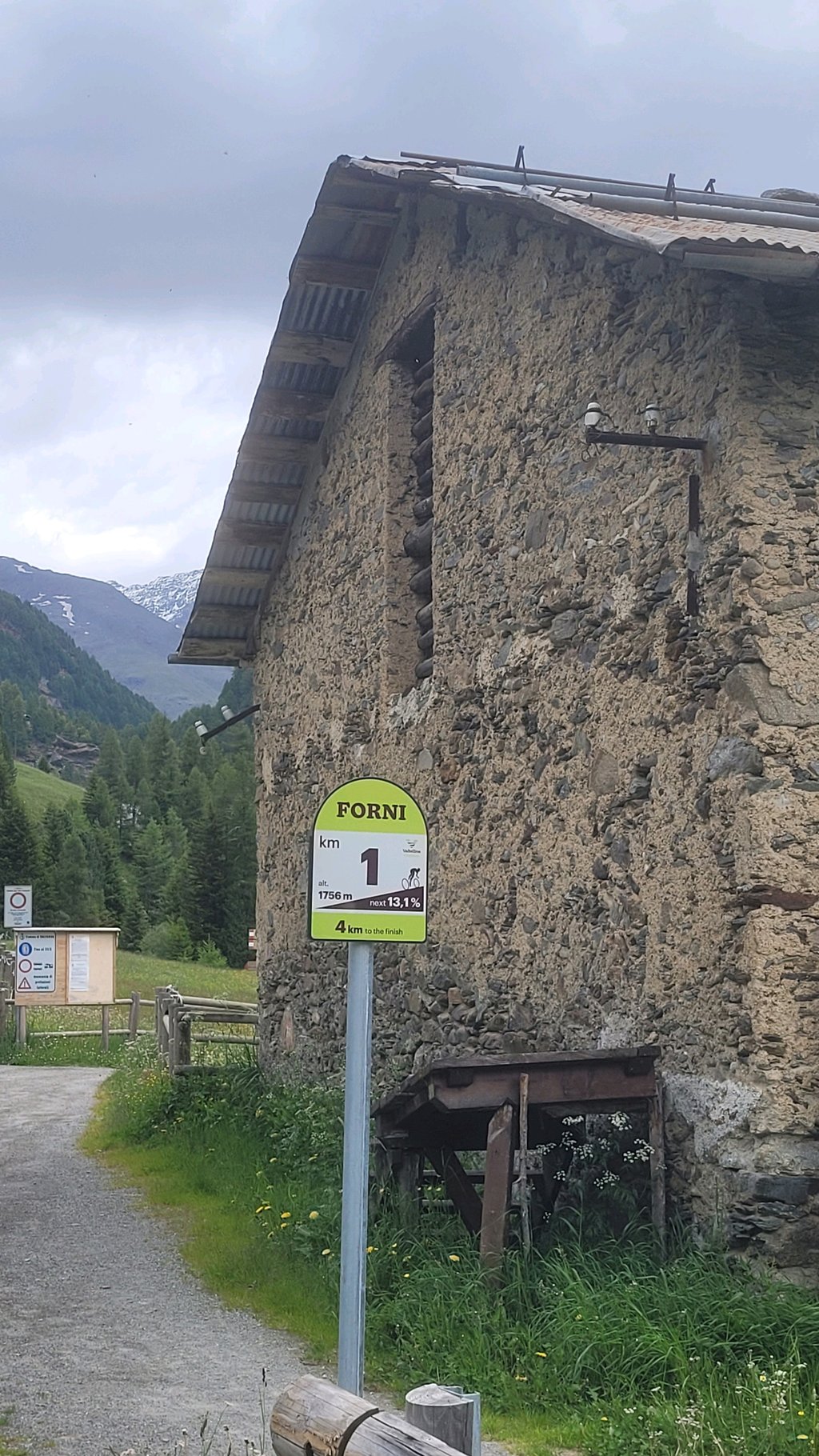
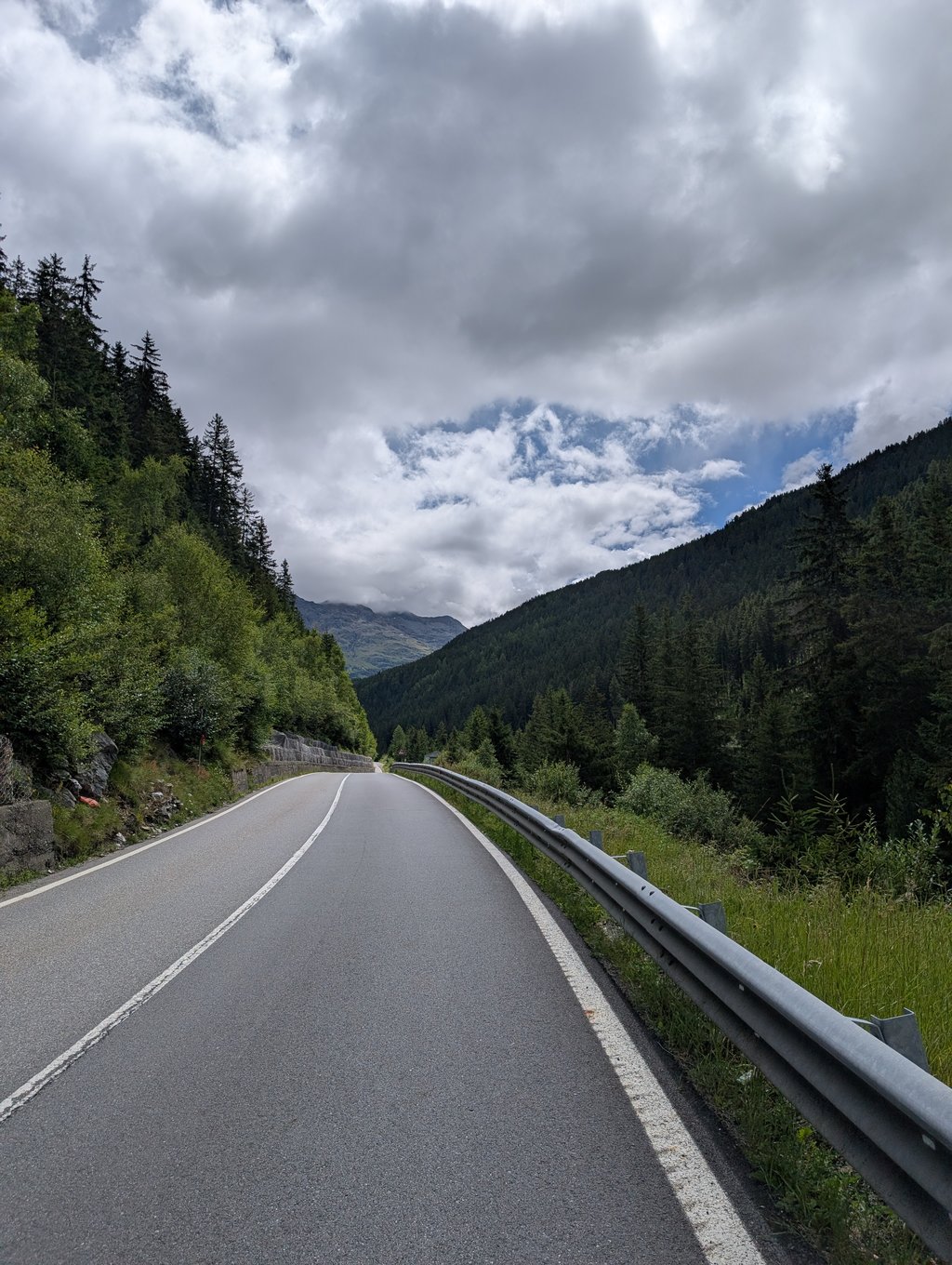
Wow, that’s a tough one. At least the section after St. Caterina. Before that, it’s the same as the Cavia, and that’s pretty easy up to St. Caterina. I did it on the way back from the Cavia. The first kilometer is easy, and then there’s a sign saying the next kilometer averages 13.1%. But the ride stays fairly gentle for a while after that, so that’s a bit of a giveaway… Sure enough, there are long stretches above 15%. For those who stick with it: the scenery is beautiful and it’s super peaceful.
Poeh, da's een pittige. Althans het stuk na St Caterina. Daarvoor is zelfde als de Cavia en die is vrij gemakkelijk tot St Caterina. Ik heb 'm gedaan op de terugweg van de Cavia. Eerste km is dan makkelijk en dan staat er een bordje dat volgende km gemiddeld 13,1% is. Maar het blijft nog even rustig doorlopen dus dat voorspelt wat... Inderdaad, hele stukken boven de 15%. Voor wie volhoudt: het is een mooie omgeving en superrustig.
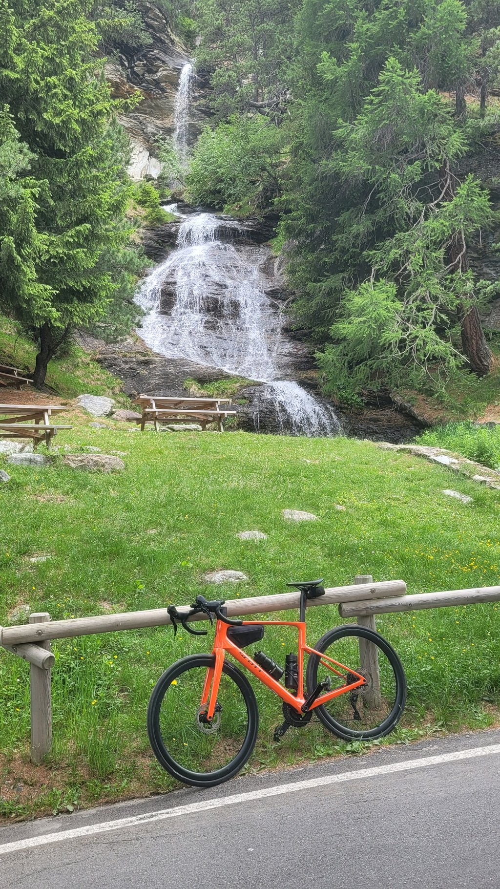
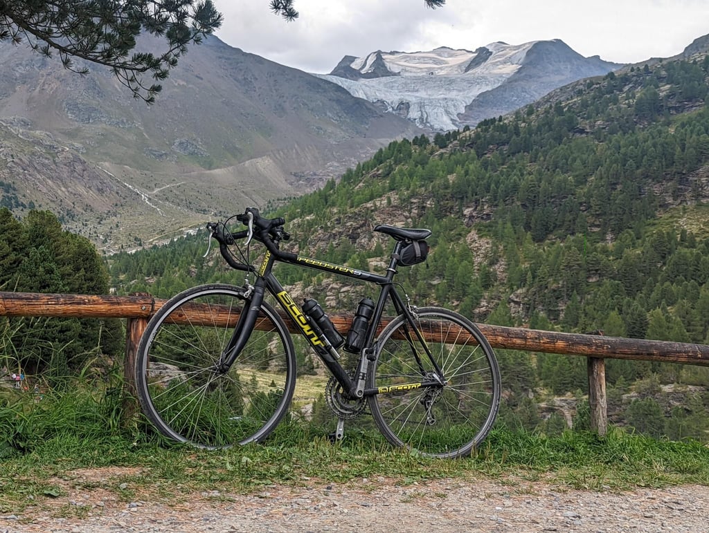
After a round of Mortirolo / Gavia I took this one from Santa Caterina, where the climb actually starts. By taking the profile from Bormio it does not show how erratic the profile after Santa Caterina is. That combined with the narrow winding road makes it a very special climb. With arrived at the top at the Rifugio a beautiful view of the glacier. Also a good starting point for a nice hike, day after it was too bad to bike (and rest day didn't come out wrong either) so hiked another beautiful round here.
Na een rondje Mortirolo / Gavia deze nog even meegepakt vanuit Santa Caterina, waar dat de klim ook daadwerkelijk begint. Door het profiel vanuit Bormio te pakken komt niet tot z'n recht hoe grillig het profiel na Santa Caterina is. Dat in combinatie met het smalle kronkelende weggetje maakt het een erg bijzondere klim. Met boven bij de Rifugio aangekomen een prachtig uitzicht op de gletsjer. Ook een goed startpunt voor een mooie wandeling, dag erna was het te slecht om te fietsen (en rustdag kwam ook niet verkeerd uit) dus hier nog een prachtige ronde gewandeld.
Beautiful and hard from Santa Caterina onwards. In my opinion it is absurd to consider it as a climb that starts in Bormio. This climb with its own character begins at the bottom of the Santa Caterina plain. There are also special signs only from there on.
Bella e dura da Santa Caterina in poi. A mio avviso è assurdo considerarla come salita che inizia da Bormio. Questa salita con il suo carattere che la contraddistingue comincia in fondo alla piana di Santa Caterina. Ci sono anche i cartelli appositi solo da lì in poi.
You do the first part from Bormio too if you are going to do the Gavia. But instead of going to the tunnel in Santa Catarina, you turn directly left as you pass by the ski lift. Past a couple of hotels, a car park and the motorhome parking area, you drive almost straight into the steepness. From the first stretch it's actually quite steep and doesn't really level out. Parts of 18 per cent according to my Garmin make this relatively short climb quite tough, but it is still doable (for me with 34x34). The views are especially picture-perfect and at the top of the hut (actually more of a hotel), the terrace is great and the food is perfect. The heatproof is a nice man and the staff are friendly.
Het eerste stuk vanuit Bormio doe je ook als je de Gavia gaat doen. Maar in plaats van naar de tunnel in Santa Catarina ga je direct linksaf als je bij de skilift voorbij komt. Langs een paar hotels, een parkeerplaats en de camperparkeerplaats rij je al bijna direct de steilte in. Vanaf het eerste stuk is het eigenlijk best steil en wordt niet echt mee vlak. Stukjes van volgens mijn Garmin 18 procent maken deze relatief korte klim toch best zwaar, maar het blijft te doen (voor mij met 34x34). Het uitzicht is vooral beeldschoon en boven bij de hut (eigenlijk meer een hotel) is het goed toeven op het terras en het eten is er perfect. De hittebestendig is een aardige man en het personeel is vriendelijk.
| 5 mph | 02:08:20 |
| 7 mph | 01:30:51 |
| 9 mph | 01:10:48 |
| 12 mph | 00:53:12 |
This page is better in the app