Plan Châtel from Sugiez is a climb in the region Fribourg. It is 1.5 mi long and bridges 712 ft of vertical ascent with an average gradient of 9.2%, resulting in a difficulty score of 214. The top of the ascent is located at 2136 ft above sea level. Climbfinder users shared 1 review/story of this climb and uploaded 1 photo.
Road name: Route Militaire
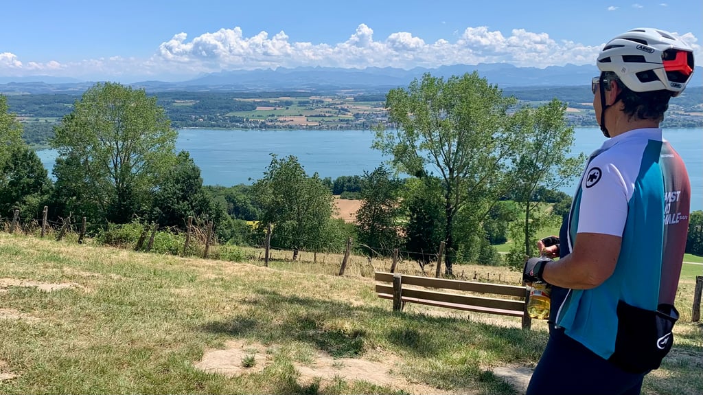
4.0 by KriketteThis is an automatic translation, the original language is: French.In a very flat region, this ascent is a surprise and takes you to the summit of Mont-Vully. It's a real stinker, but it gives you a splendid view of the Jura, the Alps and 3 lakes! A tarte du Vully (sugar and cream...) will put you back on your feet after the descent.... read more
Welcome! Please activate your account if you would like to share something. Look for the verification email in your inbox.
If you want to upload your photos, you need to create an account. It only takes 1 minute and it's completely free.
In a very flat region, this ascent is a surprise and takes you to the summit of Mont-Vully. It's a real stinker, but it gives you a splendid view of the Jura, the Alps and 3 lakes! A tarte du Vully (sugar and cream...) will put you back on your feet after the descent.
Dans une région très plate, cette montée est une surprise et vous mène au sommet du Mont-Vully. Un vrai casse-patte mais qui vous offre une vue splendide sur le Jura, les Alpes et 3 lacs ! Une tarte du Vully (sucre et crème...) vous remettrons sur pied après la descente
| 5 mph | 00:17:37 |
| 7 mph | 00:12:28 |
| 9 mph | 00:09:43 |
| 12 mph | 00:07:18 |
This page is better in the app