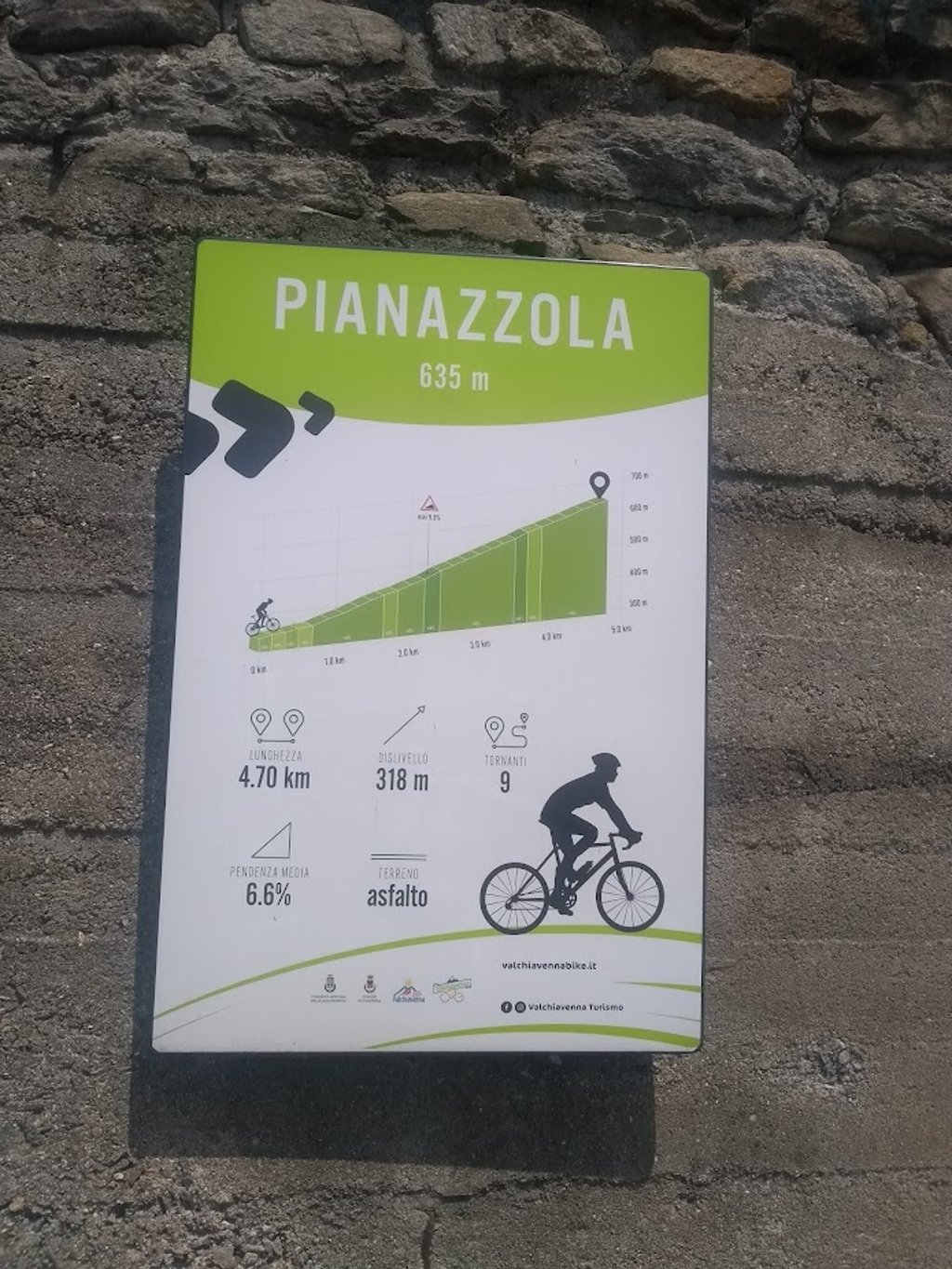
Pianazzola from Chiavenna is a climb in the region Sondrio. It is 3 mi long and bridges 1007 ft of vertical ascent with an average gradient of 6.4%, resulting in a difficulty score of 219. The top of the ascent is located at 2146 ft above sea level. Climbfinder users shared 3 reviews of this climb and uploaded 7 photos.
Road names: Via Ezio Vanoni & Località Pianazzola
5.0 by AlpenTThis is an automatic translation, the original language is: German.Short but beautiful climb directly above Chiavenna with great views. Perfect for a short evening tour, as it gets very hot there at midday.... read more
Welcome! Please activate your account if you would like to share something. Look for the verification email in your inbox.
If you want to upload your photos, you need to create an account. It only takes 1 minute and it's completely free.
Short but beautiful climb directly above Chiavenna with great views. Perfect for a short evening tour, as it gets very hot there at midday.
Kurzer, aber wunderschöner Anstieg direkt oberhalb von Chiavenna mit tollen Blicken. Perfekt für eine kurze Abendrunde, da es mittags dort sehr heiß wird.
Short smart, but great. Stunning views over Chiavenna. Barely any traffic.
Korte slim, maar geweldig. Prachtig uitzicht over Chiavenna. Nauwelijks verkeer.
This short powerful climb without extremes starts just outside Chiavenna from the main road SS37 towards Maloja.
Nine unnumbered hairpin bends take you up the open sunny terraced valley flank past houses and gardens (including grape orchards). Very nice route with panoramic views of the departure town below you.
Road ends at the highest point in the picturesque streetless village. A narrow tarmac road leads to a steep descent to a small spring just next to the church tower.
Definitely worth a visit if you are in the area!
Deze korte krachtige klim zonder extremen start even buiten Chiavenna vanaf de grote rijksweg SS37 richting Maloja.
Negen ongenummerde haarspeldbochten kronkelen je de open zonnige terrasvormige dal flank op langs huizen en tuinen (oa druiventeelt). Zeer mooie route met panoramisch zicht op de vertrekstad beneden onder jou.
Weg loopt ten einde op hoogste punt in het pittoresk stratenloos dorpje. Via een smal asfaltweggetje kan je nog even steil afdalen tot een bronnetje net naast de kerktoren.
Zeker meepikken als je daar in de buurt bent!
| 5 mph | 00:35:58 |
| 7 mph | 00:25:28 |
| 9 mph | 00:19:50 |
| 12 mph | 00:14:54 |
This page is better in the app