Pian di Montecampione is a climb in the region Brescia. It is 12.1 mi long and bridges 4948 ft of vertical ascent with an average gradient of 7.8%, resulting in a difficulty score of 1287. The top of the ascent is located at 5676 ft above sea level. Climbfinder users shared 8 reviews of this climb and uploaded 19 photos.
Road names: Via Degli Alpini, Via S Pietro Via Valle Roncagilia Via Panoramica, Via Plan di Montecampione Via Plan & Via Dante
3.0 by velocitylensThis is an automatic translation, the original language is: English.Great HC climb near Lake Iseo. This is a solid effort climb with plenty of testing sections. No out of the saddle heaves ( maybe last 500m ) but consistent gradient. Nice quiet road. I had only a handful of cars/vans pass me in first week of June. Hotel at pantani statue/summit was closed for renovations but there are bars along route in villages and Monticampione itself. Of HC climbs around europe I'd rate it 8/10 for difficulty and 5/10 for views/escape/beauty. Watch the top half of desc... read more
Welcome! Please activate your account if you would like to share something. Look for the verification email in your inbox.
If you want to upload your photos, you need to create an account. It only takes 1 minute and it's completely free.
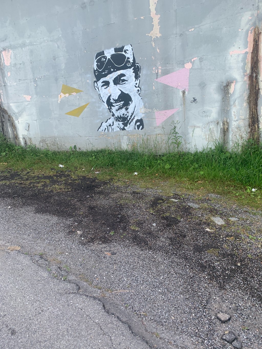
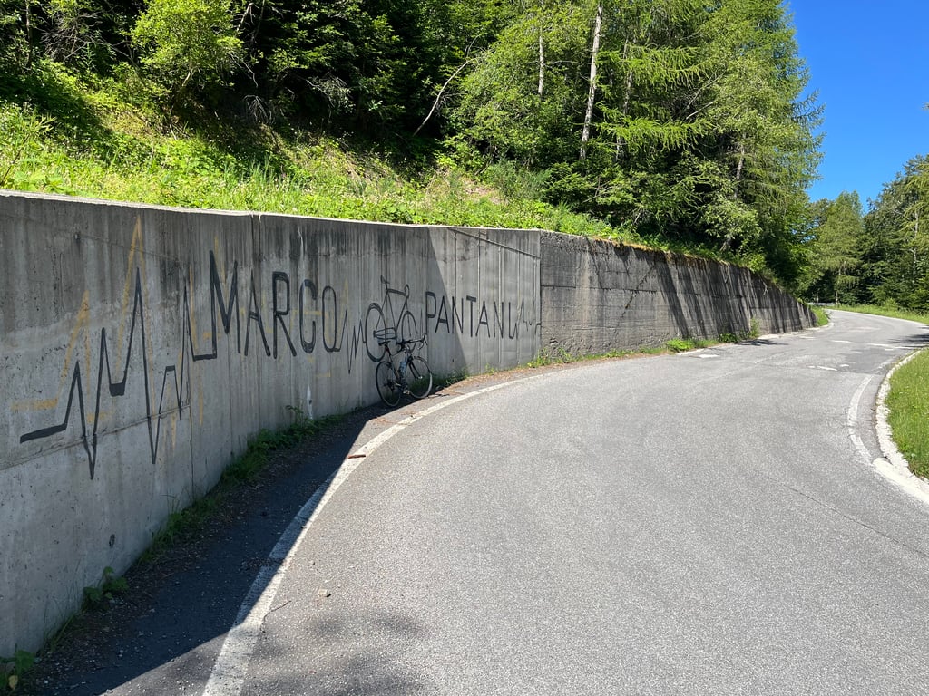
Very accessible and generally the surface is ok (8th July 26). Plenty of great vistas and hairpins plus the odd bit of biking graffiti and the monument / sculpture to the main man. I loved every bit of it.
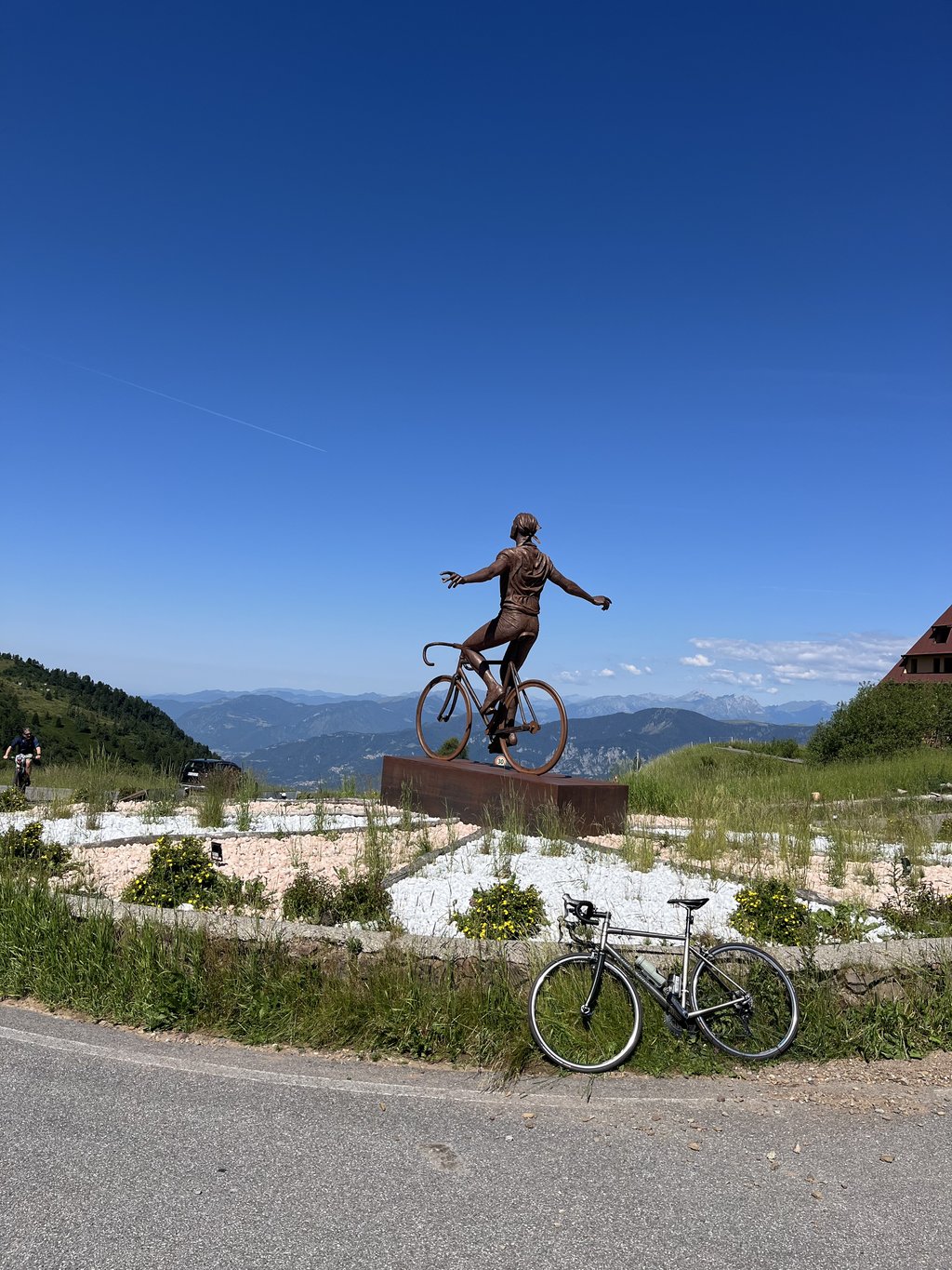
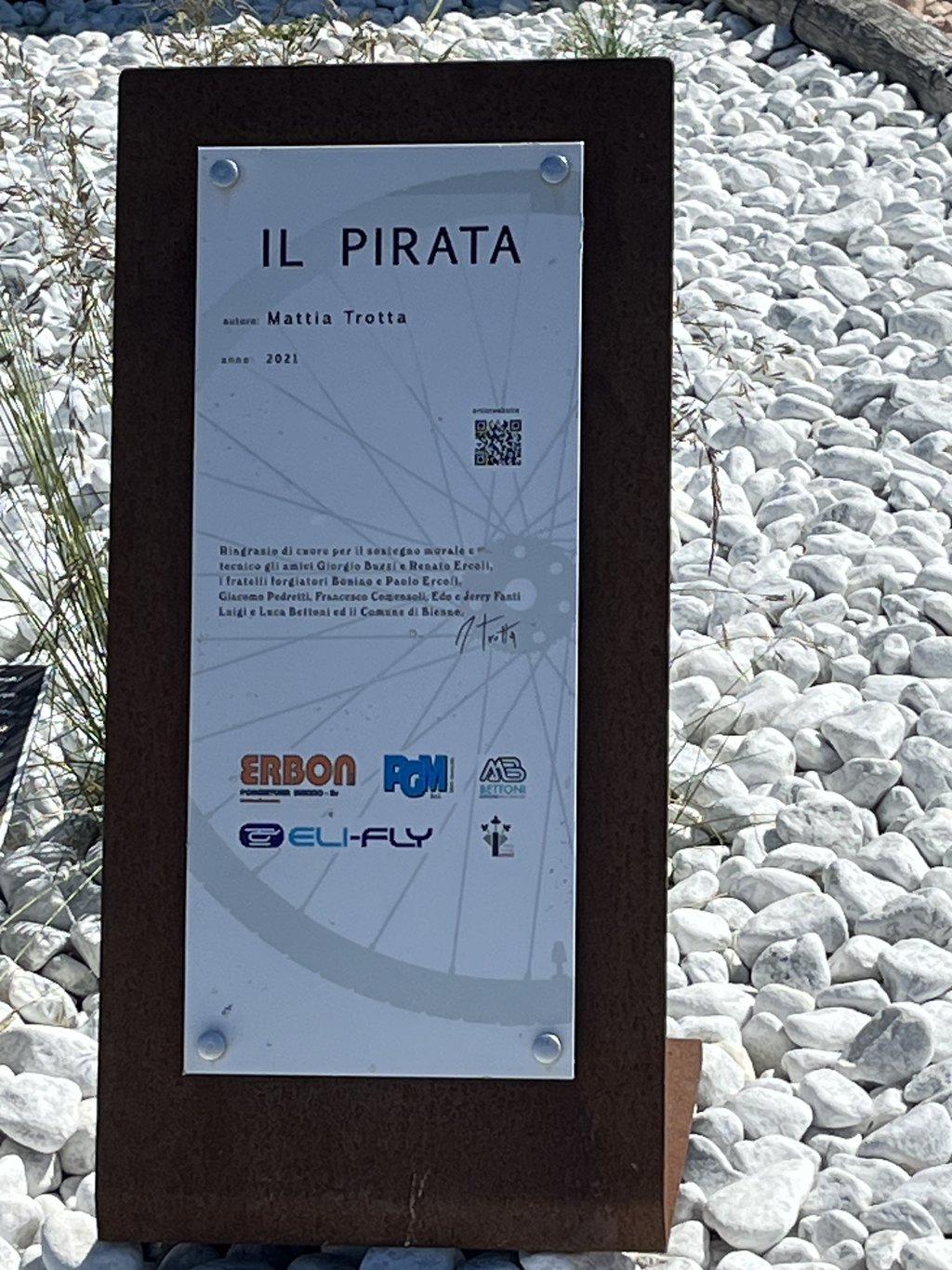
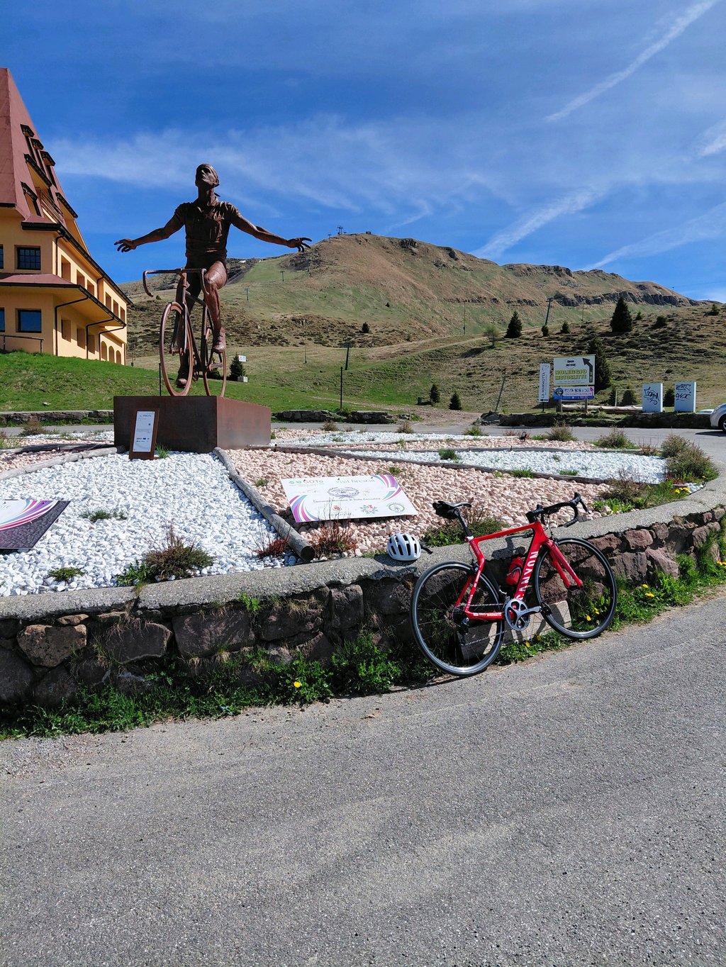
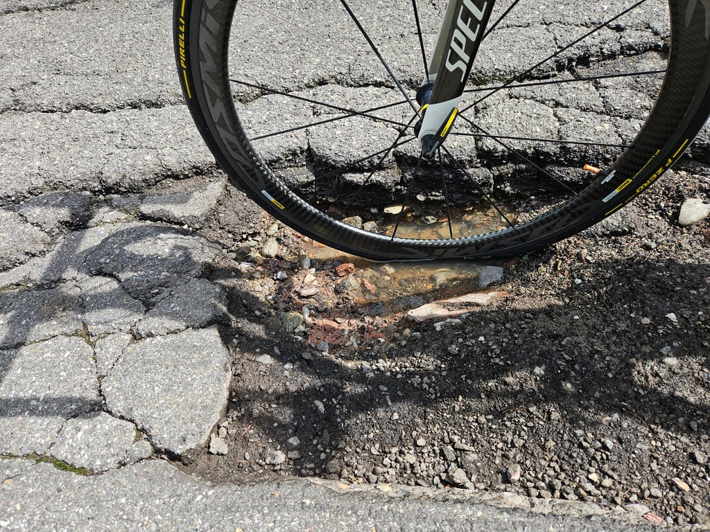
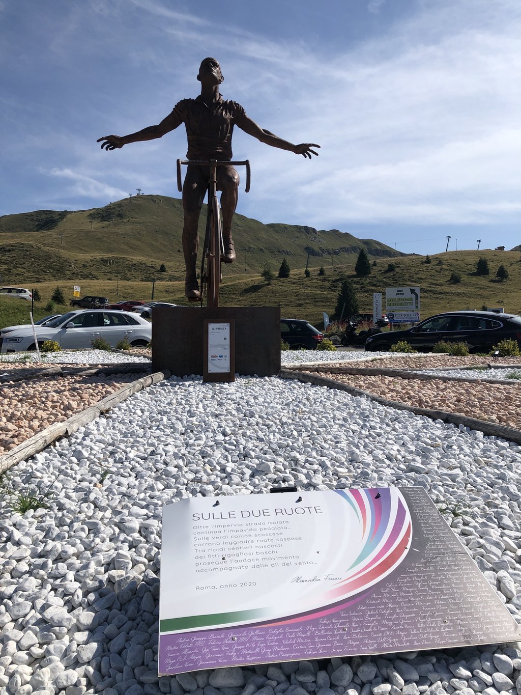
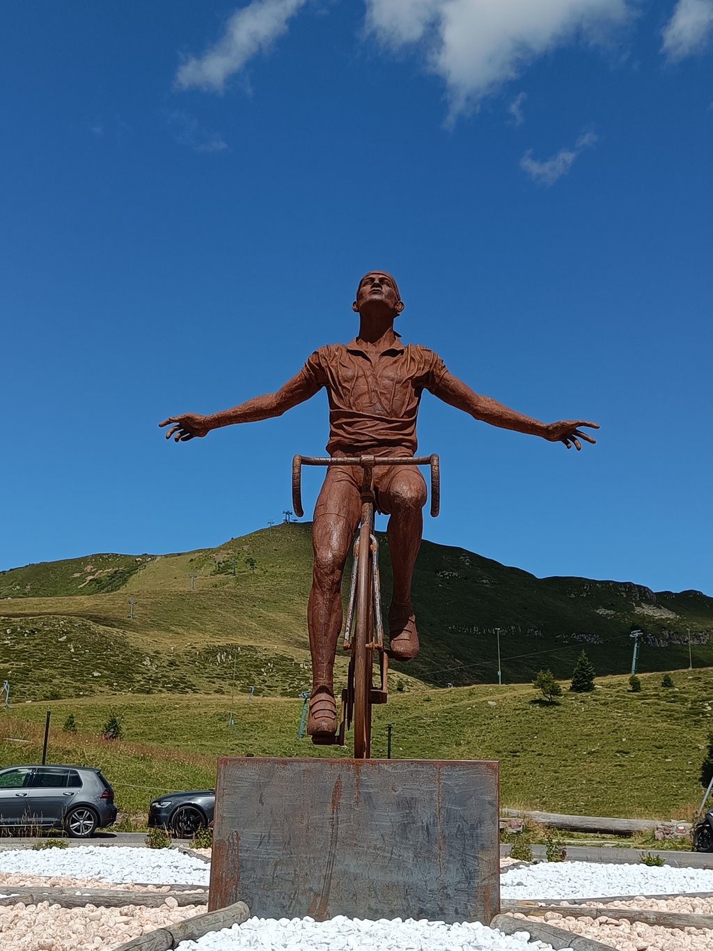
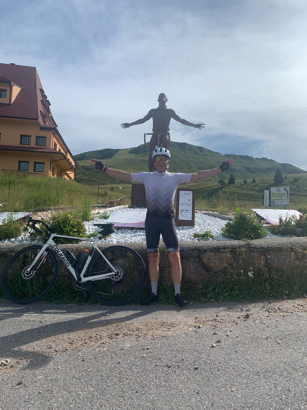
A beautiful climb—sort of like the Alpe d’Huez of this region. The road surface is poor in places, both before and after the vacation village of Montecampione. That’s no reason to avoid the climb, but do take care on the descent. The monument to Pantani alone is worth the trip. Other than that, there isn’t much to do up there in the summer.
Mooie klim, een soort Alpe d’Huez van deze regio. Wegdek is op plekken slecht, zowel voor als na het vakantiedorp Montecampione. Geen reden om de klim te mijden, maar wel voorzichtig afdalen. Momument voor Pantani alleen is al de moeite waard. Verder is er boven niet veel te beleven in de zomer.
Challenging climb overall, especially the length. The road surface from Montacampione to "le baite 1800" is not great but still worth it to get to Pantani's statue
Salita nell'insieme impegnativa, soprattutto per la lunghezza. Il manto stradale da Montacampione a "le baite 1800" non è fantastico ma comunque vale la pena arrivare alla statua di Pantani
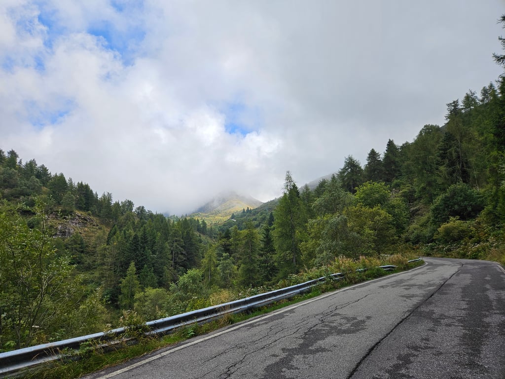
An interesting climb with a wide road and acceptable asphalt at least until Montecampione at an altitude of 1100 metres. Then it flattens out but the asphalt becomes decidedly bad for large stretches, especially at the tunnels so the darkness (never complete) makes things worse. The ascent often peaks at 10-11% alternating with short stretches of 7-8%. Hence the average of 9%. I found no drinking fountains except at the little bar near the pond. The resort buildings tell of a locality in substantial decay. The Pantani monument is worth the effort to get to the top. Little traffic.
Salita interessante con strada ampia e asfalto accettabile almeno fino a Montecampione a quota 1100. Poi spiana ma l'asfalto diventa decisamente pessimo per larghi tratti, soprattutto in corrispondenza dei tunnel quindi il buio (mai completo) peggiora le cose. La salita punta spesso a 10-11% alternando a brevi tratti 7-8%. Da qui la media del 9%. Non ho trovato fontanelle se non al baretto in prossimità del laghetto. Le costruzioni di villeggiatura raccontano una località in sostanziale decadimento. Il monumento a Pantani merita lo sforzo di arrivare in cima. Poco traffico.
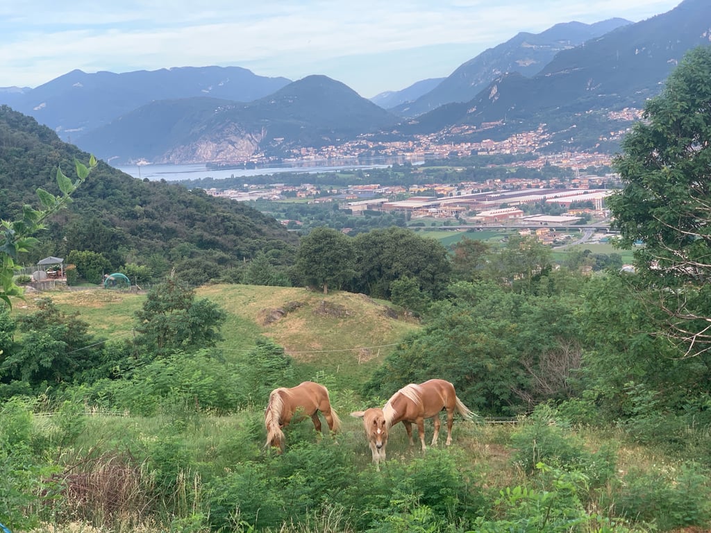
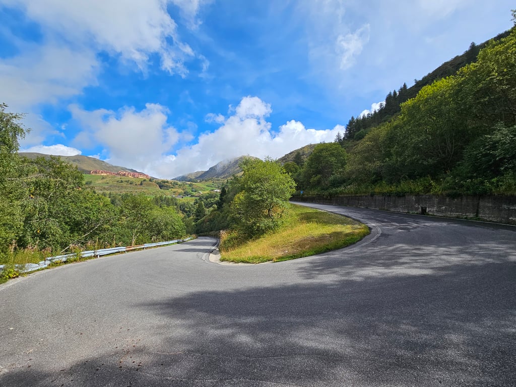
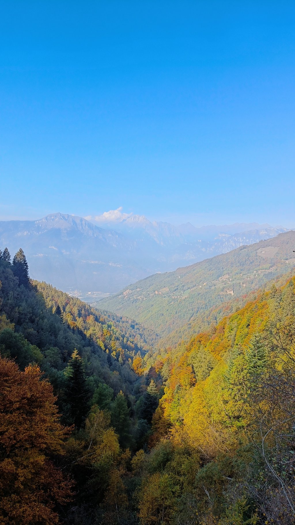
The climb begins shortly after Pisogne and is divided into two parts interspersed with a small flat at montecampione. both the first part and the second half give little breathing space, the gradients are always high and in some places in double figures. the landscape is often wooded alternating with stretches of green meadows, at the end the valley opens up. The descent offers the most spectacular scenery with breathtaking views of Lake Iseo. The asphalt is beautiful in places and rather ruined in others.
la salita inizia poco dopo Pisogne e si divide in due parti inframezzate da un piccolo piano a montecampione. sia la prima parte che la seconda metà danno poco respiro, le pendenze sono sempre alte e in alcuni tratti in doppia cifra. il paesaggio è spesso boschivo alternato a tratti con prati verdi, sul finale la valle si apre. meraviglioso l'arrivo con la statua di Pantani bellissima che domina la piazza. purtroppo è tutto abbandonato li...dovrebbe rinascere fra qualche anno. la discesa regala i paesaggi più spettacolari con viste sul lago d'iseo mozzafiato. asfalto a tratti bello in altri piuttosto rovinato. salita dura ma imperdibile.
Great HC climb near Lake Iseo. This is a solid effort climb with plenty of testing sections. No out of the saddle heaves ( maybe last 500m ) but consistent gradient. Nice quiet road. I had only a handful of cars/vans pass me in first week of June. Hotel at pantani statue/summit was closed for renovations but there are bars along route in villages and Monticampione itself. Of HC climbs around europe I'd rate it 8/10 for difficulty and 5/10 for views/escape/beauty.
Watch the top half of descent with dodgy road surfaces, especially in tunnels.
Beautiful climb that is, of course, entirely in reform of Pantani. By the statue at the top but also by all the slogans along the way. Gives a nice atmosphere. Up to Montecampione there is some life but the last part of the climb I was all alone. Then you also get some tunnelling. I found the climb long but not necessarily tough. Sometimes some stretches of 10-11% (Garmin) but these are soon succeeded by lower percentages. But it's still a long way...
Mooie beklimming die natuurlijk helemaal in hervormen staat van Pantani. Door het standbeeld op de top maar ook door alle leuzen onderweg. Geeft een leuke sfeer. Tot Montecampione is er nog wel wat leven maar het laatste deel van de klim was ik helemaal alleen. Dan krijg je ook wat tunneltjes. Ik vond de klim lang maar niet per se zwaar. Soms wat stukken van 10-11% (Garmin) maar die worden al snel opgevolgd door lagere percentages. Maar het blijft een eind…
This is a really nice climb. Is the road surface in the beginning reasonable to good, from halfway it is really less. That should not stop you from this mountain, because it is a beautiful climb!
Dit is echt een mooie klim. Is het wegdek in het begin nog redelijk tot goed, vanaf halverwege wordt het echt stukken minder. Dat mag je echter niet weerhouden deze berg te bedwingen, want het is een mooie beklimming!
| 5 mph | 02:25:36 |
| 7 mph | 01:43:05 |
| 9 mph | 01:20:20 |
| 12 mph | 01:00:21 |
This page is better in the app