View on map
© MapLibre | OpenStreetMap contributors
1%
2%
4%
6%
8%
10%
12%
15%
20%

Philippionsweg from Am Hasselholz

3.0
3 reviews | Elevation profile | 9 photos
Tips nearby
Philippionsweg from Am Hasselholz
Your achievable time
Calculating based on your best performances...
Relaxed
Maximum
W/kg
W/kg
W/kg
Analyze your climbing performance
Detailed insight into your climbing performance & automatically check off climbs
Based on your best performances.
Your best attempt:
Number of attempts:
Elevation profile Philippionsweg from Am Hasselholz

Statistics

Difficulty points 11
Length 0.4 mi
Average gradient 3.9%
Steepest segment 6.1%
Total ascent 82 ft

Short recap

Hidden gem
Feedback about this climb?
Show climbs nearby Export to GPS device

Philippionsweg from Am Hasselholz is a climb in the region Cologne. It is 0.4 mi long and bridges 82 ft of vertical ascent with an average gradient of 3.9%, resulting in a difficulty score of 11. The top of the ascent is located at 817 ft above sea level. Climbfinder users shared 3 reviews of this climb and uploaded 9 photos.

Road name: Philippionsweg

3.0 by Jarin
This is an automatic translation, the original language is: Dutch.
Lovely hidden climb just outside the city centre in a prqchtog rural area. Climb starts at a beautiful old manor house and climbs very gradually. To your left you have a beautiful view of the Aachener Wald. At the summit you have to keep to the right, as the paved road on the left ends after a few metres and turns into a forest path.... read more

Photos (9)

Philippionsweg from Am Hasselholz
transparant thumb
transparant thumb
transparant thumb

Your uploads (max 4)

Welcome! Please activate your account if you would like to share something. Look for the verification email in your inbox.

If you want to upload your photos, you need to create an account. It only takes 1 minute and it's completely free.

  • Receive free climbfinder goodies for your reviews & photos.
  • Create a bucket list and check off conquered climbs.
  • Add missing climbs.
Continue with GoogleContinue with Google Continue with FacebookContinue with Facebook Continue with AppleContinue with Apple Sign up with email
By signing up you agree to our terms of service and confirm that you have read our privacy & content policy.

Reviews (3)

5.0
4.0
3.0
2.0
1.0
Jarin
1 y 3.0 via the Climbfinder app
This is an automatic translation, the original language is: Dutch. Show original

Lovely hidden climb just outside the city centre in a prqchtog rural area. Climb starts at a beautiful old manor house and climbs very gradually. To your left you have a beautiful view of the Aachener Wald. At the summit you have to keep to the right, as the paved road on the left ends after a few metres and turns into a forest path.

Mooie verborgen klim net buiten het centrum in een prqchtog landelijk gebied. Klim begint bij een prachtig oud landhuis en klimt heel geleidelijk. Links van je heb je een prachtig uitzicht op het Aachener Wald. Op de top moet je rechts aanhouden, want linksaf houdt de verharde weg na een aantal meter op en gaat over in een bospad.

Philippionsweg from Am Hasselholz
Dashboard
BikerJohan
1 y 3.0
This is an automatic translation, the original language is: Dutch. Show original

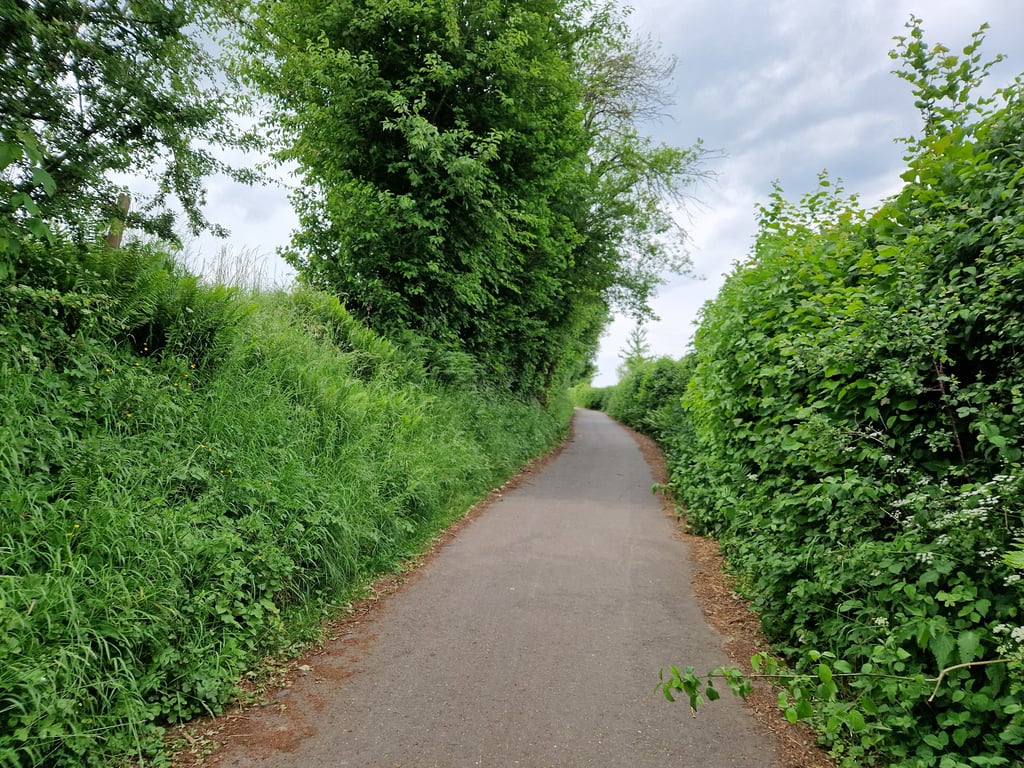
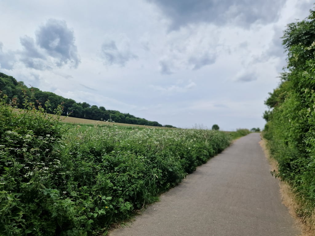
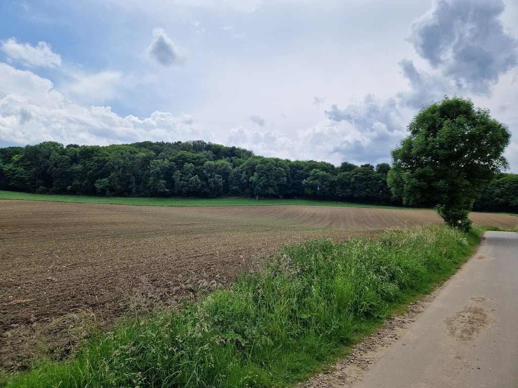
Nice climb on the south side of the Aachen district of Kronenberg. At first, you ride between hedges but towards the top you get more views of the area. After the top, descend towards the railway line. Here the choice to turn left for the climb to Karlhöher. If you turn right you can go through the railway tunnel a little later. If you turn left after this, you can drive towards the Drielandenpunt.

Leuke klim aan de zuidkant van de Akense wijk Kronenberg. In het begin rij je tussen de heggen maar richting de top krijg je meer uitzicht over de omgeving. Na de top afdalen richting de spoorlijn. Hier de keuze om links af te gaan voor de klim naar Karlhöher. Ga je rechtsaf dan kan je even later door het spoortunneltje rijden. Ga je hierna direct linksaf dan kan je richting het Drielandenpunt rijden.

Dashboard
Fedor
4 y 3.0
This is an automatic translation, the original language is: Dutch. Show original

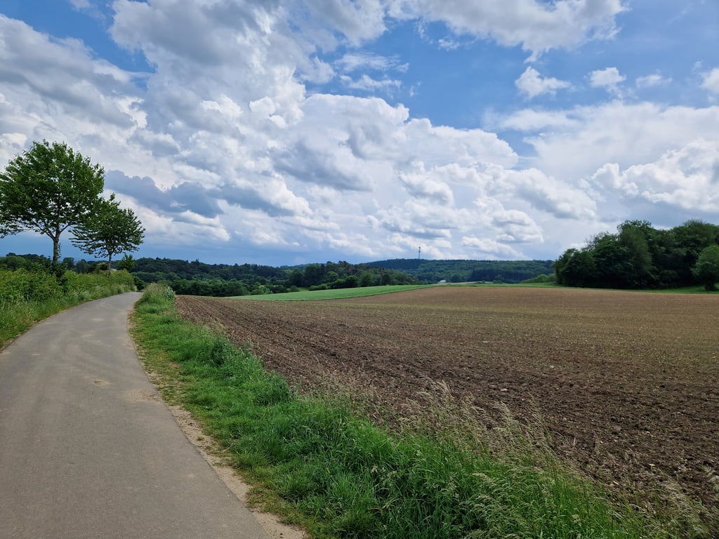
From the beautiful farms you go up the Philippionsweg, which climbs partly between hedges (at the Y-junction keep right). At the highest point there is a bench with a nice view.
This climb you can already start on the Hanbrucher Weg, an asphalt foot / bike path which unfortunately is very bumpy by tree roots. The road goes through a beautiful valley.

Vanaf de fraaie boerderijen ga je omhoog de Philippionsweg in, die deels tussen heggen door omhoog klimt (op de Y-splitsing rechts aan houden). Bij het hoogste punt een bankje met mooi uitzicht.
Deze klim kan je al laten beginnen op de Hanbrucher Weg, een asfalt voet/fietspad wat helaas zeer hobbelig is door boomwortels. De weg loopt wel door een mooi dalletje.

Philippionsweg from Am Hasselholz
Dashboard

Climbing times

5 mph 00:04:44
7 mph 00:03:21
9 mph 00:02:37
12 mph 00:01:58

Road surface condition

0% 0% 0%
Based on 0 votes
Share your knowledge. What was the road condition during your ascent?

Traffic

0% 0% 0%
Based on 0 votes
Your experience counts. How much traffic did you encounter during the climb?

Frequently Asked Questions

Philippionsweg can be cycled from 4 sides. Philippionsweg from Am Hasselholz is the most popular side, but the summit can also be reached via Philippionsweg via Gemmenicher Weg, Kronenberg from Vaalser Strasse & Kronenberg from Amsterdamer Ring.

You don't need special gearing for Philippionsweg from Am Hasselholz. The slope isn't long or steep enough to require much shifting down. You can conquer this climb on power alone. However, a compact gearing system with a smallest front chainring of 34 and largest rear sprocket of 28 or 30 is always nice if you enjoy cycling uphill. This helps maintain a smooth cadence.

Philippionsweg from Am Hasselholz is not tough enough to be assigned a mountain category. This means that even untrained cyclists can reach the top without any problems on this climb.

Philippionsweg from Am Hasselholz is 0.4 mi long.

The average gradient of Philippionsweg from Am Hasselholz is 3.9%.

Philippionsweg from Am Hasselholz has a steepest segment with an average gradient of 6.1%.

The summit of Philippionsweg from Am Hasselholz is at 817 ft.

At a slow pace of 5 mph, it takes about 00:04:44 to climb Philippionsweg from Am Hasselholz. At 7 mph the time is 00:03:21, and at 9 mph 00:02:37. For the fastest cyclists, 00:01:58 is an achievable time.

Philippionsweg from Am Hasselholz is located in the region Cologne in Germany.

This page is better in the app

Climbfinder app
Climbfinder
(Free)
Open