View on map
© MapLibre | OpenStreetMap contributors
1%
2%
4%
6%
8%
10%
12%
15%
20%

Penscherbierg from Wilwerwiltz

3.0
2 reviews | Elevation profile | 7 photos
Tips nearby
Penscherbierg from Wilwerwiltz
transparant thumb
Your achievable time
Calculating based on your best performances...
Relaxed
Maximum
W/kg
W/kg
W/kg
Analyze your climbing performance
Detailed insight into your climbing performance & automatically check off climbs
Based on your best performances.
Your best attempt:
Number of attempts:
Elevation profile Penscherbierg from Wilwerwiltz

Statistics

Difficulty points 59
Length 0.4 mi
Average gradient 9.2%
Steepest segment 15.8%
Total ascent 177 ft

Short recap

#46 average steepest climb of Luxembourg
Feedback about this climb?
Show climbs nearby Export to GPS device

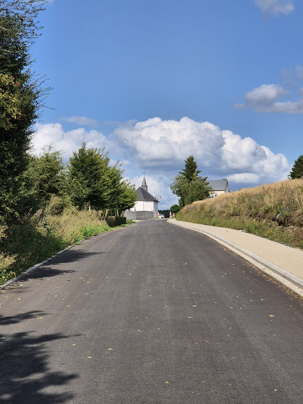
Penscherbierg from Wilwerwiltz is a climb in the region Nature Park Our. It is 0.4 mi long and bridges 177 ft of vertical ascent with an average gradient of 9.2%, resulting in a difficulty score of 59. The top of the ascent is located at 1165 ft above sea level. Climbfinder users shared 2 reviews of this climb and uploaded 7 photos.

Road name: Pënscherbierg
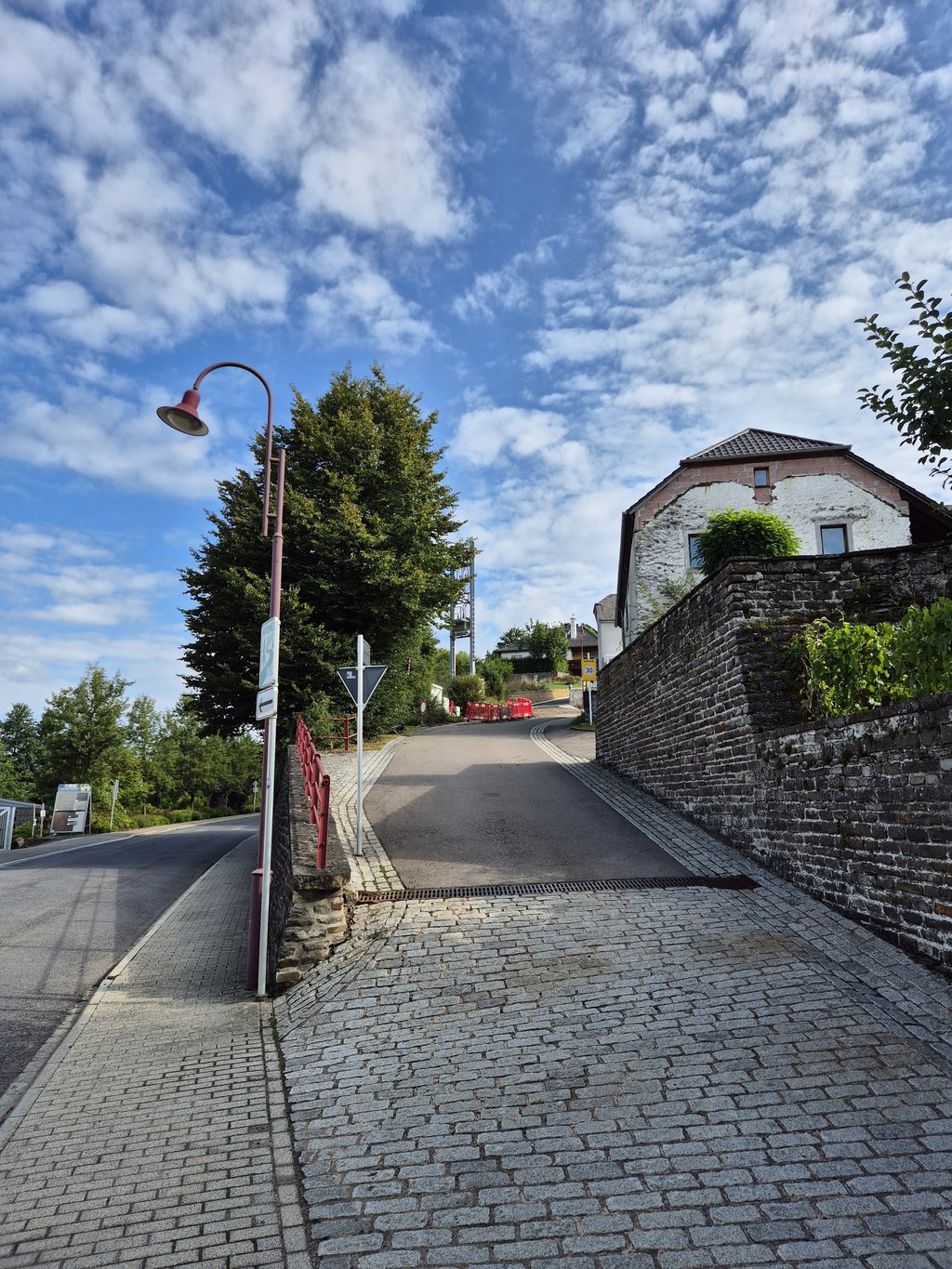
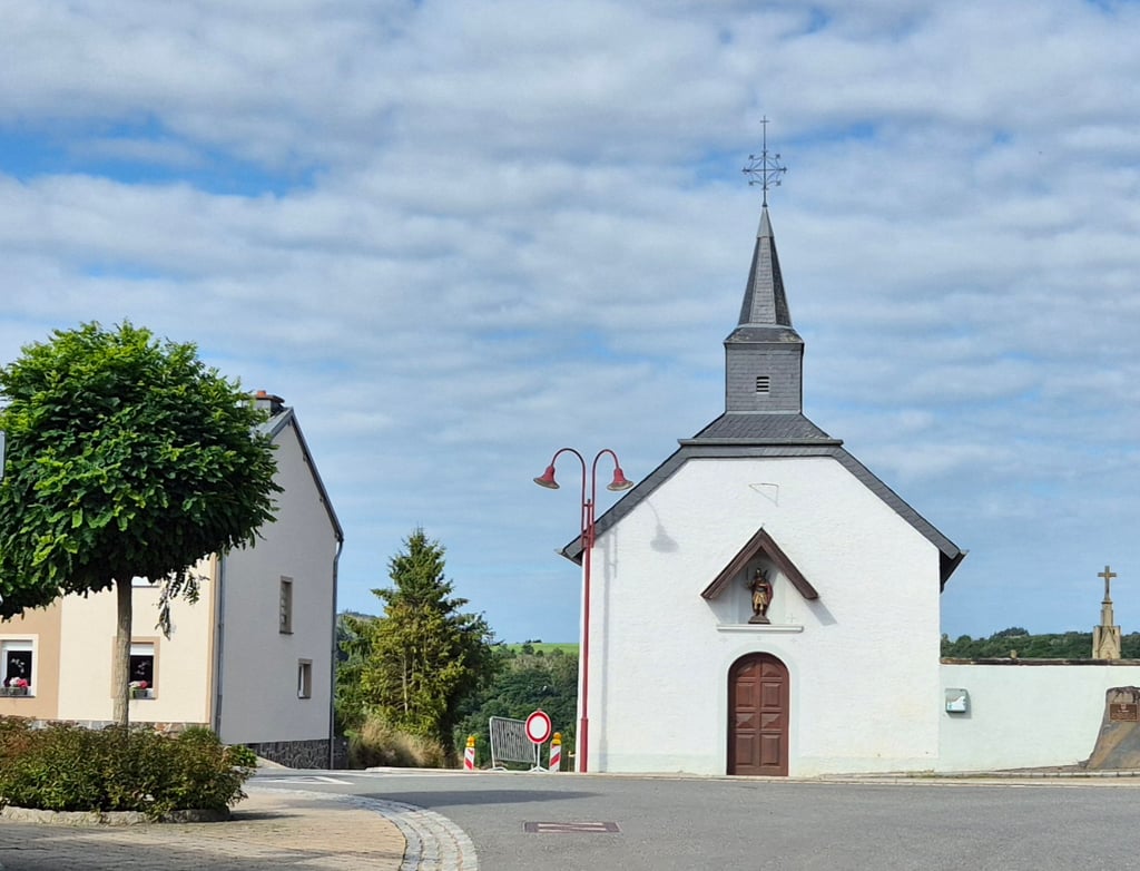
3.0 by Jarin
This is an automatic translation, the original language is: Dutch.
Climb that goes straight up steeply opposite the station in Wilwerwiltz. After a while the climb flattens out to a more pleasant gradient. At the top, you end at a very pretty little chapel on your left. By the way, in August 2025, after about's 100 metres, the road was broken up for a short distance, so I had to walk about's 30 metres.... read more

Photos (7)

Penscherbierg from Wilwerwiltz
transparant thumb
transparant thumb
transparant thumb
transparant thumb
transparant thumb

Your uploads (max 4)

Welcome! Please activate your account if you would like to share something. Look for the verification email in your inbox.

If you want to upload your photos, you need to create an account. It only takes 1 minute and it's completely free.

  • Receive free climbfinder goodies for your reviews & photos.
  • Create a bucket list and check off conquered climbs.
  • Add missing climbs.
Continue with GoogleContinue with Google Continue with FacebookContinue with Facebook Continue with AppleContinue with Apple Sign up with email
By signing up you agree to our terms of service and confirm that you have read our privacy & content policy.

Reviews (2)

5.0
4.0
3.0
2.0
1.0
Jarin
10 Mo 3.0 via the Climbfinder app
This is an automatic translation, the original language is: Dutch. Show original

Climb that goes straight up steeply opposite the station in Wilwerwiltz. After a while the climb flattens out to a more pleasant gradient. At the top, you end at a very pretty little chapel on your left. By the way, in August 2025, after about's 100 metres, the road was broken up for a short distance, so I had to walk about's 30 metres.

Klim die tegenover het station in Wilwerwiltz direct steil naar boven gaat. Na een poosje vlakt de klim af naar een aangenamer klimpercentage. Bovenaan eindig je bij een alleraardigst kapelletje aan je linkerhand. In augustus 2025 was de weg na zo'n 100 meter overigens een kort stukje opengebroken, dus moest ik zo'n 30 meter lopend afleggen.

Dashboard
Tjaart
1 y 3.0
This is an automatic translation, the original language is: Dutch. Show original

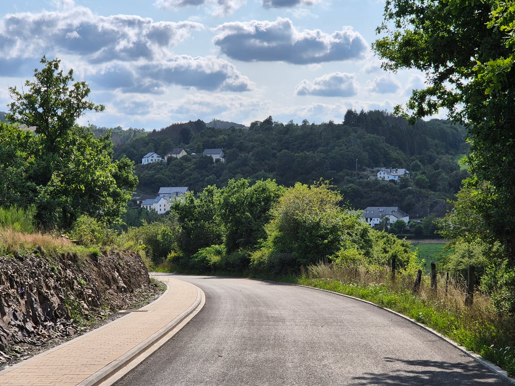
Pretty steep climb right at the start. Then flattens out a bit. Good asphalt. Partly car-free due to prohibition sign. Ends at chapel. Between buildings at first, then some better views.

Behoorlijk steile klim direct in het begin. Vlakt dan wat af. Prima asfalt. Deels autoluw door verbodsbord. Eindigt bij kapelletje. Tussen bebouwing in het begin, daarna wat betere uitzichten.

Penscherbierg from Wilwerwiltz
Dashboard

Climbing times

5 mph 00:04:22
7 mph 00:03:05
9 mph 00:02:24
12 mph 00:01:48

Road surface condition

0% 0% 0%
Based on 0 votes
Share your knowledge. What was the road condition during your ascent?

Traffic

0% 0% 0%
Based on 0 votes
Your experience counts. How much traffic did you encounter during the climb?

Frequently Asked Questions

Penscherbierg can be cycled from 3 sides. Penscherbierg from Wilwerwiltz is the most popular side, but the summit can also be reached via Enneschte Wee from Pintsch & Ierweschte Wee from Pintsch.

You don't need special gearing for Penscherbierg from Wilwerwiltz. The slope isn't long or steep enough to require much shifting down. You can conquer this climb on power alone. However, a compact gearing system with a smallest front chainring of 34 and largest rear sprocket of 28 or 30 is always nice if you enjoy cycling uphill. This helps maintain a smooth cadence.

Penscherbierg from Wilwerwiltz falls into the 5th category. With good fitness, you can ride it up with speed and power. If you have less training, shift down and climb smoothly.

Penscherbierg from Wilwerwiltz is 0.4 mi long.

The average gradient of Penscherbierg from Wilwerwiltz is 9.2%.

Penscherbierg from Wilwerwiltz has a steepest segment with an average gradient of 15.8%.

The summit of Penscherbierg from Wilwerwiltz is at 1165 ft.

At a slow pace of 5 mph, it takes about 00:04:22 to climb Penscherbierg from Wilwerwiltz. At 7 mph the time is 00:03:05, and at 9 mph 00:02:24. For the fastest cyclists, 00:01:48 is an achievable time.

Penscherbierg from Wilwerwiltz is located in the region Nature Park Our in Luxembourg.

This page is better in the app

Climbfinder app
Climbfinder
(Free)
Open