| Beautiful scenery |
| Hidden gem |
| 8 hairpin turns |
| #45 average steepest climb of Trento |
Penegal from Mendelpass is a climb in the region Trento. It is 2.4 mi long and bridges 1178 ft of vertical ascent with an average gradient of 9.3%, resulting in a difficulty score of 371. The top of the ascent is located at 5640 ft above sea level. Climbfinder users shared 2 reviews of this climb and uploaded 8 photos.
3.0 by TimmyTwoWheelsThis is an automatic translation, the original language is: Dutch.I did this climb as a follow-up to the Mendel pass. If you are also planning this: don't go too hard on the Mendel pass, you will need all your energy for this climb! The road surface is not in the best condition. One advantage is that the road is extremely quiet, it is only used by visitors to a hotel located at the top or hikers. The climb itself is quite tough in terms of steepness. Most of the climb you cycle between the woods so you are well protected from the sun. Once at the to... read more

Welcome! Please activate your account if you would like to share something. Look for the verification email in your inbox.
If you want to upload your photos, you need to create an account. It only takes 1 minute and it's completely free.
I did this climb as a follow-up to the Mendel pass. If you are also planning this: don't go too hard on the Mendel pass, you will need all your energy for this climb!
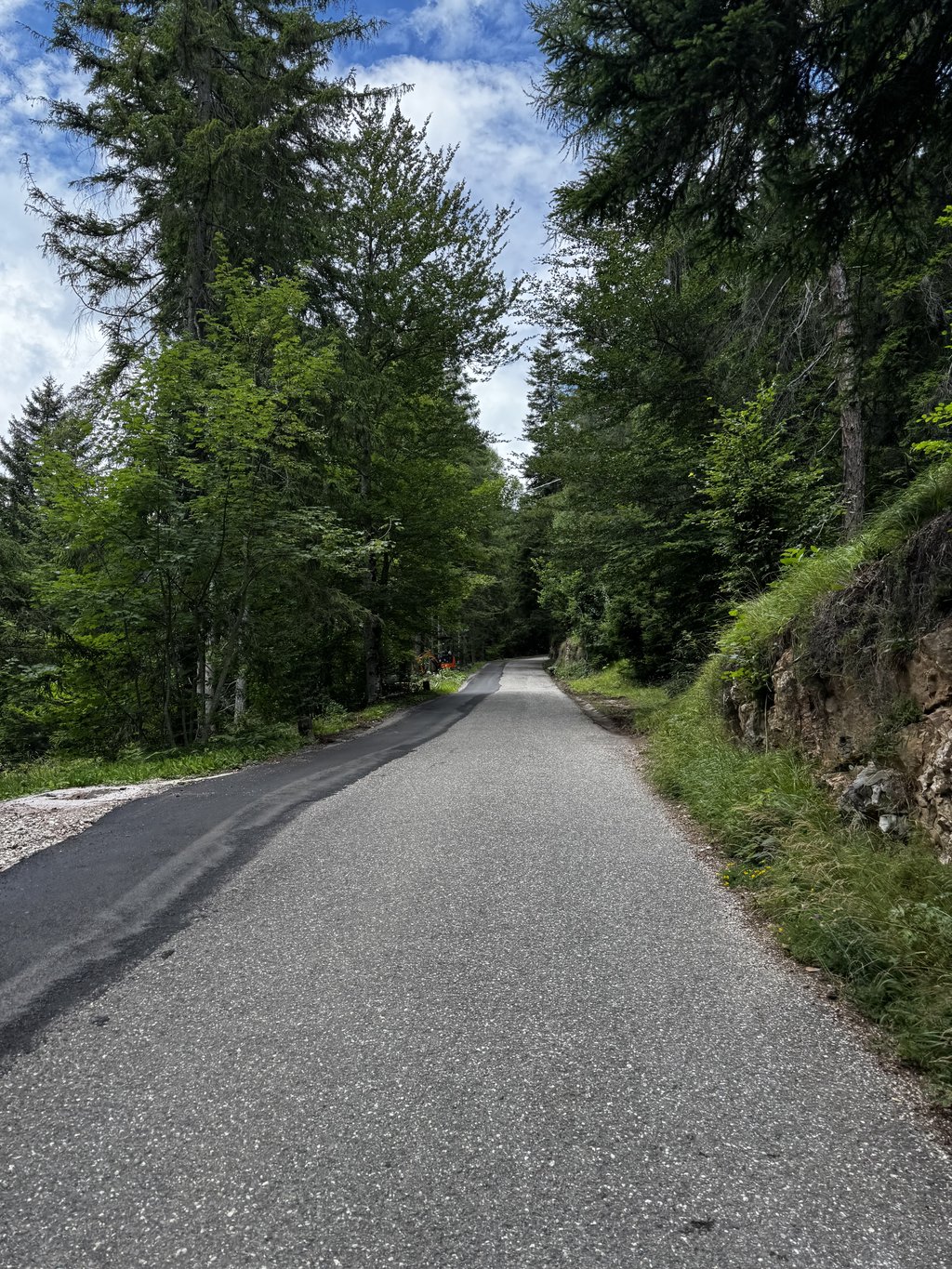
The road surface is not in the best condition. One advantage is that the road is extremely quiet, it is only used by visitors to a hotel located at the top or hikers.
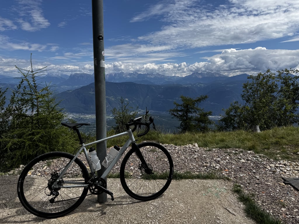
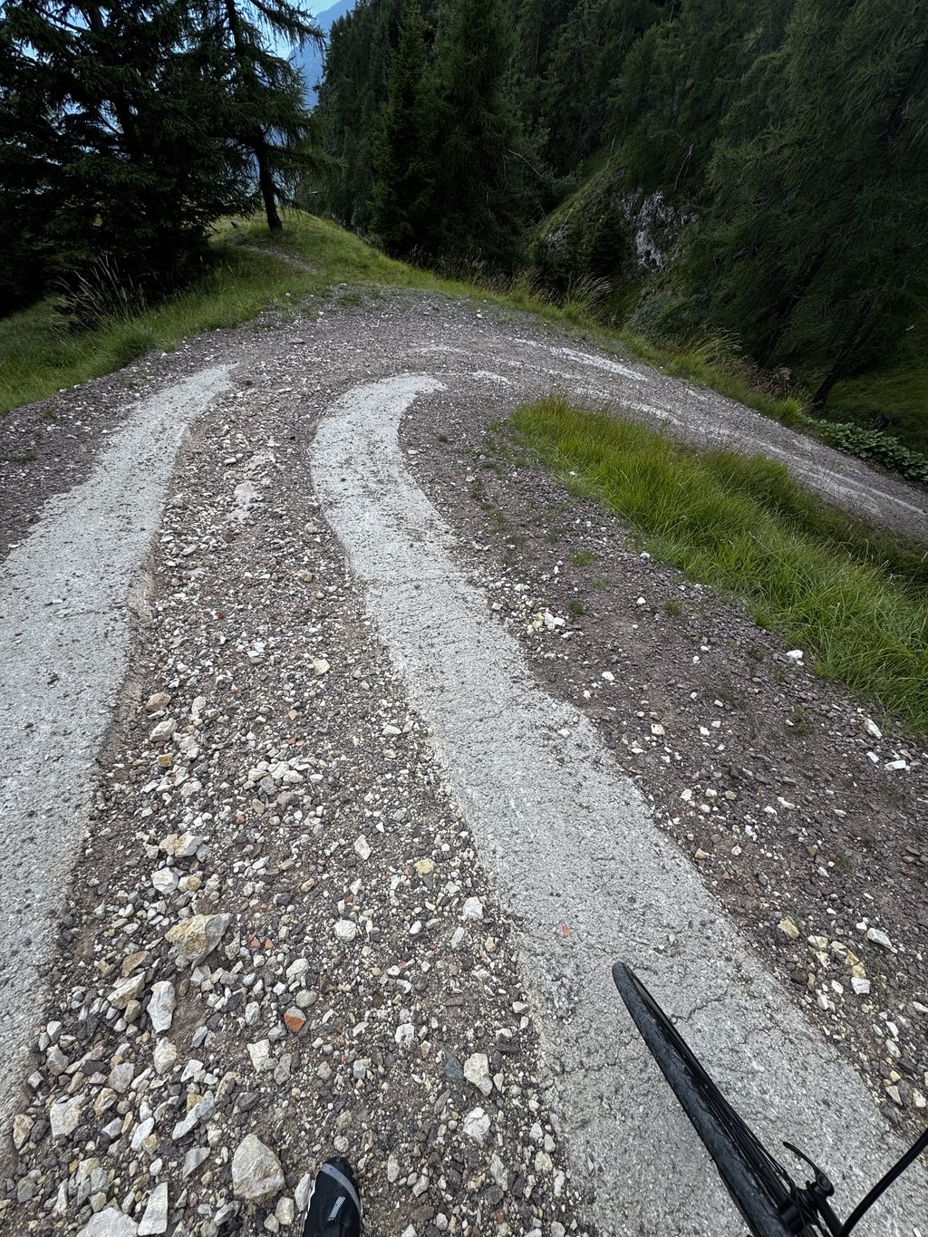
The climb itself is quite tough in terms of steepness. Most of the climb you cycle between the woods so you are well protected from the sun. Once at the top, you can continue cycling for a bit until you reach a transmission tower, where the view is great. The last bit you will have to walk, because there the road surface is extremely steep and not rideable because of all the stones.
Ik heb deze klim gedaan als vervolg op de Mendel pas. Als je dit ook van plan bent: niet te hard gaan op de Mendel pas, je zult al je energie nodig hebben voor deze klim!
Het wegdek is niet in de beste staat. Een voordeel is wel dat de weg extreem rustig is, deze wordt alleen gebruikt door bezoekers van een hotel dat boven op de top ligt of wandelaars.
De klim zelf is best pittig qua steigingspercentage. Het grootste deel van de klim fiets je tussen de bossen door dus je bent goed beschut tegen de zon. Eenmaal boven kun je nog een stukje doorfietsen tot een zendmast, daar is het uitzicht geweldig. Het laatste stukje zul je wel moeten lopen, want daar is het wegdek extreem steil en door alle stenen niet te berijden.
Short steep climb that is fresh in summer (shade and altitude) with few traffic. Worth to train your legs keeping them up. You can climb Mendelpass from Kaltern yourself (+950mt +2hr), or with a panoramic cable car (+0mt +15min on a masterpiece of mechanical engineering) and then attempt this climb quite quickly. Enjoy a long descent (20 Km) to Kaltern again.
Cable car can be busy in full summer - first car leaving at 8.13 AM may be less crowded.
| 5 mph | 00:28:49 |
| 7 mph | 00:20:24 |
| 9 mph | 00:15:54 |
| 12 mph | 00:11:56 |
This page is better in the app