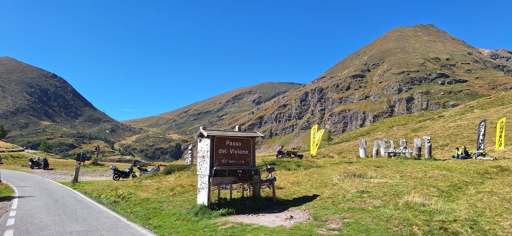
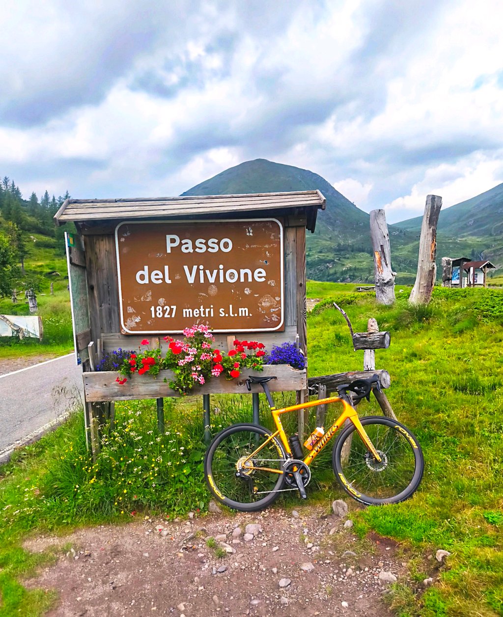
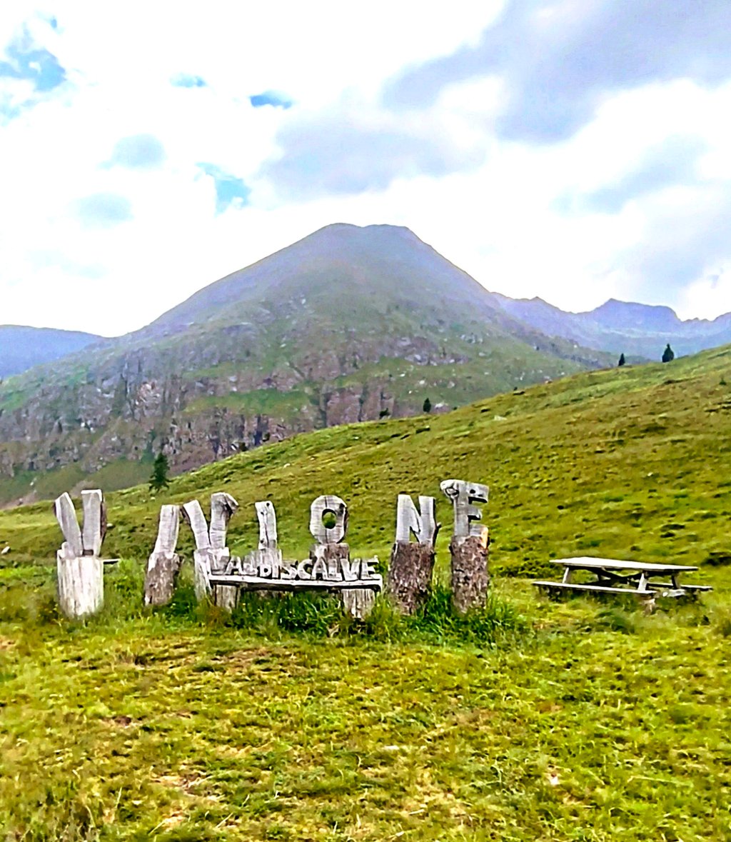
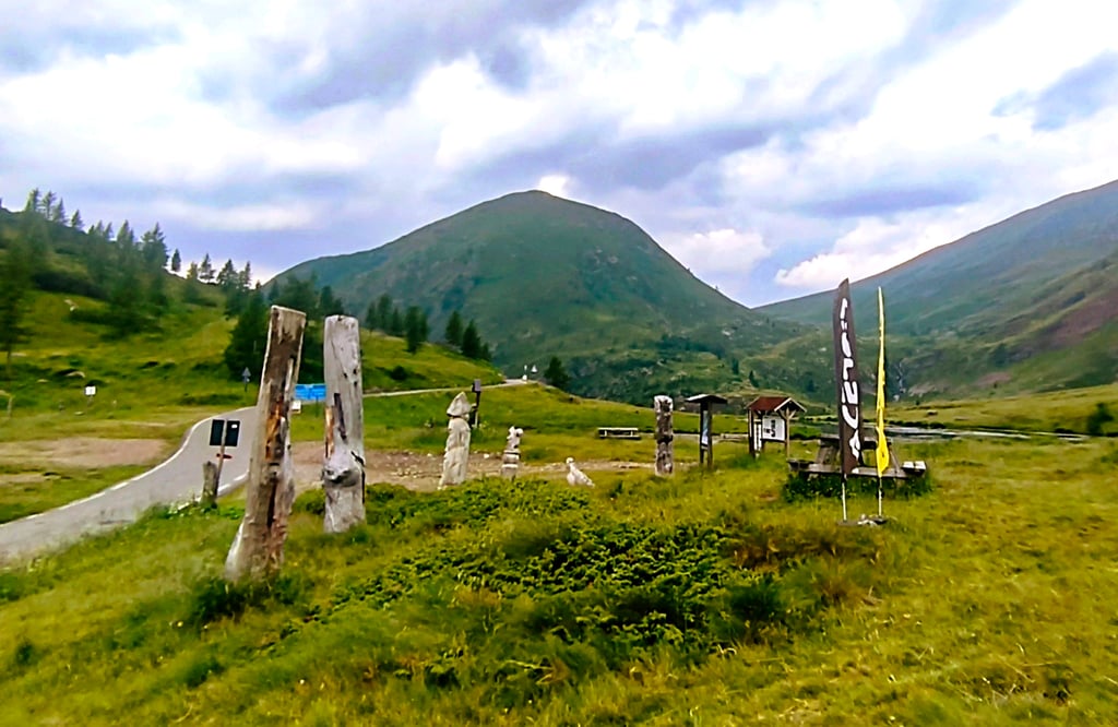
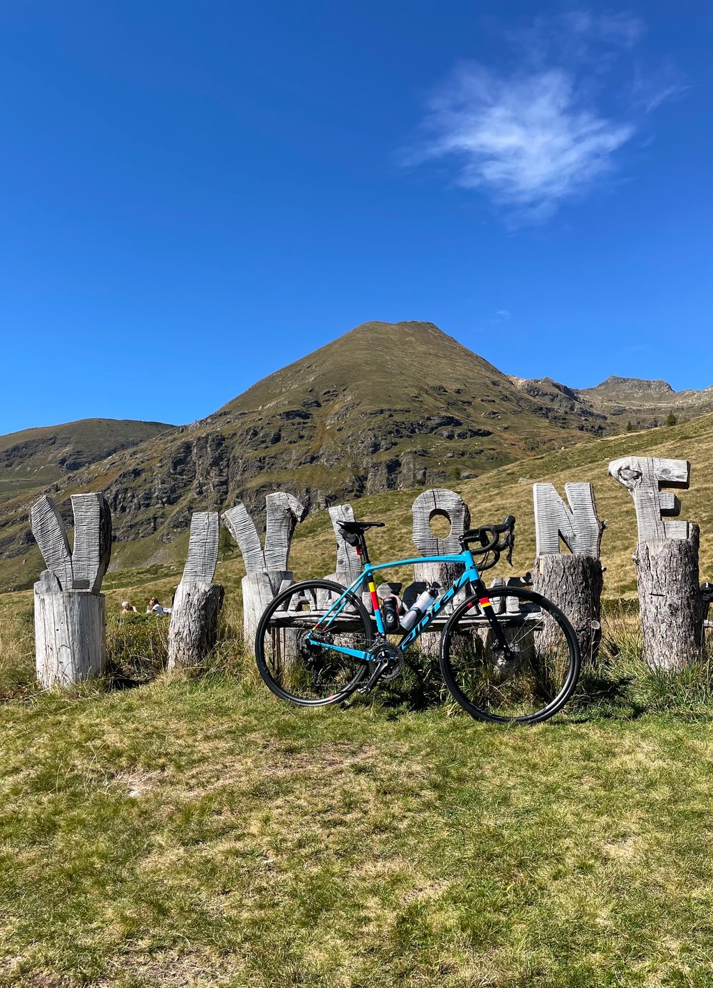
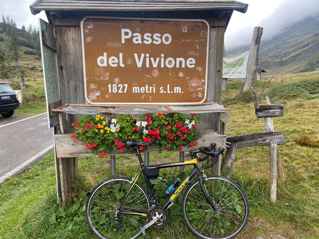
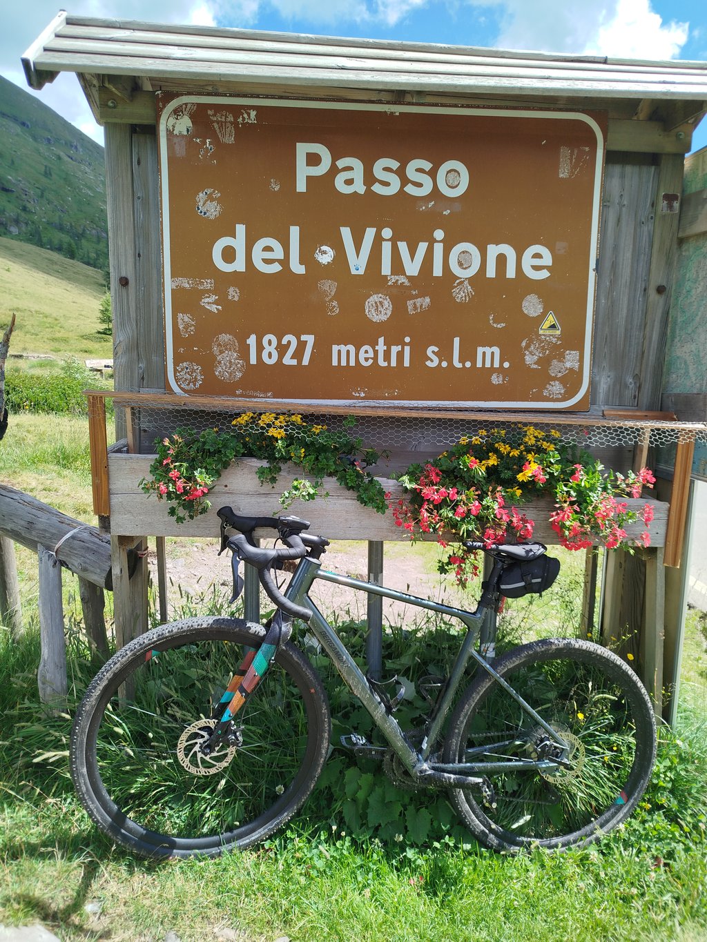
Passo del Vivione is a climb in the region Brescia. It is 12.3 mi long and bridges 4491 ft of vertical ascent with an average gradient of 6.9%, resulting in a difficulty score of 1158. The top of the ascent is located at 5994 ft above sea level. Climbfinder users shared 7 reviews of this climb and uploaded 24 photos.
Road name: SP 294 della Val di Scalve
4.0 by RobiRini66This is an automatic translation, the original language is: Italian.Beautiful panoramic climb with a less than perfect road surface. Slightly frequented and done with a loop starting from Lake Iseo. It becomes a beautiful stage. Possibility of refreshments at the finish. Beware of narrow road without protections in the first part of the descent (if you do the loop). Fountains available along the route, few.... read more
Welcome! Please activate your account if you would like to share something. Look for the verification email in your inbox.
If you want to upload your photos, you need to create an account. It only takes 1 minute and it's completely free.
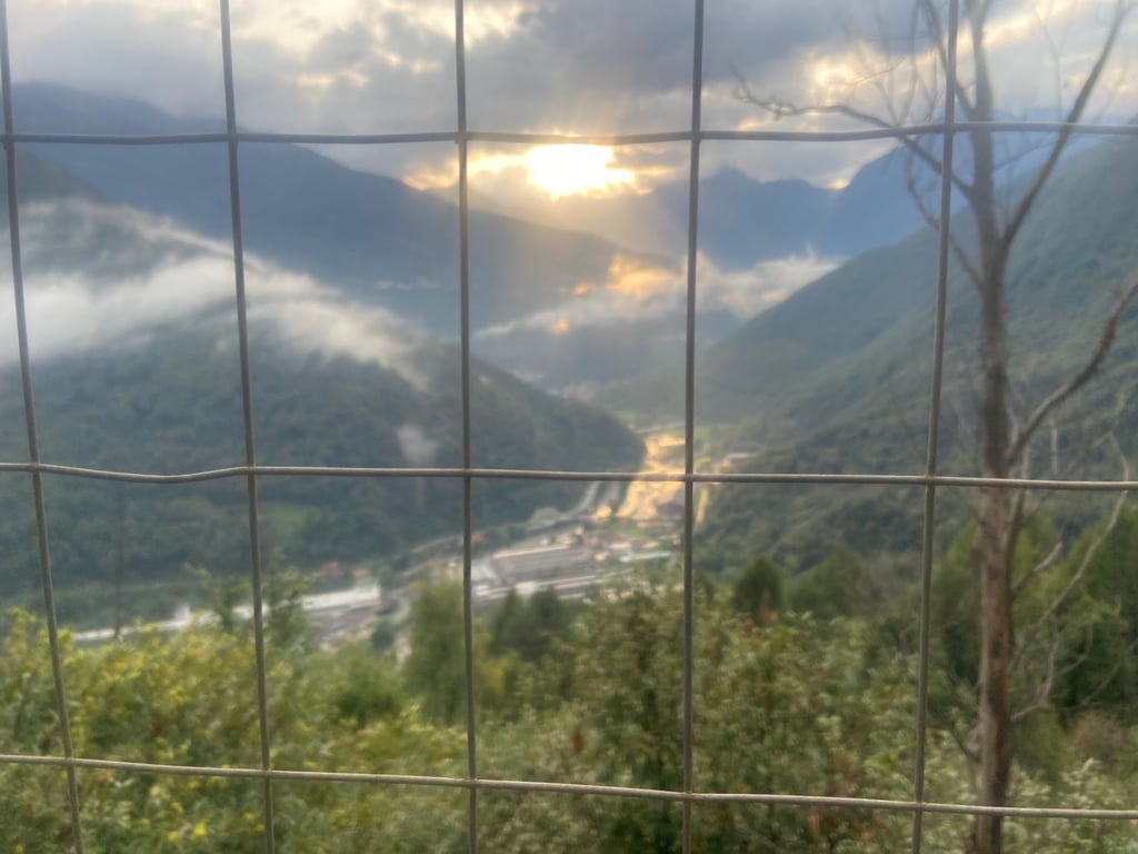
A beautiful climb, with breathtaking views as you approach the finish. The gradient is almost always steady, with the final few kilometers being particularly challenging. It’s a shame that the road surface isn’t the best in several sections. In any case, it’s always worth doing!
Bella salita, con panorama mozzafiato verso l'arrivo. Pendenza quasi sempre costante, con gli ultimi km particolarmente impegnativi. Peccato x l'asfalto che x vari tratti non è dei migliori. In ogni caso, vale sempre la pena farla!
A truly stupendous climb. Great variety of scenery in 20km of climbing. The last 5 km never let up (but already at -8 the story starts to change)! You never (and I mean never believe me) go below 10%. The first few of these last 5 km are the toughest. It is very reminiscent of the tough part of the Gavia (both in terms of the environment and the width of the roadway). Inside the forest, you go from 12 to 14%, the last three instead are constant at 10-11%, including the last kilometre and a half when you come out of the forest and have the illusion that it flattens out a bit, this is definitely not the case! It is difficult to find the rhythm even in the first 15km, there are short stretches where the gradients induce you to push, but then they change immediately and steps come up to take your pace away. In short, the unevenness takes over in the first big part, the final part, on the other hand, is smooth in all its hardness.
Una salita davvero stupenda. Grande varietà di paesaggi che in 20km di salita si susseguono rapidamente. Gli ultimi 5 km non mollano mai (ma già ai -8 la storia inizia a cambiare)! Non si scende mai (e dico mai credetemi) sotto il 10%. I primi, di questi ultimi 5km, sono i più tosti. Ricorda moltissimo la parte dura del Gavia (sia per ambiente che per larghezza della carreggiata). Dentro al bosco, si passa dal 12 al 14%, gli ultimi tre invece sono costanti al 10-11%, compeso l’ultimo km e mezzo auando si esce dal bosco e si ha l’illusione che spiani un po’, non è assolutamente così! Difficile trovare il ritmo anche nei primi 15km, ci sono brevi tratti dove le pendenze inducono a spingere ma poi cambia subito e arrivano dei gradini a toglierti il passo. Insomma, l’irregolarità la fa da padrona nella prima grande parte, quella finale invece è regolare in tutta la sua durezza.
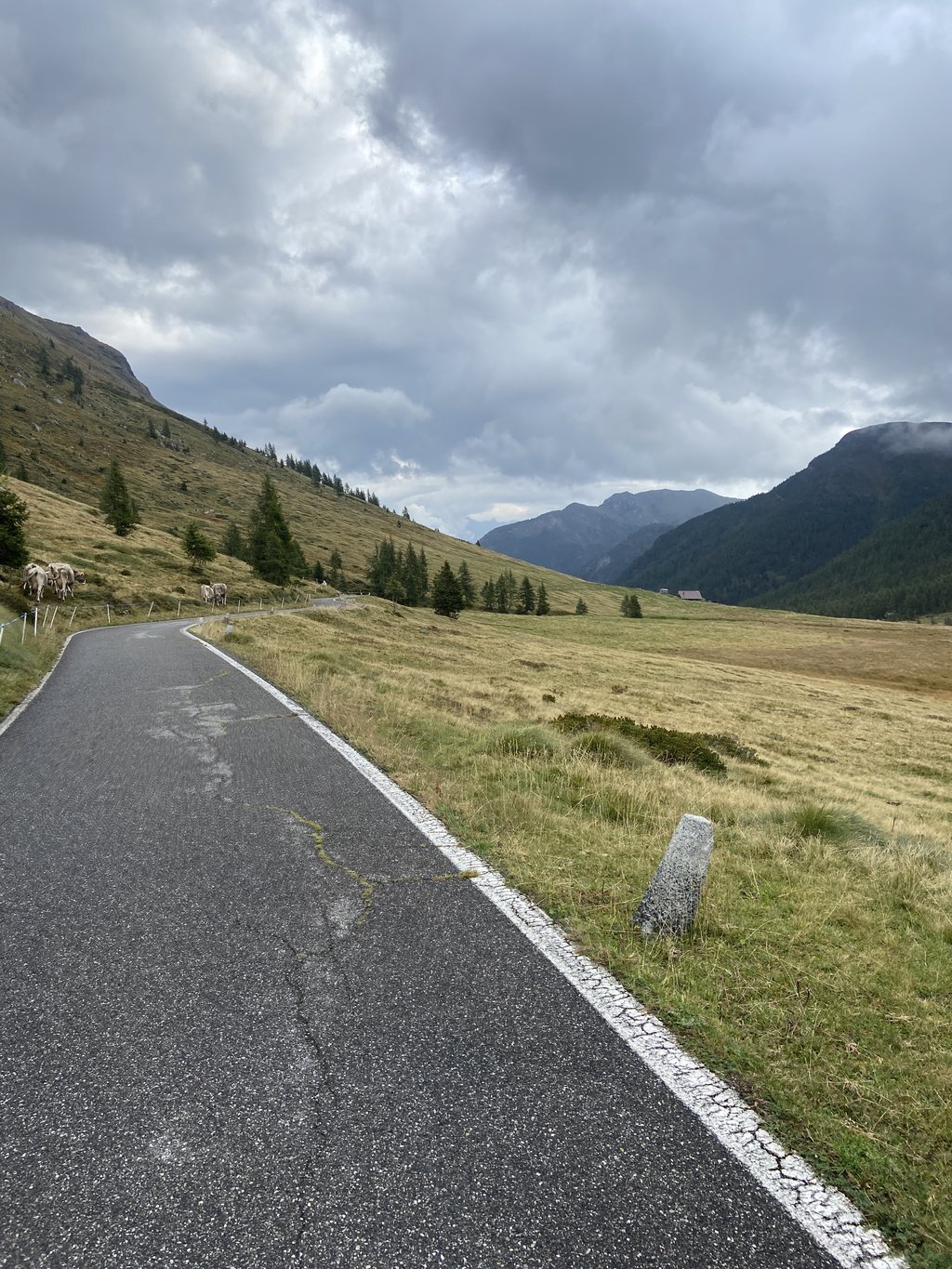
The road is so narrow that it almost looks like a bicycle path!
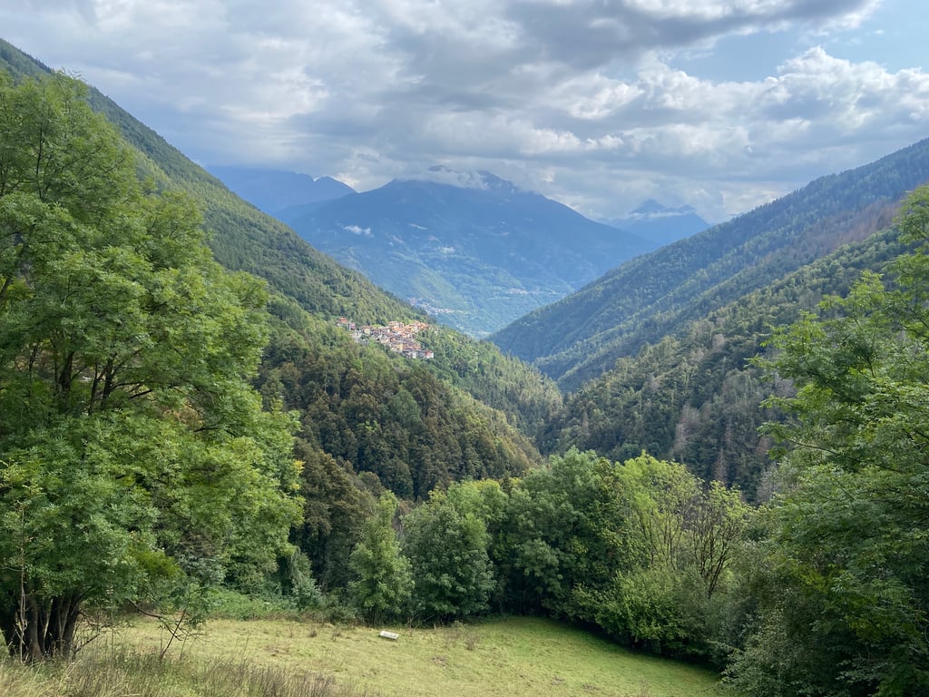
Very little traffic, the central part is immersed in greenery and the roar of torrents. From a naturalistic point of view, it is a climb that is well worth the effort, with environments that change radically, particularly if you decide to complete a loop tour, descending towards Schilpario, with views of Cimon della Bagozza, Concarena, etc. - and then return via Dezzo di Scalve or Borno. Personally, I found the last 8km of the ascent tiring!
La strada è talmente stretta che, sembra quasi una ciclabile!
Molto poco frequentata, la parte centrale è immersa nel verde e lo scroscio dei torrenti. Naturalisticamente, una salita che merita con ambienti che cambiano radicalmente, in particolare se si decide di completare un giro ad anello, scendendo verso Schilpario, con vista su Cimon della Bagozza, Concarena, etc - e poi rientrare via Dezzo di Scalve oppure Borno. Personalmente, ho trovato faticosi gli ultimi 8km dell'ascesa!
Beautiful panoramic climb with a less than perfect road surface.
Slightly frequented and done with a loop starting from Lake Iseo. It becomes a beautiful stage.
Possibility of refreshments at the finish.
Beware of narrow road without protections in the first part of the descent (if you do the loop).
Fountains available along the route, few.
Bella salita panoramica con fondo stradale non perfetto.
Poco frequentata e fatta con partenza dal lago Iseo con giro ad anello. Diventa una bella tappa.
Possibilità di ristoro all'arrivo.
Attenzione a strada stretta senza protezioni, nella prima parte di discesa (se fate il giro).
Fontane disponibili lungo il percorso, poche.
Climbed this summer, very beautiful and with little traffic. The road surface is not exactly optimal, but at the top the view is fantastic. If you are in the area, it is worth it
Cheers
Salita fatta quest'estate, molto bella e poco trafficata. Manto stradale non proprio ottimale, ma in cima il panorama è fantastico. Se si è in zona, vale la pena
Cheers
What a beautiful climb! Seems to be a beautiful cycling area anyway. Road surface is ok, it's part of the experience.
Wat een mooie klim! Schijnt sowieso mooi fietsgebied te zijn. Wegdek wel ok, hoort bij de beleving.
Road surface is in very poor condition. Cycled 15 sept 2015. A nice climb in terms of scenery though
Wegdek is in zeer slechte staat. 15 sept. 2015 gefietst. Wel een mooie klim qua omgeving
| 5 mph | 02:28:39 |
| 7 mph | 01:45:14 |
| 9 mph | 01:22:00 |
| 12 mph | 01:01:36 |
This page is better in the app