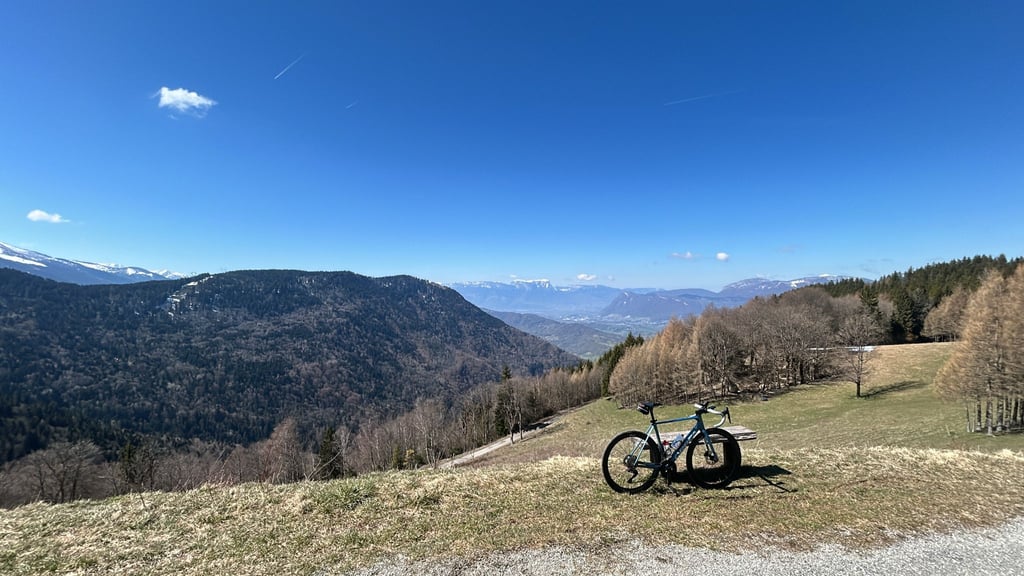
| Beautiful scenery |
| Hidden gem |
| 16 hairpin turns |
| #100 toughest climb of Auvergne-Rhône-Alpes |
| #84 most elevation gain of Savoie |
| #26 longest climb of La Maurienne |
| #87 average steepest climb of Savoie |
Montendry from Chamoux-sur-Gelon is a climb in the region La Maurienne. It is 8 mi long and bridges 3346 ft of vertical ascent with an average gradient of 8%, resulting in a difficulty score of 927. The top of the ascent is located at 4416 ft above sea level. Climbfinder users shared 3 reviews of this climb and uploaded 8 photos.
Road name: D26
3.0 by ArturoMPThis is an automatic translation, the original language is: Spanish.It is easy to climb, and up to Montendry the road is very good. From there to the top the road worsens a lot and the gutters to divert the melt water make the descent in particular not very recommendable. Even in April it is possible to find snow on the road in the shady areas (I had to walk 30m). The views from the top are spectacular. There are many people paragliding from there, which gives charm to the views and the descent.... read more

Welcome! Please activate your account if you would like to share something. Look for the verification email in your inbox.
If you want to upload your photos, you need to create an account. It only takes 1 minute and it's completely free.
It is easy to climb, and up to Montendry the road is very good. From there to the top the road worsens a lot and the gutters to divert the melt water make the descent in particular not very recommendable. Even in April it is possible to find snow on the road in the shady areas (I had to walk 30m). The views from the top are spectacular. There are many people paragliding from there, which gives charm to the views and the descent.
Es cómodo de subir, y hasta Montendry la carretera es muy buena. Desde ahí hasta arriba la carretera empeora mucho y las canaletas para desviar del agua del deshielo hacen que sobretodo la bajada sea poco recomendable. Incluso en abril es posible encontrar nieve en la carretera en las zonas de umbría (tuve que hace 30m a pie). Las vistas desde arriba son espectaculares. Hay mucha gente haciendo parapente desde allí, lo que le da encanto a las vistas y la bajada.
Early ascent from La Rochette (before the storm)
Nice climb up to Montendry, a beautiful forest road. Above Montendry the road is worse and the gutters that cut the road are a bit tricky both going up and down!
Note 2 large, angry patous in the meadows 2km from the summit...
You can get to the fort by bike. 500m of dirt road to finish, but you can get there on a road bike.
Monté tôt en partant de La Rochette (avant l’orage)
Montée sympathique jusqu'à Montendry, belle route en forêt. Au dessus la route est plus dégradée et les gouttières qui coupent la route sont un poil pénibles tant à la montée qu’à la descente !
A noter 2 gros patous énervés dans les prés à 2km du sommet...
On peut aller jusqu'au fort en vélo. 500m de chemin de terre pour finir mais ça passe en vélo de route.
Done on the morning of Wednesday 6 July 2022.
If you like nature and quiet, wild climbs, you will love this climb.
The start is exactly the same as the Col du Champ-Laurent, at the fork on the way out of Chamoux, Montendry is on the left while the Champ-Laurent is on the right.
I recommend doing this climb in the morning as it is in the shade, unlike the afternoon.
Up to the village of Montendry "which you avoid by taking the left turn towards the paragliding take-off area" the road is good, the percentages vary between 8 and 9 % very rarely above and the traffic is very calm.
The rest of the climb is on a small, very wild road, slightly degraded but rideable on a racing bike, the small downside are the countless crossings which go well on the slope but be careful on the way down.
The percentages are always around 8-9 % with 2-3 short steep passages.
After the paragliding area there are still 1 to 2 kms to go, the arrival is in the middle of the forest on a small car park for hikers.
The landscape is not very busy as there are many trees along the road, a few views of the valley and the village of Chamoux at the start and then a view down to the village of Montendry, and 1km before the finish a very nice view of the mountains.
Good road and caution
Fait Le matin mercredi 6 juillet 2022.
Ci vous aimez la nature et les ascensions calmes et sauvages, vous allez adorer cette montée.
Le départ est exactement similaire au Col du Champ-Laurent, à la bifurcation à la sortie de Chamoux, Montendry c’est à gauche alors que le Champ-Laurent c’est à droite.
Je conseille de faire cette ascension le matin car c’est à l’ombre contrairement à l’après midi.
Jusqu’au village de Montendry « que l’on évite en prenant le lacet à gauche direction aire d’envol de parapente » la route est bonne, les pourcentages varient entre 8 et 9 % très rarement au-dessus et la circulation est très calme.
Le reste de la montée s’effectue sur une petite route très sauvage, légèrement dégradée mais praticable en vélo de course, le petit bémol ce sont les innombrables traverses qui se passent bien dans la pente mais prudence en descente.
Les pourcentages sont toujours autour de 8-9 % avec 2-3 courts passages assez pentus.
Après l’aire d’envole des parapentes il reste encore 1 à 2 kms, l’arrivée se situe en pleine foret sur un petit parking de départ de randonnée pédestres.
Niveau paysage ce n’est pas très achalandé car beaucoup d’arbres bordent la route, quelques points de vue sur la vallée et le village de Chamoux au départ et ensuite une vue plongeante sur le village de Montendry, et 1km avant le final une très belle vue sur les montagnes.
Bonne route et prudence
| 5 mph | 01:35:58 |
| 7 mph | 01:07:56 |
| 9 mph | 00:52:56 |
| 12 mph | 00:39:46 |
This page is better in the app