Monte Voga from Villa di Chiavenna is a climb in the region Sondrio. It is 4.2 mi long and bridges 2320 ft of vertical ascent with an average gradient of 10.4%, resulting in a difficulty score of 875. The top of the ascent is located at 4370 ft above sea level. Climbfinder users shared 2 reviews of this climb and uploaded 6 photos.
Road names: Frazione San Barnaba & Frazione Canete
4.0 by patrickbaertThis is an automatic translation, the original language is: Dutch.The approach route from Chiavenna to the start of this relatively short dead-end climb is actually the first Italian section of the Maloja pass via the wonderfully laid out traffic-free Ciclabile della Valchiavenna along the mountain river, with already some tough climbing sections. Just before the Swiss border arrives, you leave the tourist cycle path at the reservoir (Lago di Villa di Chiavenna) to climb the valley flank in San Barnaba. Via new asphalt to Canette with its little church befor... read more
Welcome! Please activate your account if you would like to share something. Look for the verification email in your inbox.
If you want to upload your photos, you need to create an account. It only takes 1 minute and it's completely free.
Lonely and beautiful climb, which is very irregular with steep ramps. Nevertheless, a very rewarding forest ascent
Einsamer und schöner Anstieg, der sehr unregelmäßig mit steilen Rampen ist. Trotzdem eine sehr lohnenswerte Waldauffahhrt
The approach route from Chiavenna to the start of this relatively short dead-end climb is actually the first Italian section of the Maloja pass via the wonderfully laid out traffic-free Ciclabile della Valchiavenna along the mountain river, with already some tough climbing sections.
Just before the Swiss border arrives, you leave the tourist cycle path at the reservoir (Lago di Villa di Chiavenna) to climb the valley flank in San Barnaba.
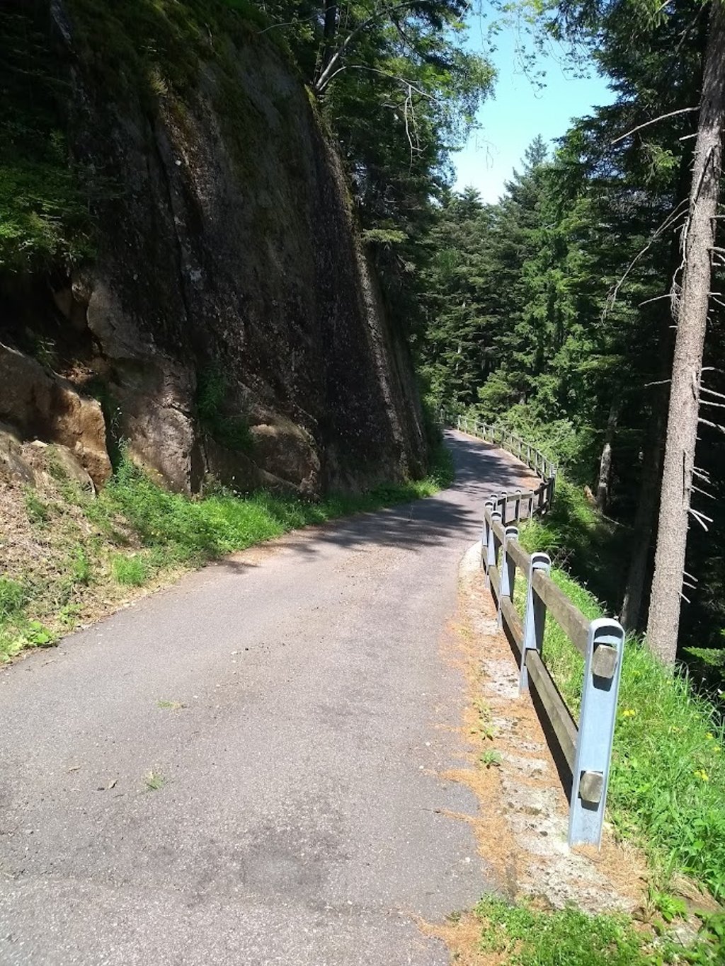
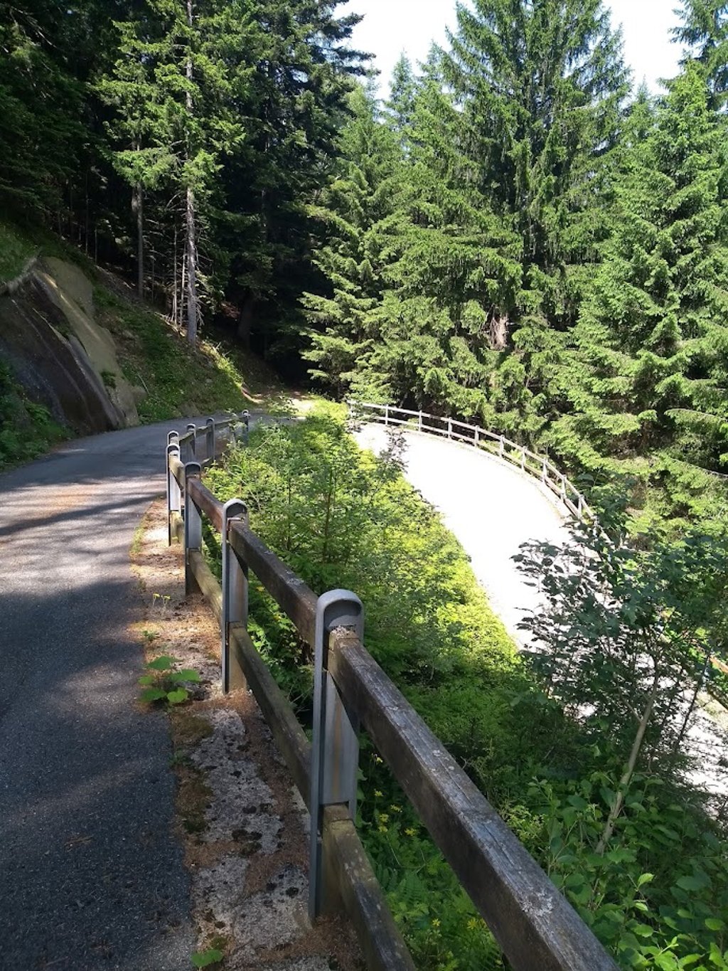
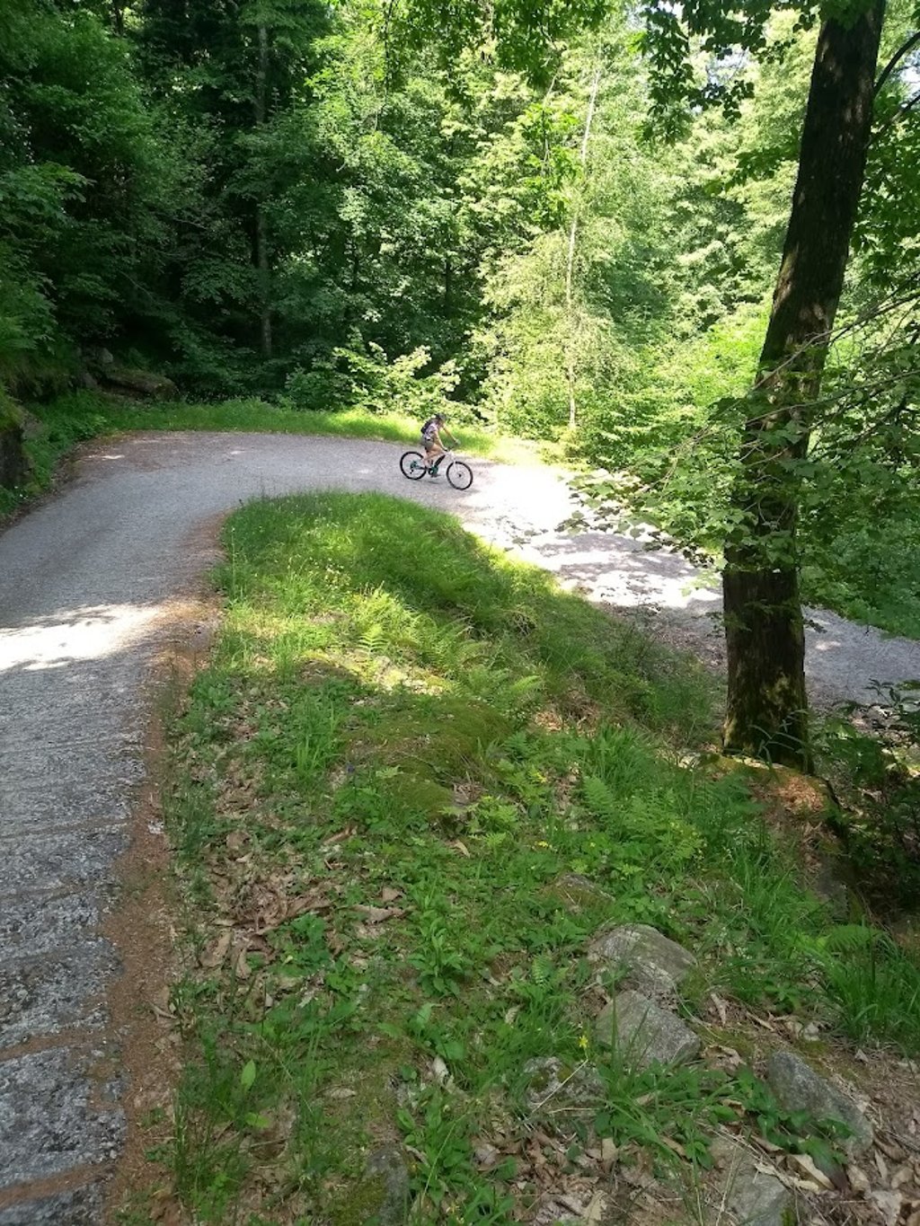
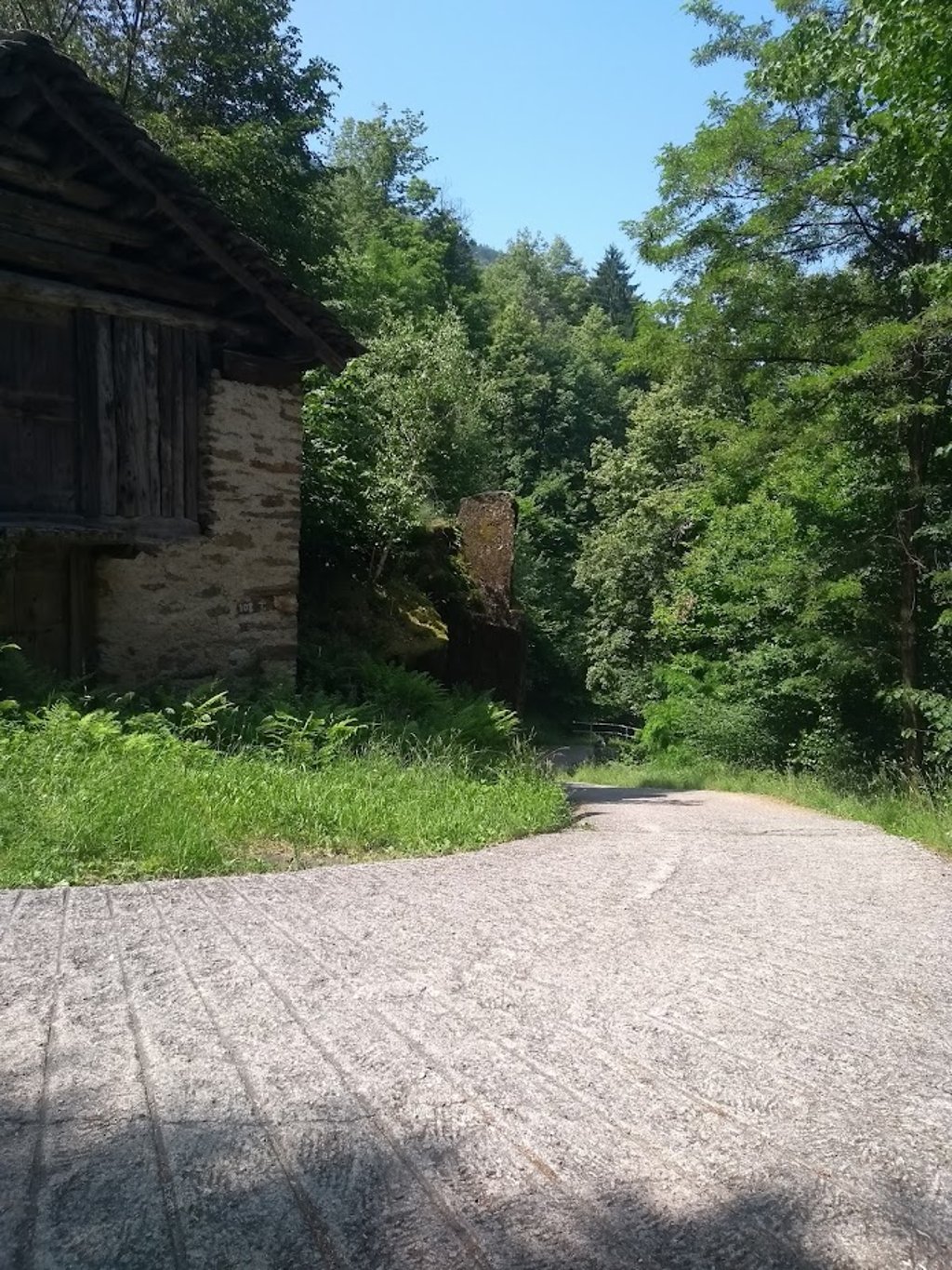
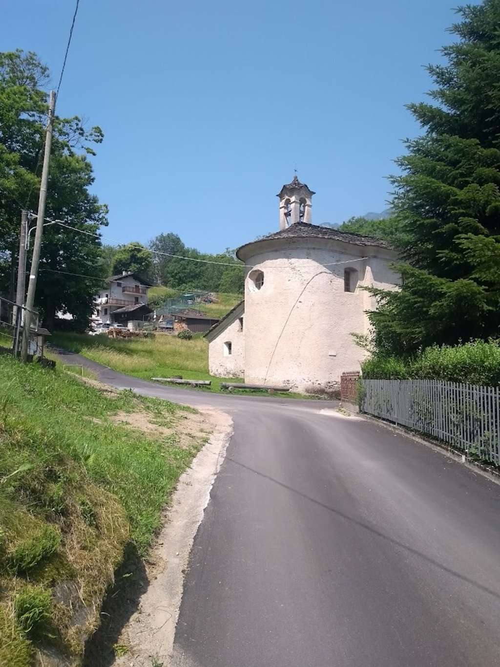
Via new asphalt to Canette with its little church before finally diving into the forest via hairpin bends. Many turns will follow. It is an irregular climb where the +10pct kilometres dominate. June 2025 I was sheltered from the scorching sun under the canopy but this was interrupted sporadically for panoramic views of the snow-capped mountain peaks on the opposite side.
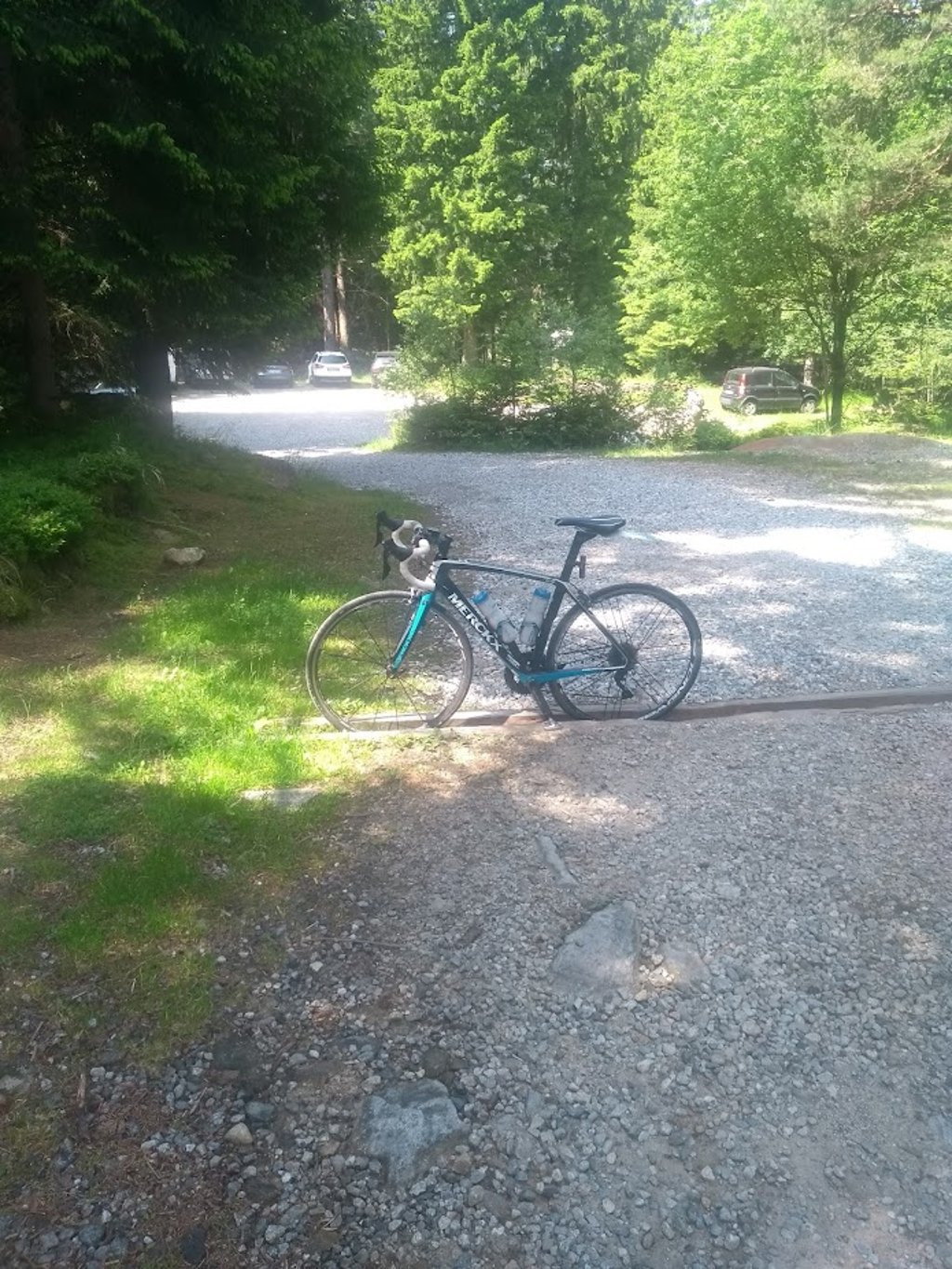
The road dead-ends at a car park with a few chalets around it.
Practical:
No supplies at the end or along the way.
Very variable road surface with nasty rough ridged concrete in the steep bends. Careful on descent.
Those who get a kick out of a tough low-traffic forest flank climb of +10 pct with hairpin bends a volonté will get their money's worth here!
De aanlooproute vanuit Chiavenna tot de start van deze relatief korte doodlopende klim is eigenlijk het eerste italiaans deel van de Malojapas via de wondermooi langs de bergrivier aangelegde verkeersvrije Ciclabile della Valchiavenna,met reeds enkele pittige klimstroken.
Even voordat de zwitserse grens eraan komt verlaat je ter hoogte van het stuwmeer (Lago di Villa di Chiavenna) het toeristisch fietspad om in San Barnaba de valleiflank op te klimmen.
Via nieuw asfalt tot Canette met kerkje om dan via haarspeldbocht definitief het woud in te duiken. Er zullen nog veel bochten volgen. Het is een onregelmatige klim waar de +10pct kilometers overheersen. Juni 2025 was ik onder het bladerdak beschut voor de brandende zon doch dit werd sporadisch onderbroken voor panoramische zicht op de besneeuwde bergpieken aan de overzijde.
De weg loopt dood op een parking met errond enkele chalets.
Praktisch:
Geen bevoorrading op einde of onderweg.
Heel wisselend wegdek met vervelend ruw geribbeld beton in de steile bochten. Voorzichtig in afdaling.
Wie kickt op een stevige verkeersarme woudflankklim van +10 pct met haarspeldbochten a volonté komt hier aan zijn trekken!
| 5 mph | 00:51:03 |
| 7 mph | 00:36:08 |
| 9 mph | 00:28:10 |
| 12 mph | 00:21:09 |
This page is better in the app