| Beautiful scenery |
| Hidden gem |
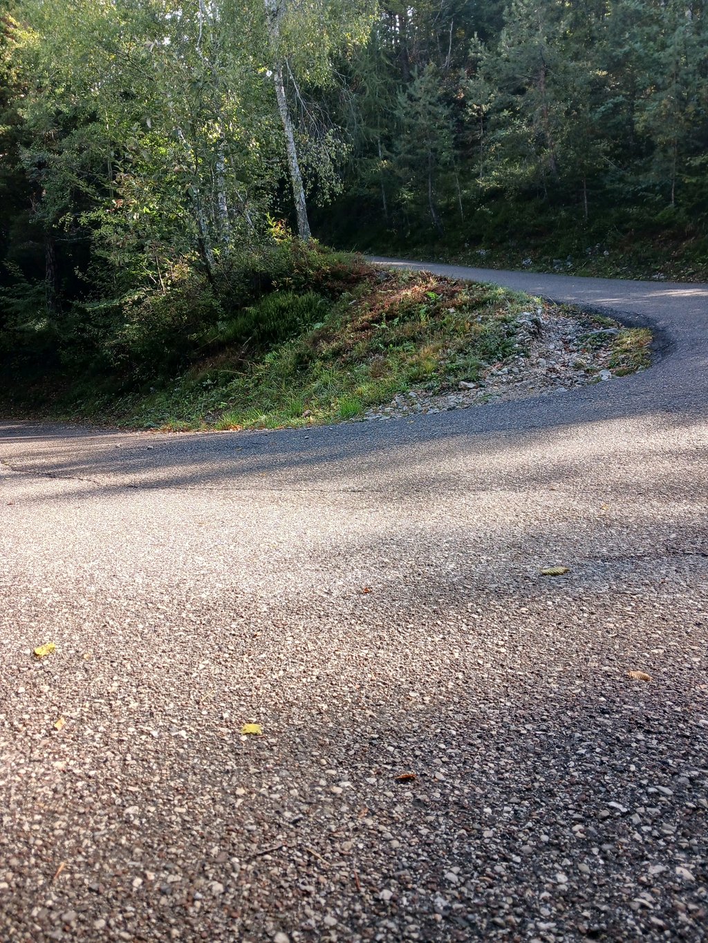
| 28 hairpin turns |
| #95 toughest climb of World |
| #82 most elevation gain of Italy |
| #88 longest climb of Trentino-South Tyrol |
| #32 average steepest climb of Trento |
Monte Varagna from Torbole is a climb in the region Trento. It is 9.3 mi long and bridges 4826 ft of vertical ascent with an average gradient of 9.9%, resulting in a difficulty score of 1682. The top of the ascent is located at 5072 ft above sea level. Climbfinder users shared 5 reviews of this climb and uploaded 14 photos.
Road names: SS240, Via della Màsera, Via delle Cesure & Via Monte Baldo
5.0 by patrickbaertThis is an automatic translation, the original language is: Dutch.Cycled very tough climb (late August 2023) to one of the many peaks that make up the Monte Baldo massif on the eastern flank of Lake Garda. As the very busy SS240 between Torbole and Nago is forbidden to cyclists, there is an alternative (as on CF route) that can already count as a run-up. Bike path starts at Piazza Goethe,tourist square in the centre of Torbole. Immediately firmly turning uphill on cobblestones. A traffic light regulates climbing/descending traffic on the very narrow route. Th... read more

Welcome! Please activate your account if you would like to share something. Look for the verification email in your inbox.
If you want to upload your photos, you need to create an account. It only takes 1 minute and it's completely free.
The road to the parking lot. Extremely difficult and very long. Just when it seems like you’re nearing the end, there are three 22% gradients on the final stretch. Fortunately, the road is shaded.
Droga do parkingu. Ekstremalnie trudny i bardzo długi. Gdy się wydaje, że zbliża się końcówka na ostatnim odcinku są 3 sekcje po 22%. Na szczęscie droga prowadzi w cieniu.
An iconic climb for people like me who live in the Upper Garda area. The start from the square in Torbole, gives you 2 options after 100m of road: turn right for Busatte (shorter and steeper), or turn left for Nago. After about 2km the 2 routes rejoin at an altitude of 250m, and the climb towards Malga Zures (685m) begins. The road here already has gradients reaching 15% in several sections, fortunately the hairpin bends allow some breathing space. Once past Malga zures, there are a few easier kilometres (but don't think it flattens out much, the gradients remain constant at 8-9-10%), first to Malga Casina (1030m) and shortly afterwards to the Nago meadows (1255m). From here, 3-4 km up to the bar where you stand in apnea, the slopes reach peaks of 20% if not more. From the stanga (1560m), continue for about 1.5km, 5 hairpin bends of dirt road and we finally arrive at Monte Varagna. I recommend taking the descent to Malga Campei once at the top, and going to refresh yourself with a nice hot meal at the refuge, because there is nothing to be found on Monte Varagna. The alternative is an hour's bike ride to the Altissimo :)
Salita simbolo per chi vive come me nell’alto Garda. La partenza dalla piazza di Torbole, ti dà 2 opzioni dopo 100m di strada:svolta a destra per Busatte (più breve e pendente), oppure svolta a sinistra per Nago. Dopo circa 2 km le 2 vie si ricongiungono ad un altitudine di 250m, e inizia la scalata verso malga zures (685m). La strada qui presenta già pendenze che arrivano al 15% in diversi tratti, per fortuna i tornanti permettono un po’ di respiro. Passata malga zures, si ha qualche km più agevole (ma non pensate che spiani granché, le pendenze restano costanti sul 8-9-10%, fino a Malga Casina prima (1030m) e poco dopo ai prati di Nago (1255m). Da qui, 3-4 km fino alla stanga dove si sta in apnea, le pendenze arrivano fino a picchi del 20% se non di più. Dalla stanga (1560m) si può proseguire per 1.5 km circa, 5 tornanti di strada sterrata e finalmente arriviamo a Monte Varagna. Consiglio di prendere la discesa per Malga campei una volta in cima, e andare a rifocillarsi con un bel pasto caldo al rifugio, perché sul monte varagna non si trova nulla. L’alternativa è un ora di bici in spalla per raggiungere l’Altissimo :)
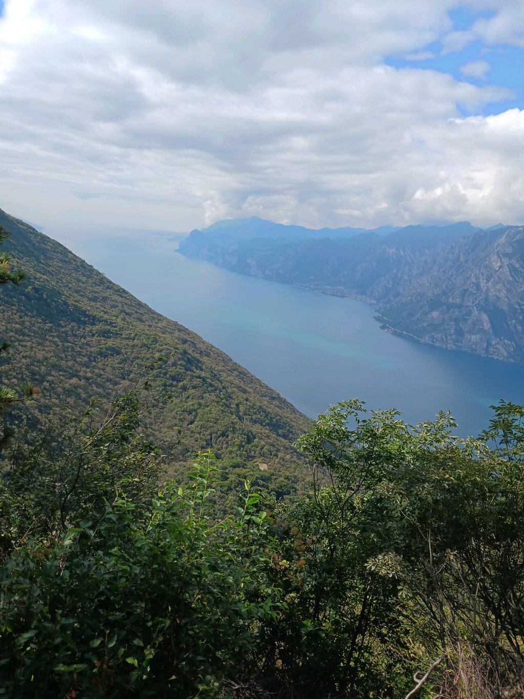
Really nice climb with low car traffic, It was like 10 cars for 1.5h. However the road is sometimes really narrow and there are a lot of bumps and wet section, so better be careful on the descent. There are nice view of Riva, Torbole and Garda lake, but mainly on lower sections. Most of the climb is in shadow, which is convenient for uphill part, but better get jacket for a descent. Most of the people are scailing it with mountain or e-bikes. It is a pity that there is no view on the summit.
Cycled very tough climb (late August 2023) to one of the many peaks that make up the Monte Baldo massif on the eastern flank of Lake Garda.
As the very busy SS240 between Torbole and Nago is forbidden to cyclists, there is an alternative (as on CF route) that can already count as a run-up. Bike path starts at Piazza Goethe,tourist square in the centre of Torbole. Immediately firmly turning uphill on cobblestones. A traffic light regulates climbing/descending traffic on the very narrow route. Then followed by a climbing stretch on straight road (8%) up the valley flank to Nago. A narrow road with regular hairpin bends continues between vineyards and a shady forest between the rocks, regularly interrupted for panoramic views ever higher up towards Lake Garda. There is hardly any habitation or traffic.
The last 5 km are beastly as you climb continuously at double-digit percentages to end at a small car park where the asphalt road stops. With the MTB you can continue up to the real summit of Monte Varagna.
Practical: no supplies at summit or en route. Only on start route.
Climbing challenge out of category with bird's eye view of Lake Garda!
Not coincidentally hardly any road bikes and many (electro) MTB's encountered along the way .
Zeer stevige klim gefietst (eind augustus 2023) naar één van de vele toppen die samen het Monte Baldo massief uitmaken op de oostflank van het Garda meer.
Gezien de zeer drukke SS240 tussen Torbole en Nago verboden is voor fietsers is er een alternatief (zoals op CF route) dat al kan tellen als aanloop. Fietsweg start op Piazza Goethe,toeristisch plein in centrum Torbole. Direct stevig draaiend omhoog op kasseitjes. Een verkeerslicht regelt het klimmend/dalend verkeer op de heel smalle route. Nadien gevolgd door een klimmend stuk op rechte weg (8%) de valleiflank op tot Nago. Op smalle weg met regelmatig haarspeldbochten gaat het verder tussen wijngaarden overgaande in schaduwrijk woud tussen de rotsen dat regelmatig onderbroken wordt voor panoramische uitzichten steeds hogerop het Gardameer. Er is amper bewoning en verkeer.
De laatste 5 km. zijn beestachtig want je klimt continu met dubbele cijferpercentages om te eindigen op een kleine parking alwaar de asfaltweg stop. Met de MTB kan je nog verder tot de echte top van Monte Varagna.
Praktisch: geen bevoorrading op top of onderweg. Alleen op beginroute.
Klimuitdaging buiten categorie met vogelperspectief zicht op het Gardameer!
Niet toevallig amper racefietsen en veel (electro) MTB's onderweg tegengekomen .
Nice climb! Pity that the end is not at the top, last part is no-go on a racing bike because of pebbles/chalk.
Mooie klim! Jammer dat einde niet op de top ligt, laatste stuk is op racefiets no-go vanwege kiezels/stenen.
| 5 mph | 01:51:41 |
| 7 mph | 01:19:04 |
| 9 mph | 01:01:37 |
| 12 mph | 00:46:17 |
This page is better in the app