Monte Tovo from Doccio is a climb in the region Vercelli. It is 4.9 mi long and bridges 2638 ft of vertical ascent with an average gradient of 10.1%, resulting in a difficulty score of 986. The top of the ascent is located at 3957 ft above sea level. Climbfinder users shared 3 reviews of this climb and uploaded 7 photos.
This is an automatic translation, the original language is: Italian.
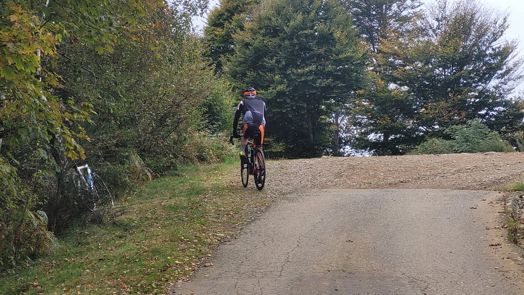
Hardest climb in the "lower" Valsesia. The side from Doccio is slightly tougher as it has constant gradients almost exclusively above 10%. The hardest part is between -3 and 2.5km where the Garmin was consistently marking me 20%.
Beautiful climb and well worth climbing!...read more
Photos (7)
Welcome! Please activate your account if you would like to share something. Look for the verification email in your inbox.
This is an automatic translation, the original language is: Italian.
Show original
Hardest climb in the "lower" Valsesia. The side from Doccio is slightly tougher as it has constant gradients almost exclusively above 10%. The hardest part is between -3 and 2.5km where the Garmin was consistently marking me 20%.
Beautiful climb and well worth climbing!
La salita più dura della "bassa" Valsesia. Il versante da Doccio risulta leggermente più duro in quanto con pendenze sempre costanti e quasi esclusivamente sopra il 10%. Il pezzo più duro è tra i -3 e i 2,5km dove il Garmin mi segnava costantemente 20%.
Salita bella e che merita di essere scalata!
This is an automatic translation, the original language is: Italian.
Show original
The bicycle ascent from Doccio to Monte Tovo, located near Borgosesia in the province of Vercelli, represents one of the challenges with a capital "S" for every mountain-loving cyclist. Although located in the Biellese pre-Alps, this climb does not become lethal simply because it is not very long. But the numbers it offers in terms of average and maximum gradient are quite telling.
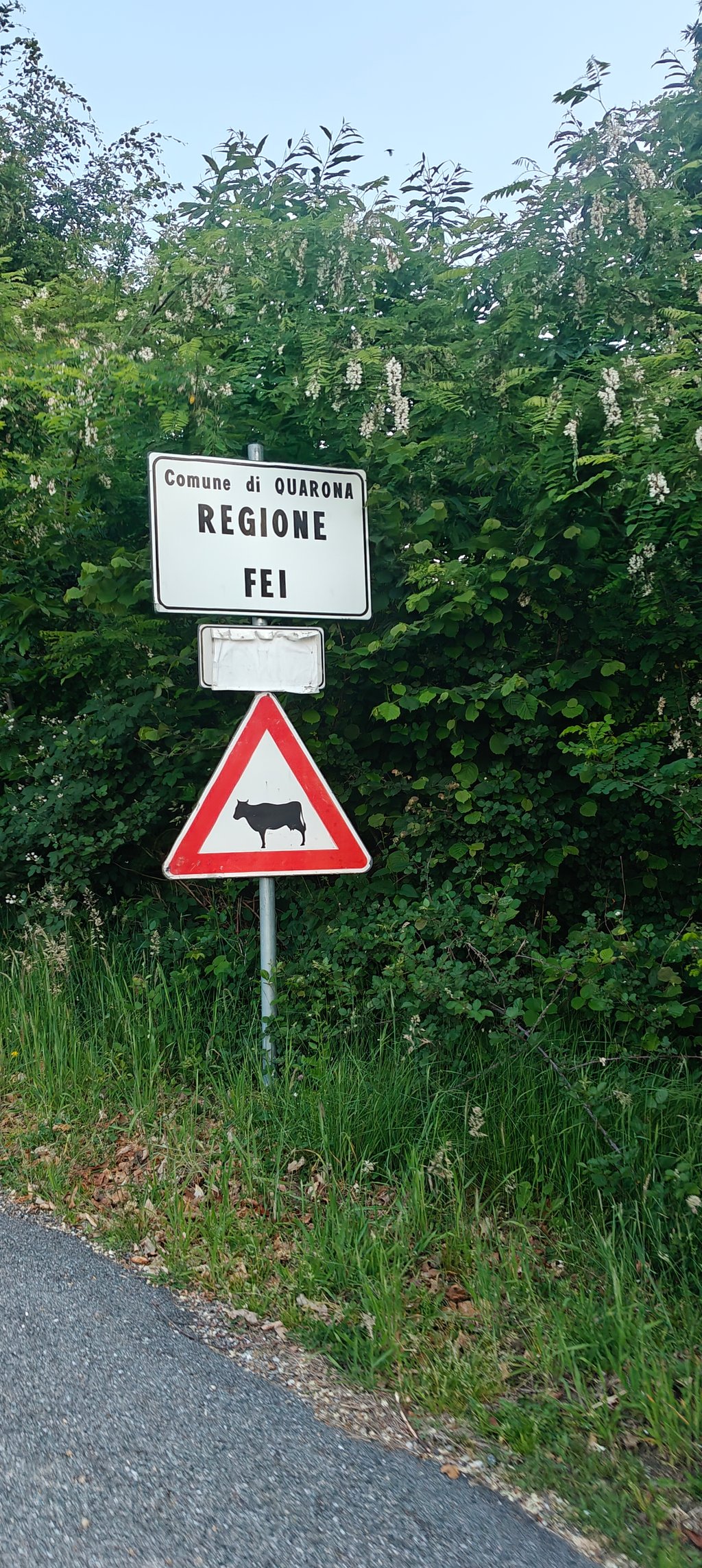
The route starts in Doccio, a small hamlet of Quarona, and winds its way along narrow, winding roads, with gradients in double figures from the outset. The road immediately climbs towards Fei with gradients fixed at 12-13%. Be careful not to get carried away because even after Fei and as far as the little chapel of S. Bernardo, the climb is unforgiving and offers gradients that are also very hard: it is not uncommon to display 15, 16 and 17% on the cyclocomputer.
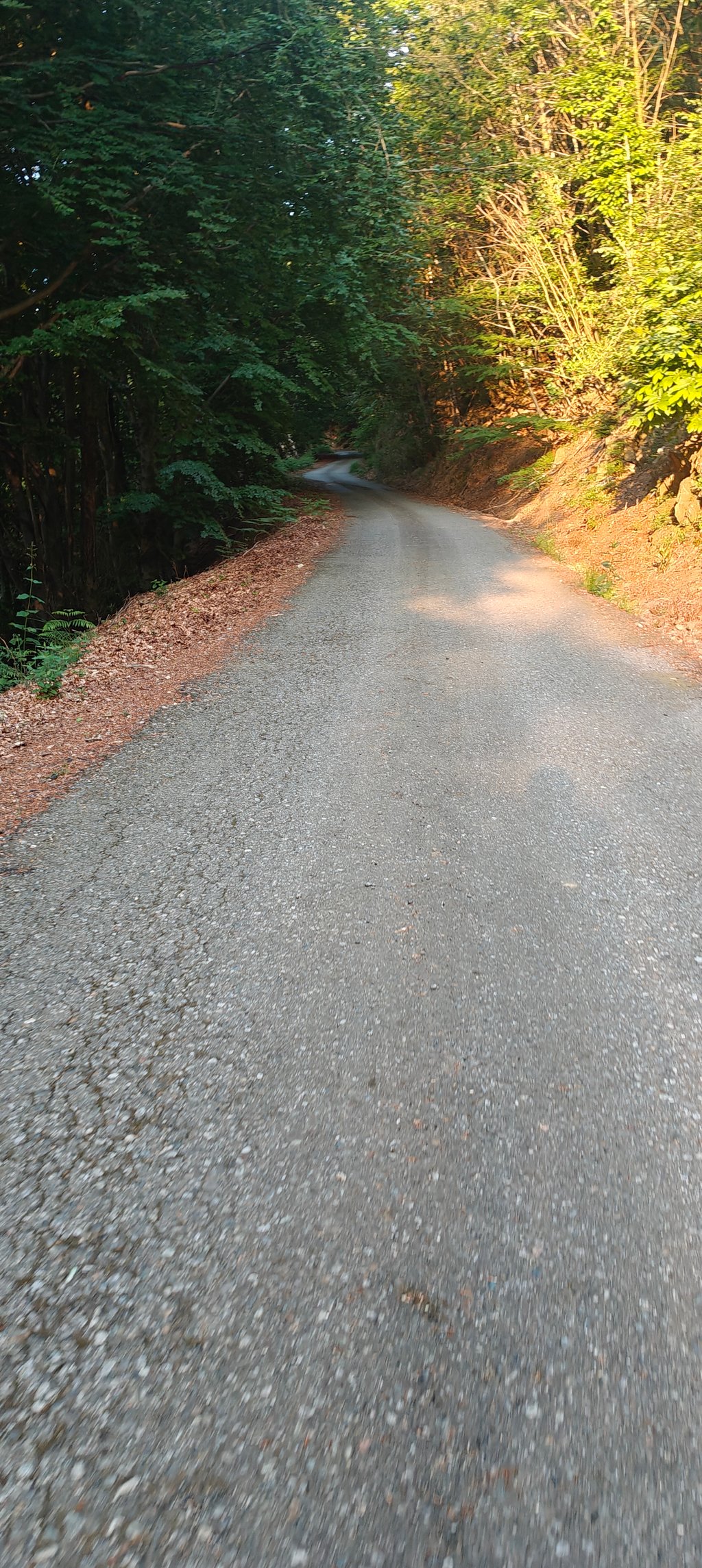
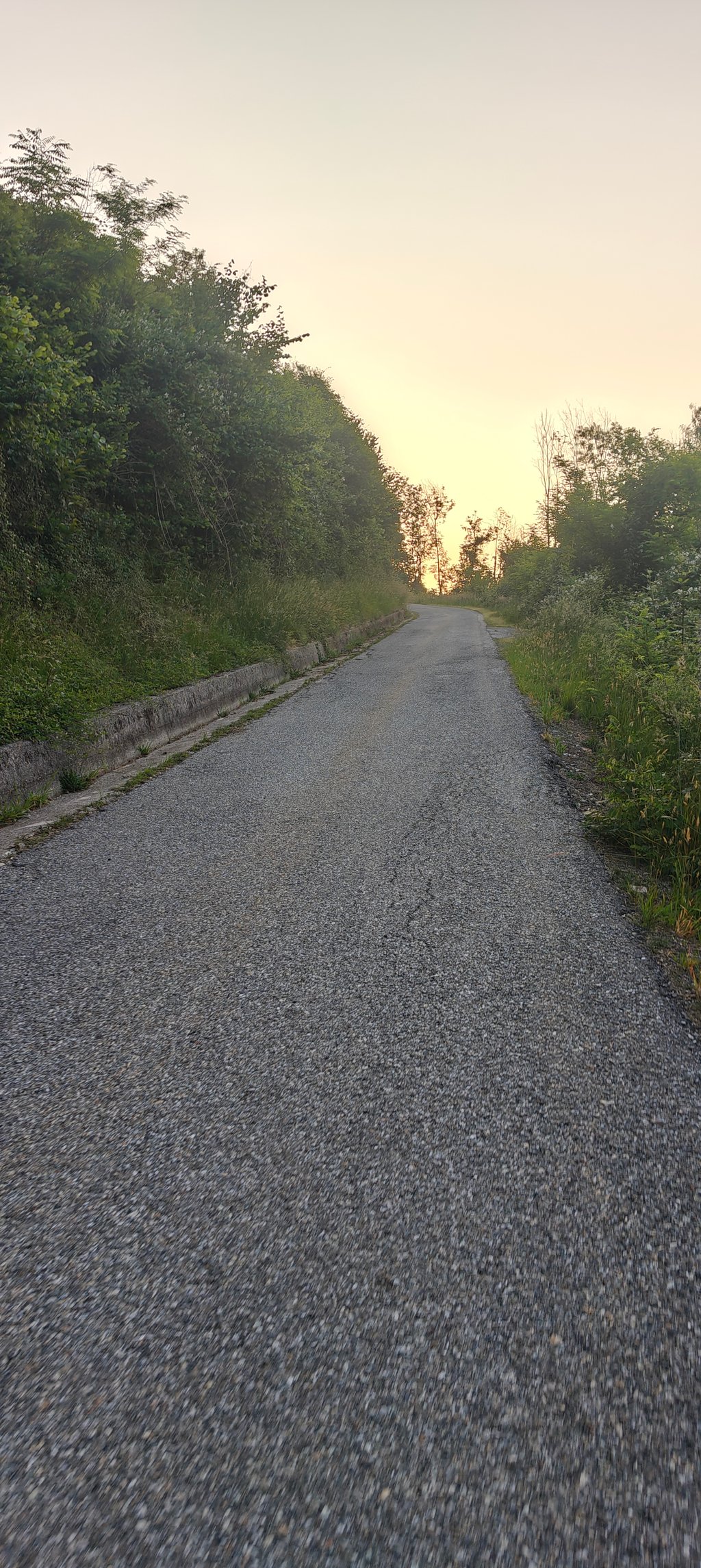
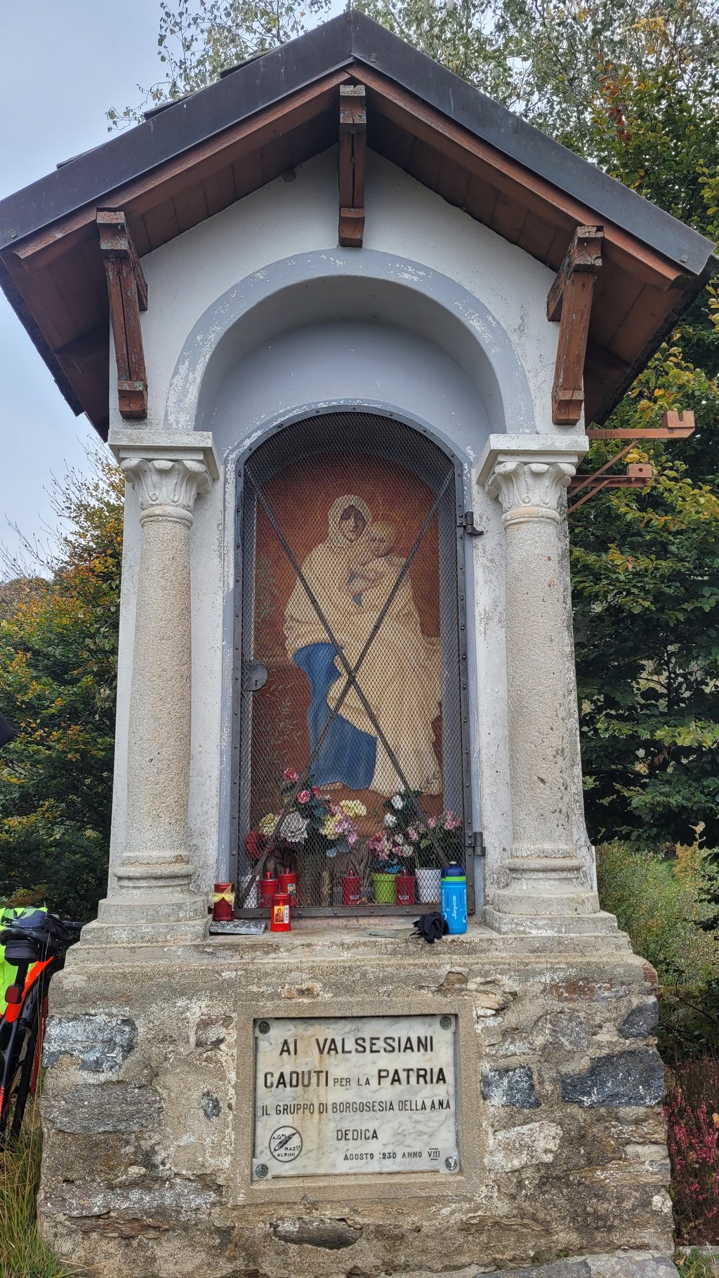
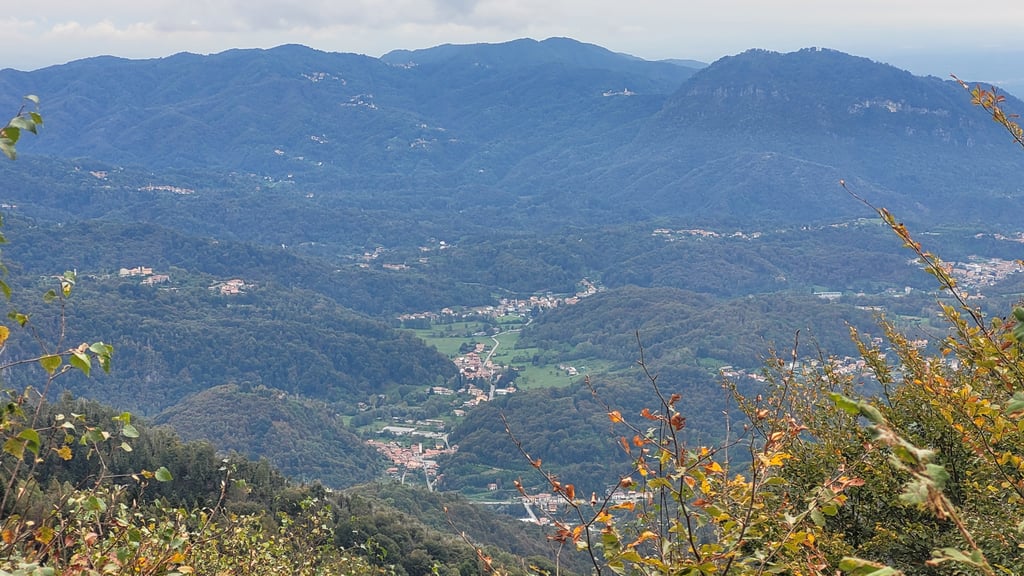
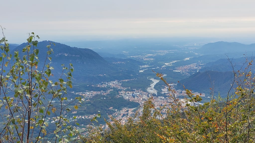
During the climb, you are not able to enjoy any particular views. You are immersed in dense forest until the end of the bitumen road at over 1200 m above sea level and only near a small votive chapel will you be able to enjoy a beautiful view of the lower part of the Sesia valley and the surrounding peaks, with the summit of Monte Tovo behind you. To stock up on water, remember to do so at Doccio or Fei. There is nothing at the summit and the Gillodi refuge below (reached by descending along the road on the Foresto side) is not always open.
The last section of the climb (from the S. Bernardo chapel) is the most manageable, with gradients that drop well below 10% (except for a final surge near the dirt forecourt at the top of the ascent), but if you have arrived with your strength at rock bottom and your legs on the line, even the last 2 km can become difficult.
The ascent from Doccio to Monte Tovo is one of the most rewarding cycling experiences in the area for those who enjoy real, hard and tough climbs. It requires good physical preparation and a bicycle with the right gearing for the gradients, but in return it offers the thrill of having mastered a climb that is difficult to find in the area (with the exception of the twin climbs from Isolella and Foresto and the Alpe di Noveis).
La salita in bicicletta da Doccio al Monte Tovo, situata nei pressi di Borgosesia in provincia di Vercelli, rappresenta una delle sfide con la "S" maiuscola per ogni ciclista amante della montagna. Pur posizionata nelle prealpi Biellesi, questa scalata non diventa letale solo perché non è lunghissima. Ma i numeri che offre in termini di pendenza media e massima sono piuttosto esplicativi.
Il percorso inizia a Doccio, una piccola frazione di Quarona, e si snoda lungo strade strette e tortuose, con pendenze in doppia cifra da subito. La strada si inerpica subito verso Fei con pendenze fisse al 12-13%. Attenzione a non farsi prendere la mano perché anche dopo Fei e fino alla cappelletta di S. Bernardo la salita non perdona e offre pendenze anche molto dure: non è raro visualizzare sul ciclocomputer 15, 16 e 17%.
Durante la salita, non si riesce a godere di particolari panorami. Si è immersi nel fitto bosco fino al termine del bitume a oltre 1200 m sul livello del mare e solo in prossimità di una cappelletta votiva si potrà godere di un bel panorama sulla parte bassa della valle del Sesia e sulle cime circostanti avendo alle spalle la vetta del Monte Tovo. Per rifornirsi d'acuq ricordarsi di farlo a Doccio o a Fei. In cima non c'è nulla e il sottostante rifugio Gillodi (raggiungbile scendendo lungo la strada del versante di Foresto) non è sempre aperto.
L'ultimo tratto della salita (dalla Cappella S. Bernardo) è il più abbordabile, con pendenze che si abbassano ampiamente sotto il 10% (tranne un'ultima impennata in prossimità del piazzale sterrato al culmine dell'ascesa), ma se si è arrivati con le forze al lumicino e le gambe in croce, anche gli ultimi 2 km possono diventare difficili.
La salita da Doccio al Monte Tovo è una delle esperienze ciclistiche più gratificanti della zona per coloro che amano le salite vere, dure e ostiche. Richiede una buona preparazione fisica e una bicicletta con rapportatura adeguata alle pendenze, ma offre in cambio l'emozione di aver domato un'ascesa difficile da trovare nei dintorni (eccezion fatta per la gemella che sale da Isolella e Foresto e l'alpe di Noveis).
This is an automatic translation, the original language is: Italian.
Show original
Spectacular climb in the rather depressing setting of lower Valsesia. But here you immediately leave the valley floor and climb quickly and steeply through woods and hamlets. Then only woods and sweat. Beautiful indeed.
Spettacolare salita nel contesto piuttosto deprimente della bassa Valsesia. Ma qui si abbandona subito il fondovalle e si sale rapidamente e ripidamente per boschi e frazioncine. Poi solo boschi e sudore. Bella davvero.
Monte Tovo from Doccio is a challenging ascent. For this type of climbing, we recommend mountain gearing, specifically a compact system. This means a small front chainring of 34 teeth, combined with a rear cassette where, depending on your level, strength, and experience, you choose a sprocket with 30, 32, or even 34 teeth. Remember that a smooth cadence is always more efficient!
Monte Tovo from Doccio belongs to the Hors Catégorie, the top category. These are legendary and very tough climbs. A solid cycling condition, experience, and a good climbing gear ratio are essential to maintain a smooth cadence and complete the climb comfortably.
Monte Tovo from Doccio is 4.9 mi long.
The average gradient of Monte Tovo from Doccio is 10.1%.
Monte Tovo from Doccio has a steepest segment with an average gradient of 22.4%.
The summit of Monte Tovo from Doccio is at 3957 ft.
At a slow pace of 5 mph, it takes about 00:59:39 to climb Monte Tovo from Doccio. At 7 mph the time is 00:42:14, and at 9 mph 00:32:54. For the fastest cyclists, 00:24:43 is an achievable time.
Monte Tovo from Doccio is located in the region Vercelli in Italy.