View on map
© MapLibre | OpenStreetMap contributors
1%
2%
4%
6%
8%
10%
12%
15%
20%

Mont Voyenne from Rosamel

3.5
2 reviews | Elevation profile | 6 photos
Tips nearby
Mont Voyenne from Rosamel
transparant thumb
transparant thumb
Your achievable time
Calculating based on your best performances...
Relaxed
Maximum
W/kg
W/kg
W/kg
Analyze your climbing performance
Detailed insight into your climbing performance & automatically check off climbs
Based on your best performances.
Your best attempt:
Number of attempts:
Elevation profile Mont Voyenne from Rosamel

Statistics

Difficulty points 65
Length 1 mi
Average gradient 5.1%
Steepest segment 12.8%
Total ascent 279 ft
Feedback about this climb?
Show climbs nearby Export to GPS device

Mont Voyenne from Rosamel is a climb in the region Caps et Marais d'Opale. It is 1 mi long and bridges 279 ft of vertical ascent with an average gradient of 5.1%, resulting in a difficulty score of 65. The top of the ascent is located at 377 ft above sea level. Climbfinder users shared 2 reviews of this climb and uploaded 6 photos.

Road name: Rue de Rosamel

This is an automatic translation, the original language is: French.
I really enjoyed this climb despite the more than average road. The approach is beautiful and the last 500 metres very steep.... read more

Photos (6)

Mont Voyenne from Rosamel

Your uploads (max 4)

Welcome! Please activate your account if you would like to share something. Look for the verification email in your inbox.

If you want to upload your photos, you need to create an account. It only takes 1 minute and it's completely free.

  • Receive free climbfinder goodies for your reviews & photos.
  • Create a bucket list and check off conquered climbs.
  • Add missing climbs.
Continue with GoogleContinue with Google Continue with FacebookContinue with Facebook Continue with AppleContinue with Apple Sign up with email
By signing up you agree to our terms of service and confirm that you have read our privacy & content policy.

Reviews (2)

5.0
4.0
3.0
2.0
1.0
mikansopierval
1 y 4.0 00:05:53 (10.6 mph)
This is an automatic translation, the original language is: French. Show original

I really enjoyed this climb despite the more than average road. The approach is beautiful and the last 500 metres very steep.

J'ai bien aimé cette montée malgré une route plus que moyenne. L'approche est très belle et les 500 derniers mètres très raides.

Dashboard
Leon
4 y 3.0
This is an automatic translation, the original language is: Dutch. Show original

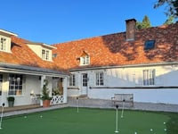
A somewhat hidden climb, but therefore not less worthwhile. On a rural road, where you will not see a car, you climb up for more than a kilometer at very mild percentages. The devil is clearly in the tail. The last 500 meters go up in a mean way. Unfortunately, in this part of the climb, the quality of the road surface leaves much to be desired. If this doesn't bother you, the climb is definitely worth including in your route. Be sure to look back several times, because the views are beautiful.

Een wat verborgen klim, maar daarom niet minder de moeite waard. Op een landelijke weg, waar je geen auto zal tegenkomen, klim je ruim een kilometer aan zeer milde percentages omhoog. Het venijn zit hem dan ook duidelijk in de staart. De laatste 500 meter lopen gemeen omhoog. Helaas laat in dit deel van de klim de kwaliteit van het wegdek wat te wensen over. Mocht dit je niet storen, is de klim zeker leuk om eens in je route op te nemen. Kijk ook zeker enkele keren achterom, want de uitzichtingen zijn prachtig.

Dashboard

Climbing times

5 mph 00:12:30
7 mph 00:08:51
9 mph 00:06:54
12 mph 00:05:11

Road surface condition

0% 0% 0%
Based on 0 votes
Share your knowledge. What was the road condition during your ascent?

Traffic

0% 0% 0%
Based on 0 votes
Your experience counts. How much traffic did you encounter during the climb?

Frequently Asked Questions

Mont Voyenne can be cycled from 3 sides. Mont Voyenne from Frencq is the most popular side, but the summit can also be reached via Mont Voyenne from Rosamel & Mont Voyenne from Étaples.

You don't need special gearing for Mont Voyenne from Rosamel. The slope isn't long or steep enough to require much shifting down. You can conquer this climb on power alone. However, a compact gearing system with a smallest front chainring of 34 and largest rear sprocket of 28 or 30 is always nice if you enjoy cycling uphill. This helps maintain a smooth cadence.

Mont Voyenne from Rosamel falls into the 5th category. With good fitness, you can ride it up with speed and power. If you have less training, shift down and climb smoothly.

Mont Voyenne from Rosamel is 1 mi long.

The average gradient of Mont Voyenne from Rosamel is 5.1%.

Mont Voyenne from Rosamel has a steepest segment with an average gradient of 12.8%.

The summit of Mont Voyenne from Rosamel is at 377 ft.

At a slow pace of 5 mph, it takes about 00:12:30 to climb Mont Voyenne from Rosamel. At 7 mph the time is 00:08:51, and at 9 mph 00:06:54. For the fastest cyclists, 00:05:11 is an achievable time.

Mont Voyenne from Rosamel is located in the region Caps et Marais d'Opale in France.

This page is better in the app

Climbfinder app
Climbfinder
(Free)
Open