| #13 toughest climb of Hauts-de-France |
| #36 most elevation gain of Hauts-de-France |
| #78 average steepest climb of Caps et Marais d'Opale |
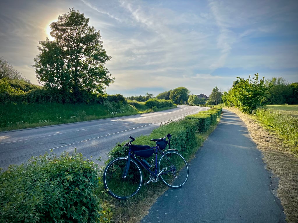
Mont Lambert from Baincthun is a climb in the region Caps et Marais d'Opale. It is 1.2 mi long and bridges 427 ft of vertical ascent with an average gradient of 6.7%, resulting in a difficulty score of 105. The top of the ascent is located at 528 ft above sea level. Climbfinder users shared 3 reviews of this climb and uploaded 11 photos.
Road names: Route de Desvres (D341) & Bois du Mont Lambert (D341)
3.0 by LeonThis is an automatic translation, the original language is: Dutch.Mont Lambert is not to be missed. This hill with its characteristic antennae pops up from all angles. From afar you can see the road rising dangerously steep. It probably depends on whether you like the aesthetic or the sporty aspect of the climb. With a kilometre of consistently 8 to 9% percent uphill and over 100 climbing points, this is certainly one of the tougher climbs in the area. At the same time, however, the lorries are racing up it with you. Fortunately, for the most part there is a... read more

Welcome! Please activate your account if you would like to share something. Look for the verification email in your inbox.
If you want to upload your photos, you need to create an account. It only takes 1 minute and it's completely free.
It's not the most beautiful in the Boulogne area. Nor is it the most pleasant. The road is wide and busy, but you can climb onto a sort of cycle path in good condition. But that doesn't mean you can't breathe in the exhaust fumes.
The road climbs fairly well and steadily. There's a big, long bend on the way down that's really nice. Up ahead, the village of Mont Lambert, with its unassuming charm and large antennae perched on the hill. A gravel path leads up to it.
Ce n’est pas la plus belle des environs de Boulogne. Ce n’est pas non plus la plus agréable. La route est large et fréquentée mais on peut grimper sur une sorte de piste cyclable en bon état. Ce qui n’empêche pas de respirer les gaz d’échappement.
Ça monte plutôt correctement et régulièrement. Un grand et long virage très sympa à redescendre. Là-haut, le village du Mont Lambert, sans grand charme et les grandes antennes juchées sur la colline. Un chemin gravel permet de s’en approcher.
Climb of the longer type, to be taken in small group absolutely on the cycle path due to the traffic on the road. The summit is signalled by red pole, however, not many special views at the top.
Klim van het langere type, in kleine groep absoluut op het fietspad te nemen gezien de drukte van de baan. De top wordt aangegeven door rode mast, echter weinig speciale vergezichten bovenaan.
Mont Lambert is not to be missed. This hill with its characteristic antennae pops up from all angles. From afar you can see the road rising dangerously steep. It probably depends on whether you like the aesthetic or the sporty aspect of the climb. With a kilometre of consistently 8 to 9% percent uphill and over 100 climbing points, this is certainly one of the tougher climbs in the area. At the same time, however, the lorries are racing up it with you. Fortunately, for the most part there is a good cycle path so that you are not hindered by all this traffic. But it is not very idyllic.
Additional detail: Ivan Basso won here in 2012 the mountain points in the 3rd stage of the Tour de France.
De Mont Lambert valt niet te missen. Vanuit allerlei hoeken duikt deze heuvel met zijn karakteristieke antennes op. Van verre zie je de weg al vervaarlijk steil omhoog lopen. Het ligt er vermoedelijk aan in hoeverre voor jouw het esthetische dan wel het sportieve aspect meespeelt of je dit een fijne klim vindt. Met een kilometer consequent met 8 a 9% procent omhoog rijden en ruim 100 klimpunten is dit zeker één van de lastigere klimmen van de omgeving. Echter tergelijkertijd razen de vrachtwagens met je mee omhoog. Gelukkig ligt er voor het grootste deel een degelijk fietspad, zodat je geen hinder hebt van al dat verkeer. Maar heel idylisch is het geheel niet.
Aanvullend detail: Ivan Basso haalde won hier in 2012 de bergpunten in de 3de etappe van de Tour de France.
| 5 mph | 00:14:38 |
| 7 mph | 00:10:21 |
| 9 mph | 00:08:04 |
| 12 mph | 00:06:04 |
This page is better in the app