View on map
© MapLibre | OpenStreetMap contributors
1%
2%
4%
6%
8%
10%
12%
15%
20%

Mail de Louréus

0 reviews | Elevation profile | 0 photos
Tips nearby
Your achievable time
Calculating based on your best performances...
Relaxed
Maximum
W/kg
W/kg
W/kg
Analyze your climbing performance
Detailed insight into your climbing performance & automatically check off climbs
Based on your best performances.
Your best attempt:
Number of attempts:
Elevation profile Mail de Louréus

Statistics

Difficulty points 667
Length 4.7 mi
Average gradient 8.9%
Steepest segment 16%
Total ascent 2205 ft

Short recap

9 hairpin turns
#90 toughest climb of Occitania
#13 most elevation gain of Haute-Garonne
#20 longest climb of Haute-Garonne
#82 average steepest climb of Haute-Garonne
Feedback about this climb?
Show climbs nearby Export to GPS device

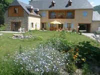
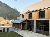
Mail de Louréus is a climb in the region Haute-Garonne. It is 4.7 mi long and bridges 2205 ft of vertical ascent with an average gradient of 8.9%, resulting in a difficulty score of 667. The top of the ascent is located at 5108 ft above sea level. Climbfinder users shared 0 reviews of this climb and uploaded 0 photos.

Photos (0)

transparant thumb
transparant thumb
transparant thumb
transparant thumb
transparant thumb
transparant thumb

Your uploads (max 4)

Welcome! Please activate your account if you would like to share something. Look for the verification email in your inbox.

If you want to upload your photos, you need to create an account. It only takes 1 minute and it's completely free.

  • Receive free climbfinder goodies for your reviews & photos.
  • Create a bucket list and check off conquered climbs.
  • Add missing climbs.
Continue with GoogleContinue with Google Continue with FacebookContinue with Facebook Continue with AppleContinue with Apple Sign up with email
By signing up you agree to our terms of service and confirm that you have read our privacy & content policy.

Reviews (0)

5.0
4.0
3.0
2.0
1.0

Climbing times

5 mph 00:56:27
7 mph 00:39:58
9 mph 00:31:09
12 mph 00:23:24

Road surface condition

0% 0% 0%
Based on 0 votes
Share your knowledge. What was the road condition during your ascent?

Traffic

0% 0% 0%
Based on 0 votes
Your experience counts. How much traffic did you encounter during the climb?

Frequently Asked Questions

Mail de Louréus is a challenging ascent. For this type of climbing, we recommend mountain gearing, specifically a compact system. This means a small front chainring of 34 teeth, combined with a rear cassette where, depending on your level, strength, and experience, you choose a sprocket with 30, 32, or even 34 teeth. Remember that a smooth cadence is always more efficient!

Mail de Louréus is a first-category climb: long and tough. Do not underestimate this climb. Many famous Tour de France cols fall into this category. Prepare for a long, challenging ride. Only well-trained riders will reach the top smoothly. Make sure you have a road bike with climbing gears and enough training; otherwise, it will be a struggle.

Mail de Louréus is 4.7 mi long.

The average gradient of Mail de Louréus is 8.9%.

Mail de Louréus has a steepest segment with an average gradient of 16%.

The summit of Mail de Louréus is at 5108 ft.

At a slow pace of 5 mph, it takes about 00:56:27 to climb Mail de Louréus. At 7 mph the time is 00:39:58, and at 9 mph 00:31:09. For the fastest cyclists, 00:23:24 is an achievable time.

Mail de Louréus is located in the region Haute-Garonne in France.

This page is better in the app

Climbfinder app
Climbfinder
(Free)
Open