| Hidden gem |
| 15 hairpin turns |
| #88 toughest climb of Canary Islands |
| #55 most elevation gain of Canary Islands |
| #46 longest climb of Canary Islands |
| #34 average steepest climb of Gran Canaria |
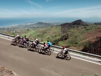
Lomo de Pedro Alfonso from El Tablero is a climb in the region Gran Canaria. It is 9.1 mi long and bridges 2595 ft of vertical ascent with an average gradient of 5.4%, resulting in a difficulty score of 637. The top of the ascent is located at 2671 ft above sea level. Climbfinder users shared 4 reviews of this climb and uploaded 3 photos.
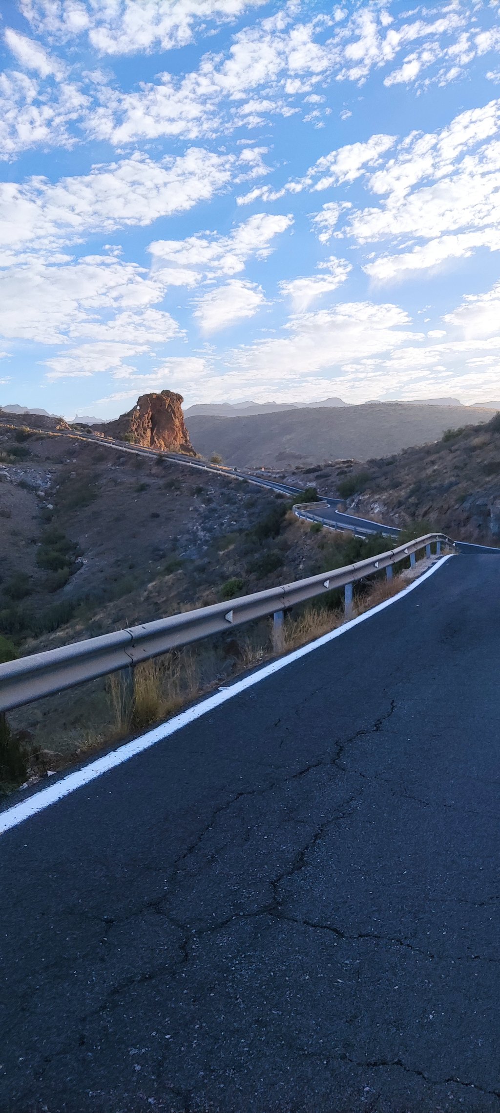
Road name: GC-604
3.0 by TZRThis is an automatic translation, the original language is: Dutch.Surprising climb. Heavier than expected. Good road, but undulating profile so that you have to tackle the 'steepest 100 meters' several times. In terms of landscape, in my opinion, perhaps not the most beautiful in the beginning, but the last few km beautiful views. Nice to do.... read more
Welcome! Please activate your account if you would like to share something. Look for the verification email in your inbox.
If you want to upload your photos, you need to create an account. It only takes 1 minute and it's completely free.
I hate to say it, but I didn't finish this one....
No shade at all, bloody hot and really a lot heavier than I expected based on the profile.
With m'n 100kg I'm obviously not much of a climber and the short sections where the Wahoo indicated 14 / 15%, I really went into the red with then too little recovery time in the very short less steep sections.
I hope to take revenge one day, because a challenge should not be avoided ;-)!
Ladder wise it is not much, but the view makes up for it when you get higher.
Ik zeg het niet graag, maar ik heb deze niet afgemaakt...
Geen enkele schaduw, bloedheet en echt een stuk zwaarder dan ik op basis van het profiel had verwacht.
Met m'n 100kg ben ik natuurlijk niet echt een klimmer en de korte stukjes waar de Wahoo 14 / 15% aangaf, ging ik dan ook echt in het rood met vervolgens te weinig herstel tijd in de hele korte minder stijle stukken.
Ik hoop een keer revanche te nemen, want een uitdaging moet je natuurlijk niet uit de weg gaan ;-)!
Ladschappelijk is het niet veel, uitzicht maakt als je hoger komt dan wel weer wat goed.
When I saw the gradient I thought this would be a nice running climb, but yes in Gran Canaria there are no running climbs and certainly not this one.
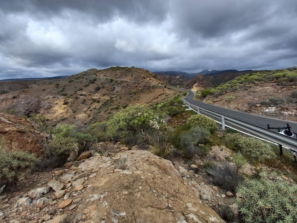
In the beginning through a village it is all still fairly constant with about'n 5,6,7%, once out of the village you get a few times a wall that you have to go up and then immediately descend again, this goes on a few times.
The last few hundred metres are quite tough and the road stops abruptly and turns into a dirt track.
The view at the top is beautiful, though.
Toen ik het stijgingspercentage zag dacht ik dat dit een lekkere lopend klimmetje zou zijn, maar ja in Gran Canaria zijn er echter geen lopende klimmen en deze al helemaal niet.
In het begin door een dorpje heen is het allemaal nog wel redelijk constant met zo'n 5,6,7% ongeveer, eenmaal uit het dorp krijg je een aantal keren een muurtje die je omhoog moet om vervolgens ook weer gelijk wat te dalen, dit gaat een paar keer zo door..
De laatste paar honderd meters zijn nog best wel even pittig en de weg stopt abrupt en gaat over in zandpad.
Het uitzicht boven is wel prachtig.
Surprising climb. Heavier than expected. Good road, but undulating profile so that you have to tackle the 'steepest 100 meters' several times. In terms of landscape, in my opinion, perhaps not the most beautiful in the beginning, but the last few km beautiful views. Nice to do.
Verrassende klim. Zwaarder dan verwacht. Goede weg, maar golvend profiel wat maakt dat je de ‘steilste 100 meter’ meerdere malen te lijf moet. Landschappelijk m.i. in het begin misschien niet de mooiste, maar de laatste paar km prachtige uitzichten. Leuk om te doen.
| 5 mph | 01:50:24 |
| 7 mph | 01:18:10 |
| 9 mph | 01:00:55 |
| 12 mph | 00:45:46 |
This page is better in the app