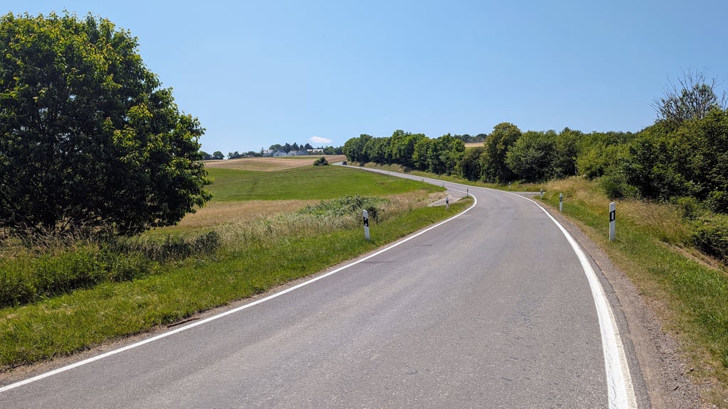
| Beautiful scenery |
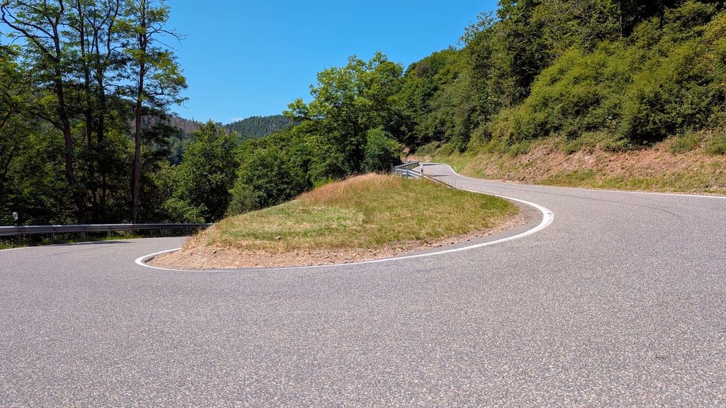
| 2 hairpin turns |
| #96 toughest climb of Rhineland-Palatinate |
| #43 most elevation gain of Eifel |
Linder Höhe from Brück is a climb in the region Eifel. It is 2.9 mi long and bridges 951 ft of vertical ascent with an average gradient of 6.3%, resulting in a difficulty score of 209. The top of the ascent is located at 1575 ft above sea level. Climbfinder users shared 2 reviews of this climb and uploaded 2 photos.
Road names: K 29, Hauptstraße & K 29
4.0 by XaviElSchwalboThis is an automatic translation, the original language is: German.A long and relatively difficult climb for the region. The climb leads from the Ahr through a forest to the village of Lind and on to a kind of plateau. The climb itself is fairly constant in the first part, after a short flatter section it varies more strongly up to the summit. Traffic is present, but generally fairly quiet. Although there are no great views, it is still a nice climb.... read more
Welcome! Please activate your account if you would like to share something. Look for the verification email in your inbox.
If you want to upload your photos, you need to create an account. It only takes 1 minute and it's completely free.
A long and relatively difficult climb for the region. The climb leads from the Ahr through a forest to the village of Lind and on to a kind of plateau. The climb itself is fairly constant in the first part, after a short flatter section it varies more strongly up to the summit. Traffic is present, but generally fairly quiet. Although there are no great views, it is still a nice climb.
Eine lange und relativ schwere Steigung für die Region. Der Anstieg führt von der Ahr aus durch einen Wald in das Dorf Lind und weiter auf eine Art Hochebene. Der Anstieg selber ist im ersten Teil ziemlich konstant nach einer kurzen flacheren Passage variieren sie bis zum Gipfel stärker. Verkehr ist zwar vorhanden, aber allgemein ziemlich ruhig. Zwar gibt es keine größeren Aussichten, dennoch ein schöner Kletteranstieg.
The ascent to Lind is a quiet and decent Ahr climb. The ascent begins with the only two hairpin bends and then leads through the forest on good tarmac at a moderate gradient. Good for rolling. Out of the forest, the road makes a 90-degree bend and you can see the destination of Lind. Now it gets really steep without the road showing it ;) - The nasty thing is that the climb only ends a good 200 metres after Lind. So don't rejoice too soon at the town sign. All in all a cool climb
Die Auffahrt nach Lind ist eine ruhige und anständige Ahr Steigung. Die Steigung beginnt mit den einzigen beiden Serpentinen und führt dann einsam auf gutem Asphalt durch den Wald bei mäßigen Prozenten. Gut zum rollen. Aus dem Wald heraus macht die Straße einen 90grad Knick und man sieht den Zielort Lind. Jetzt wirds richtig steil ohne dass man es der Straße ansieht ;) - fies ist, dass der Anstieg erst gut 200m hinter Lind endet. Also beim Ortsschild nicht zu früh freuen. Insgesamt cooler Anstieg
| 5 mph | 00:34:25 |
| 7 mph | 00:24:22 |
| 9 mph | 00:18:59 |
| 12 mph | 00:14:16 |
This page is better in the app