Tips nearby


| 22 hairpin turns |
| Bad road |
| #55 toughest climb of La Maurienne |
| #57 most elevation gain of La Maurienne |
| #62 longest climb of La Maurienne |
| #20 average steepest climb of Savoie |
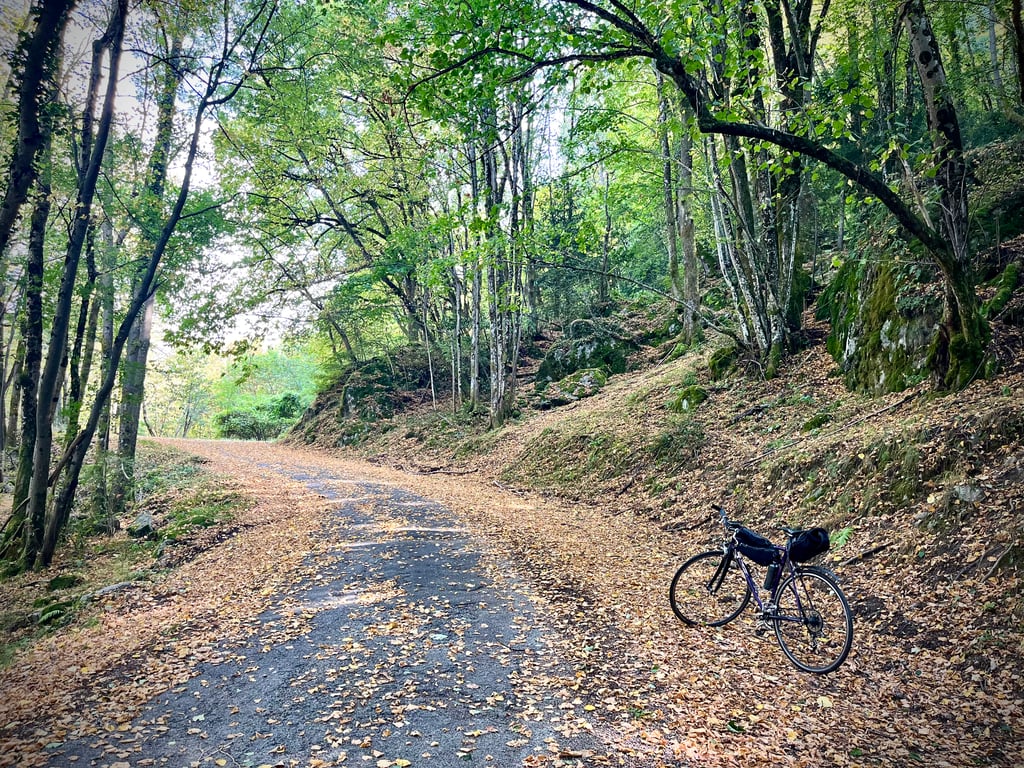
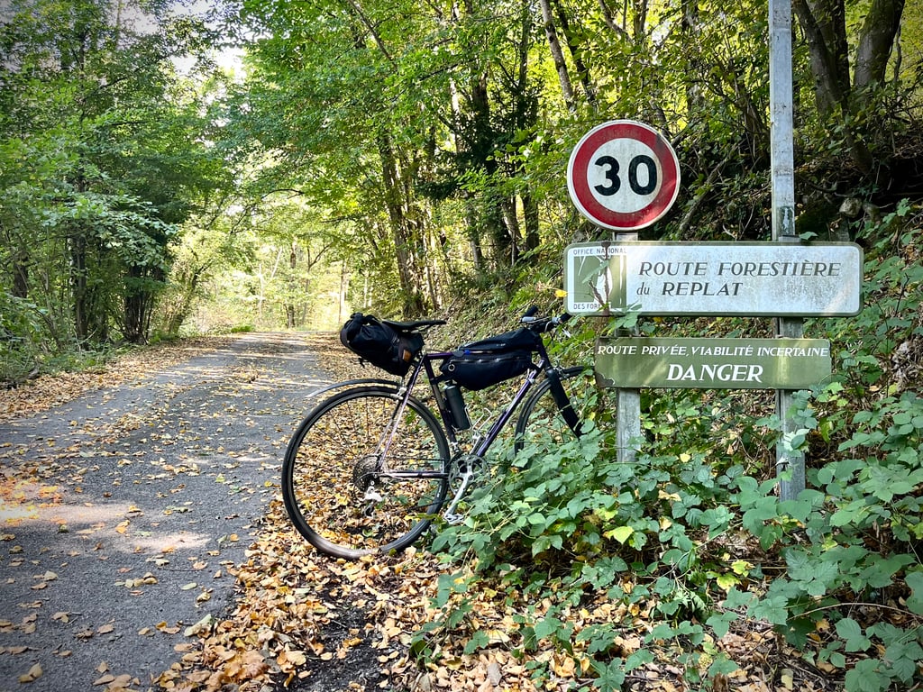
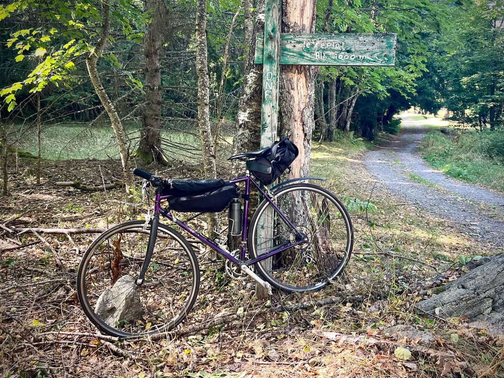
Le Replat from Saint Rémy de Maurienne is a climb in the region La Maurienne. It is 3.3 mi long and bridges 1670 ft of vertical ascent with an average gradient of 9.6%, resulting in a difficulty score of 522. The top of the ascent is located at 3268 ft above sea level. Climbfinder users shared 1 review/story of this climb and uploaded 5 photos.
Road names: Route du Moulin de la Chavane & Route Forestière du Replat
3.0 by CromagnonThis is an automatic translation, the original language is: French.A very pretty and pleasant climb! The forest here is very beautiful and wild. The climb takes place in the shade, which is really nice today! The surface is rough and uneven, but it's easy to climb. Be careful on the descent (uneven tarmac, small bumps, gravel, dead leaves, branches, etc.). 22 delightful bends. Steep gradients. And absolute calm! A must if you don't want to see anyone else and if you're tired of the big passes around here. At the top, a refuge and a spring.... read more
Welcome! Please activate your account if you would like to share something. Look for the verification email in your inbox.
If you want to upload your photos, you need to create an account. It only takes 1 minute and it's completely free.
A very pretty and pleasant climb! The forest here is very beautiful and wild.
The climb takes place in the shade, which is really nice today!
The surface is rough and uneven, but it's easy to climb.
Be careful on the descent (uneven tarmac, small bumps, gravel, dead leaves, branches, etc.).
22 delightful bends.
Steep gradients.
And absolute calm! A must if you don't want to see anyone else and if you're tired of the big passes around here.
At the top, a refuge and a spring. I hope the water is drinkable. If not, I bid you farewell and thank you Climbfinder!
I really enjoyed this short but intense climb.
Très mignonne et agréable ascension ! La forêt est ici très belle et sauvage.
La montée se fait à l’ombre et ça, c’est appréciable aujourd’hui !
Le revêtement est effectivement approximatif et dégradé mais on grimpe sans gêne particulière.
Vigilance dans la descente (irrégularité du bitume, petites bosses, gravillons, feuilles mortes, branchages…).
22 virages qui font plaisir.
Des pourcentages qui ne font pas de cadeaux.
Et le calme absolu ! À faire si vous ne voulez plus voir personne et si vous êtes fatigués par les grands cols environnants.
En haut, un refuge et une source. J’espère que l’eau est potable. Dans le cas contraire, je vous dis adieu et merci à Climbfinder !
J’ai bien aimé cette côte courte mais intense.
| 5 mph | 00:39:46 |
| 7 mph | 00:28:09 |
| 9 mph | 00:21:56 |
| 12 mph | 00:16:29 |
This page is better in the app