Tips nearby


Le Prioux from Moutiers is a climb in the region Savoie. It is 20.1 mi long and bridges 4386 ft of vertical ascent with an average gradient of 4.1%, resulting in a difficulty score of 773. The top of the ascent is located at 5784 ft above sea level. Climbfinder users shared 4 reviews of this climb and uploaded 11 photos.
Road names: D 915 & Route de Pralognan
4.0 by patrickbaertThis is an automatic translation, the original language is: Dutch.Long climb to the end of the dead-end valley Vallée des Prioux, still past Pralognan, cycled in August 2024. Left from Brides les Bains on busy road to end up in Bozel via short descent to and over the river bridge. Leaving that via long straight slightly uphill road to Le Villard. At the hydroelectric plant building there, a series of 6 hairpin bends start up the forest flank. Long road climbs further without extreme % with gentle curves, a few more hairpins, near the mountain river thro... read more

Welcome! Please activate your account if you would like to share something. Look for the verification email in your inbox.
If you want to upload your photos, you need to create an account. It only takes 1 minute and it's completely free.
A lovely, peaceful climb—enjoy the view. That’s what makes this such a fantastic climb. Not too difficult, but absolutely beautiful.
Mooie rustige klim, geniet van het uitzicht. Dat maakt dit een fantastische klim. Niet al te moeilijk, welheel erg mooi.
Long climb to the end of the dead-end valley
Vallée des Prioux, still past Pralognan, cycled in August 2024.
Left from Brides les Bains on busy road to end up in Bozel via short descent to and over the river bridge.
Leaving that via long straight slightly uphill road to Le Villard. At the hydroelectric plant building there, a series of 6 hairpin bends start up the forest flank.
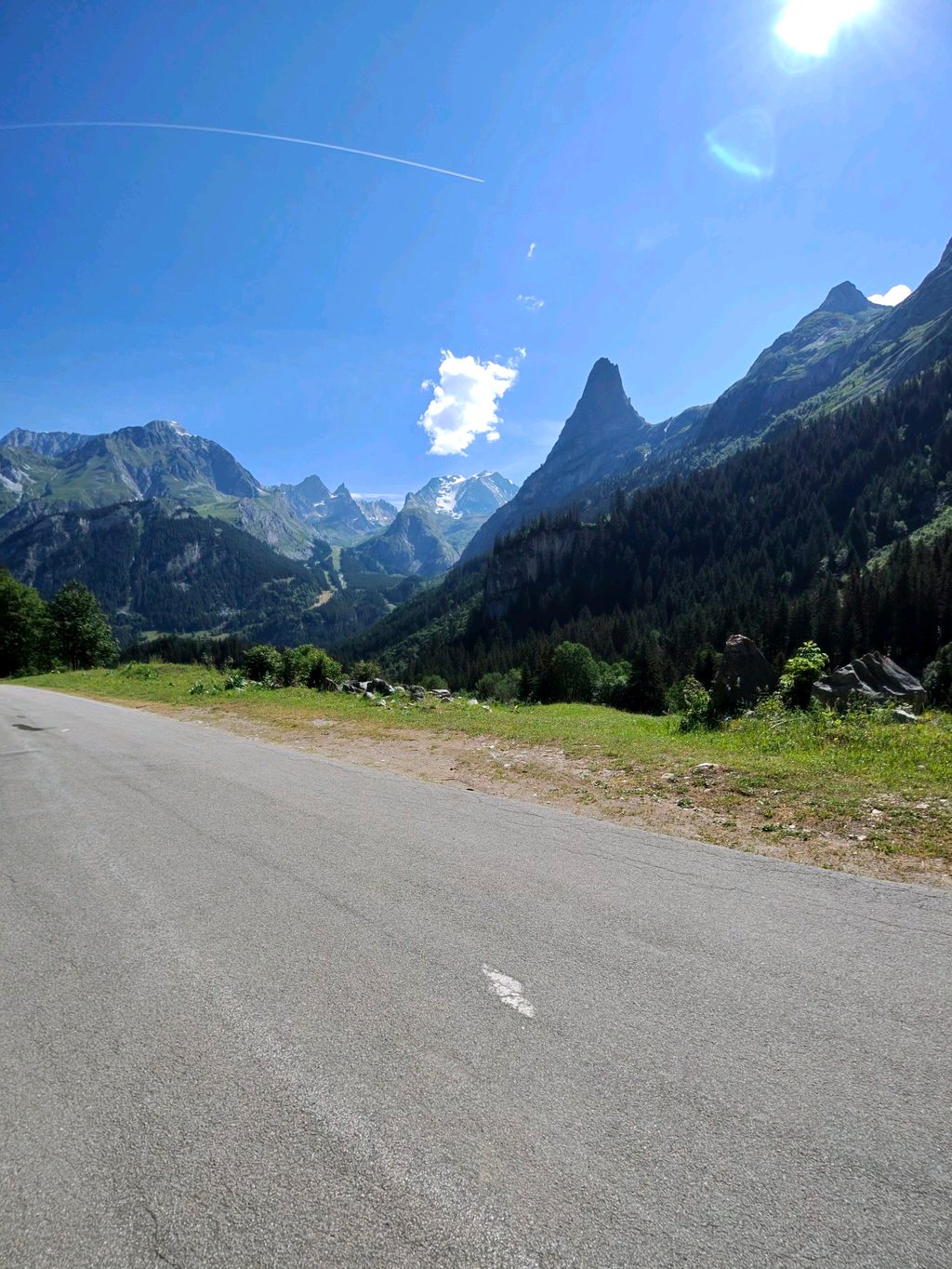
Long road climbs further without extreme % with gentle curves, a few more hairpins, near the mountain river through small villages surrounded by imposing rock massifs until Pralognan La Vanoise.
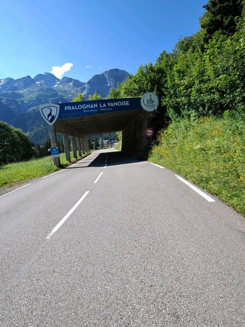
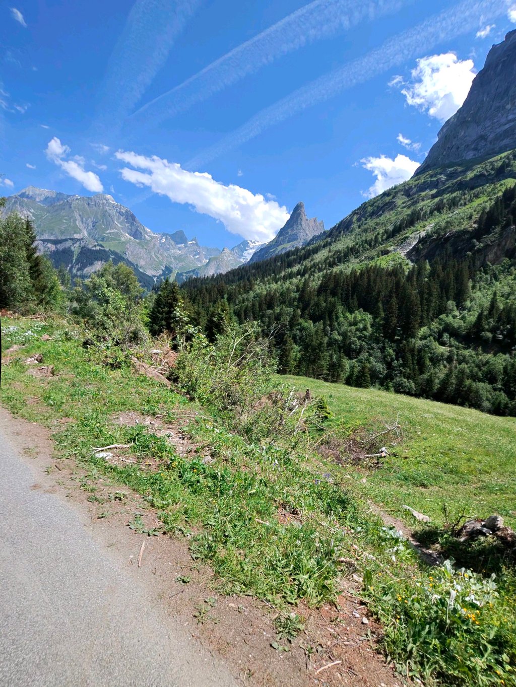
After cycling through this summer tourist hiking village, there are the last hairpin turns to then follow the mountain river Doron de Chavière upstream again on narrow fairly straight road with hardly any traffic, surrounded by the rocky outcrops and snow-capped peaks of the National Park de la Vanoise.
Le Prioux is starting point for hikers with parking and an Auberge (food&drink). The asphalt continues for a while until it changes to gravel thv Pont de la Peche.
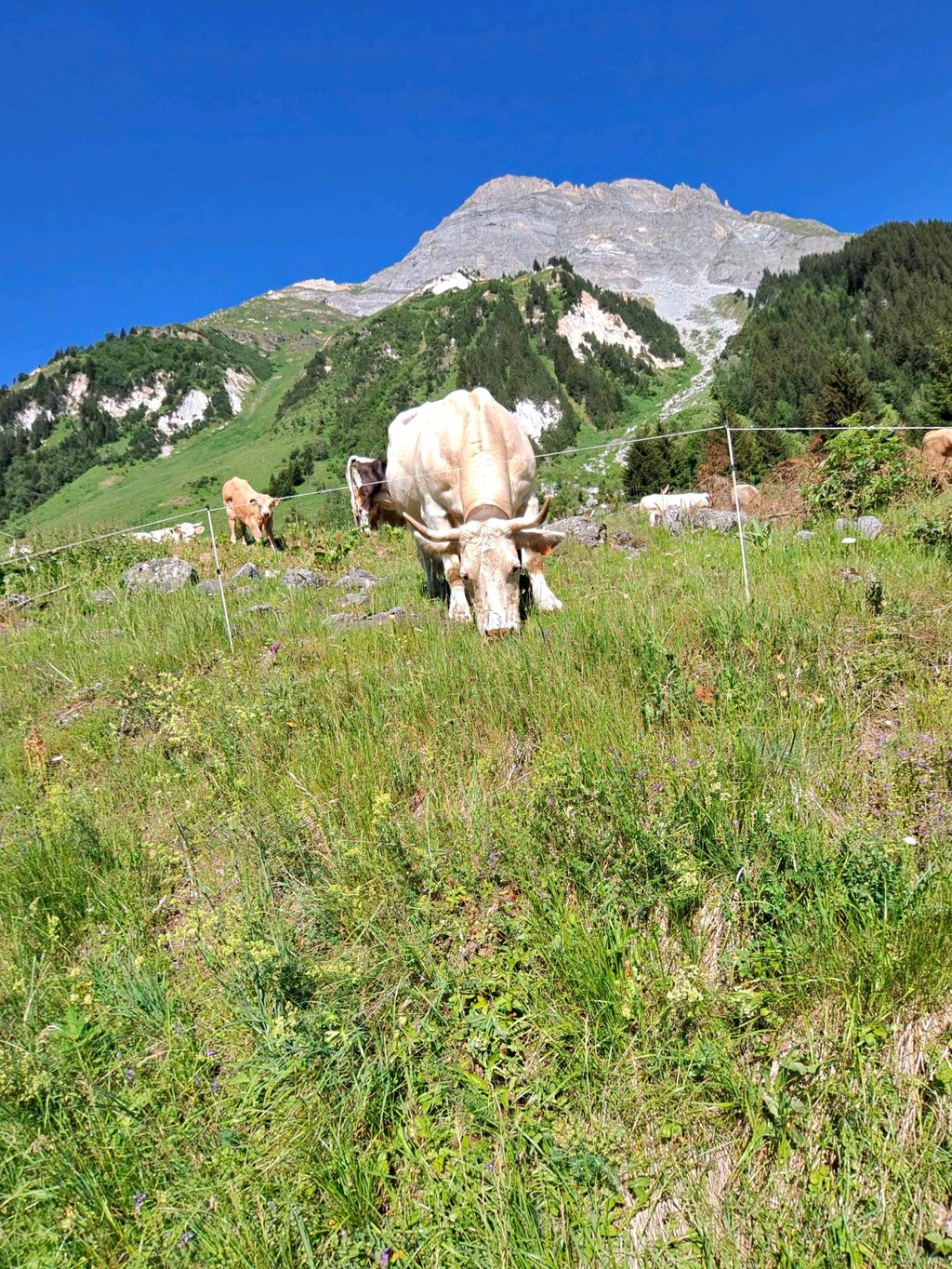
Typical uphill route in dead-end valley without extremes with mostly pure nature lock!
Lange klim naar het einde van het doodlopende dal
Vallée des Prioux, nog voorbij Pralognan, gefietst in augustus 2024.
Vertrok vanuit Brides les Bains op drukke weg om via korte afdaling naar en over de rivierbrug in Bozel te belanden.
Dat verlaat je via lange rechte licht stijgende weg naar Le Villard. Aan het gebouw van de waterkrachtcentrale aldaar start een reeks van 6 haarspeldbochten de woudflank op.
Lange weg klimt zonder extreme % verder met flauwe bochten, nog enkele haarspeldbochten, in de nabijheid van de bergrivier door kleine dorpjes omgeven door imposante rotsmassieven tot Pralognan La Vanoise.
Na het doorfietsen van dit zomers toeristisch wandeldorp zijn er de laatste haarspeldbochten om nadien op smalle vrij rechte weg met amper verkeer weer de bergrivier Doron de Chavière stroomopwaarts te volgen, omgeven door de rotspartijen en besneeuwde toppen van het Nationaal Park de la Vanoise.
Le Prioux is vertrekpunt voor wandelaars met parking en een Auberge (eten&drinken). Het asfalt gaat nog even verder tot het overgaat in gravel thv. Pont de la Peche.
Typische opklim route in doodlopend dal zonder extremen met vooral puur natuur slot!
Cycled this climb from the campsite in Bozel. Nice even climb where you can keep a good speed. The view on the 'top' in the valley is a nice reward. Just like the coke on the terrace of the refugé. Take some cash with you.
Deze klim gefietst vanaf de camping in Bozel. Mooie gelijkmatige klim waar je een prima snelheid kan vasthouden. Het uitzicht op de 'top' in de vallei is een mooie beloning. Net als het colaatje op het terras van de refugé. Neem wel even cash geld mee.
| 5 mph | 04:03:08 |
| 7 mph | 02:52:08 |
| 9 mph | 02:14:08 |
| 12 mph | 01:40:47 |
This page is better in the app