Le Motte from Sante Lucia is a climb in the region Sondrio. It is 1.9 mi long and bridges 771 ft of vertical ascent with an average gradient of 7.7%, resulting in a difficulty score of 201. The top of the ascent is located at 4629 ft above sea level. Climbfinder users shared 4 reviews of this climb and uploaded 1 photo.
Road name: Via al Forte
2.0 by Maikel1989This is an automatic translation, the original language is: Dutch.This is a quieter, shorter, but also trickier alternative to the busy link road starting from Bormio towards Livigno, for if you want to cycle from Forte di Oga to Lago Cancano, for example. Say you want to cycle to Livigno, this way you also cut off the start of Passo Foscagno (For the purists among us who want to ride a climb completely before ticking it off...)... read more
Welcome! Please activate your account if you would like to share something. Look for the verification email in your inbox.
If you want to upload your photos, you need to create an account. It only takes 1 minute and it's completely free.
This is a quieter, shorter, but also trickier alternative to the busy link road starting from Bormio towards Livigno, for if you want to cycle from Forte di Oga to Lago Cancano, for example. Say you want to cycle to Livigno, this way you also cut off the start of Passo Foscagno (For the purists among us who want to ride a climb completely before ticking it off...)
Dit is een rustiger, korter, maar ook lastiger alternatief voor de drukke verbindingsweg die vertrekt vanuit Bormio richting Livigno, voor als je bijvoorbeeld van Forte di Oga naar Lago Cancano wilt fietsen. Stel dat je naar Livigno wilt fietsen snij je op deze manier ook het begin van de Passo Foscagno af (Voor de puristen onder ons die een klim volledig willen rijden voor ze deze afvinken...)
It's a good choice if you want to reach Passo Foscagno or Torri di Fraele from Bormio, as an alternative to the first leg of SS301 or Premadio.
It is a good climb to get warmed up for a longer ride. You can also continue higher up to the Forte di Oga, although the road quality degrades a lot in that direction.
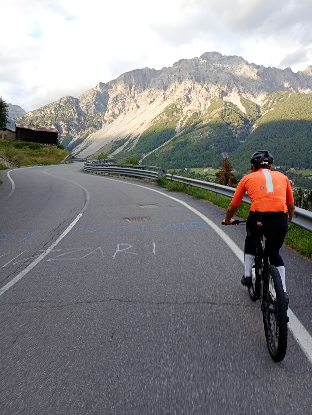
Start in Santa Lucia, just outside the town, where you turn right off the main road (SS38 to Sondrio) to climb steeply through the first 3 hairpin bends in quick succession. Followed by a wide road up the valley slope with fantastic panoramic views of Bormio and its four valleys. Halfway back 2 hairpins and after cycling past the exit to the village of Oga (see climbfinder Forte di Oga) the plateau comes in sight. At the top cafe / restaurant with parking and chairlift to the fortress. But then you better take the bike for some extra altimeters.
Short nice warm up or rest day climb!
Start in Santa Lucia, even buiten de stad, waar je rechts de grote rijksweg (SS38 naar Sondrio) afdraait om direct via de eerste 3 haarspeldbochten kort na elkaar stevig te klimmen. Gevolgd door brede weg tegen de valleiflank omhoog met fantastisch panoramisch uitzicht op Bormio en zijn vier dalen. Halfweg terug 2 haarspeldbochten en na het voorbijfietsen van de afslag naar dorpje Oga (zie climbfinder Forte di Oga) komt het plateau in zicht. Op de top cafe/restaurant met parking en stoeltjeslift naar het fort. Maar dan kan je beter de fiets nemen voor wat extra hoogtemeters.
Korte mooie opwarm of rustdag klim!
With all the big climbs near Bormio, this is a climb for a rest day, especially because of the views on Bormio and the Stelvio. The beginning is a bit busier and quite a few hundred meters of hard work, but then it becomes doable. My suggestion is to descend to the village of Oga (with bricks) and from there into the woods behind it, towards an old fortress (not much to see) and beyond. At times a bit more for a gravel bike, but quiet and beautiful. You can even cross there to the road to Livigno, but then you have to pay attention to the route.
Met alle grootse beklimmingen in de buurt van Bormio is dit een klim voor een rustdag, zeker vanwege het uitzicht op Bormio en de Stelvio. Het begin is nog wat drukker en best een paar honderd meter flink werken, maar daarna wordt het prima te doen. Mijn suggestie is wel om af te buigen naar het plaatsje Oga (met klinkers) en vandaar het bosgebied daarachter in, richting een oud fort (niet veel te zien) en verder. Wel bij vlagen iets meer voor een gravelbike, maar wel rustig en mooi. Je kan zelfs doorsteken daar naar de weg richting Livigno, maar dan moet je wel goed op de route letten.
| 5 mph | 00:22:50 |
| 7 mph | 00:16:10 |
| 9 mph | 00:12:36 |
| 12 mph | 00:09:28 |
This page is better in the app