Tips nearby


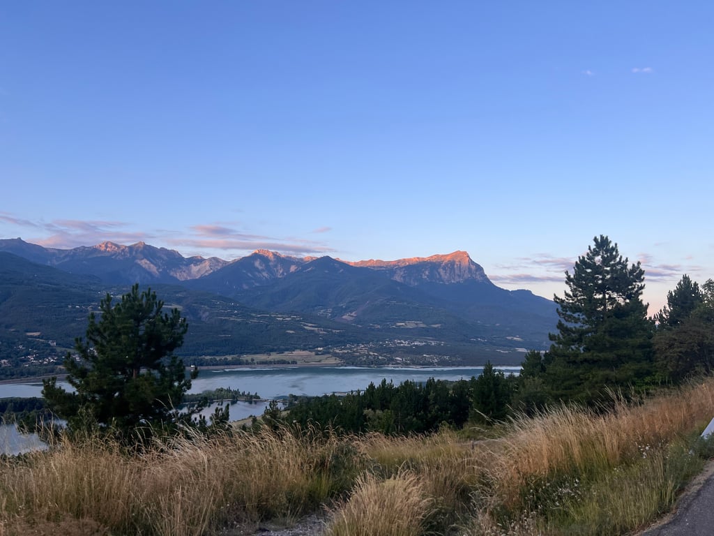
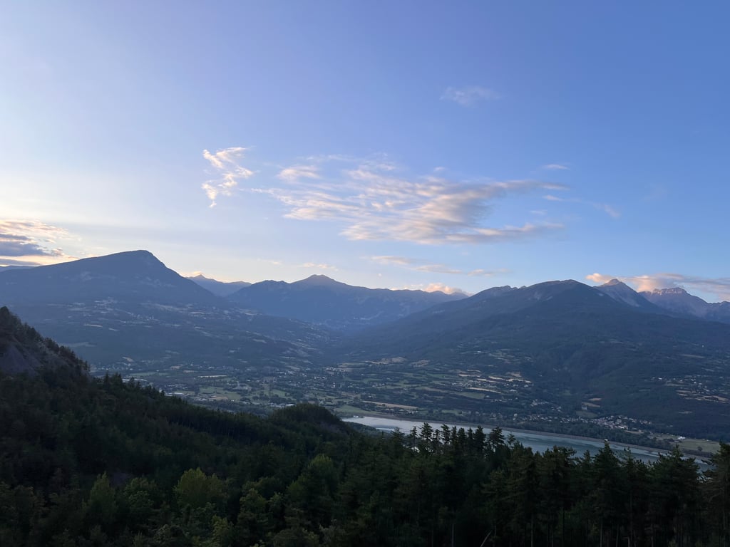
Le Méans from Embrun via Puy Sanières is a climb in the region Serre Ponçon. It is 7.7 mi long and bridges 1663 ft of vertical ascent with an average gradient of 4.1%, resulting in a difficulty score of 351. The top of the ascent is located at 4163 ft above sea level. Climbfinder users shared 6 reviews of this climb and uploaded 13 photos.
Road name: D9
2.0 by bramleijThis is an automatic translation, the original language is: Dutch.Mean, never even climb. Style and less style constantly alternate, but it never gets really easy. And that for 'a thing without a name', which is a setback for all your sweat drops :-) The rest of the road is fine, and as part of a (half) tour around Lac a nice trip. I wouldn't detour especially for it but the view is a nice reward.... read more

Welcome! Please activate your account if you would like to share something. Look for the verification email in your inbox.
If you want to upload your photos, you need to create an account. It only takes 1 minute and it's completely free.
Mean, never even climb. Style and less style constantly alternate, but it never gets really easy. And that for 'a thing without a name', which is a setback for all your sweat drops :-) The rest of the road is fine, and as part of a (half) tour around Lac a nice trip. I wouldn't detour especially for it but the view is a nice reward.
Gemene, nooit gelijkmatige klim. Stijl en minder stijl wisselen elkaar voortdurend af, maar echt makkelijk wordt ‘ie nooit. En dat voor ‘een ding zonder naam’, dat is dan toch een tegenvaller voor al je zweetdruppels :-) De weg is prima verder, en als onderdeel van een (half) rondje Lac een leuke tocht. Ik zou er niet speciaal voor omrijden maar het uitzicht is een fijne beloning.
This trail is part of a longer signposted route. The climb offers magnificent views. The tarmac is not good but suitable for road bikes. Watch out for cars and the heat during the day. This is the start of the embrun triathlon, so it's well worth doing.
Cette trace fait partie d’un parcours balisé plus long. La montée offre des vue sur des paysages magnifique. Le bitume n’est pas bon mais convient à des vélos de routes. Attention aux voitures et à la chaleur en journée. C’est le départ du triathlon d’embrun donc à faire.
There are a lot of slope changes on this road, from 10-15% to -3/-4%, on a surface that is hazardous to say the least. Fortunately, the view is worth the effort, with the magnificent Lac de Serre Poncon and the surrounding mountains, because the route is far from being a pleasure, at least for me, as I like a nice, regular pass with a road in good condition (unfortunately, the opposite is true here).
Enormément de ruptures de pentes sur cette route, on passe de 10-15% à -3/-4%, sur un revêtement pour le moins hasardeux. Heureusement que la vue en vaut la chandelle avec le magnifique Lac de Serre Poncon et les montagnes environnantes, car la route est très loin d'être une partie de plaisir, en tout cas pour ma part, aimant les beaux cols réguliers avec une route en bon état (là ici c'est tout l'inverse malheureusement)
If you are looking for a nice not-too-hard climb where you can enjoy beautiful views over the lake Lac de Serre Poncon, this is highly recommended.
A solid start followed by some flatter sections and even some metres downhill. Unfortunately some gravel on the road here and there.
Just before the end a nice surprise with a steep section to 22% (written on the road) after which you reach the top. After this I continued to the top of the Cote de Saint Apollinaire where the Tour passed.
Als je op zoek bent naar een leuke niet al te zware klim waarbij je kan genieten van een mooi uitzicht over het meer Lac de Serre Poncon is dit een echte aanrader.
Een stevig begin gevolgd door wat vlakkere stukken en zelfs wat meters in dalende lijn. Helaas wel her en der wat grind op de weg.
Vlak voor het einde een leuke verrassing met een steil stuk tot 22% (staat op de weg geschreven) waarna je boven komt. Zelf hierna door gereden naar de top van de Cote de Saint Apollinaire waar de Tour passeerde.
From Embrun (at the Avia petrol station) the climb starts. It goes up immediately. The climb ends above a beautiful gorge.
Vanuit Embrun (bij het Avia benzinestation) gaat begint de klim. Het gaat meteen goed omhoog. De klim eindigt boven een prachtige kloof.
Actually, the climb is longer. Goes up to Le Méans. Then about 10 km. It is on the D9 and part of the Route des Puys. That is a loop around the eastern part of Lac Serre Poncon. So Embrun, Les Puys, Prunières and Savines-le-Lac. Beautiful route of 45 km. Is well marked with every km a sign.
Eigenlijk is de klim langer. Loopt door tot Le Méans. Dan zo'n 10 km. Het is de D9 volgen en onderdeel van de Route des Puys. Dat is een lusje om het Oostelijk deel van Lac Serre Poncon. Dus Embrun, Les Puys, Prunières en Savines-le-Lac. Mooie route om te fietsen van 45 km. Staat goed aangegeven met elke km een bordje.
| 5 mph | 01:32:26 |
| 7 mph | 01:05:26 |
| 9 mph | 00:51:00 |
| 12 mph | 00:38:19 |
This page is better in the app