Tips nearby


Le Laisonnay d'En Bas from Bozel is a climb in the region Savoie. It is 8.3 mi long and bridges 2352 ft of vertical ascent with an average gradient of 5.4%, resulting in a difficulty score of 511. The top of the ascent is located at 5167 ft above sea level. Climbfinder users shared 9 reviews of this climb and uploaded 37 photos.
Road names: Route de Champagny, D 91b & D 91b
5.0 by patrickbaertThis is an automatic translation, the original language is: Dutch.Beautiful dead-end climb up to the start of Parc National de la Vanoise cycled August 2024. Spicy start in Bozel on wide (busy) road through some semi-open galleries to touristy Champagny and Vanoise. Through hairpin turns you cycle to the higher village area where the road narrows into a beautiful yet steep balcony route. Under avalanche gantries, it winds through a narrow rock gorge formed by the deeper mountain river. Once through this, the valley widens and you cycle slightly uphill on w... read more
Welcome! Please activate your account if you would like to share something. Look for the verification email in your inbox.
If you want to upload your photos, you need to create an account. It only takes 1 minute and it's completely free.
Patrick Baert was full of praise (5 stars), but Serge Navetat was more skeptical (3 stars).
Their reviews are often excellent and always very helpful. I think Serge was just in a bad mood that day…
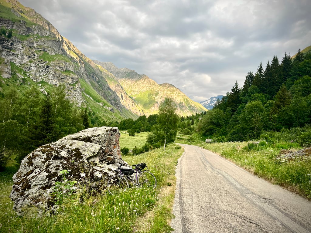
A very pleasant drive that takes us straight into the Vanoise National Park.
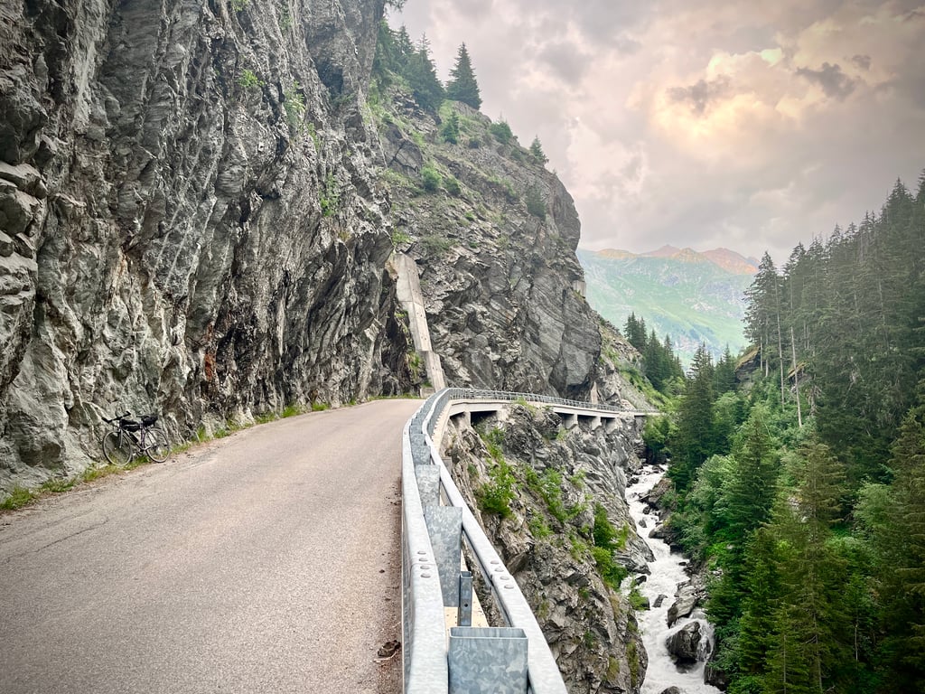
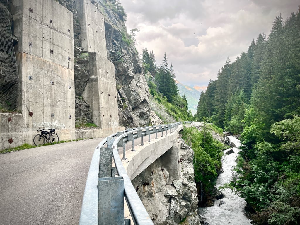
This road is “the Gorges Road.” That’s what it’s called here. The road overlooks the valley and offers spectacular views.
You can feel both the power and the fragility of this crumbling mountain. Its rock faces are downright intimidating.
Two enormous avalanche barriers and equally colossal retaining walls prove that nature is very much alive here and means business.
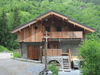
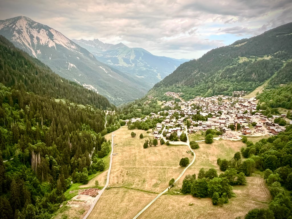
The villages along the way aren’t half bad. The scenery at the end is elegant.
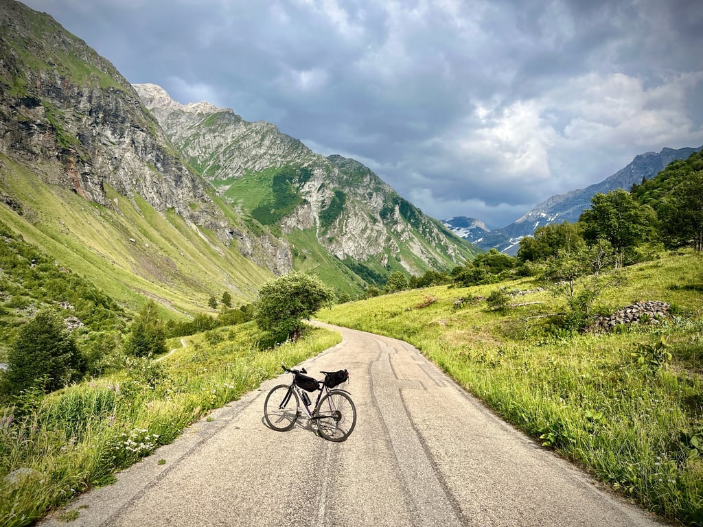
The final stretch is a gentle, leisurely ride through the alpine pastures.
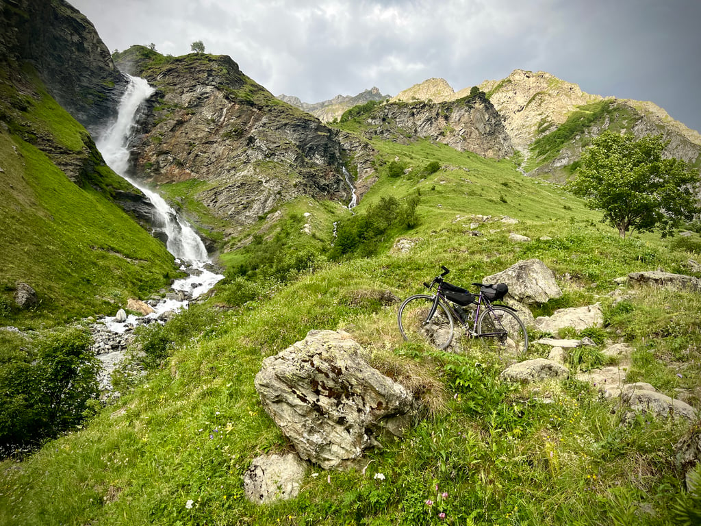
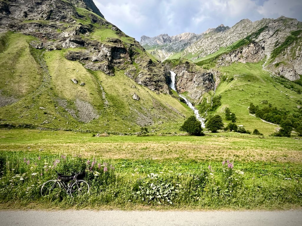
Continuing on toward Le Laisonnay d’En Haut, you’ll discover a lovely waterfall.
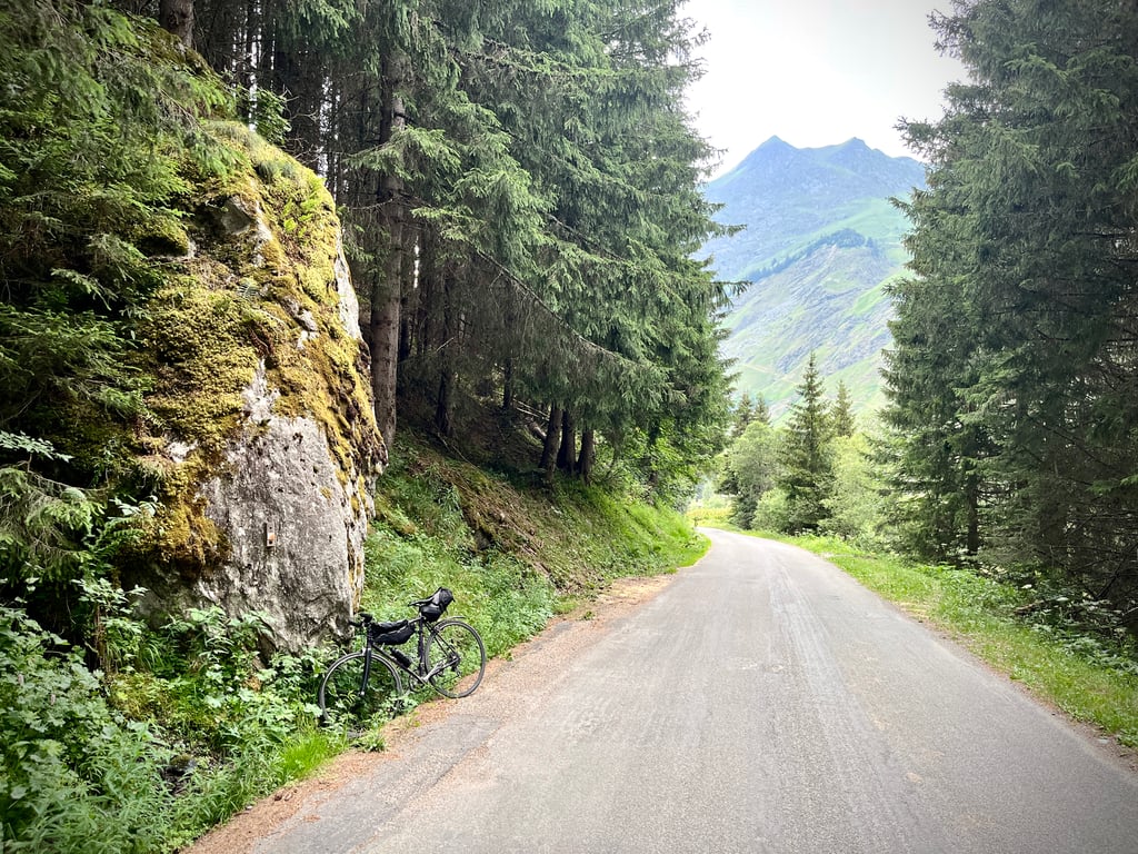
The road conditions vary by section, but they’re generally excellent. The descent is a treat.
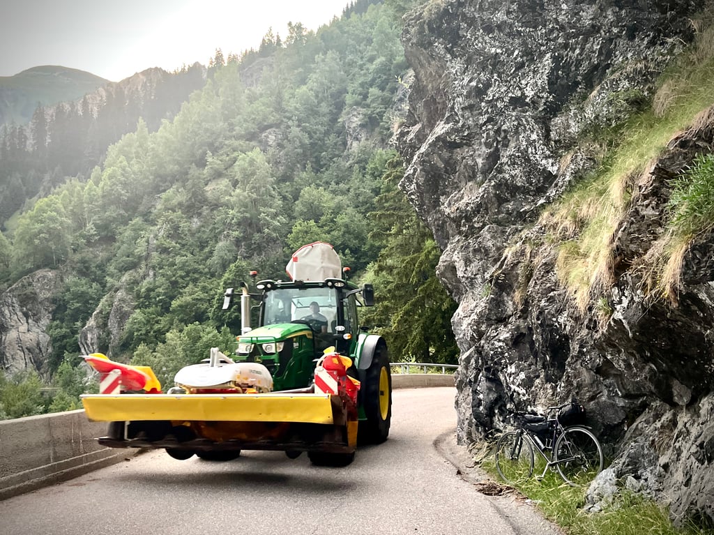
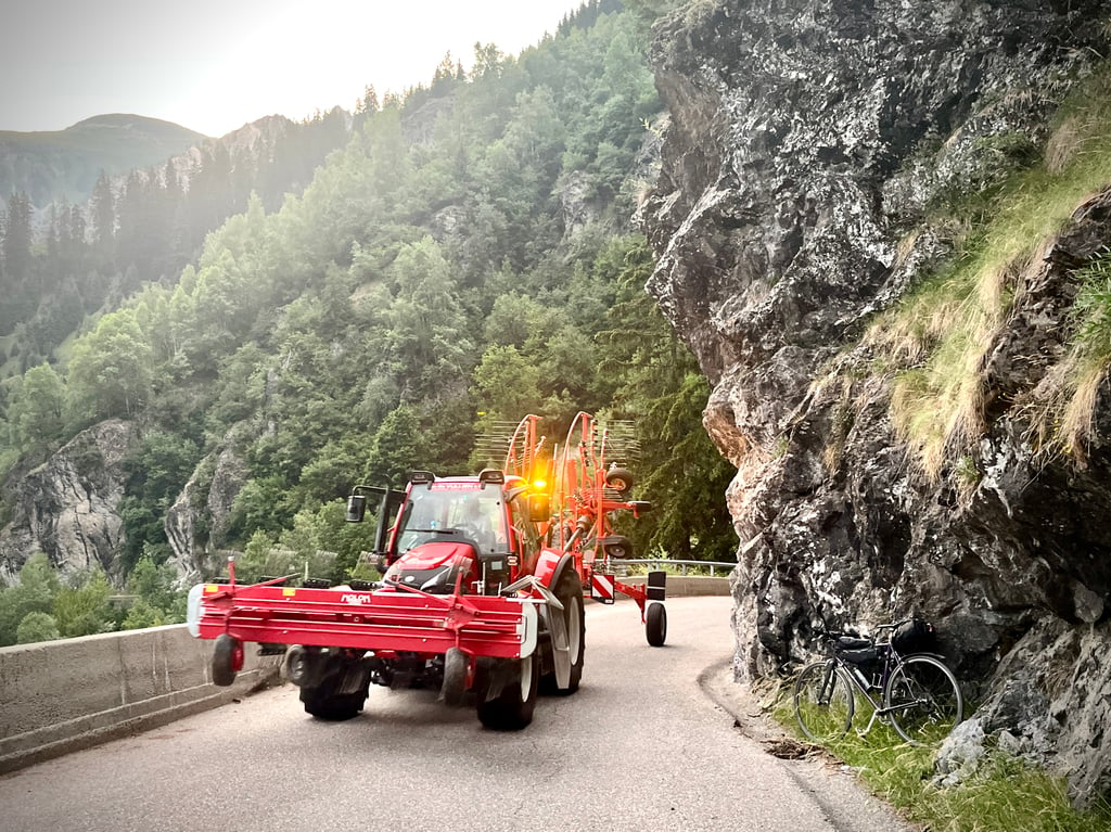
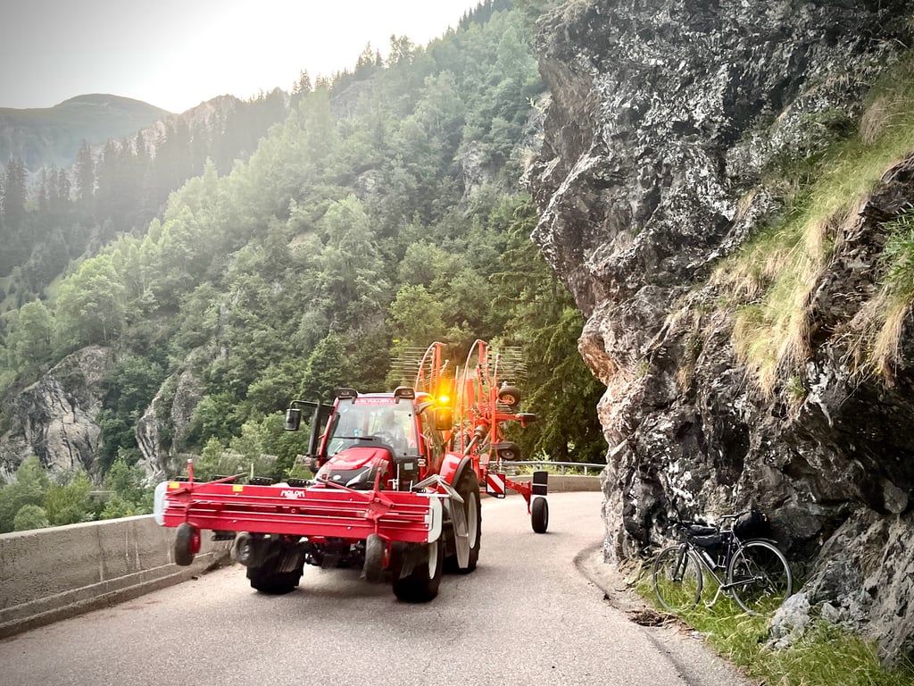
Be careful—this road isn’t very wide, and at the end of the day, you might encounter large farm vehicles (photos…).
A truly enjoyable climb to recover from La Loze… A dilemma when it comes to the rating! Off the top of my head, I’d give it 4 stars, but that would lower the overall rating, so I’m giving it 5 while thinking 4. And besides, it’ll balance out Serge’s rating.
Patrick Baert était dithyrambique (5 étoiles), mais Serge Navetat était plus sceptique (3 étoiles).
Leurs commentaires sont souvent excellents et toujours fort utiles. Je crois que ce jour là, Serge était grognon…
Une bien agréable ascension qui nous mène tout droit dans le parc naturel de la Vanoise.
Cette route, c’est « la route des gorges ». C’est son nom, ici. La route surplombe la vallée et offre des vues spectaculaires.
On ressent à la fois la puissance, mais aussi la fragilité de cette montagne qui se délite. Ses parois rocheuses sont franchement intimidantes.
Deux énormes paravalanches, des murs de soutènement tout aussi colossaux nous prouvent qu’ici, la nature est bien vivante et ne plaisante pas.
Les villages traversés ne sont pas moches. Les paysages à l’arrivée sont élégants.
La fin est une vraie balade douce dans les alpages.
En poursuivant vers Le Laisonnay d’En Haut, on découvre une chouette cascade.
L’état de la route varie selon les tronçons, mais il est plutôt excellent. La descente est un régal.
Attention, cette route n’est pas très large et en fin de journée, on peut croiser de gros véhicules agricoles (photos…).
Une montée vraiment plaisante à faire pour se remettre de la Loze…
Dilemne pour la note ! Spontanément, je donnerais 4 étoiles, mais ça ferait baisser la note globale, alors, ce sera 5 en pensant 4,5….
Et puis ça compensera la note de Serge.
Superb climb with steady ascent of around 8% from Bozel to Champagny. After Champagny follows a beautiful but tough section, then it gets easier and the road continues for several kilometres. Truly a must do!
Schitterende klim met vanuit Bozel tot Champagny gelijkmatige stijging van rond de 8%. Na Champagny volgt een prachtig maar pittig stuk, daarna wordt het makkelijker en loopt de weg nog een aantal kilometers door. Echt een must do!
Beautiful dead-end climb up to the start of Parc National de la Vanoise cycled August 2024.
Spicy start in Bozel on wide (busy) road through some semi-open galleries to touristy Champagny and Vanoise.
Through hairpin turns you cycle to the higher village area where the road narrows into a beautiful yet steep balcony route.
Under avalanche gantries, it winds through a narrow rock gorge formed by the deeper mountain river.
Once through this, the valley widens and you cycle slightly uphill on wide road between green alpine meadows flanked on both sides by pure high mountains (rocks/waterfalls/glaciers/snow-capped peaks).
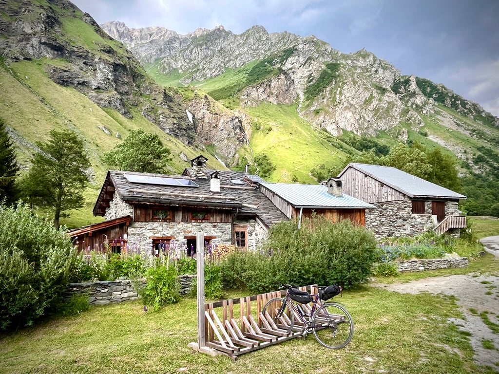
End point is parking for hikers and trekkers. There is a water source,public WC and a refuge (provisioning).
Thanks to Climbfinder, I trekked further into the nature park here with backpack and mountain boots a few days later!
Practical: variable asphalt quality, sometimes car traffic on the narrow balcony route, Coming from Pralognan/Prioux you can avoid the approach from Bozel via a shortcut.
Hidden Top Climb, mandatory fare if you're around there!
Prachtige doodlopende klim tot aan het begin van het Parc National de la Vanoise gefietst augustus 2024.
Pittige start in Bozel op brede (drukke) weg door enkele halfopen gaanderijen tot het toeristische Champagny en Vanoise.
Via haarspeldbochten fiets je naar het hogere dorpsgedeelte waar de weg versmalt tot een prachtige doch steile balkonroute.
Onder lawine gaanderijen wringt deze zich door een nauwe rotskloof (gorge) gevormd door de dieper gelegen bergrivier.
Eens daardoor verbreedt het dal en fiets je licht klimmend op brede weg tussen de groene alpenweiden geflankeerd langs beide zijden door puur hooggebergte (rotsen/watervallen/ gletsjers/besneeuwde toppen).
Eindpunt is parking voor wandelaars en trekkers. Er is een waterbron,publieke WC en een refuge (bevoorrading).
Dankzij Climbfinder trok ik hier met rugzak en bergschoenen enkele dagen later verder het natuurpark in.!
Praktisch: wisselende asfaltkwaliteit, op de smalle balkonroute soms stroppend autoverkeer, Komende van Pralognan/Prioux kan je via een doorsteek de aanloop vanuit Bozel vermijden.
Verborgen Topklim, verplichte kost als je daar in de buurt bent!
Without a doubt a hidden gem this climb really has everything.
Rock formations tunnels tightly along a large waterfall. Once you get above the tree line it is truly phenomenal, stunning views waterfalls everywhere you see hikers runners mountain bikers people on horses. When I saw the profile and also because of the classification of the climb I was in doubt about doing it, very glad I did because this is one of the most beautiful climbs.
Zonder twijfel een verborgen juweeltje deze klim heeft werkelijk alles.
Rotsformaties tunneltjes strak langs een grote waterval. Als je eenmaal boven de boomgrens komt is het werkelijk fenomenaal, schitterende uitzichten watervalletjes overal zie je hikers hardlopers mountainbikers mensen op paarden. Toen ik het profiel zag en ook vanwege de classificatie van de klim zat ik te twijfelen om hem te doen, zeer blij dat ik hem gedaan heb want dit is een van de mooiste klimmen.
Made in July 2021, the traffic is moderate to heavy depending on the time of day and especially the period.
For the first few kilometres, the road up to Pralognan is overlooked.
The steepest slopes are in the crossing of Champagny and then in the passage of the paravalanches.
The last few kilometres are gently sloping through the high mountain pastures.
The finish is at a car park just after crossing a bridge.
Fait au mois de juillet 2021, la circulation est de modérée à forte suivant les heures de la journée et surtout les périodes.
Sur les tout premiers kilomètres on surplombe la route qui monte à Pralognan.
Les pentes les plus fortes se situent dans la traversée de Champagny puis au passage du paravalanches.
Les derniers kilomètres sont en pente douce à travers les alpages de haute montagne.
L'arrivée se situe sur un parking juste après la traversée d'un pont.
Wonderful climb, with beautiful views, little traffic and good tarmac. Recommended is also the alternative route up via the hairpin bends of the D915 to Champagny. Then a climb with (short) tunnels and overhanging roads. At the end, a view of the eternal snow
Prachtige klim, met mooie vergezichten, weinig verkeer en goed asfalt. Aanrader is ook de alternatieve route omhoog, via de haarspeldbochten van de D915 naar Champagny. Daarna een klim met (korte) tunnels en overhangende wegen. Aan het einde uitzicht op de eeuwige sneeuw
The most beautiful part of the Vanoise. That's the reward you get after climbing the steepest parts past Champagny - up to 13% on my GPS.
Het mooiste van de Vanoise. Dat krijg je als beloning nadat je de steilste delen voorbij Champagny - tot 13% op mijn gps - hebt beklommen.
Nice steady climb with good visibility and good road surface. As a reward, you end up in a valley with old-fashioned waterfalls :-)
Fijne regelmatige klim met mooi zicht op goed wegdek. Als beloning kom je boven in een vallei terecht met ouderwetse watervalletjes :-)
| 5 mph | 01:39:37 |
| 7 mph | 01:10:31 |
| 9 mph | 00:54:57 |
| 12 mph | 00:41:17 |
This page is better in the app