Le Haut Pichot via Rue Arnoult is a climb in the region Caps et Marais d'Opale. It is 1.3 mi long and bridges 285 ft of vertical ascent with an average gradient of 4.2%, resulting in a difficulty score of 58. The top of the ascent is located at 581 ft above sea level. Climbfinder users shared 1 review/story of this climb and uploaded 2 photos.
Road names: Chemin du Mont de la Marne & D239
2.0 by CromagnonThis is an automatic translation, the original language is: French.Let's be clear, this side doesn't compare at all with the only, real side, the one that starts from Verlincthun. On this side, it's a bit bland and there's little effort required to get back to the Mont Violette antenna. Beautiful fields on the left and a Christ before the finish. Nothing too crazy. At least we can enjoy the descent to Verlincthun. ... read more
Welcome! Please activate your account if you would like to share something. Look for the verification email in your inbox.
If you want to upload your photos, you need to create an account. It only takes 1 minute and it's completely free.
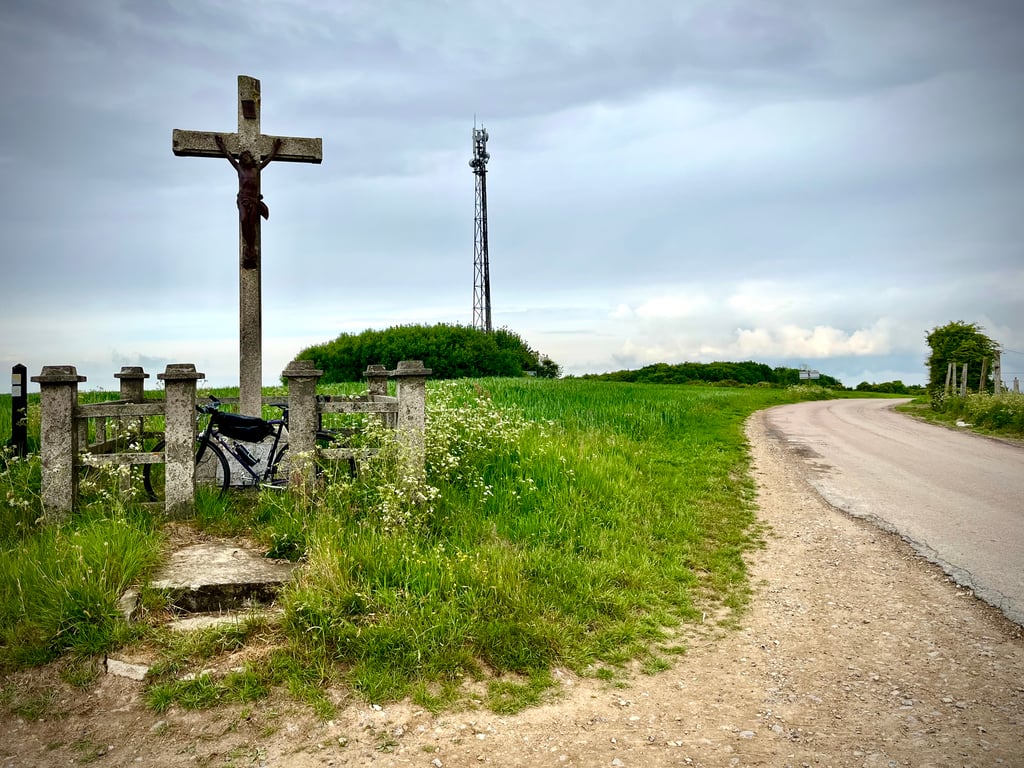
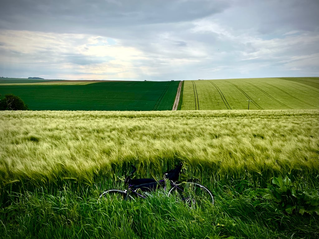
Let's be clear, this side doesn't compare at all with the only, real side, the one that starts from Verlincthun.
On this side, it's a bit bland and there's little effort required to get back to the Mont Violette antenna. Beautiful fields on the left and a Christ before the finish. Nothing too crazy.
At least we can enjoy the descent to Verlincthun.
Soyons clair, ce versant ne supporte absolument pas la comparaison avec le seul, le vrai versant, celui qui démarre de Verlincthun.
De ce côté, c’est un peu fade et il y a peu d’efforts à fournir pour regagner l’antenne du Mont Violette. De beaux champs sur la gauche et un Christ avant l’arrivée. Rien de bien dingue.
Au moins, on profite de la descente vers Verlincthun.
| 5 mph | 00:15:29 |
| 7 mph | 00:10:57 |
| 9 mph | 00:08:32 |
| 12 mph | 00:06:25 |
This page is better in the app