Tips nearby


| 25 hairpin turns |
| #40 average steepest climb of Savoie |
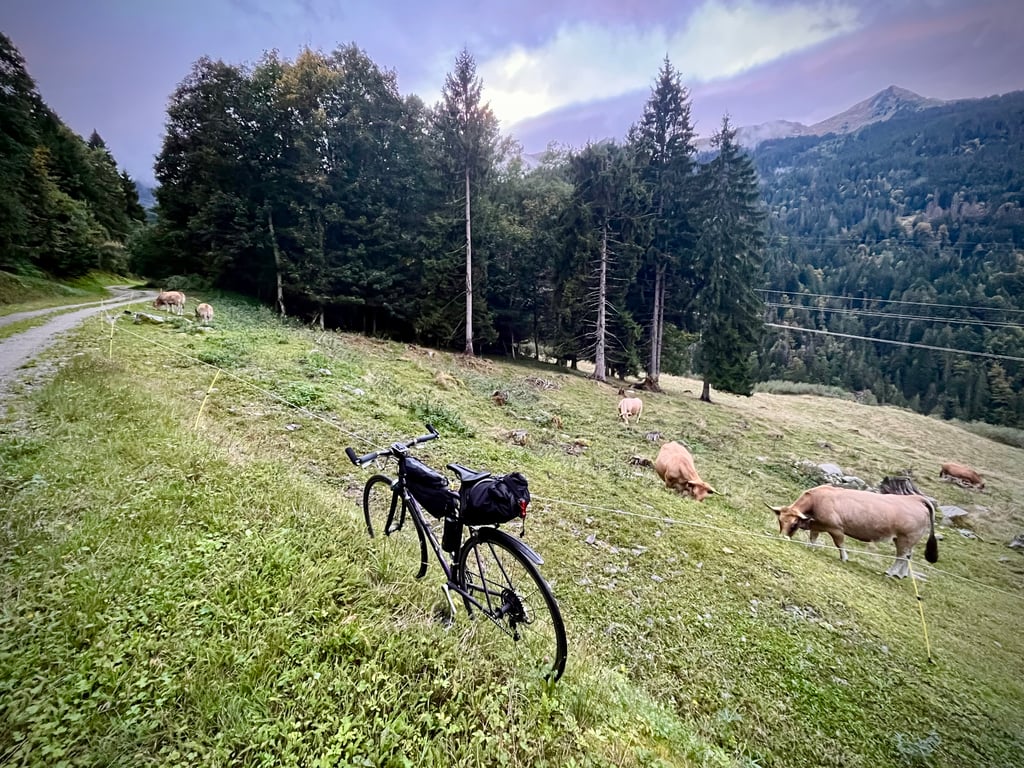
Le Grand Planbois from Rognaix is a climb in the region Savoie. It is 4.5 mi long and bridges 2106 ft of vertical ascent with an average gradient of 8.8%, resulting in a difficulty score of 579. The top of the ascent is located at 3399 ft above sea level. Climbfinder users shared 2 reviews of this climb and uploaded 15 photos.
3.0 by CromagnonThis is an automatic translation, the original language is: French.A narrow and very pretty little road that zigzags frantically! 25 hairpins in 7.3km! The road isn't immaculate, but it's still very rideable and pleasant. The last 800 metres are on easy sandy gravel. No difficulty for a road bike. In autumn, however, the ground was littered with chestnuts. Beware, the gradients are not at all trivial. It climbs well and all the way. Some very serious sections. The forest is wild and the switchbacks are magnificent. It's fairly short and ther... read more

Welcome! Please activate your account if you would like to share something. Look for the verification email in your inbox.
If you want to upload your photos, you need to create an account. It only takes 1 minute and it's completely free.
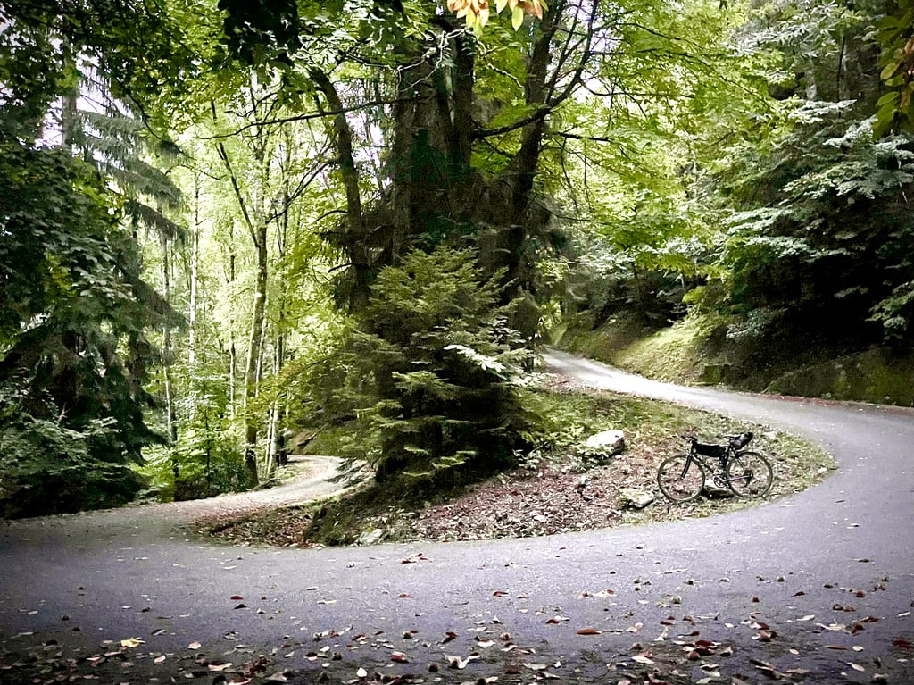
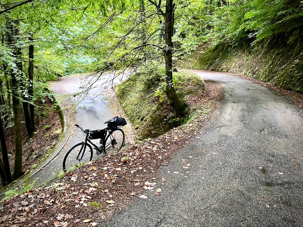
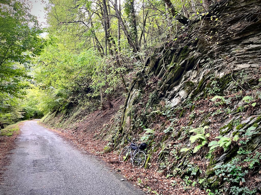
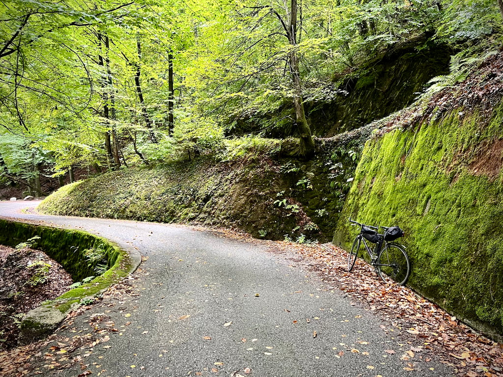
A narrow and very pretty little road that zigzags frantically!
25 hairpins in 7.3km!
The road isn't immaculate, but it's still very rideable and pleasant.
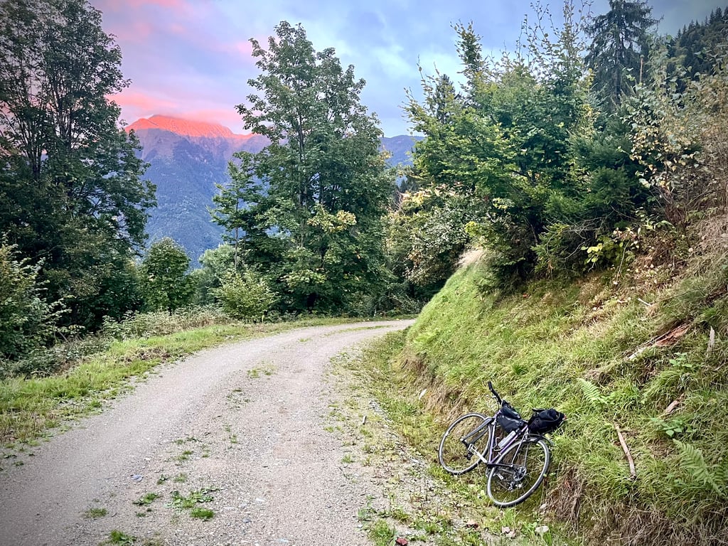
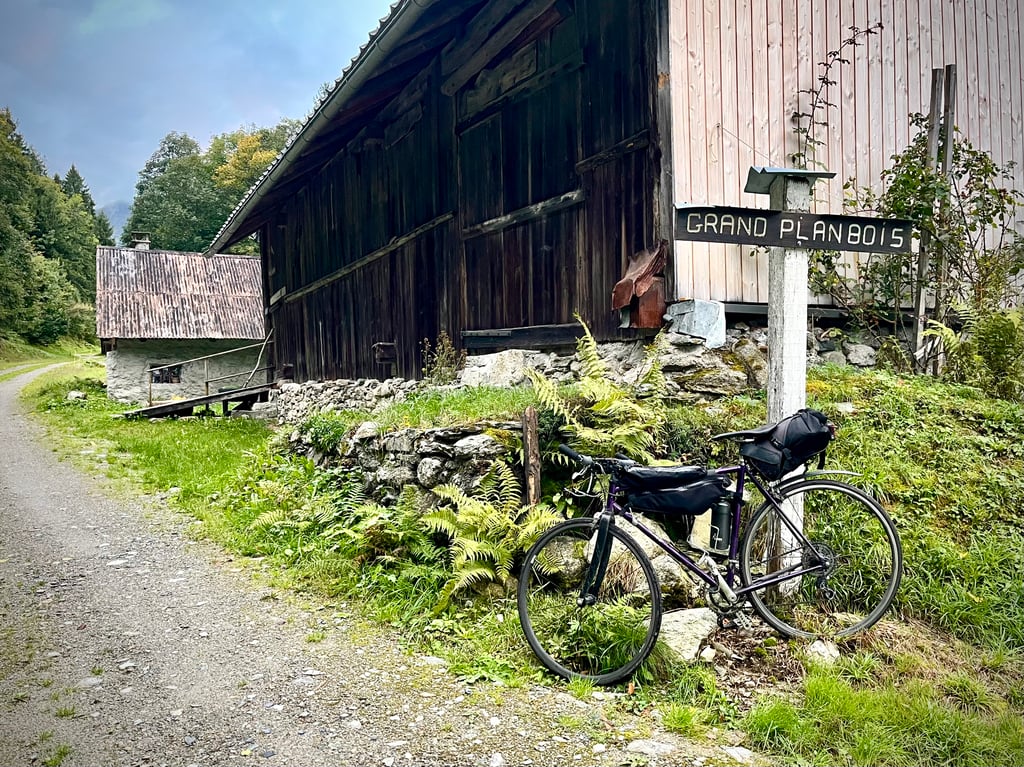
The last 800 metres are on easy sandy gravel. No difficulty for a road bike. In autumn, however, the ground was littered with chestnuts.
Beware, the gradients are not at all trivial. It climbs well and all the way. Some very serious sections.
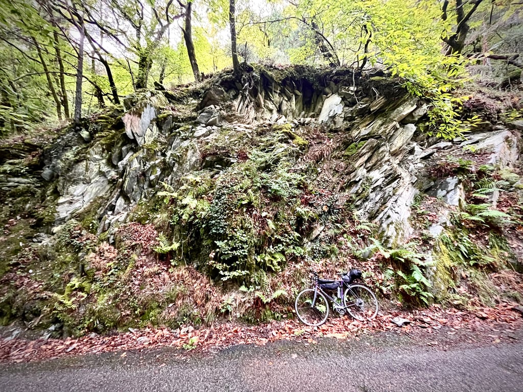
The forest is wild and the switchbacks are magnificent. It's fairly short and there's never a dull moment.
No vehicles.
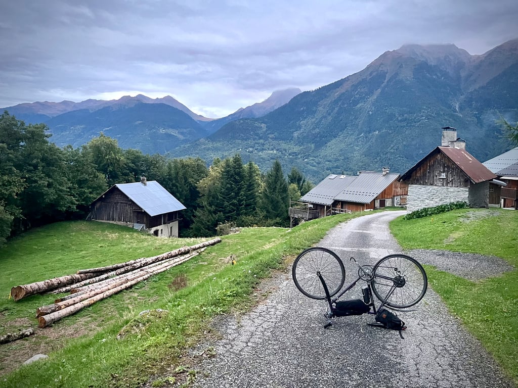
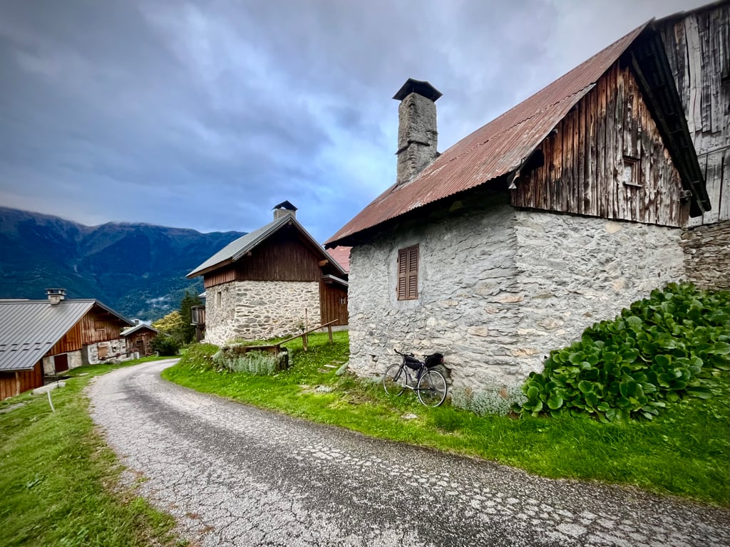
At the top, just a few pretty chalets try to make up a hamlet that nobody has named. Unless Le Grand Planbois is the name of this hilltop district of Rognaix... The sign does exist, but it's at the level of the last house.
On second thoughts, I'll go with that.
To sum up, it's a short but solid climb, with wild undergrowth, stunning bends and absolute peace and quiet.
Not bad!
Une étroite et très mignonne petite route qui zigzague avec frénésie !
25 épingles en 7,3km !
La route n’est pas impeccable mais elle reste très praticable et agréable.
Les 800 derniers mètres se font sur du gravel sablonneux facile. Aucune difficulté avec un vélo de route. Par contre, à l’automne, le sol était jonché de châtaignes.
Attention, les pourcentages ne sont pas du tout anecdotiques. Ça grimpe bien et tout au long du parcours. Quelques passages bien sérieux.
La forêt est sauvage et les lacets sont magnifiques. C’est assez court et on ne s’ennuie pas.
Aucun véhicule.
En haut, juste de jolis chalets tentent de composer un hameau auquel personne ne semble avoir donné de nom. A moins que Le Grand Planbois soit le nom de ce quartier perché de Rognaix… Le panneau existe bien mais il est posé au niveau de la dernière maison…
À bien y réfléchir, je retiens cette hypothèse.
Et contrairement à ce qu’affirme le commentaire de Serge, cette montée ne finit pas en cul de sac. C’est juste que la route devient un chemin gravel, du gravel light qui n’abîme pas les vélos…
Et oui, là-haut, une fois la montée achevée, il y a bien une vue sur la chaîne de montagnes. Peut-être serait-il préférable d’aller au bout des ascensions pour en parler plus justement ?
En guise de résumé, une montée courte mais solide, des sous-bois sauvages, des virages épatants et le calme absolu.
Pas mal du tout !
Done on 24th October 2020.
Small road in the woods above Rognaix ( Savoie ) the tarmac itself isn't bad but the scenery isn't great, it ends in a cul de sac.
Fait le 24 octobre 2020.
Petite route dans les bois au dessus de Rognaix ( Savoie ) le bitume en lui même n'est pas mauvais mais niveau paysage rien de terrible, ça se termine en cul de sac.
La pente est parfois très forte avec fréquents passages au dessus de 12% et parfois au dessus de 15%
| 5 mph | 00:54:27 |
| 7 mph | 00:38:33 |
| 9 mph | 00:30:02 |
| 12 mph | 00:22:34 |
This page is better in the app