Tips nearby


| Hidden gem |
| #94 toughest climb of Hautes-Pyrénées |
| #61 most elevation gain of Hautes-Pyrénées |
| #38 longest climb of Hautes-Pyrénées |
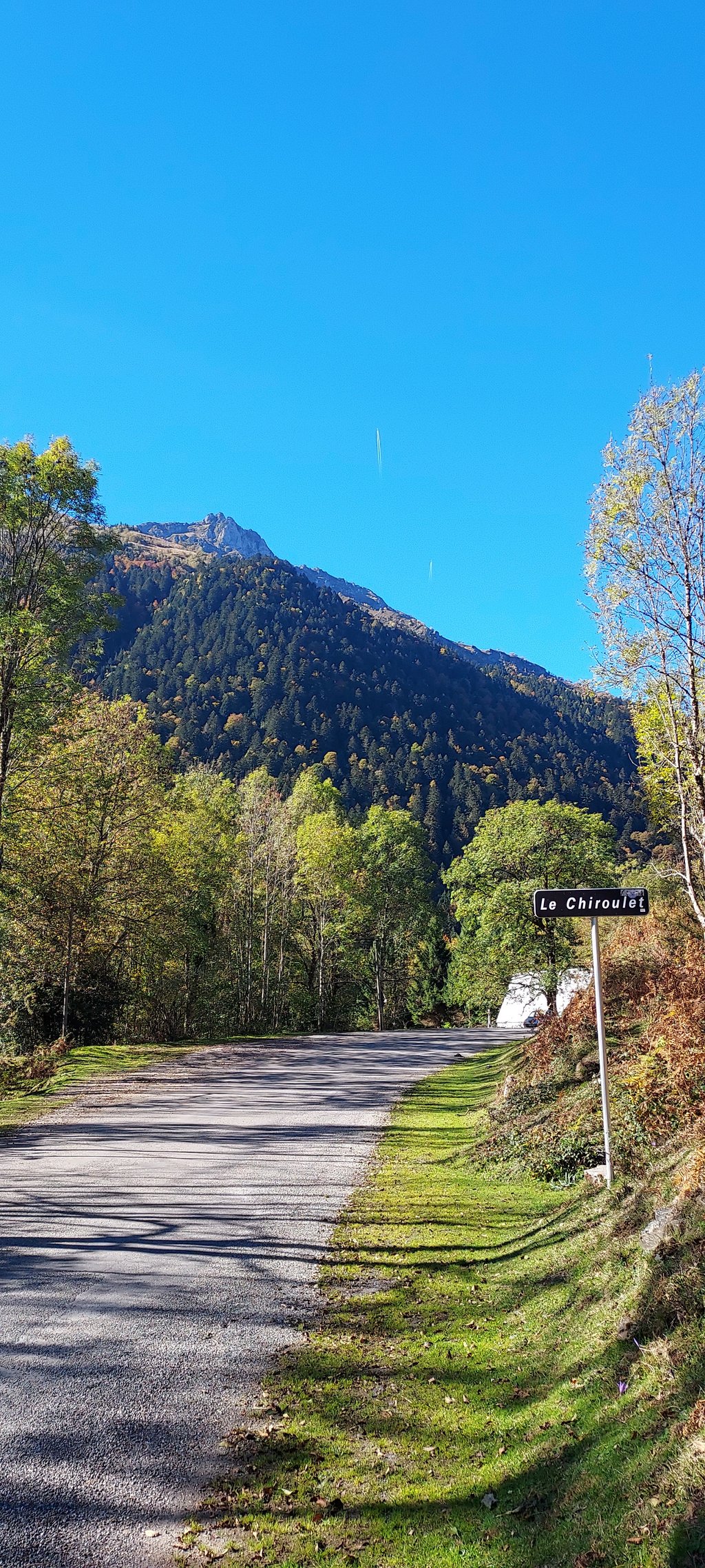
Le Chiroulet from Baudéan is a climb in the region Hautes-Pyrénées. It is 6.3 mi long and bridges 1444 ft of vertical ascent with an average gradient of 4.3%, resulting in a difficulty score of 260. The top of the ascent is located at 3514 ft above sea level. Climbfinder users shared 6 reviews of this climb and uploaded 4 photos.
Road name: D29
4.0 by vincente_hp65This is an automatic translation, the original language is: French.Surely one of the most beautiful arrivals after a climb, the splendid view makes for a leisurely ascent that nevertheless requires strength to negotiate the final ramp 1.5/2 km from the summit. It's steep and long, over 1km at 10% or more.... read more
Welcome! Please activate your account if you would like to share something. Look for the verification email in your inbox.
If you want to upload your photos, you need to create an account. It only takes 1 minute and it's completely free.
Surely one of the most beautiful arrivals after a climb, the splendid view makes for a leisurely ascent that nevertheless requires strength to negotiate the final ramp 1.5/2 km from the summit. It's steep and long, over 1km at 10% or more.
Sûrement l’une des plus belles arrivées après une montée, la vue splendide concrétise une montée tranquille qui nécessite néanmoins de la force pour franchir la rampe terminale à 1,5/2 kil du sommet. Elle est raide et longue , plus de 1km à 10% voir plus.
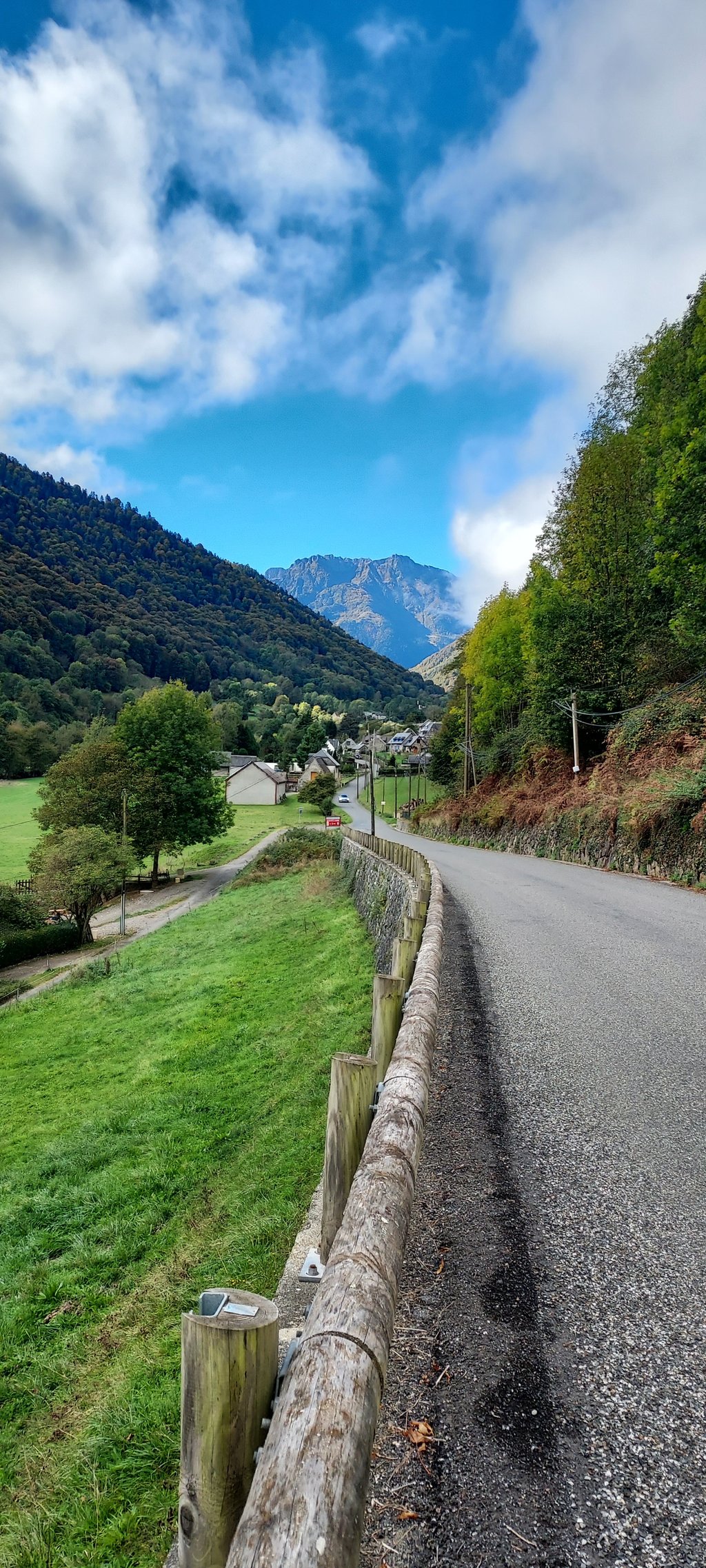
At Baudean, take the D29 towards the Lesponne valley. You will pass through several hamlets on gentle slopes. There is a little traffic, however, as the valley floor is a starting point for many hikes. The road rises once you're surrounded by woods, between 6 and 9 %.After about ten km from Baudean you arrive at Le Chiroulet , car park, restaurant, hotel and departure for a walk to the lakes. A pleasant outing!
A Baudean,prendre la D29 direction vallée de Lesponne. On traverse plusieurs hameau sur des pentes douces. Il y a un peu de circulation malgré tout car le fond de vallée est un départ de randonnées. La route s'élève une fois que l'on est entouré de bois, entre 6 et 9 %.Après une dizaine de km depuis Baudean on arrive au Chiroulet , parking , restaurant, hôtel et départ pour marche vers les lac . Sortie agréable !
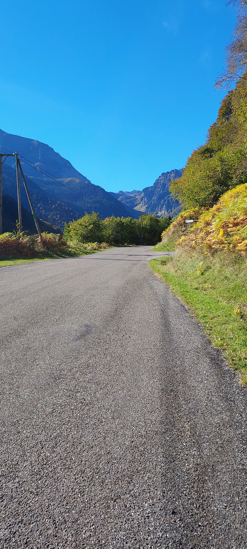
The ascent is in two parts: after climbing up the valley, you reach a long, steep ramp before emerging into a sublime setting.
Montée en deux partie ou après une remontée de vallée on attrape une longue et raide rampe avant de débouler dans un décors sublime
The average gradient is not very steep, but it climbs all the way for 10 km, and in the upper two-thirds there is a steeper gradient ( 10 % ) for a good kilometre or even a little more. Put 50 minutes go with small breaks landscape ( beautiful view under the pic du midi de Bigorre, beautiful donkeys in the fields). I' m 67 years old, I often cycle but it' s a bit my upper limit to stay in pleasure.
Pente moyenne pas très importante mais ça monte tout le long sur 10 km et aux deux - tiers supérieurs il y a une pente plus soutenue ( 10 % ) sur un bon kilomètre voire un peu plus. Mis 50 minutes aller avec de petites pauses paysage ( belle vue sous le pic du midi de Bigorre, beaux ânes dans les champs). J’ ai 67 ans, je pratique souvent le vélo mais c’ est un peu ma limite supérieure pour rester dans du plaisir.
Maybe not the most spectacular (few nice views), but if you're in the area, definitely worth it. Traffic is not "light" light, as there's the parking at the summit for - mostly - hikers, and you're passing lots of houses up until "the wall" near the end... Good restaurant to enjoy a drink or a pancake before you return. As the asphalt is fine, you can get down fast, but be careful as there are a few tricky bends.
Nice climb in an open valley with good road and little traffic.
The 4.3% average gradient can be misleading with 2km close to 10% on the end
Jolie montée dans une vallée ouverte, avec route en bon état et peu de trafic.
Les 4,3% de pente moyenne peuvent être trompeurs avec 2 km proches de 10% sur la fin
| 5 mph | 01:16:17 |
| 7 mph | 00:54:00 |
| 9 mph | 00:42:05 |
| 12 mph | 00:31:37 |
This page is better in the app