Tips nearby


Le Borbois from Albertville is a climb in the region Annecy. It is 3.9 mi long and bridges 1476 ft of vertical ascent with an average gradient of 7.2%, resulting in a difficulty score of 359. The top of the ascent is located at 2598 ft above sea level. Climbfinder users shared 2 reviews of this climb and uploaded 1 photo.
Road names: Route de Bongain & Route du Tal
2.0 by CromagnonThis is an automatic translation, the original language is: French.Three paths lead to this Borbon wood. This one is the longest and perhaps the most varied. We start off in the center of Albertville, winding through houses and chalets, and then quickly reach more wooded areas. The forest road is pleasant. The road is good, but at the top, the surface of the Tal path is deteriorating. There's not much to see, apart from a relay antenna. Nearby, the Col du Vorger is, in my opinion, more exciting. Today it's raining hard, so no new photos: I'm recy... read more
Welcome! Please activate your account if you would like to share something. Look for the verification email in your inbox.
If you want to upload your photos, you need to create an account. It only takes 1 minute and it's completely free.
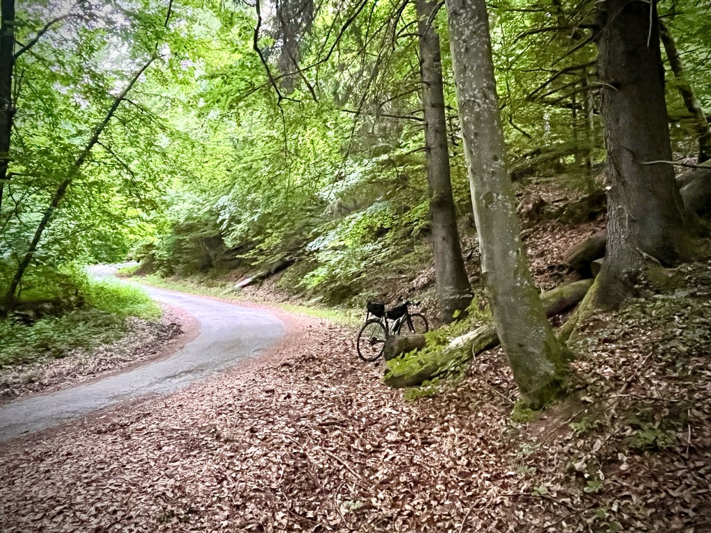
Three paths lead to this Borbon wood. This one is the longest and perhaps the most varied.
We start off in the center of Albertville, winding through houses and chalets, and then quickly reach more wooded areas. The forest road is pleasant. The road is good, but at the top, the surface of the Tal path is deteriorating. There's not much to see, apart from a relay antenna. Nearby, the Col du Vorger is, in my opinion, more exciting. Today it's raining hard, so no new photos: I'm recycling a picture of the Lançon road with an identical ending.
Trois chemins conduisent à ce bois de Borbon. Celui-ci est le plus long et aussi le plus varié.
On démarre au centre d’Albertville, on serpente au milieu de maisons et de chalets et puis on parvient très vite dans des zones plus boisées. La route de la forêt est plaisante et en bon état, mais en haut, le revêtement du chemin du Tal se dégrade. Il n’y a pas grand chose à voir sauf pour les collectionneurs d’antennes relais.
Dans les environs proches, le col du Vorger est, selon moi, bien plus excitant. Aujourd’hui, grosse pluie, donc pas de nouvelles photos : je recycle une image de la route de Lançon dont la fin est identique.
Living near Albertville, I've done this climb 2-3 times, and it represents a good preparatory sporting effort.
You can push on to the end of the TAL route, but I don't recommend it as it's in poor condition.
There is nothing miraculous about the scenery.
It's a climb to make if there's no other option or if you want to collect something.
Habitant proche d'Albertville j'ai effectué 2-3 fois cette ascension, elle représente un bon effort sportif de préparation.
On peut pousser jusqu'à la fin de la route du TAL mais je déconseille car en mauvais état.
Niveau paysages, rien de bien miraculeux.
Une ascension à effectuer si il n'y a pas d'autres options ou pour sa collection.
| 5 mph | 00:47:07 |
| 7 mph | 00:33:21 |
| 9 mph | 00:26:00 |
| 12 mph | 00:19:32 |
This page is better in the app