View on map
© MapLibre | OpenStreetMap contributors
1%
2%
4%
6%
8%
10%
12%
15%
20%

Le Bédat from Bagnères de Bigorre

2.0
1 review/story | Elevation profile | 4 photos
In some places the road surface of this climb is bad, but it can be ridden with a road bike.
Tips nearby
Le Bédat from Bagnères de Bigorre
transparant thumb
transparant thumb
transparant thumb
transparant thumb
Your achievable time
Calculating based on your best performances...
Relaxed
Maximum
W/kg
W/kg
W/kg
Analyze your climbing performance
Detailed insight into your climbing performance & automatically check off climbs
Based on your best performances.
Your best attempt:
Number of attempts:
Elevation profile Le Bédat from Bagnères de Bigorre
bad road (along the entire length)

Statistics

Difficulty points 288
Length 1 mi
Average gradient 11.3%
Steepest segment 24.7%
Total ascent 623 ft

Short recap

2 hairpin turns
Bad road
#83 toughest climb of Hautes-Pyrénées
#80 average steepest climb of Pyrenees
Feedback about this climb?
Show climbs nearby Export to GPS device

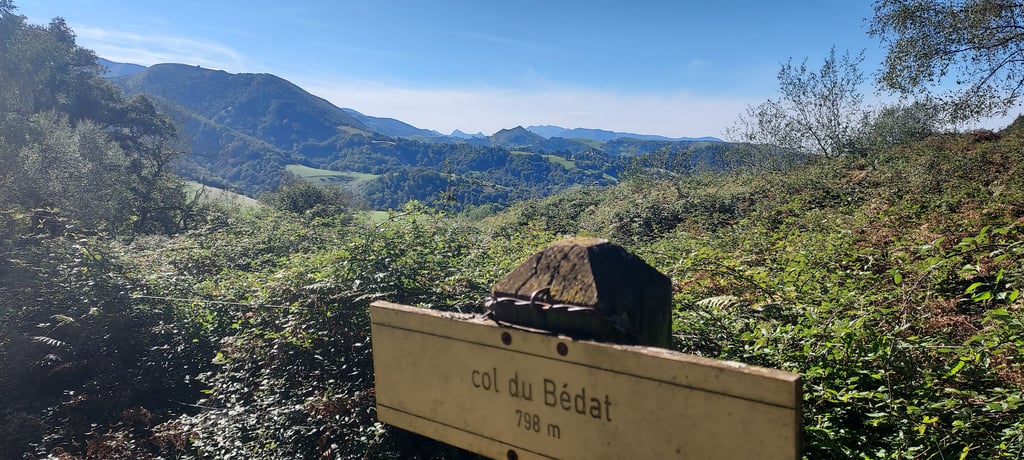
Le Bédat from Bagnères de Bigorre is a climb in the region Hautes-Pyrénées. It is 1 mi long and bridges 623 ft of vertical ascent with an average gradient of 11.3%, resulting in a difficulty score of 288. The top of the ascent is located at 2438 ft above sea level. Climbfinder users shared 1 review/story of this climb and uploaded 4 photos.

Road names: Avenue Prosper Noguès, Rue Joseph Bouget & Domaine de l'Arbizon
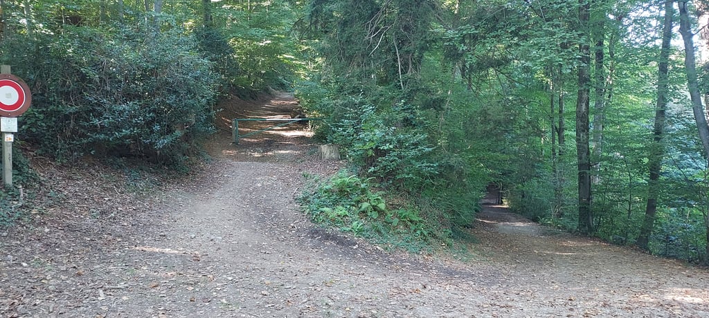
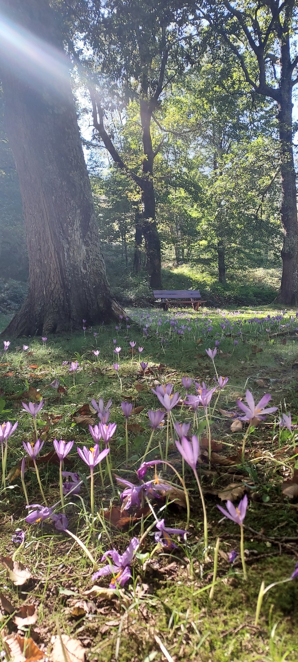
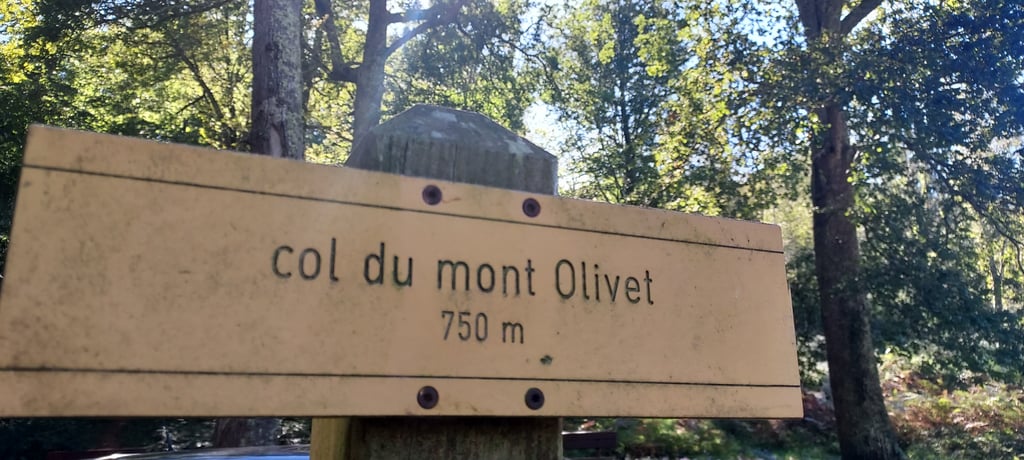
2.0 by HiFolk
This is an automatic translation, the original language is: French.
The ascent starts from the small car park in the Vallon du Salut, then you walk between the houses on the Arbizon estate and, when you arrive in front of the MGEN hospital, take the right-hand access to the staff delivery entrance. There's a barrier to cross and the stony dirt track climbs up into the woods. Mountain biking or gravel is recommended, although the route is accessible as far as the Col du Mont Olivet, and the last few metres to the Col du Bedat and La Vierge can be explored on... read more

Photos (4)

Le Bédat from Bagnères de Bigorre
transparant thumb
transparant thumb

Your uploads (max 4)

Welcome! Please activate your account if you would like to share something. Look for the verification email in your inbox.

If you want to upload your photos, you need to create an account. It only takes 1 minute and it's completely free.

  • Receive free climbfinder goodies for your reviews & photos.
  • Create a bucket list and check off conquered climbs.
  • Add missing climbs.
Continue with GoogleContinue with Google Continue with FacebookContinue with Facebook Continue with AppleContinue with Apple Sign up with email
By signing up you agree to our terms of service and confirm that you have read our privacy & content policy.

Reviews (1)

5.0
4.0
3.0
2.0
1.0
HiFolk
8 Mo 2.0 via the Climbfinder app
This is an automatic translation, the original language is: French. Show original

The ascent starts from the small car park in the Vallon du Salut, then you walk between the houses on the Arbizon estate and, when you arrive in front of the MGEN hospital, take the right-hand access to the staff delivery entrance. There's a barrier to cross and the stony dirt track climbs up into the woods. Mountain biking or gravel is recommended, although the route is accessible as far as the Col du Mont Olivet, and the last few metres to the Col du Bedat and La Vierge can be explored on foot. Beautiful views from the summit.

L'ascension démarre du petit parking "vallon du Salut".On chemine ensuite entre les maisons du domaine de l'arbizon et une fois arrivé devant l'hôpital de la MGEN, il faut prendre l'accès à droite " entrée du personnel- livraison. Il y a une barrière à franchir et le chemin de terre , caillouteux , s'élève dans les bois. VTT ou gravel conseillé même si accessible jusqu'au col du mont Olivet.Les derniers mètres vers le col du Bedat et la vierge se font à pied. Beau panorama au sommet

Dashboard

Climbing times

5 mph 00:12:33
7 mph 00:08:53
9 mph 00:06:55
12 mph 00:05:12

Road surface condition

0% 0% 100%
Based on 1 vote
Share your knowledge. What was the road condition during your ascent?

Traffic

100% 0% 0%
Based on 1 vote
Your experience counts. How much traffic did you encounter during the climb?

Frequently Asked Questions

Le Bédat from Bagnères de Bigorre is a challenging ascent. For this type of climbing, we recommend mountain gearing, specifically a compact system. This means a small front chainring of 34 teeth, combined with a rear cassette where, depending on your level, strength, and experience, you choose a sprocket with 30, 32, or even 34 teeth. Remember that a smooth cadence is always more efficient!

Le Bédat from Bagnères de Bigorre is a 3rd-category climb. Almost anyone can handle this climb, as long as you have a bike with climbing gears. If you have little training, you will probably need to shift down significantly. For experienced riders, Le Bédat from Bagnères de Bigorre is not a problem.

Le Bédat from Bagnères de Bigorre is 1 mi long.

The average gradient of Le Bédat from Bagnères de Bigorre is 11.3%.

Le Bédat from Bagnères de Bigorre has a steepest segment with an average gradient of 24.7%.

The summit of Le Bédat from Bagnères de Bigorre is at 2438 ft.

At a slow pace of 5 mph, it takes about 00:12:33 to climb Le Bédat from Bagnères de Bigorre. At 7 mph the time is 00:08:53, and at 9 mph 00:06:55. For the fastest cyclists, 00:05:12 is an achievable time.

Le Bédat from Bagnères de Bigorre is located in the region Hautes-Pyrénées in France.

This page is better in the app

Climbfinder app
Climbfinder
(Free)
Open