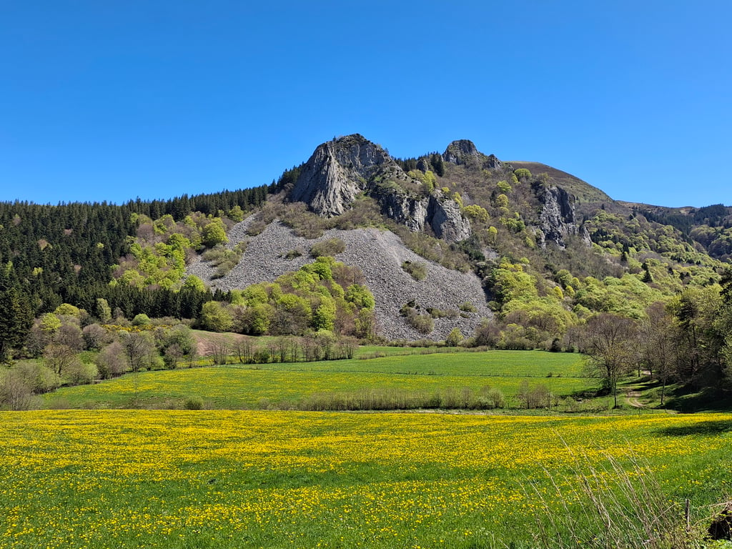
View on map
© MapLibre | OpenStreetMap contributors
1%
2%
4%
6%
8%
10%
12%
15%
20%

Col de Guery from Rochefort Montagne

4.3
3 reviews | Elevation profile | 5 photos
Tips nearby
Col de Guery from Rochefort Montagne
transparant thumb
transparant thumb
transparant thumb
Your achievable time
Calculating based on your best performances...
Relaxed
Maximum
W/kg
W/kg
W/kg
Analyze your climbing performance
Detailed insight into your climbing performance & automatically check off climbs
Based on your best performances.
Your best attempt:
Number of attempts:
Elevation profile Col de Guery from Rochefort Montagne

Statistics

Difficulty points 248
Length 6.7 mi
Average gradient 3.8%
Steepest segment 12.9%
Total ascent 1355 ft

Short recap

Beautiful scenery
#66 toughest climb of Puy-de-Dôme
#92 most elevation gain of Auvergne
#53 longest climb of Auvergne
Feedback about this climb?
Show climbs nearby Export to GPS device

Col de Guery from Rochefort Montagne is a climb in the region Puy-de-Dôme. It is 6.7 mi long and bridges 1355 ft of vertical ascent with an average gradient of 3.8%, resulting in a difficulty score of 248. The top of the ascent is located at 4098 ft above sea level. Climbfinder users shared 3 reviews of this climb and uploaded 5 photos.

Road name: D80

4.0 by PeterSmit
This is an automatic translation, the original language is: Dutch.
Nice climb, well done. Superb views.... read more

Photos (5)

Col de Guery from Rochefort Montagne
transparant thumb

Your uploads (max 4)

Welcome! Please activate your account if you would like to share something. Look for the verification email in your inbox.

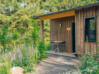
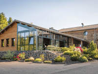
If you want to upload your photos, you need to create an account. It only takes 1 minute and it's completely free.

  • Receive free climbfinder goodies for your reviews & photos.
  • Create a bucket list and check off conquered climbs.
  • Add missing climbs.
Continue with GoogleContinue with Google Continue with FacebookContinue with Facebook Continue with AppleContinue with Apple Sign up with email
By signing up you agree to our terms of service and confirm that you have read our privacy & content policy.

Reviews (3)

5.0
4.0
3.0
2.0
1.0
PeterSmit
1 y 4.0 00:30:19 (13.3 mph)
This is an automatic translation, the original language is: Dutch. Show original

Nice climb, well done. Superb views.

Lekkere klim, goed te doen. Schitterende uitzichten.

Dashboard
Geronimo
1 y 5.0
This is an automatic translation, the original language is: French. Show original

A very nice, very quiet climb, a little demanding at the end. The view at the finish is splendid!

Très belle montée, très calme, un peu exigeante sur la fin. Le panorama à l'arrivée est splendide !

Dashboard
Cyclauvergne
3 y 4.0 00:35:00 (11.5 mph)
This is an automatic translation, the original language is: French. Show original

My favourite slope, quite a hard start, especially in winter like the last time I climbed it with my second club and a good stomach bug that day. Then a flat area where we pick up speed, before the steep final stretch to reach the car park, circling the Roche Sanadoire and Tullière, two pieces of the Puy de Sancy ejected by a cataclysmic eruption 180 000 years ago.

Mon versant préféré, début assez dur, notamment en hiver comme la dernière fois que je l'ai grimpé avec mon second club et une bonne gastro ce jour là. Puis replat où on reprend de la vitesse, avant le final pentu pour arriver au parking en ceinturant la Roche Sanadoire et Tullière, deux morceaux du Puy de Sancy éjecter par une éruption cataclysmique, il y a 180 000 ans.

Dashboard

Climbing times

5 mph 01:21:05
7 mph 00:57:24
9 mph 00:44:44
12 mph 00:33:36

Road surface condition

75% 25% 0%
Based on 4 votes
Share your knowledge. What was the road condition during your ascent?

Traffic

100% 0% 0%
Based on 5 votes
Your experience counts. How much traffic did you encounter during the climb?

Frequently Asked Questions

Col de Guery can be cycled from 3 sides. Col de Guery from Orcival is the most popular side, but the summit can also be reached via Col de Guery from Rochefort Montagne & Col de Guéry from le Mont-Dore.

You don't need special gearing for Col de Guery from Rochefort Montagne. The slope isn't long or steep enough to require much shifting down. You can conquer this climb on power alone. However, a compact gearing system with a smallest front chainring of 34 and largest rear sprocket of 28 or 30 is always nice if you enjoy cycling uphill. This helps maintain a smooth cadence.

Col de Guery from Rochefort Montagne is a 3rd-category climb. Almost anyone can handle this climb, as long as you have a bike with climbing gears. If you have little training, you will probably need to shift down significantly. For experienced riders, Col de Guery from Rochefort Montagne is not a problem.

Col de Guery from Rochefort Montagne is 6.7 mi long.

The average gradient of Col de Guery from Rochefort Montagne is 3.8%.

Col de Guery from Rochefort Montagne has a steepest segment with an average gradient of 12.9%.

The summit of Col de Guery from Rochefort Montagne is at 4098 ft.

At a slow pace of 5 mph, it takes about 01:21:05 to climb Col de Guery from Rochefort Montagne. At 7 mph the time is 00:57:24, and at 9 mph 00:44:44. For the fastest cyclists, 00:33:36 is an achievable time.

Col de Guery from Rochefort Montagne is located in the region Puy-de-Dôme in France.

This page is better in the app

Climbfinder app
Climbfinder
(Free)
Open