La Croix de Pinet from Murianette via La Pérerée is a climb in the region Grenoble. It is 6.9 mi long and bridges 2070 ft of vertical ascent with an average gradient of 5.7%, resulting in a difficulty score of 546. The top of the ascent is located at 2769 ft above sea level. Climbfinder users shared 3 reviews of this climb and uploaded 2 photos.
Road names: Montée du Champ de la Vigne, D 291, Route de la Pérérée, Route de la Pérérée & Route du Rocharey
5.0 by Franck_PastorThis is an automatic translation, the original language is: French.One of my favorite climbs in the region (with the one of the col du Coq towards Saint-Nazaire). It is very varied in its slopes as well as in the landscapes it offers, and it is generally much quieter than the other climbs leading to the Belledonne balcony. In spite of the slope, you should not miss the splendid panorama of the Grésivaudan valley when you cross the two laces of the clearing located between km 2 and km 3, after a long passage in the forest. Then follows a short descent and... read more
Welcome! Please activate your account if you would like to share something. Look for the verification email in your inbox.
If you want to upload your photos, you need to create an account. It only takes 1 minute and it's completely free.
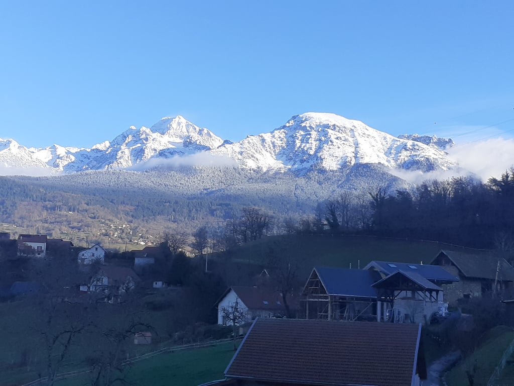
Like all the climbs leading up to Belledonne, this one is a challenge. This particular route has the advantage of following a quiet road, with varied scenery and a diverse elevation profile. It’s a challenge right from the start, but once you reach the hamlet of La Pérerée, you can catch your breath and enjoy the small hamlets and the rural charm of the area. The climb up to the Croix de Pinet, on the other hand, really takes a toll on your legs, with some steep sections to tackle. You might find yourself struggling a bit depending on the rest of the route...
Comme toutes les montées accédant à Belledonne, elle se mérite. Celle-ci a l'avantage d'emprunter une route tranquille, avec des paysages et un profil très varié. On est en prise dès le pied, mais à partir du hameau de La Pérerée on récupère et on profite des petits hameaux et du charme rural du coin. La remontée vers la Croix de Pinet fait par contre très mal aux jambes, avec des murs à gravir. On peut y laisser des plumes selon la suite du parcours...
A very lightly travelled pass, a great warm-up before moving on to the Chamrousse pass. Both are around 34km long, so it's a heavy ride without being too much.
Col très peu emprunté, un très bon échauffement avant d'enchaîner avec celui de Chamrousse. Les deux font a peu près 34km, ça envoie du lourd sans que ce soit too much
One of my favorite climbs in the region (with the one of the col du Coq towards Saint-Nazaire). It is very varied in its slopes as well as in the landscapes it offers, and it is generally much quieter than the other climbs leading to the Belledonne balcony.
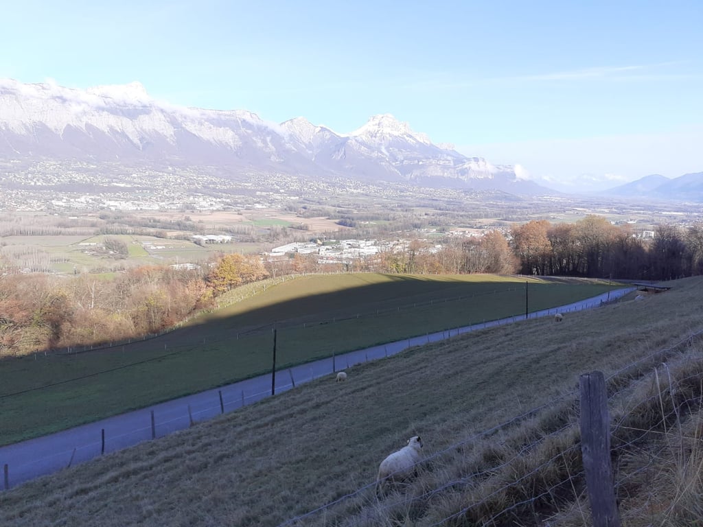
In spite of the slope, you should not miss the splendid panorama of the Grésivaudan valley when you cross the two laces of the clearing located between km 2 and km 3, after a long passage in the forest.
Then follows a short descent and an ascent to the hamlet of Pérerée. Then, a picturesque and very shaded false flat allows to recover on a rather narrow road until the hamlet of Ferrats, and entry in the village of Corps d'Uriage, regrouping several hamlets.
From there, two very difficult kilometers (on a very narrow road with a perfectible surface) await you towards the hamlet of Rocharey and the Croix de Pinet. Having ridden it regularly, I am absolutely certain that the average percentages of this section are closer to 15 % than to 10 %. Be particularly careful at the hairpin to the right shortly before km 10, you're practically at a standstill there.
Une de mes montées préférées de la région (avec celle du col du Coq versant Saint-Nazaire). Elle est très variée dans ses pentes aussi bien que dans les paysages qu'elle propose, et elle est généralement bien plus tranquille que les autres ascensions menant au balcon de Belledonne.
Malgré la pente, il ne faut surtout pas manquer le splendide panorama dont on dispose sur la vallée du Grésivaudan lorsqu'on traverse les deux lacets de la clairière située entre le km 2 et le km 3, après un long passage en pleine forêt.
Fait suite une courte redescente puis une remontée jusqu'au hameau de la Pérerée. Ensuite, un faux-plat pittoresque et très ombragé permet de récupérer sur une route assez étroite jusqu'au hameau des Ferrats, et entrée dans le village de Corps d'Uriage, regroupant plusieurs hameaux.
De là, deux kilomètres très ardus (sur une route très étroite au revêtement perfectible) vous attend vers le hameau de Rocharey et la Croix de Pinet. Pour l'avoir régulièrement pratiquée, je suis absolument certain que les pourcentages moyens de cette section sont plus proches de 15 % que des 10 %. Attention notamment à l'épingle à cheveux vers la droite peu avant le km 10, on y est pratiquement à l'arrêt.
| 5 mph | 01:23:34 |
| 7 mph | 00:59:10 |
| 9 mph | 00:46:06 |
| 12 mph | 00:34:38 |
This page is better in the app