| 7 hairpin turns |
| #76 toughest climb of Annecy |
| #87 most elevation gain of Annecy |
| #99 longest climb of Annecy |
| #80 average steepest climb of Haute Savoie |
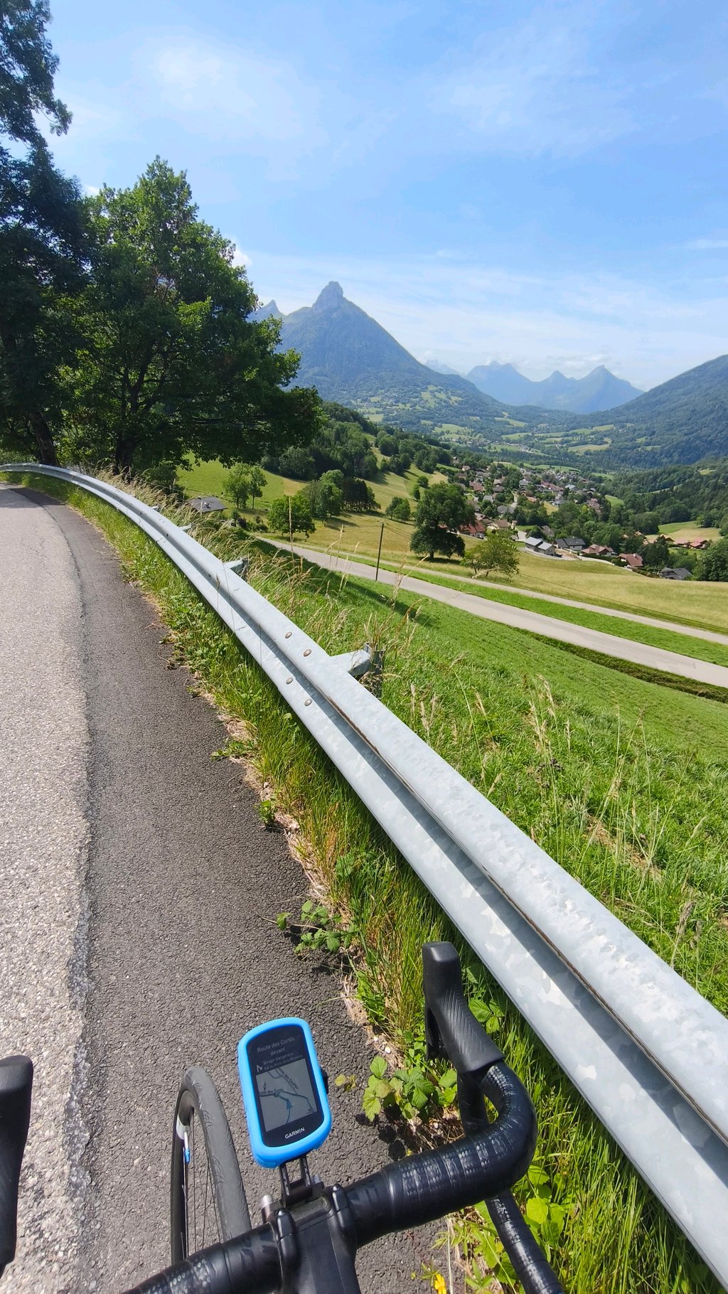
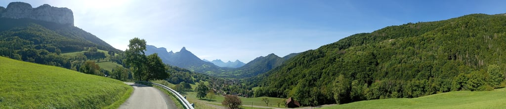
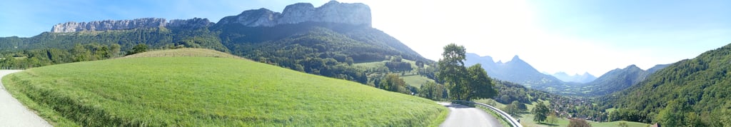
La Blonnière from Dingy-Saint-Clair is a climb in the region Annecy. It is 3.1 mi long and bridges 1424 ft of vertical ascent with an average gradient of 8.6%, resulting in a difficulty score of 400. The top of the ascent is located at 3412 ft above sea level. Climbfinder users shared 3 reviews of this climb and uploaded 7 photos.
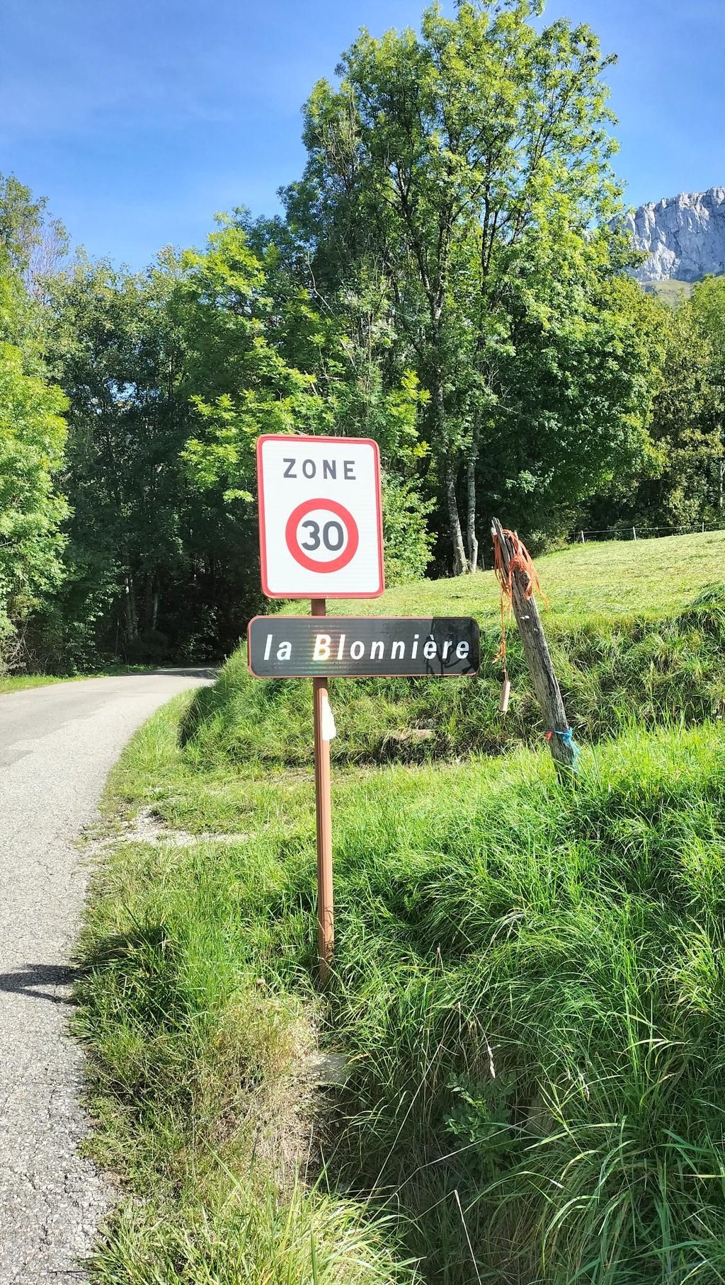
Road names: Route de la Blonnière & Route de la Blonnière
4.0 by sergenavetatThis is an automatic translation, the original language is: French.On Wednesday 10 September we took advantage of a beautiful day to set off on all the little hamlets around Thônes, 6 of which we had planned (La Blonnière, Le Sappey, Montremond, La Closette, Les Chappes and Le Mont), all of which we had found on Climbfinder. After 4, the final climb at La Closette was so steep that our legs were on fire. The last 2 were postponed until next year. Departure from a car park in Thônes (of which there are many) towards La Blonnière, passing through La Balme d... read more
Welcome! Please activate your account if you would like to share something. Look for the verification email in your inbox.
If you want to upload your photos, you need to create an account. It only takes 1 minute and it's completely free.
On Wednesday 10 September we took advantage of a beautiful day to set off on all the little hamlets around Thônes, 6 of which we had planned (La Blonnière, Le Sappey, Montremond, La Closette, Les Chappes and Le Mont), all of which we had found on Climbfinder.
After 4, the final climb at La Closette was so steep that our legs were on fire. The last 2 were postponed until next year.
Departure from a car park in Thônes (of which there are many) towards La Blonnière, passing through La Balme de Thuy to avoid the D16 linking Annecy to Les Arravis.
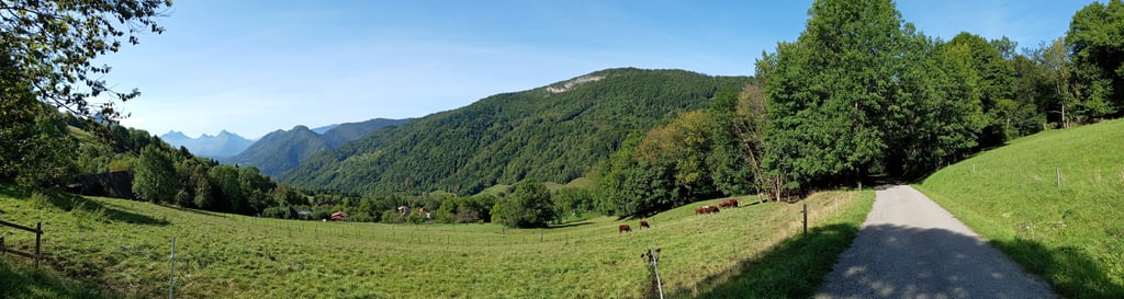
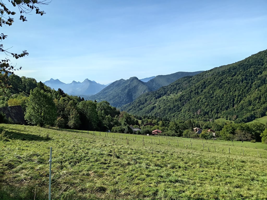
At Dingy St Clair we reach the foot of the climb, which gets off to a strong start after just a few dozen metres. The tarmac is very good, the gradients steep to very steep but not regular, which breaks our rhythm in a long straight stretch of almost 800 metres before the first hairpin bend, after 4 km we cross the Hameaux that gives this climb its name, and there's another 1 km including the last 500 metres in the woods to reach the finish (Parking du Saugy).
The scenery is sublime, especially on the descent.
Ce mercredi 10 septembre nous avons profité d'une belle journée pour nous lancer sur tout les petits Hameaux autour de Thônes nous en avions prévu 6 ( La Blonnière, Le Sappey, Montremond, La Closette, Les Chappes et le Mont ) tous repérés sur Climbfinder.
Au bout de 4, final à la Closette les jambes en feu tellement c'était raide, les 2 derniers sont reportés à l'an prochain.
Départ d'un parking de Thônes ( ils y en a beaucoup ) direction la Blonnière en passant par La Balme de Thuy pour éviter la D16 qui relie Annecy aux Arravis.
À Dingy St Clair Nous voilà au pied de l'ascension, ça commence fort après seulement quelques dizaines de mètres, le bitume est très bon, les pentes fortes à très fortes mais pas régulières ce qui nous casse le rythme dans une grande ligne droite de presque 800M avant le premier lacet, après 4km traversée du Hameaux qui donne son nom à cette ascension, il reste encore 1km dont les 500 derniers mètres dans les bois pour arriver au final ( Parking du Saugy ).
Les paysages sont sublimes, principalement lors de la descente.
A great discovery for training on steep gradients. No traffic, quiet road, appropriate gear ratios necessary gradient rarely below 9% , passages that exceed 13% a must-see. Descent by the same route.
Une belle découverte pour s’entraîner sur forts pourcentages. Pas de circulation, route tranquille , braquets adaptés nécessaires pente rarement en deçà de 9% , des passages qui dépassent 13% à voir absolument. Redescente par la même route.
The climb is short and steep with a relatively even gradient of around 11/12%. Be careful, this climb is a dead end.
L'ascension est courte et raide avec une pente relativement régulière autour de 11/12%. Attention, cette montée est une impasse.
| 5 mph | 00:37:46 |
| 7 mph | 00:26:44 |
| 9 mph | 00:20:50 |
| 12 mph | 00:15:39 |
This page is better in the app