View on map
© MapLibre | OpenStreetMap contributors
1%
2%
4%
6%
8%
10%
12%
15%
20%

L'Abbaye from Villard Noir

2.0
1 review/story | Elevation profile | 4 photos
Tips nearby
L'Abbaye from Villard Noir
transparant thumb
transparant thumb
transparant thumb
transparant thumb
Your achievable time
Calculating based on your best performances...
Relaxed
Maximum
W/kg
W/kg
W/kg
Analyze your climbing performance
Detailed insight into your climbing performance & automatically check off climbs
Based on your best performances.
Your best attempt:
Number of attempts:
Elevation profile L'Abbaye from Villard Noir

Statistics

Difficulty points 294
Length 3.4 mi
Average gradient 6.8%
Steepest segment 11.9%
Total ascent 1220 ft

Short recap

Beautiful scenery
5 hairpin turns
Feedback about this climb?
Show climbs nearby Export to GPS device

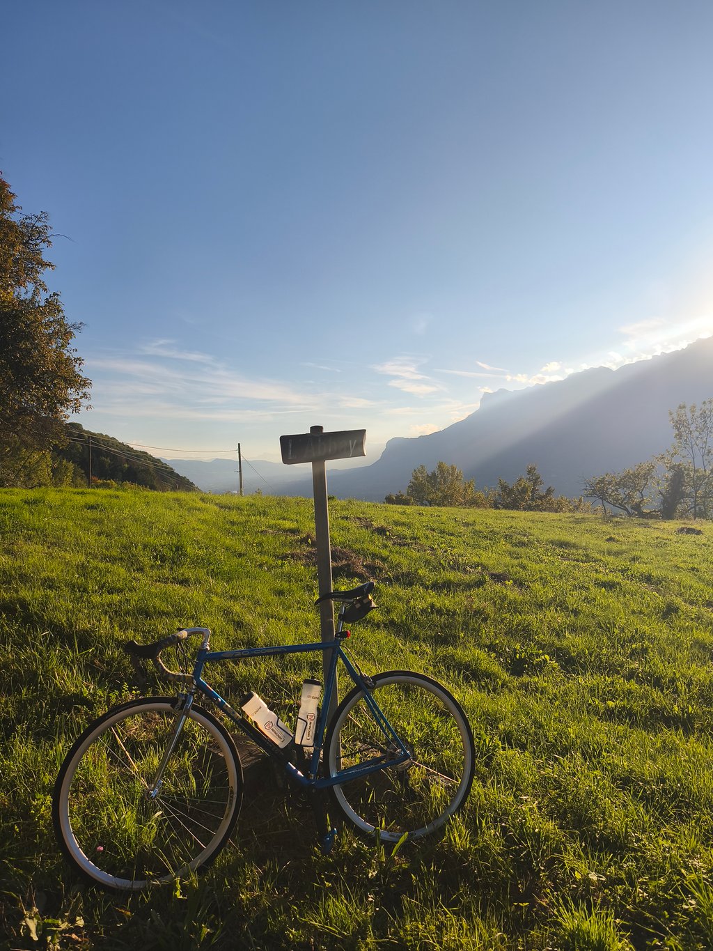
L'Abbaye from Villard Noir is a climb in the region Grenoble. It is 3.4 mi long and bridges 1220 ft of vertical ascent with an average gradient of 6.8%, resulting in a difficulty score of 294. The top of the ascent is located at 2116 ft above sea level. Climbfinder users shared 1 review/story of this climb and uploaded 4 photos.

Road names: Route de Malbourget, Chemin de Chalaise & Route de Berruer
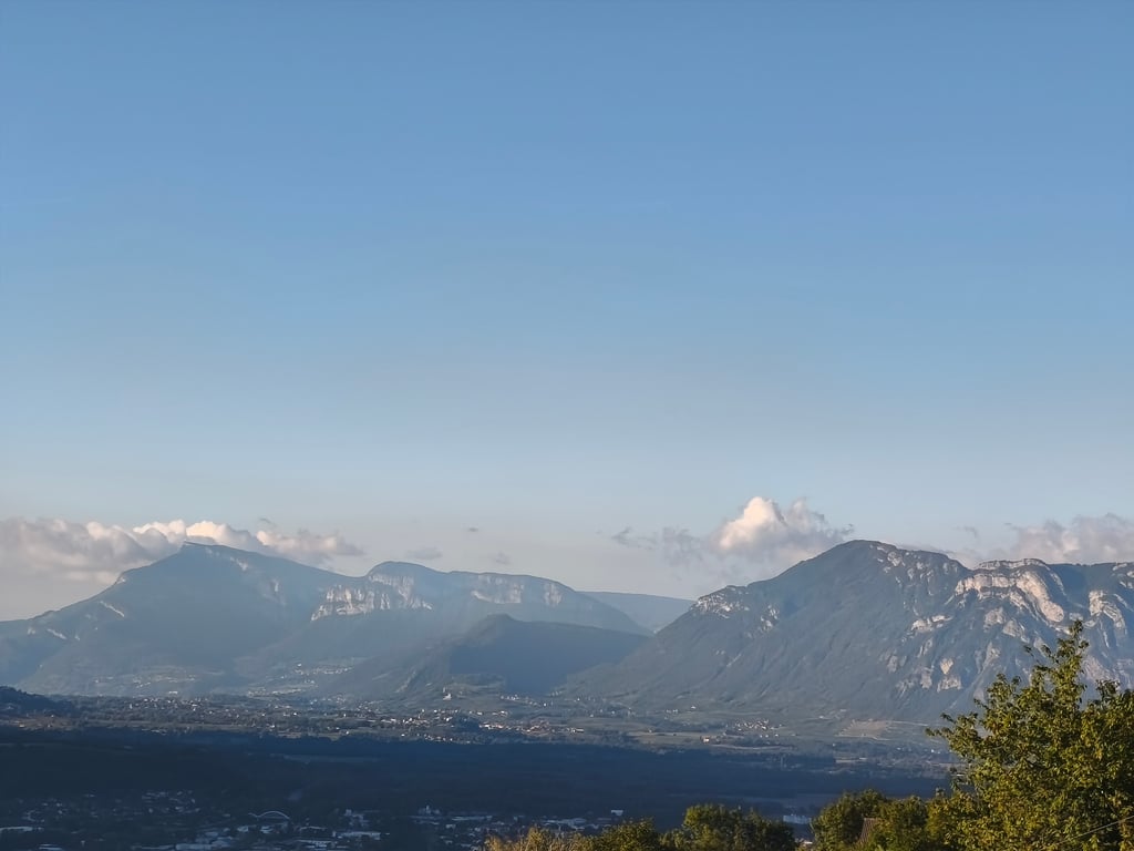
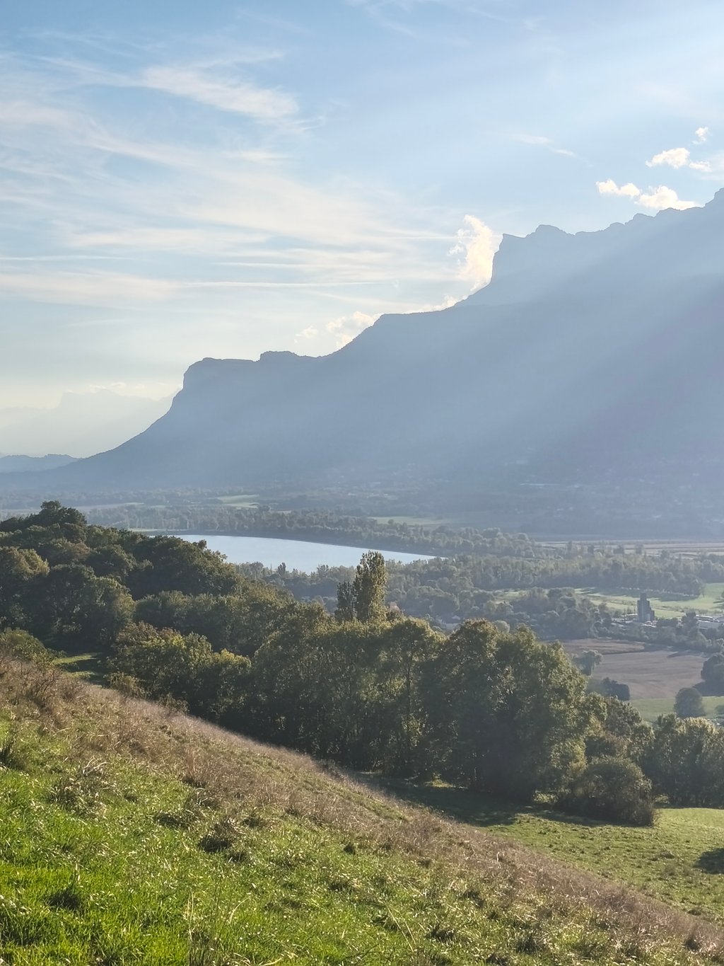
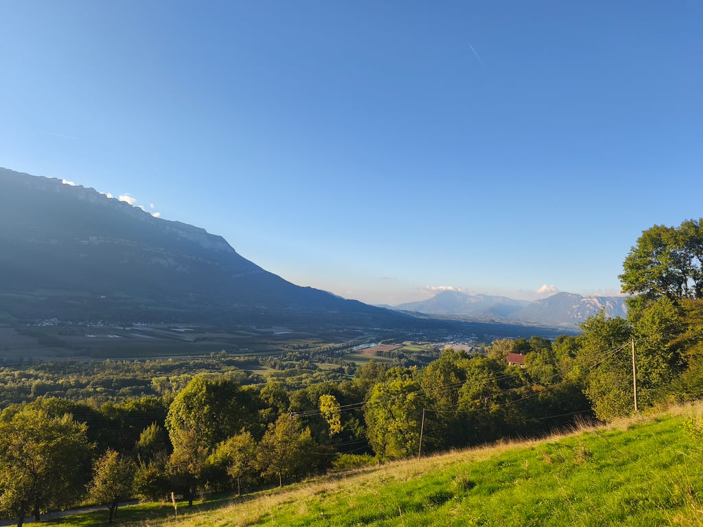
2.0 by Seb38
This is an automatic translation, the original language is: French.
A short climb on a very quiet road of fairly good quality. The profile doesn't seem right to me, the road is more like 5km for 300m of ascent. This gives an average percentage closer to 6% than 7.6%. You need to follow the D287 and then the D287a, and not the route shown on the map, as the latter path is blocked due to a landslide. The climb offers lovely views of the Chartreuse and Grésivaudan mountains, as well as the Bauges.... read more

Photos (4)

L'Abbaye from Villard Noir
transparant thumb
transparant thumb

Your uploads (max 4)

Welcome! Please activate your account if you would like to share something. Look for the verification email in your inbox.

If you want to upload your photos, you need to create an account. It only takes 1 minute and it's completely free.

  • Receive free climbfinder goodies for your reviews & photos.
  • Create a bucket list and check off conquered climbs.
  • Add missing climbs.
Continue with GoogleContinue with Google Continue with FacebookContinue with Facebook Continue with AppleContinue with Apple Sign up with email
By signing up you agree to our terms of service and confirm that you have read our privacy & content policy.

Reviews (1)

5.0
4.0
3.0
2.0
1.0
Seb38
8 Mo 2.0
This is an automatic translation, the original language is: French. Show original

A short climb on a very quiet road of fairly good quality. The profile doesn't seem right to me, the road is more like 5km for 300m of ascent. This gives an average percentage closer to 6% than 7.6%. You need to follow the D287 and then the D287a, and not the route shown on the map, as the latter path is blocked due to a landslide. The climb offers lovely views of the Chartreuse and Grésivaudan mountains, as well as the Bauges.

Petite ascension sur une route très calme et d'assez bonne qualité. Le profil ne me semble pas correct, la route fait plutôt 5km pour 300m de dénivelé. Cela donne un pourcentage moyen plus proche de 6% que 7,6%. Il faut suivre la D287 puis la D287a, et non pas le parcours indiqué sur la carte, car le dernier chemin est barré pour cause d'éboulement. La montée offre une jolie vue sur la Chartreuse et le Grésivaudan, ainsi que les Bauges.

L'Abbaye from Villard Noir
Dashboard

Climbing times

5 mph 00:41:12
7 mph 00:29:10
9 mph 00:22:44
12 mph 00:17:04

Road surface condition

100% 0% 0%
Based on 1 vote
Share your knowledge. What was the road condition during your ascent?

Traffic

100% 0% 0%
Based on 1 vote
Your experience counts. How much traffic did you encounter during the climb?

Frequently Asked Questions

L'Abbaye from Villard Noir is a challenging ascent. For this type of climbing, we recommend mountain gearing, specifically a compact system. This means a small front chainring of 34 teeth, combined with a rear cassette where, depending on your level, strength, and experience, you choose a sprocket with 30, 32, or even 34 teeth. Remember that a smooth cadence is always more efficient!

L'Abbaye from Villard Noir is a 3rd-category climb. Almost anyone can handle this climb, as long as you have a bike with climbing gears. If you have little training, you will probably need to shift down significantly. For experienced riders, L'Abbaye from Villard Noir is not a problem.

L'Abbaye from Villard Noir is 3.4 mi long.

The average gradient of L'Abbaye from Villard Noir is 6.8%.

L'Abbaye from Villard Noir has a steepest segment with an average gradient of 11.9%.

The summit of L'Abbaye from Villard Noir is at 2116 ft.

At a slow pace of 5 mph, it takes about 00:41:12 to climb L'Abbaye from Villard Noir. At 7 mph the time is 00:29:10, and at 9 mph 00:22:44. For the fastest cyclists, 00:17:04 is an achievable time.

L'Abbaye from Villard Noir is located in the region Isère in France.

This page is better in the app

Climbfinder app
Climbfinder
(Free)
Open