View on map
© MapLibre | OpenStreetMap contributors
1%
2%
4%
6%
8%
10%
12%
15%
20%

Konijnenberg via Wijnberg

3.3
3 reviews | Elevation profile | 5 photos
Tips nearby
Konijnenberg via Wijnberg
transparant thumb
transparant thumb
transparant thumb
Your achievable time
Calculating based on your best performances...
Relaxed
Maximum
W/kg
W/kg
W/kg
Analyze your climbing performance
Detailed insight into your climbing performance & automatically check off climbs
Based on your best performances.
Your best attempt:
Number of attempts:
Elevation profile Konijnenberg via Wijnberg

Statistics

Difficulty points 9
Length 0.8 mi
Average gradient 2.1%
Steepest segment 4.6%
Total ascent 82 ft
Feedback about this climb?
Show climbs nearby Export to GPS device

Konijnenberg via Wijnberg is a climb in the region Hageland. It is 0.8 mi long and bridges 82 ft of vertical ascent with an average gradient of 2.1%, resulting in a difficulty score of 9. The top of the ascent is located at 108 ft above sea level. Climbfinder users shared 3 reviews of this climb and uploaded 5 photos.

Road names: Wijnberg & Rommelaar
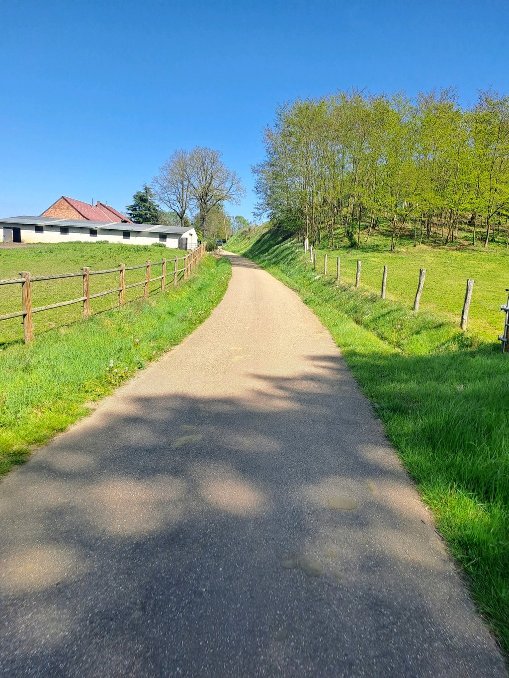
3.0 by Andre
This is an automatic translation, the original language is: Dutch.
Very nice climb on a narrow road where rarely a car comes. Known to cyclists in the neighborhood. The klil itself is not much but the beautiful nature makes you think you are in Austria or Switzerland. The fun part is the undulating course and a good layer of asphalt.... read more

Photos (5)

Konijnenberg via Wijnberg
transparant thumb

Your uploads (max 4)

Welcome! Please activate your account if you would like to share something. Look for the verification email in your inbox.

If you want to upload your photos, you need to create an account. It only takes 1 minute and it's completely free.

  • Receive free climbfinder goodies for your reviews & photos.
  • Create a bucket list and check off conquered climbs.
  • Add missing climbs.
Continue with GoogleContinue with Google Continue with FacebookContinue with Facebook Continue with AppleContinue with Apple Sign up with email
By signing up you agree to our terms of service and confirm that you have read our privacy & content policy.

Reviews (3)

5.0
4.0
3.0
2.0
1.0
Andre
1 Mo 3.0
This is an automatic translation, the original language is: Dutch. Show original

Very nice climb on a narrow road where rarely a car comes. Known to cyclists in the neighborhood. The klil itself is not much but the beautiful nature makes you think you are in Austria or Switzerland. The fun part is the undulating course and a good layer of asphalt.

Heel leuke klim op een smal weggetje waar zelden een auto komt. Gekend bij de fietsers in de buurt. De klil zelf stelt weinig voor maar de prachtige natuur doet je denken dat je in Oostenrijk of Zwitserkand bent. Het leuje is vooral het golvende parcours en een goede asfaltlaag.

Dashboard
Glen_Solana
1 y 4.0
This is an automatic translation, the original language is: Dutch. Show original

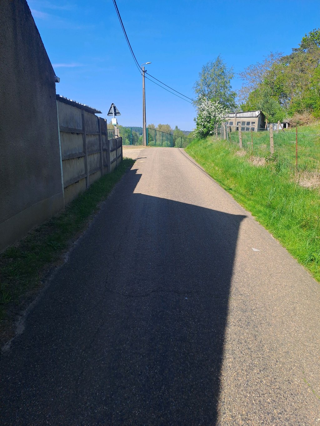
The first section is a stretch of Wijnberg. Here you can pick up speed. Then you have to make a sharp left turn. You switch gears smaller as it visibly goes uphill, but after the bend there is a small kink and then a descent begins.
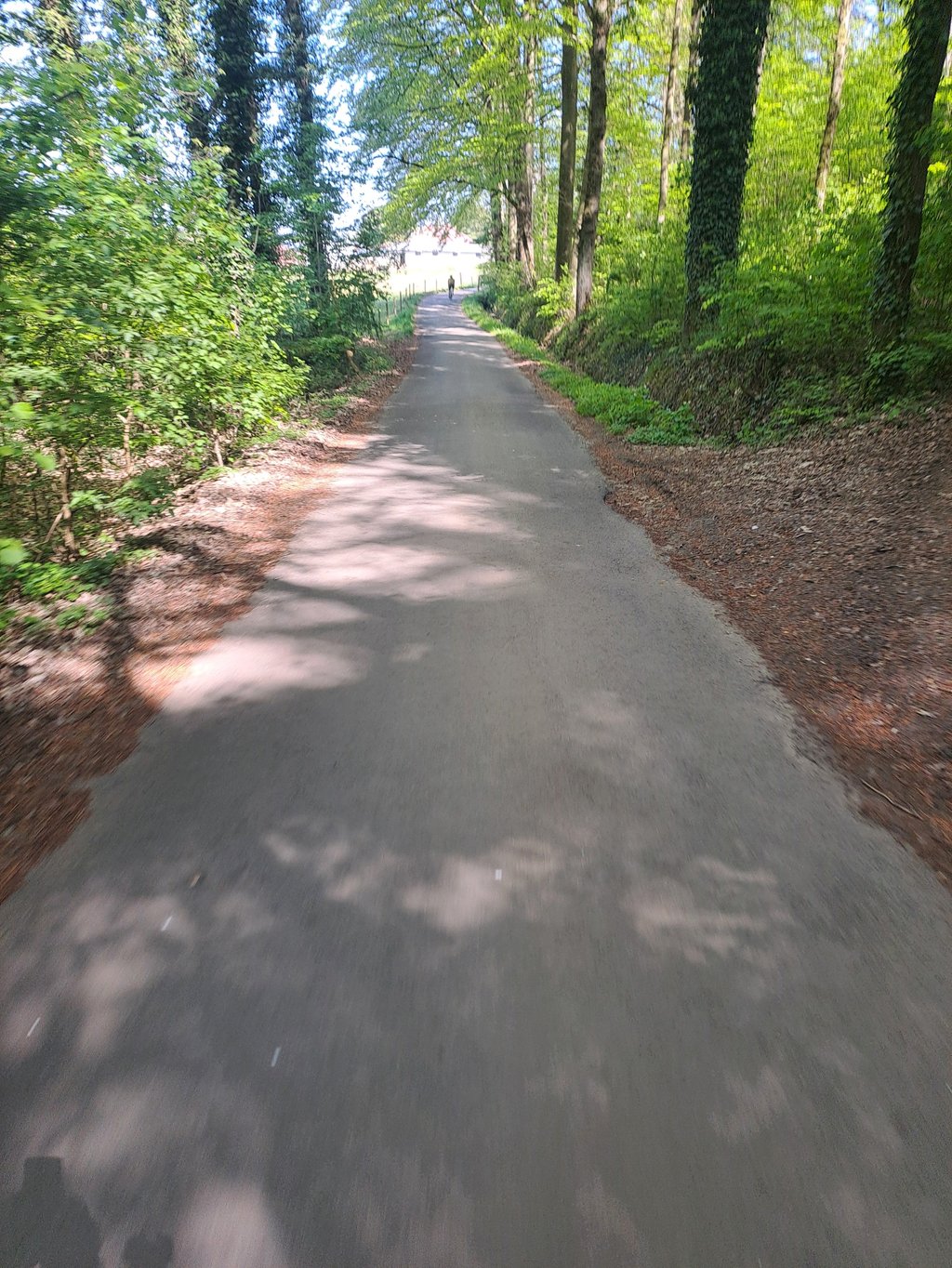
Very nice tarmac road through nature with nice views. Nice to explore this little road.
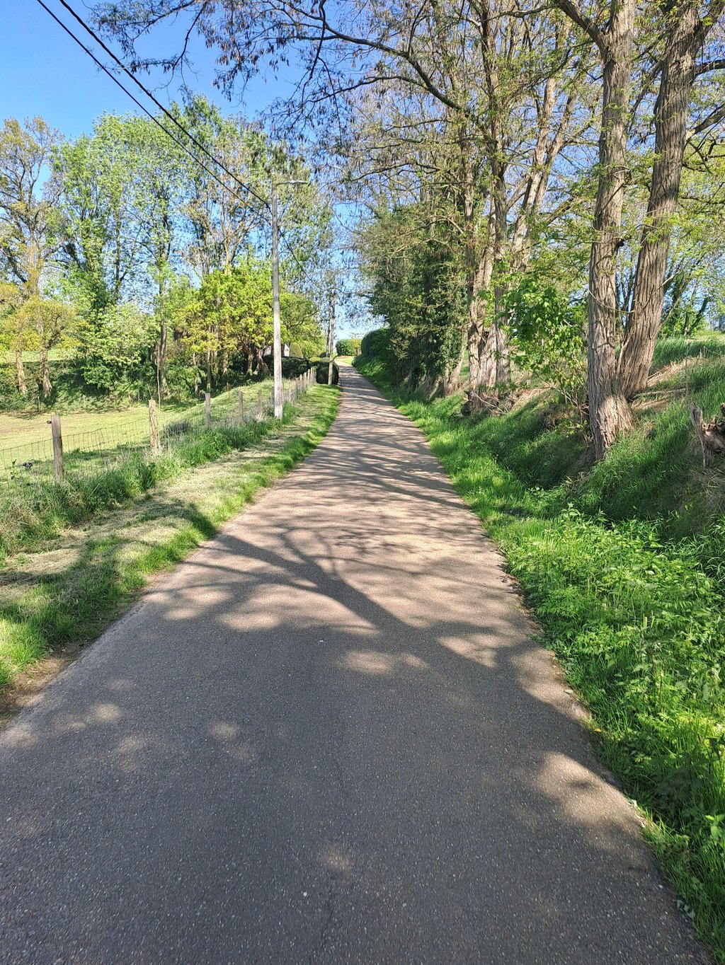
When the first houses return, the road starts to rise again a bit. The speed you have through the descent ensures that you already get far. After the first hump, you can see the last section in the distance. Just a little more push and you will be at the top.

Het eerste gedeelte is een stuk van de Wijnberg. Hier kan je snelheid maken. Dan moet je een scherpe bocht naar links. Je schakelt kleiner omdat het zichtbaar naar omhoog gaat, maar na de bocht is er een klein knikje en dan begint een afdaling.
Heel leuk asfaltwegje door de natuur met mooie vergezichten. Leuk om dit wegje te ontdekken.
Wanneer de eerste huizen terug komen, begint de weg terug wat te stijgen. De snelheid die je hebt door de afdaling zorgt ervoor dat je al ver raakt. Na het eerste bultje zie je in de verte nog het laatste gedeelte. Nog even doorzetten en je bent boven.

Dashboard
Fun
2 y 3.0

Very easy climb between some fields. There is almost no traffic.

Konijnenberg via Wijnberg
Dashboard

Climbing times

5 mph 00:09:06
7 mph 00:06:26
9 mph 00:05:01
12 mph 00:03:46

Road surface condition

100% 0% 0%
Based on 1 vote
Share your knowledge. What was the road condition during your ascent?

Traffic

100% 0% 0%
Based on 1 vote
Your experience counts. How much traffic did you encounter during the climb?

Frequently Asked Questions

Konijnenberg can be cycled from 4 sides. Konijnenberg via Wijnberg is the most popular side, but the summit can also be reached via Konijnenberg via Rommelaar, Rommelaar from Rillaar & Rommelaar from Rommelaar.

You don't need special gearing for Konijnenberg via Wijnberg. The slope isn't long or steep enough to require much shifting down. You can conquer this climb on power alone. However, a compact gearing system with a smallest front chainring of 34 and largest rear sprocket of 28 or 30 is always nice if you enjoy cycling uphill. This helps maintain a smooth cadence.

Konijnenberg via Wijnberg is not tough enough to be assigned a mountain category. This means that even untrained cyclists can reach the top without any problems on this climb.

Konijnenberg via Wijnberg is 0.8 mi long.

The average gradient of Konijnenberg via Wijnberg is 2.1%.

Konijnenberg via Wijnberg has a steepest segment with an average gradient of 4.6%.

The summit of Konijnenberg via Wijnberg is at 108 ft.

At a slow pace of 5 mph, it takes about 00:09:06 to climb Konijnenberg via Wijnberg. At 7 mph the time is 00:06:26, and at 9 mph 00:05:01. For the fastest cyclists, 00:03:46 is an achievable time.

Konijnenberg via Wijnberg is located in the region Flemish Brabant in Belgium.

This page is better in the app

Climbfinder app
Climbfinder
(Free)
Open