View on map
© MapLibre | OpenStreetMap contributors
1%
2%
4%
6%
8%
10%
12%
15%
20%

Imrother Acker from Onsdorf

2.5
2 reviews | Elevation profile | 14 photos
Tips nearby
Imrother Acker from Onsdorf
Your achievable time
Calculating based on your best performances...
Relaxed
Maximum
W/kg
W/kg
W/kg
Analyze your climbing performance
Detailed insight into your climbing performance & automatically check off climbs
Based on your best performances.
Your best attempt:
Number of attempts:
Elevation profile Imrother Acker from Onsdorf

Statistics

Difficulty points 86
Length 0.9 mi
Average gradient 6.6%
Steepest segment 11.6%
Total ascent 328 ft
Feedback about this climb?
Show climbs nearby Export to GPS device

Imrother Acker from Onsdorf is a climb in the region Hunsrück. It is 0.9 mi long and bridges 328 ft of vertical ascent with an average gradient of 6.6%, resulting in a difficulty score of 86. The top of the ascent is located at 1293 ft above sea level. Climbfinder users shared 2 reviews of this climb and uploaded 14 photos.

Road names: Brückwies & L 135
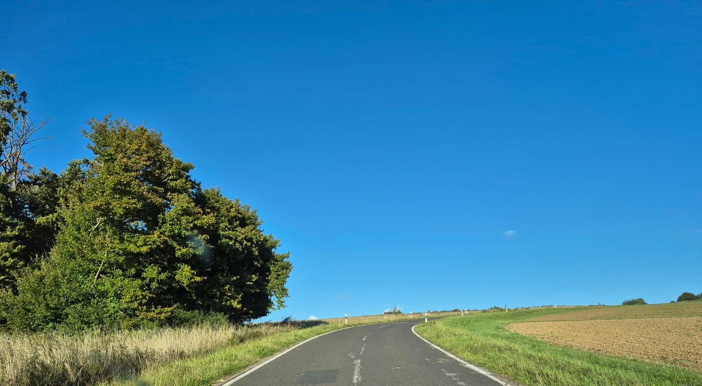
3.0 by Fedor
This is an automatic translation, the original language is: Dutch.
Climb over a fairly quiet local link road out of the village. Then follows a flat section for a while but after the left-hand bend it runs nicely up the slope and through the forest until just past the hairpin bend after which it flattens out. Until the forest nice views to the right and back.... read more

Photos (14)

Imrother Acker from Onsdorf
transparant thumb
transparant thumb
transparant thumb
transparant thumb

Your uploads (max 4)

Welcome! Please activate your account if you would like to share something. Look for the verification email in your inbox.

If you want to upload your photos, you need to create an account. It only takes 1 minute and it's completely free.

  • Receive free climbfinder goodies for your reviews & photos.
  • Create a bucket list and check off conquered climbs.
  • Add missing climbs.
Continue with GoogleContinue with Google Continue with FacebookContinue with Facebook Continue with AppleContinue with Apple Sign up with email
By signing up you agree to our terms of service and confirm that you have read our privacy & content policy.

Reviews (2)

5.0
4.0
3.0
2.0
1.0
Fedor
1 y 3.0
This is an automatic translation, the original language is: Dutch. Show original

Climb over a fairly quiet local link road out of the village. Then follows a flat section for a while but after the left-hand bend it runs nicely up the slope and through the forest until just past the hairpin bend after which it flattens out. Until the forest nice views to the right and back.

Klim over een redelijk rustige lokale verbindingsweg het dorp uit. Daarna volgt even een vlak stuk maar na de bocht naar links loopt het lekker tegen de helling omhoog en door het bos tot net voorbij de haarspeldbocht waarna het afvlakt. Tot aan het bos leuk uitzicht over rechts en naar achteren.

Imrother Acker from Onsdorf
Dashboard
GioGiro
2 y 2.0
This is an automatic translation, the original language is: German. Show original

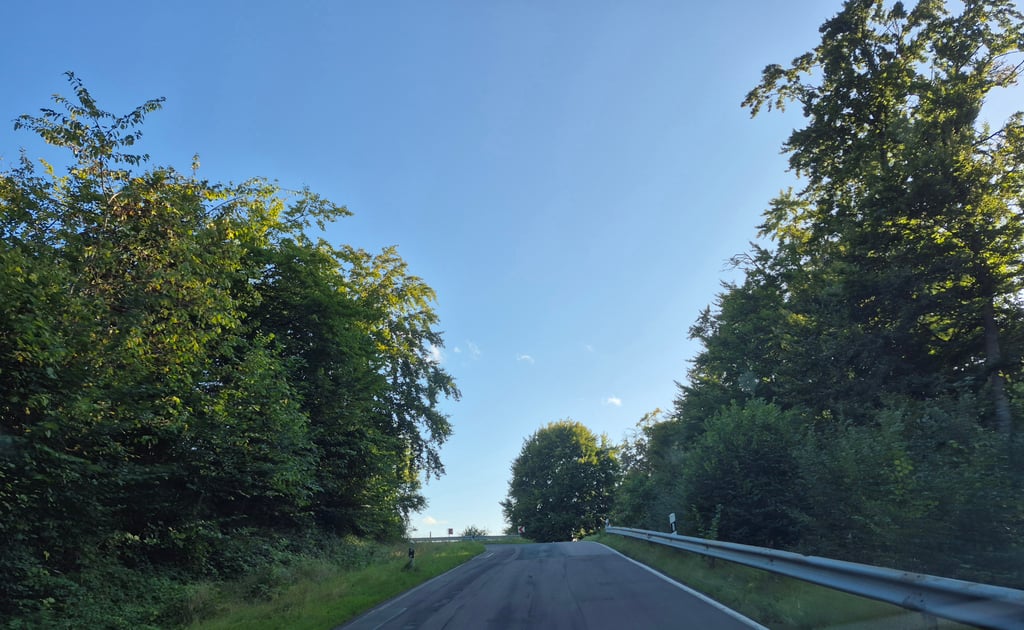
After Onsdorf, there is a nice even gradient of over 10%. After the hairpin bend, the route flattens out again. Once at the top, you can choose between a ride down to Mannebach or a flat ride along the Römerweg to the Helenenkreuz near Bilzingen.

Nach Onsdorf kommt eine schöne gleichmäßige Steigung mit über 10%. Nach der Serpentine wird es wieder flacher. Oben angekommen kann man wählen zwischen einer Fahrt runter nach Mannebach oder einer flachen Fahrt über den Römerweg hin zum Helenenkreuz bei Bilzingen.

Dashboard

Climbing times

5 mph 00:11:20
7 mph 00:08:02
9 mph 00:06:15
12 mph 00:04:42

Road surface condition

0% 0% 0%
Based on 0 votes
Share your knowledge. What was the road condition during your ascent?

Traffic

0% 0% 0%
Based on 0 votes
Your experience counts. How much traffic did you encounter during the climb?

Frequently Asked Questions

Imrother Acker can be cycled from 2 sides. Imrother Acker from Mannebach is the most popular side, but the summit can also be reached via Imrother Acker from Onsdorf.

You don't need special gearing for Imrother Acker from Onsdorf. The slope isn't long or steep enough to require much shifting down. You can conquer this climb on power alone. However, a compact gearing system with a smallest front chainring of 34 and largest rear sprocket of 28 or 30 is always nice if you enjoy cycling uphill. This helps maintain a smooth cadence.

Imrother Acker from Onsdorf is a 4th-category climb. A sprint to the top is usually not an option, and untrained riders will definitely feel it in their legs. For trained cyclists, it is a great training climb.

Imrother Acker from Onsdorf is 0.9 mi long.

The average gradient of Imrother Acker from Onsdorf is 6.6%.

Imrother Acker from Onsdorf has a steepest segment with an average gradient of 11.6%.

The summit of Imrother Acker from Onsdorf is at 1293 ft.

At a slow pace of 5 mph, it takes about 00:11:20 to climb Imrother Acker from Onsdorf. At 7 mph the time is 00:08:02, and at 9 mph 00:06:15. For the fastest cyclists, 00:04:42 is an achievable time.

Imrother Acker from Onsdorf is located in the region Rhineland-Palatinate in Germany.

This page is better in the app

Climbfinder app
Climbfinder
(Free)
Open