Hondsrug from Beitel is a climb in the region South Limburg. It is 0.7 mi long and bridges 82 ft of vertical ascent with an average gradient of 2.2%, resulting in a difficulty score of 6. The top of the ascent is located at 630 ft above sea level. Climbfinder users shared 3 reviews of this climb and uploaded 6 photos.
Road name: Hondsrug
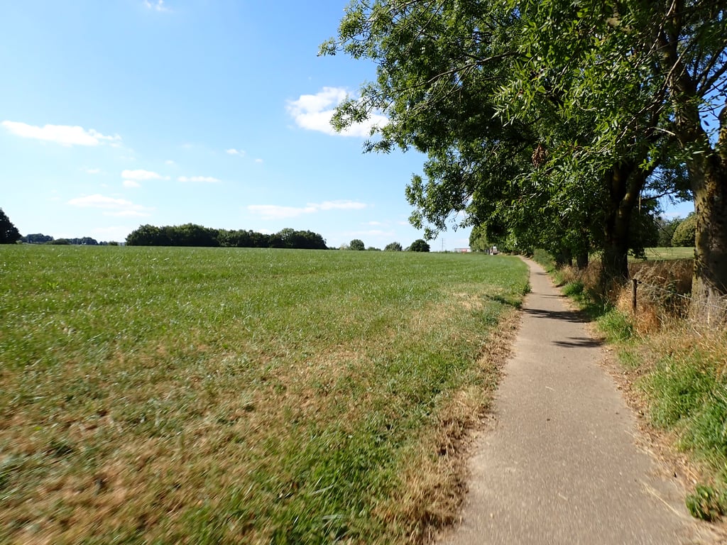
2.0 by BikerJohanThis is an automatic translation, the original language is: Dutch.Not too difficult false flat climb over bike path outside the west side of industrial area De Beitel. You reach the beginning of the climb from the main road from Simpelveld to Kerkrade. The first part is bike path and the second part a narrow road. ... read more
Welcome! Please activate your account if you would like to share something. Look for the verification email in your inbox.
If you want to upload your photos, you need to create an account. It only takes 1 minute and it's completely free.
Not too difficult false flat climb over bike path outside the west side of industrial area De Beitel. You reach the beginning of the climb from the main road from Simpelveld to Kerkrade. The first part is bike path and the second part a narrow road.
Niet te moeilijke vals plat klim over fietspad buiten de westzijde van industrieterrein De Beitel. Je bereikt het begin van de klim vanaf de doorgaande weg van Simpelveld naar Kerkrade. Het eerste deel is fietspad en het tweede deel een smal weggetje.
You get to the start of the climb through a descent on a cycle path with some tree roots below. The climb on the cycle path and then a road is fine, through mostly green surroundings close to the industrial estate.
Je komt bij het begin van de klim door een afdaling over een fietspad met beneden wat boomwortels. De klim op het fietspad en daarna een weggetje is prima, door grotendeels groene omgeving vlak bij het industrieterrein.
A nice green gap between highway and industrial area, partly in a valley. The first part is a tarmac cycle path, the second part a small road. The part in front of the houses is the most difficult part (relatively speaking) but all in all you don't do this one for the altimeters or the points but more for the surroundings.
Een mooi groen tussendoorstekertje tussen snelweg en industrieterrein, deels in een dalletje. Het eerste deel is een asfaltfietspad, het tweede deel een klein weggetje. Het stukje voor de huizen is het meest pittige (relatief gezien dan) gedeelte maar al met al doe je deze niet voor de hoogtemeters of punten maar meer voor de omgeving waarbij de weg ook nog stijgt.
| 5 mph | 00:08:31 |
| 7 mph | 00:06:01 |
| 9 mph | 00:04:42 |
| 12 mph | 00:03:31 |
This page is better in the app