View on map
© MapLibre | OpenStreetMap contributors
1%
2%
4%
6%
8%
10%
12%
15%
20%

Hilsen from Linthal

2.8
5 reviews | Elevation profile | 1 photo
Tips nearby
Hilsen from Linthal
transparant thumb
transparant thumb
transparant thumb
transparant thumb
transparant thumb
transparant thumb
transparant thumb
Your achievable time
Calculating based on your best performances...
Relaxed
Maximum
W/kg
W/kg
W/kg
Analyze your climbing performance
Detailed insight into your climbing performance & automatically check off climbs
Based on your best performances.
Your best attempt:
Number of attempts:
Elevation profile Hilsen from Linthal

Statistics

Difficulty points 535
Length 2.6 mi
Average gradient 10.7%
Steepest segment 22.3%
Total ascent 1470 ft

Short recap

6 hairpin turns
#16 toughest climb of Grand Est
#92 most elevation gain of Grand Est
#91 longest climb of Upper Rhine
#43 average steepest climb of Grand Est
Feedback about this climb?
Show climbs nearby Export to GPS device

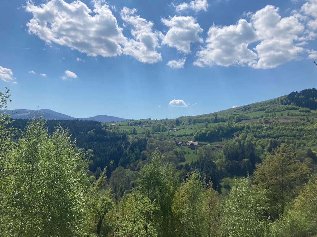
Hilsen from Linthal is a climb in the region Upper Rhine. It is 2.6 mi long and bridges 1470 ft of vertical ascent with an average gradient of 10.7%, resulting in a difficulty score of 535. The top of the ascent is located at 2956 ft above sea level. Climbfinder users shared 5 reviews of this climb and uploaded 1 photo.

3.0 by imaximei
This is an automatic translation, the original language is: French.
A nice climb to do in the area because of its big gradients and a nice view on the valley on the way up. For the road bikes, the descent is necessarily done by the same way.... read more

Photos (1)

Hilsen from Linthal
transparant thumb
transparant thumb
transparant thumb
transparant thumb
transparant thumb

Your uploads (max 4)

Welcome! Please activate your account if you would like to share something. Look for the verification email in your inbox.

If you want to upload your photos, you need to create an account. It only takes 1 minute and it's completely free.

  • Receive free climbfinder goodies for your reviews & photos.
  • Create a bucket list and check off conquered climbs.
  • Add missing climbs.
Continue with GoogleContinue with Google Continue with FacebookContinue with Facebook Continue with AppleContinue with Apple Sign up with email
By signing up you agree to our terms of service and confirm that you have read our privacy & content policy.

Reviews (5)

5.0
4.0
3.0
2.0
1.0
Jawo
9 Mo 4.0
This is an automatic translation, the original language is: Dutch. Show original

As a climb, a nice challenge. Because of little traffic, it is possible to use the entire width of the road. The traffic that is there drives very quietly because of the slope, road surface and curves. You can hear them coming from a distance.

The inn (see other review) is unfortunately not always open.

I did the descent slowly and braked almost constantly, due to the aforementioned road surface problems.

Als klim een mooie uitdaging. Vanwege weinig verkeer is het mogelijk de hele breedte van de weg te gebruiken. Het verkeer dat er is rijdt erg rustig ivm de helling, het wegdek en de bochten. Je hoort ze op afstand aankomen.

De herberg (zie andere review) is helaas niet altijd open.

De afdaling heb ik rustig gedaan en nagenoeg constant geremd, ivm de eerder genoemde wegdek problemen.

Dashboard
BaeumlinF63
9 Mo 3.0
This is an automatic translation, the original language is: French. Show original

Be careful, it's hard, very hard.
The gradients remain high throughout the climb and the quality of the road doesn't help matters, but it's good training.
Do it from time to time

Attention dure, très dure.
Les pourcentages restent élevés pendant toute la montée et la qualité de la route n'arrange rien, mais c'est un bon entrainement.
A faire de temps en temps

Dashboard
mtxvelo
1 y 2.0
This is an automatic translation, the original language is: French. Show original

Difficult and tiring climb, fortunately there's an inn at the top to quench your thirst.
The surface at the bottom is deteriorating, with a few holes, but it is better towards the top.
On a road bike it's a dead end, but on a gravel bike you can take a different route.

Montée difficile et usante, heureusement qu'il y a une auberge en haut pour se désaltérer.
le revêtement en bas se dégrade, avec quelques trous, il est meilleur vers le haut.
En vélo de route c'est un cul de sac, mais en gravel on peut partir vers un autre chemin.

Hilsen from Linthal
Dashboard
neel
1 y 2.0
This is an automatic translation, the original language is: Dutch. Show original

Not recommended very heavy climb almost always very steep you

Niet aanteraden zeer zwaare klim bijna altijd zeer stijl je

Dashboard
imaximei
4 y 3.0
This is an automatic translation, the original language is: French. Show original

A nice climb to do in the area because of its big gradients and a nice view on the valley on the way up. For the road bikes, the descent is necessarily done by the same way.

Une côte sympa à faire dans le coin pour ses gros pourcentages et une belle vue sur la vallée en montant. Pour les vélos de route, la descente se fait obligatoirement par le même chemin.

Dashboard

Climbing times

5 mph 00:31:28
7 mph 00:22:17
9 mph 00:17:22
12 mph 00:13:02

Road surface condition

0% 80% 20%
Based on 5 votes
Share your knowledge. What was the road condition during your ascent?

Traffic

100% 0% 0%
Based on 5 votes
Your experience counts. How much traffic did you encounter during the climb?

Frequently Asked Questions

Hilsen from Linthal is a challenging ascent. For this type of climbing, we recommend mountain gearing, specifically a compact system. This means a small front chainring of 34 teeth, combined with a rear cassette where, depending on your level, strength, and experience, you choose a sprocket with 30, 32, or even 34 teeth. Remember that a smooth cadence is always more efficient!

Hilsen from Linthal is a serious climb and falls into the 2nd category. With a good basic fitness level, even without much cycling experience, you can complete this climb just fine. However, a bike with climbing gears is a must. Without experience or training, it will be really tough – but that’s part of the challenge!

Hilsen from Linthal is 2.6 mi long.

The average gradient of Hilsen from Linthal is 10.7%.

Hilsen from Linthal has a steepest segment with an average gradient of 22.3%.

The summit of Hilsen from Linthal is at 2956 ft.

At a slow pace of 5 mph, it takes about 00:31:28 to climb Hilsen from Linthal. At 7 mph the time is 00:22:17, and at 9 mph 00:17:22. For the fastest cyclists, 00:13:02 is an achievable time.

Hilsen from Linthal is located in the region Upper Rhine in France.

This page is better in the app

Climbfinder app
Climbfinder
(Free)
Open