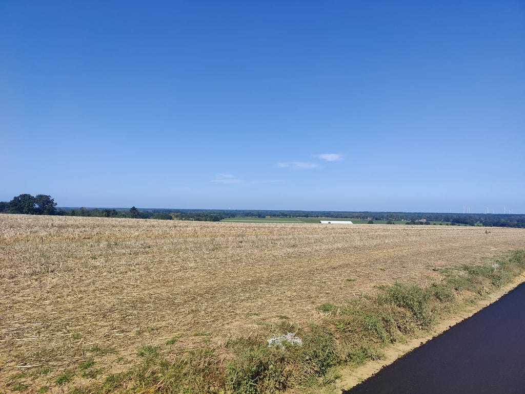
Hillensberger Steigerung from Lahrstrasse is a climb in the region Cologne. It is 0.6 mi long and bridges 125 ft of vertical ascent with an average gradient of 4%, resulting in a difficulty score of 17. The top of the ascent is located at 328 ft above sea level. Climbfinder users shared 4 reviews of this climb and uploaded 12 photos.
3.0 by BikerJohanThis is an automatic translation, the original language is: Dutch.Nice climb in the countryside between Hillensberg and the NL/D border. If you start the climb from Lahrstrasse, you can see the top well ahead of you. Appearances are deceptive, however, because after the steepest part along the orchard, you still get a bit of false to the top. The road was asphalted some time ago, is in good condition and in dry weather is fine to ride. In wet weather (including agricultural work) it is muddy due to run-off water and the climb of the Bergstrasse is a better alt... read more
Welcome! Please activate your account if you would like to share something. Look for the verification email in your inbox.
If you want to upload your photos, you need to create an account. It only takes 1 minute and it's completely free.
Nice climb in the countryside between Hillensberg and the NL/D border. If you start the climb from Lahrstrasse, you can see the top well ahead of you. Appearances are deceptive, however, because after the steepest part along the orchard, you still get a bit of false to the top. The road was asphalted some time ago, is in good condition and in dry weather is fine to ride. In wet weather (including agricultural work) it is muddy due to run-off water and the climb of the Bergstrasse is a better alternative towards the Netherlands.
Leuke klim in het buitengebied tussen Hillensberg en de grens NL/D. Als je vanaf de Lahrstrasse aan de klim begint zie je de top al ruimschoots voor je liggen. Schijn bedriegt echter omdat je na het steilste deel langs de boomgaard nog een stuk vals krijgt tot aan de top. De weg is enige tijd geleden opnieuw geasfalteerd, ligt er prima bij en is bij droog weer prima te berijden. Bij nat weer (incl. landbouwwerkzaamheden) is het er modderig door afstromend water en is de klim van de Bergstrasse een beter alternatief richting Nederland.
Fortunately, it was dry and sunny when I took this climb, so the tarmac was in good shape and without too much mud. However, the asphalt on both sides of the road was occasionally broken by heavy agricultural vehicles. So stay in the middle of the road!
In poorer weather conditions and mud on the road, I can imagine wondering whether the road is paved at all,
At the top of the ascent of this so-called 'Schlounberg' you can easily overlook the marker/information sign that stands a little further down the little street on the right. The adjacent marker stone marks the official highest point of the Municipality of Selfkant, of which the Selfkanters are apparently particularly proud. From this point, on a clear day, you can enjoy a beautiful wide view and can even see Maasbracht's power plant (according to the information board).
Gelukkig was het droog en zonnig toen ik deze klim nam, dus het asfalt lag er goed bij en zonder al te veel modder (behalve wat zand bij de opgang). Wel was het asfalt aan de beide zijkanten van de weg af en toe kapotgereden door zware landbouwvoertuigen. In het midden van de weg blijven dus!
Bij mindere weersomstandigheden en met modder op de weg kan ik me voorstellen dat je je afvraagt of de weg wel verhard is,
Bovenaan de beklimming van deze zogeheten 'Schlounberg' zie je het markerings/informatiebord dat iets verderop in het straatje rechts staat eenvoudig over het hoofd. De naastgelegen markeringssteen markeert het officiële hoogste punt van de Gemeente Selfkant, waar de Selfkanters kennelijk bijzonder trots op zijn.
Vanaf dit punt kun je bij helder weer genieten van een prachtig weids uitzicht en kun je zelfs de energiecentrale van Maasbracht zien (volgens het informatiebord).
Climb in the open field that runs parallel to the Bergstrasse in Hillensberg. Unlike the Bergstrasse, this climb does not run very well, even though it is less steep. Due to the arable traffic, this road, especially in bad weather, is regularly 'schmutzig'. Otherwise, a nice area for cycling.
Klim in het open veld die parallel loopt aan de Bergstrasse in Hillensberg. In tegenstelling tot de Bergstrasse loopt deze klim niet zo lekker, ook al is hij minder steil. Door het akkerbouwverkeer is deze weg, zeker met slecht weer, geregeld 'schmutzig'. Verder een mooie omgeving om te fietsen.
A climb where you can see the steep part in front of you at the start. I had the feeling that the steepest part was a bit steeper than indicated but that could also be due to the wind because it has free play here and when there is a headwind it gets a lot harder. After the steep part we had another piece of false flat. Nice country road with reasonable asphalt which can be dirty. In the last part there are a few holes but you can easily pass them. Nice view to the back.
Een klim waarbij je het steile gedeelte mooi voor je ziet liggen bij het begin. Had wel het gevoel dat het steilste stuk wat steiler was dan aangegeven maar dat kan ook aan de wind liggen want die heeft hier vrij spel en bij tegenwind wordt het meteen een stuk zwaarder. Na het steile gedeelte nog een stuk vals plat. Leuk landweggetje met redelijk asfalt wat wel vies kan zijn. In het laatste gedeelte enkele gaten maar daar kan je goed langs. Mooi uitzicht naar achteren.
| 5 mph | 00:07:11 |
| 7 mph | 00:05:05 |
| 9 mph | 00:03:57 |
| 12 mph | 00:02:58 |
This page is better in the app