Heideveldweg from Heerlerheide is a climb in the region South Limburg. It is 0.3 mi long and bridges 69 ft of vertical ascent with an average gradient of 5%, resulting in a difficulty score of 12. The top of the ascent is located at 397 ft above sea level. Climbfinder users shared 4 reviews of this climb and uploaded 12 photos.
Road name: Heideveldweg
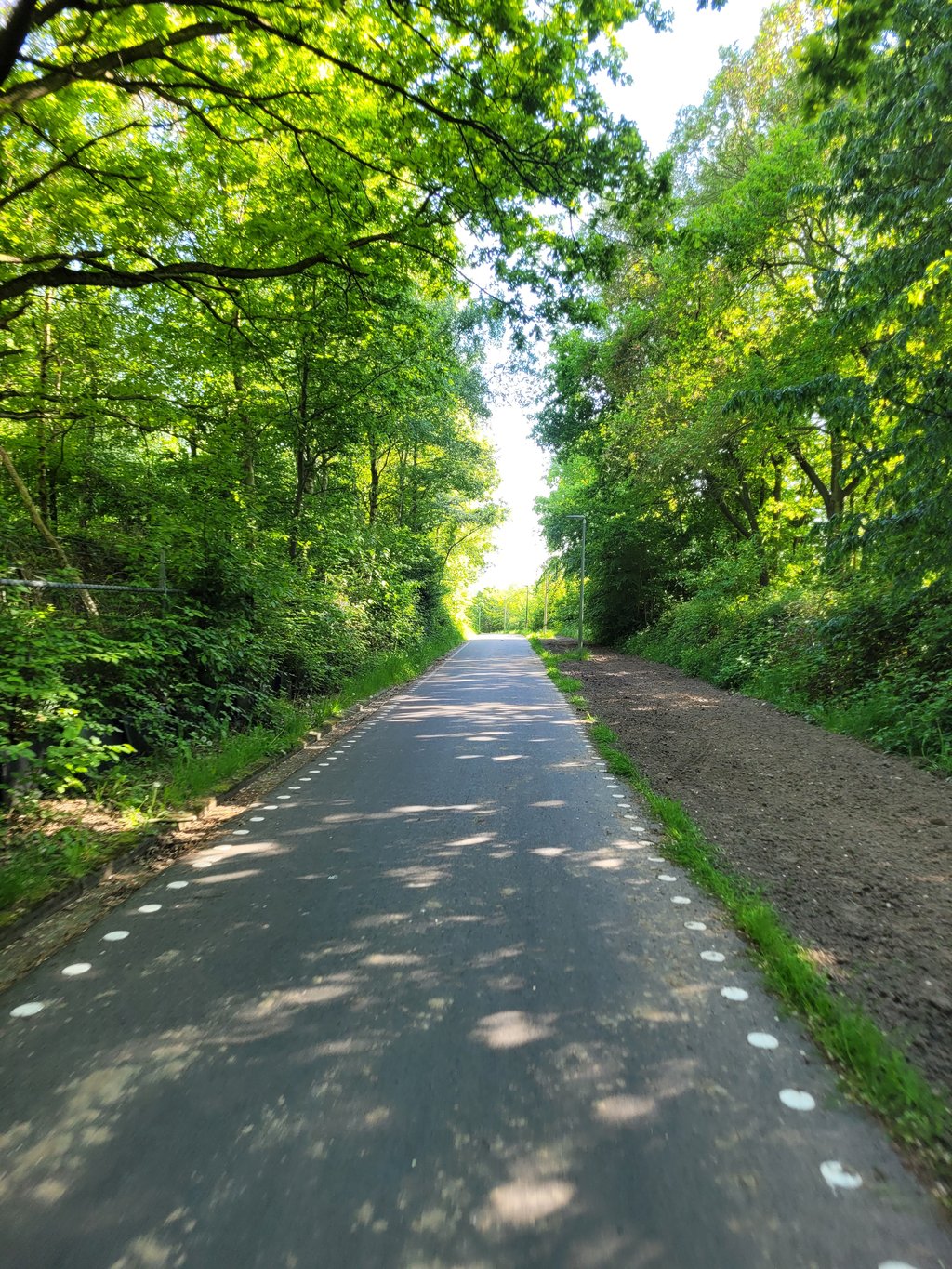
3.0 by BikerJohanThis is an automatic translation, the original language is: Dutch.Short climb from the Heerlen neighborhood of Heksenberg in southern direction. The climb still starts on an ordinary street that a little further turns into a fine bike path. The climb starts slowly but the gradient increases quickly. You ride over the area of the former coal mine Oranje Nassau 4.... read more
Welcome! Please activate your account if you would like to share something. Look for the verification email in your inbox.
If you want to upload your photos, you need to create an account. It only takes 1 minute and it's completely free.
Short climb from the Heerlen neighborhood of Heksenberg in southern direction. The climb still starts on an ordinary street that a little further turns into a fine bike path. The climb starts slowly but the gradient increases quickly. You ride over the area of the former coal mine Oranje Nassau 4.
Kort klimmetje vanuit de Heerlense wijk Heksenberg in zuidelijke richting. De klim begint nog op een gewone straat die een stukje verder overgaat in een prima fietspad. De klim begint rustig maar het stijgingspercentage loopt al snel op. Je rijdt over het gebied van de vml. kolenmijn Oranje Nassau 4.
The climb actually starts earlier, but as soon as you leave the neighbourhood and see the monument on your left that reminds you of the mine that used to be there, the climb really begins. The road surface is excellent so before you know it, you are at the top. Not worth a diversion but nice if you're in the area.
De klim begint eigenlijk al eerder, maar zodra je de wijk uitrijd en an je linkerhand het monument ziet dat herinnert aan de mijn die er heeft gelegen, begint de klim pas echt. Het wegdek is uitstekend dus voor je het weet ben je boven. Geen omweg waard maar mooi als je in de buurt bent.
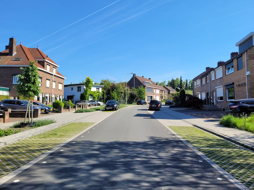
Smaller ascent which first leads through a residential area and then through a green area and which becomes steadily steeper towards the end.
Kleinerer Anstieg der zunächst durch ein Wohngebiet führt und anschließend durch ein Grünstück führt und der zum Ende hin stetig steiler wird.
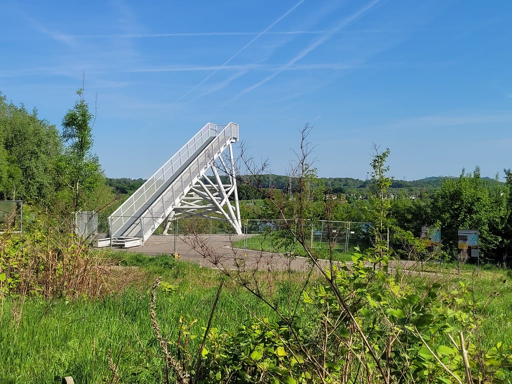
Climb that starts out relaxed but soon gets a lot steeper. The steepest part is just after the houses. Then you go straight on onto an asphalt cycle path which still continues nicely to the clear summit. At the start of the cycle path, a nice viewpoint (tower) over the former quarry is on the left.
Klimmetje dat relaxed begint maar al snel een stuk steiler wordt. Het steilste stuk is net na de huizen. Daarna ga je rechtdoor een asfaltfietspad op wat nog steeds lekker doortrekt tot de duidelijke top. Bij het begin van het fietspad links een mooi uitzichtpunt (toren) over de voormalige groeve.
| 5 mph | 00:03:09 |
| 7 mph | 00:02:13 |
| 9 mph | 00:01:44 |
| 12 mph | 00:01:18 |
This page is better in the app