View on map
© MapLibre | OpenStreetMap contributors
1%
2%
4%
6%
8%
10%
12%
15%
20%

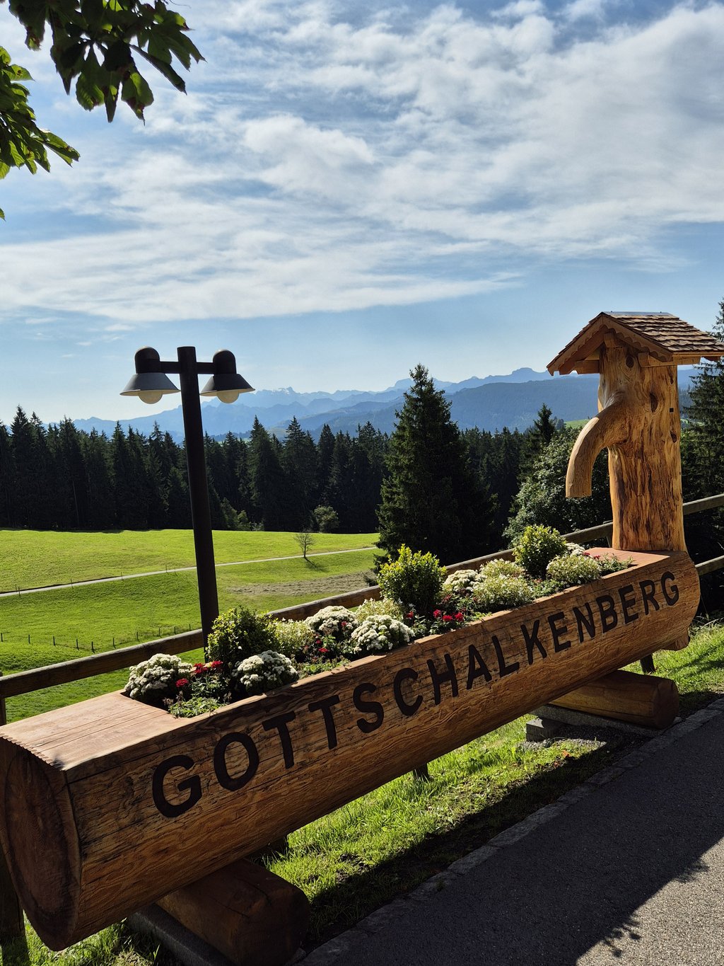
Gottschalkenberg from Bostadel

4.0
2 reviews | Elevation profile | 1 photo
Gottschalkenberg from Bostadel
transparant thumb
transparant thumb
transparant thumb
transparant thumb
transparant thumb
transparant thumb
transparant thumb
Your achievable time
Calculating based on your best performances...
Relaxed
Maximum
W/kg
W/kg
W/kg
Analyze your climbing performance
Detailed insight into your climbing performance & automatically check off climbs
Based on your best performances.
Your best attempt:
Number of attempts:
Elevation profile Gottschalkenberg from Bostadel

Statistics

Difficulty points 490
Length 4.5 mi
Average gradient 7.1%
Steepest segment 18.7%
Total ascent 1709 ft

Short recap

4 hairpin turns
Feedback about this climb?
Show climbs nearby Export to GPS device

Gottschalkenberg from Bostadel is a climb in the region Swiss Alps. It is 4.5 mi long and bridges 1709 ft of vertical ascent with an average gradient of 7.1%, resulting in a difficulty score of 490. The top of the ascent is located at 3796 ft above sea level. Climbfinder users shared 2 reviews of this climb and uploaded 1 photo.

Road names: Neudorfstrasse & Gottschalkenbergstrasse

This is an automatic translation, the original language is: Dutch.
Challenging, sometimes a bit uneven, but mostly long and steep. The first kilometer is still nice and wide. Then you pass through a small village and into the woods. You ride in a nice, sheltered spot, but unfortunately there’s no view. There’s (almost) no one else out there, which is nice. Just past the summit is a little restaurant, and from there you can enjoy a nice descent :)... read more

Photos (1)

Gottschalkenberg from Bostadel
transparant thumb
transparant thumb
transparant thumb
transparant thumb
transparant thumb

Your uploads (max 4)

Welcome! Please activate your account if you would like to share something. Look for the verification email in your inbox.

If you want to upload your photos, you need to create an account. It only takes 1 minute and it's completely free.

  • Receive free climbfinder goodies for your reviews & photos
  • Create a bucket list and check off conquered climbs
  • Add missing climbs
Continue with GoogleContinue with Google Continue with FacebookContinue with Facebook Continue with AppleContinue with Apple Sign up with email
By signing up you agree to our terms of service and confirm that you have read our privacy & content policy.

Reviews (2)

5.0
4.0
3.0
2.0
1.0
JurneSleddens
4 d 4.0
This is an automatic translation, the original language is: Dutch. Show original

Challenging, sometimes a bit uneven, but mostly long and steep. The first kilometer is still nice and wide. Then you pass through a small village and into the woods. You ride in a nice, sheltered spot, but unfortunately there’s no view. There’s (almost) no one else out there, which is nice. Just past the summit is a little restaurant, and from there you can enjoy a nice descent :)

Uitdagend, soms wat onregelmatig maar vooral lang steil. De eerste kilometer is nog lekker over een bredere baan. Daarna door een dorpje en het bos in. Je rijdt lekker beschut maar je hebt helaas geen uitzicht. Er rijdt (bijna) niemand dus dat is prettig. Iets na de top is een restaurantje en vanaf daar kun je mooi afdalen :)

Dashboard
SEK
1 y 4.0 via the Climbfinder app
This is an automatic translation, the original language is: German. Show original

A classic for the longer evening tour from Zurich and for hot summer days - very nice to ride. Almost the whole route leads through the forest, little traffic, tarmac is ok - quite evenly steep. There's a restaurant with a terrace at the top

Ein Klassiker für sie grössere Abendrunde von Zürich und für heisse Sommertage - sehr schön zu fahren. Fast die ganze Strecke führt durch den Wald, wenig Verkehr, Asphalt ist ok - recht gleichmässig Steil. Ober gibt's ein Restaurant mit Terrasse

Dashboard

Climbing times

5 mph 00:54:44
7 mph 00:38:45
9 mph 00:30:11
12 mph 00:22:41

Road surface condition

0% 0% 0%
Based on 0 votes
Share your knowledge. What was the road condition during your ascent?

Traffic

0% 0% 0%
Based on 0 votes
Your experience counts. How much traffic did you encounter during the climb?

Frequently Asked Questions

Gottschalkenberg can be cycled from 3 sides. Gottschalkenberg from Bostadel is the most popular side, but the summit can also be reached via Gottschalkenberg from Bostadel via Sparenbach & Gottschalkenberg from Menzingen.

Gottschalkenberg from Bostadel is a challenging ascent. For this type of climbing, we recommend mountain gearing, specifically a compact system. This means a small front chainring of 34 teeth, combined with a rear cassette where, depending on your level, strength, and experience, you choose a sprocket with 30, 32, or even 34 teeth. Remember that a smooth cadence is always more efficient!

Gottschalkenberg from Bostadel is a serious climb and falls into the 2nd category. With a good basic fitness level, even without much cycling experience, you can complete this climb just fine. However, a bike with climbing gears is a must. Without experience or training, it will be really tough – but that’s part of the challenge!

Gottschalkenberg from Bostadel is 4.5 mi long.

The average gradient of Gottschalkenberg from Bostadel is 7.1%.

Gottschalkenberg from Bostadel has a steepest segment with an average gradient of 18.7%.

The summit of Gottschalkenberg from Bostadel is at 3796 ft.

At a slow pace of 5 mph, it takes about 00:54:44 to climb Gottschalkenberg from Bostadel. At 7 mph the time is 00:38:45, and at 9 mph 00:30:11. For the fastest cyclists, 00:22:41 is an achievable time.

Gottschalkenberg from Bostadel is located in the region in Switzerland.

This page is better in the app

Climbfinder app
Climbfinder
(Free)
Open