View on map
© MapLibre | OpenStreetMap contributors
1%
2%
4%
6%
8%
10%
12%
15%
20%

Goletto di Cadino from Bienno

4.5
2 reviews | Elevation profile | 6 photos
Tips nearby
Goletto di Cadino from Bienno
transparant thumb
transparant thumb
Your achievable time
Calculating based on your best performances...
Relaxed
Maximum
W/kg
W/kg
W/kg
Analyze your climbing performance
Detailed insight into your climbing performance & automatically check off climbs
Based on your best performances.
Your best attempt:
Number of attempts:
Elevation profile Goletto di Cadino from Bienno

Statistics

Difficulty points 1344
Length 12.2 mi
Average gradient 7.7%
Steepest segment 17%
Total ascent 4961 ft

Short recap

15 hairpin turns
#95 toughest climb of Italy
#66 most elevation gain of Italy
#33 longest climb of Lombardy
#54 average steepest climb of Brescia
Feedback about this climb?
Show climbs nearby Export to GPS device

Goletto di Cadino from Bienno is a climb in the region Brescia. It is 12.2 mi long and bridges 4961 ft of vertical ascent with an average gradient of 7.7%, resulting in a difficulty score of 1344. The top of the ascent is located at 6358 ft above sea level. Climbfinder users shared 2 reviews of this climb and uploaded 6 photos.

Road names: Via Luigi Ercoli, Via Guglielmo Marconi, SPBS345 & Strada statale del Passo di Crocedomini

This is an automatic translation, the original language is: Italian.
Very nice climb, long and hard enough. Always even gradients, allows you to set your own pace and manage the effort.... read more

Photos (6)

Goletto di Cadino from Bienno

Your uploads (max 4)

Welcome! Please activate your account if you would like to share something. Look for the verification email in your inbox.

If you want to upload your photos, you need to create an account. It only takes 1 minute and it's completely free.

  • Receive free climbfinder goodies for your reviews & photos.
  • Create a bucket list and check off conquered climbs.
  • Add missing climbs.
Continue with GoogleContinue with Google Continue with FacebookContinue with Facebook Continue with AppleContinue with Apple Sign up with email
By signing up you agree to our terms of service and confirm that you have read our privacy & content policy.

Reviews (2)

5.0
4.0
3.0
2.0
1.0
RiccardoC25
9 Mo 5.0 via the Climbfinder app
This is an automatic translation, the original language is: Italian. Show original

Very nice climb, long and hard enough. Always even gradients, allows you to set your own pace and manage the effort.

Salita molto bella lunga e dura il giusto. Pendenze sempre regolari, consente di impostare il proprio passo e gestire lo sforzo.

Dashboard
RobiRini66
3 y 4.0 02:17:50 (5.3 mph)
This is an automatic translation, the original language is: Italian. Show original

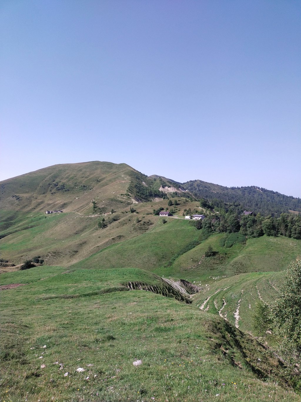
Classic Val Camonica climb, which can be ascended from Breno or Brienno. The road then rejoins after about 5km. From Brienno it is slightly more demanding.
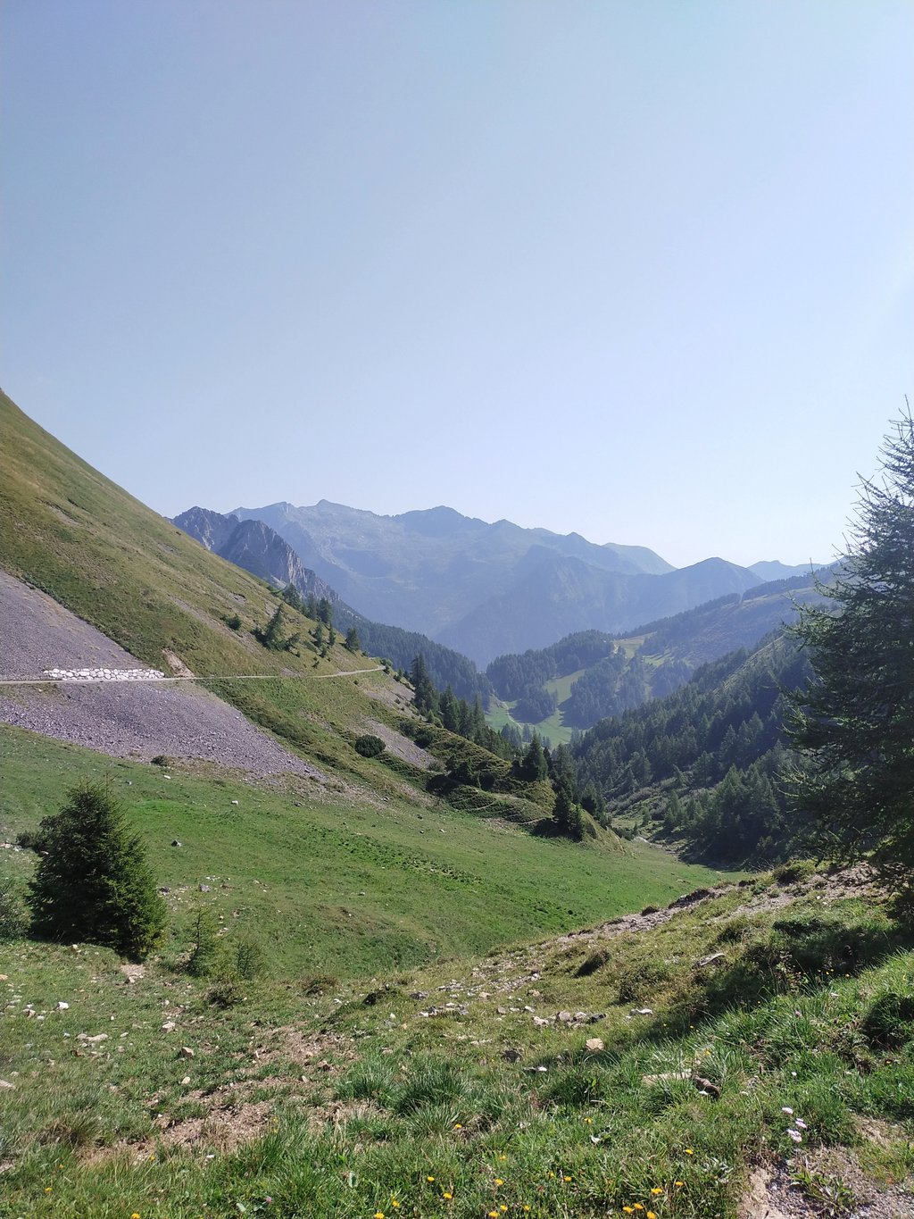
Constant climb in beautiful surroundings, shame about the cloudy weather which took away the view
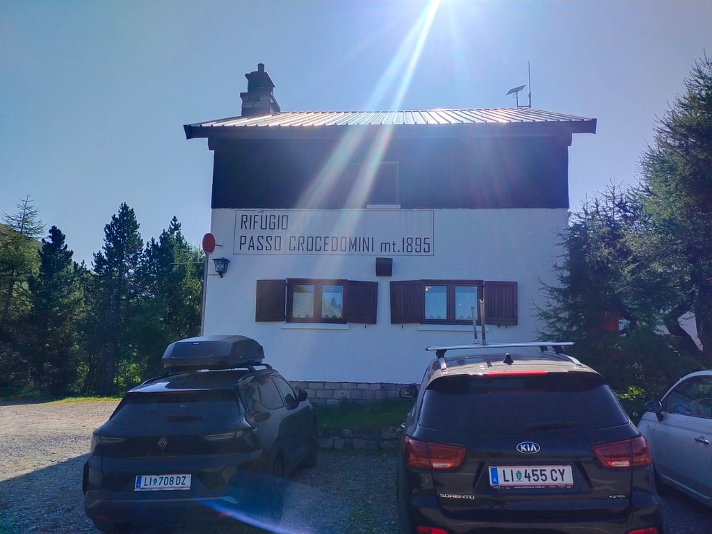
At the top, refuge for a good meal, always open. I recommend continuing on to Passo Maniva and descending from Bovegno to close a breathtaking tour.
Fountains present along the route.
I started from Boario terme and parked outside the village.

Salita classica della Val Camonica che si può salire da Breno o da Brienno. La strada poi si ricongiunge dopo circa 5km. Da Brienno è leggermente più impegnativa.
Salita costante in bell'ambiente, peccato per il tempo nuvoloso che mi ha tolto il panorama
In cima rifugio per un buon pasto, sempre aperto. Consiglio di proseguire per il Passo Maniva e scendere da Bovegno per chiudere un giro mozzafiato.
Fontane presenti lungo il percorso.
Io sono partito da Boario terme e ho parcheggiato fuori dal paese.

Goletto di Cadino from Bienno
Dashboard

Climbing times

5 mph 02:27:02
7 mph 01:44:05
9 mph 01:21:07
12 mph 01:00:56

Road surface condition

100% 0% 0%
Based on 2 votes
Share your knowledge. What was the road condition during your ascent?

Traffic

100% 0% 0%
Based on 2 votes
Your experience counts. How much traffic did you encounter during the climb?

Frequently Asked Questions

Goletto di Cadino can be cycled from 3 sides. Goletto di Cadino from Breno is the most popular side, but the summit can also be reached via Goletto di Cadino from Bagolino & Goletto di Cadino from Bienno.

Goletto di Cadino from Bienno is a challenging ascent. For this type of climbing, we recommend mountain gearing, specifically a compact system. This means a small front chainring of 34 teeth, combined with a rear cassette where, depending on your level, strength, and experience, you choose a sprocket with 30, 32, or even 34 teeth. Remember that a smooth cadence is always more efficient!

Goletto di Cadino from Bienno belongs to the Hors Catégorie, the top category. These are legendary and very tough climbs. A solid cycling condition, experience, and a good climbing gear ratio are essential to maintain a smooth cadence and complete the climb comfortably.

Goletto di Cadino from Bienno is 12.2 mi long.

The average gradient of Goletto di Cadino from Bienno is 7.7%.

Goletto di Cadino from Bienno has a steepest segment with an average gradient of 17%.

The summit of Goletto di Cadino from Bienno is at 6358 ft.

At a slow pace of 5 mph, it takes about 02:27:02 to climb Goletto di Cadino from Bienno. At 7 mph the time is 01:44:05, and at 9 mph 01:21:07. For the fastest cyclists, 01:00:56 is an achievable time.

Goletto di Cadino from Bienno is located in the region Brescia in Italy.

This page is better in the app

Climbfinder app
Climbfinder
(Free)
Open