| #70 most elevation gain of Pays de Herve |
| #71 longest climb of Belgium |
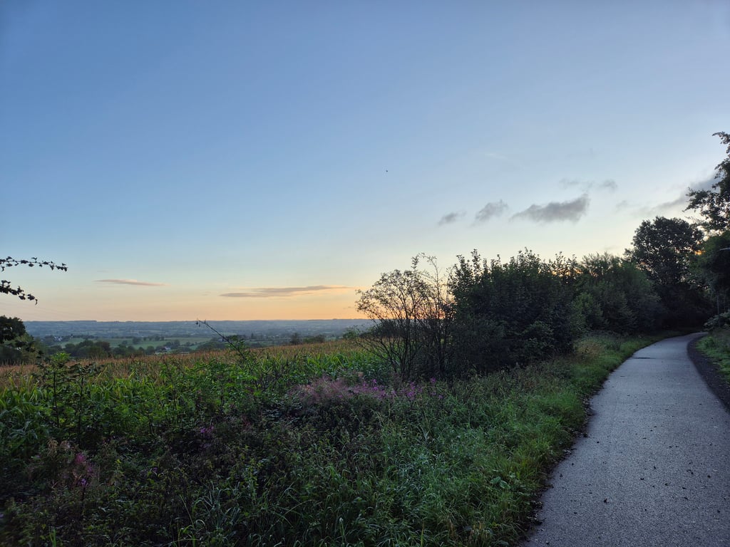
Fort de Battice via RAVeL5 L38 is a climb in the region Pays de Herve. It is 4.1 mi long and bridges 410 ft of vertical ascent with an average gradient of 1.9%, resulting in a difficulty score of 41. The top of the ascent is located at 1063 ft above sea level. Climbfinder users shared 4 reviews of this climb and uploaded 19 photos.
Road name: RAVeL5 L38
2.0 by NoahColinThis is an automatic translation, the original language is: French.Ravel is long and not very steep, but it goes by quickly and smoothly.... read more
Welcome! Please activate your account if you would like to share something. Look for the verification email in your inbox.
If you want to upload your photos, you need to create an account. It only takes 1 minute and it's completely free.
Ravel is long and not very steep, but it goes by quickly and smoothly.
Ravel long pas très pentu mais se passe très rapidement et sans encombre
Fine cycle path. If you want to make few altitude metres, for whatever reason, this is a good one. The cycle path is free flowing, and as you progress you have nice views. The whole ravel takes you roughly from Liège to the Drielandenpunt. Or vice versa. It can be very busy in summer. In winter or after a rainstorm, the path looks wet as it is under trees.
Prima fietspad. Wie weinig hoogtemeters wil maken, om wat voor reden dan ook heeft hier een goede aan. Het fietspad is vrijliggend, en naarmate je vordert heb je mooie uitzichten. De gehele ravel brengt je grofweg van Luik tot het Drielandenpunt. Of vice versa. Het kan heel druk zijn in de zomer. In de winter of na een regenbui ligt het pad er nat bij, omdat het onder de bomen ligt.
Nice long car-free false flat climb over Ligne 38. The climb starts at Froidthier and ends thv the Battice fortress.
Leuke lange autovrije vals plat klim over Ligne 38. De klim begint bij Froidthier en eindigt thv het fort van Battice.
Climb consisting mainly of false flat but because of its length you still pack quite a few altimeters... and you do feel them a bit. The whole climb is on a completely separate cycle path (section of old railway track) with perfect tarmac. Several times you cross a road (well-marked) where you have to give way. The first part you ride through a kind of green tunnel, after which you regularly have beautiful views. The cycle path is quite wide but can be busy on nice days.
Klim die vooral uit vals plat bestaat maar vanwege de lengte pak je toch best wat hoogtemeters mee... en die voel je toch wel een beetje. De hele klim loopt over een geheel vrijliggend fietspad (traject oude spoorweg) met perfect asfalt. Je kruist enkele keren een weg (goed aangegeven) waar je voorrang moet verlenen. Het eerste stuk rijd je door een soort groene tunnel, daarna heb je regelmatig mooie uitzichten en vanaf de fietsbrug in Thimister een leuk doorkijkje naar het centrum. Het fietspad is best breed maar kan op mooie dagen wel druk zijn.
| 5 mph | 00:49:35 |
| 7 mph | 00:35:06 |
| 9 mph | 00:27:21 |
| 12 mph | 00:20:33 |
This page is better in the app