Flushing Hill is a climb in the region Cornwall. It is 0.4 mi long and bridges 194 ft of vertical ascent with an average gradient of 8.3%, resulting in a difficulty score of 63. The top of the ascent is located at 207 ft above sea level. Climbfinder users shared 1 review/story of this climb and uploaded 2 photos.
This is an automatic translation, the original language is: Dutch.
I was curious and curious to see if I could make the crossing across Gillan Creek at low tide and hike-a-bike. Once down at the quay, I saw the footpath and left it. Still glad I went here and back, as you have a view of the beautiful Gillan Creek, which looks almost jungle-like at low tide. After that, you do have to go back up, which is seriously steep, narrow, but not impossible. You do have to stop for descending cars. As on many country roads in Cornwall, you need not expect anything from t...read more
Photos (2)
Welcome! Please activate your account if you would like to share something. Look for the verification email in your inbox.
This is an automatic translation, the original language is: Dutch.
Show original
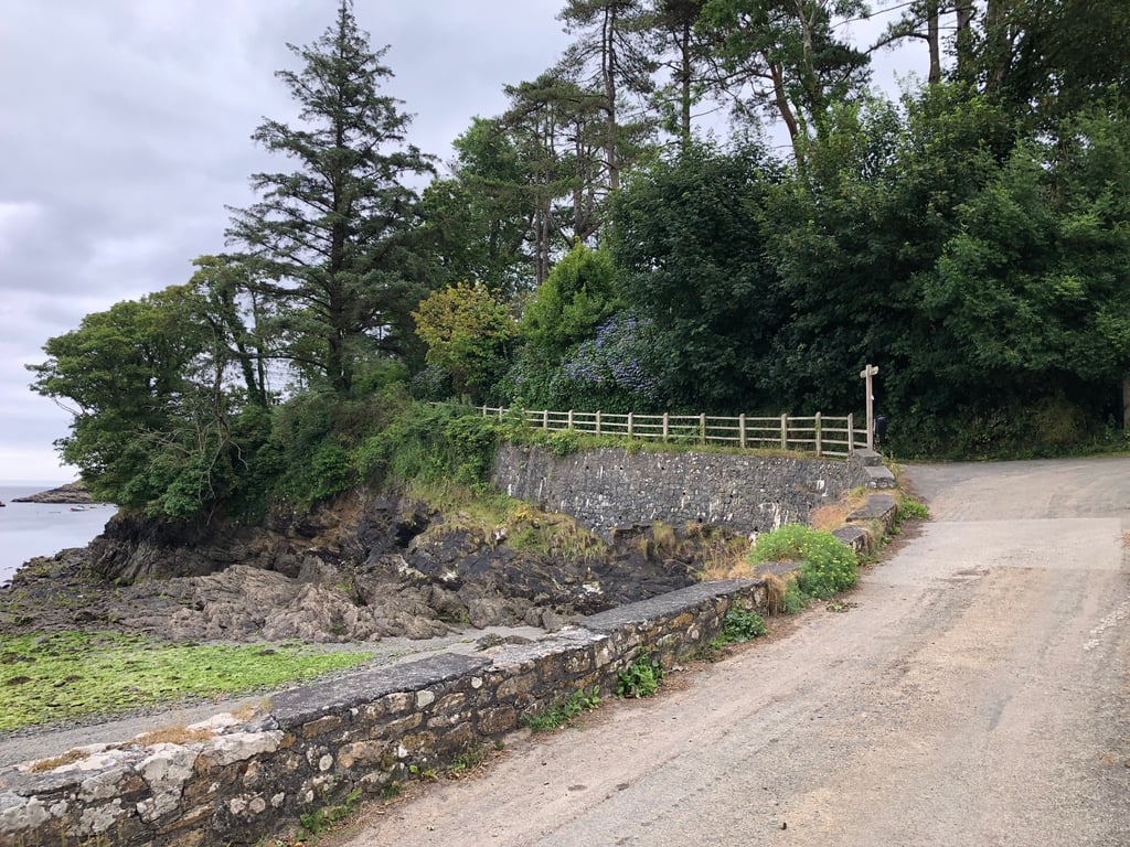
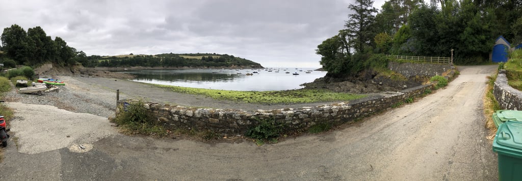
I was curious and curious to see if I could make the crossing across Gillan Creek at low tide and hike-a-bike. Once down at the quay, I saw the footpath and left it. Still glad I went here and back, as you have a view of the beautiful Gillan Creek, which looks almost jungle-like at low tide. After that, you do have to go back up, which is seriously steep, narrow, but not impossible. You do have to stop for descending cars. As on many country roads in Cornwall, you need not expect anything from the road surface but all the more from the amount of flora. By the way, I can also recommend the road along Gillan Creek.
Ik was nieuwsgierig en benieuwd of ik met laagwater en hike-a-bike de overtocht kon maken over Gillan Creek. Eenmaal beneden aan de kade zag ik het voetpad en heb dat maar links laten liggen. Toch blij dat ik hier heen en weer ben gegaan, want je hebt zicht op de prachtige Gillan Creek, die er met laagwater bijna jungle-achtig uitziet. Daarna moet je wel weer omhoog en dat is serieus steil, smal, maar niet onmogelijk. Voor dalende auto’s moet je wel stoppen. Net als op veel buitenwegen in Cornwall hoef je niks te verwachten van het wegdek maar des te meer van de hoeveelheid flora. Ik kan overigens de weg langs Gillan Creek ook aanbevelen.
Share your knowledge. What was the road condition during your ascent?
Traffic
0% 0% 0%
Based on 0 votes
Your experience counts. How much traffic did you encounter during the climb?
Frequently Asked Questions
You don't need special gearing for Flushing Hill. The slope isn't long or steep enough to require much shifting down. You can conquer this climb on power alone. However, a compact gearing system with a smallest front chainring of 34 and largest rear sprocket of 28 or 30 is always nice if you enjoy cycling uphill. This helps maintain a smooth cadence.
Flushing Hill falls into the 5th category. With good fitness, you can ride it up with speed and power. If you have less training, shift down and climb smoothly.
Flushing Hill is 0.4 mi long.
The average gradient of Flushing Hill is 8.3%.
Flushing Hill has a steepest segment with an average gradient of 15%.
The summit of Flushing Hill is at 207 ft.
At a slow pace of 5 mph, it takes about 00:05:19 to climb Flushing Hill. At 7 mph the time is 00:03:46, and at 9 mph 00:02:56. For the fastest cyclists, 00:02:12 is an achievable time.