Tips nearby


Feissons sur Salins from Moutiers is a climb in the region Savoie. It is 7 mi long and bridges 2615 ft of vertical ascent with an average gradient of 7%, resulting in a difficulty score of 589. The top of the ascent is located at 4206 ft above sea level. Climbfinder users shared 5 reviews of this climb and uploaded 32 photos.
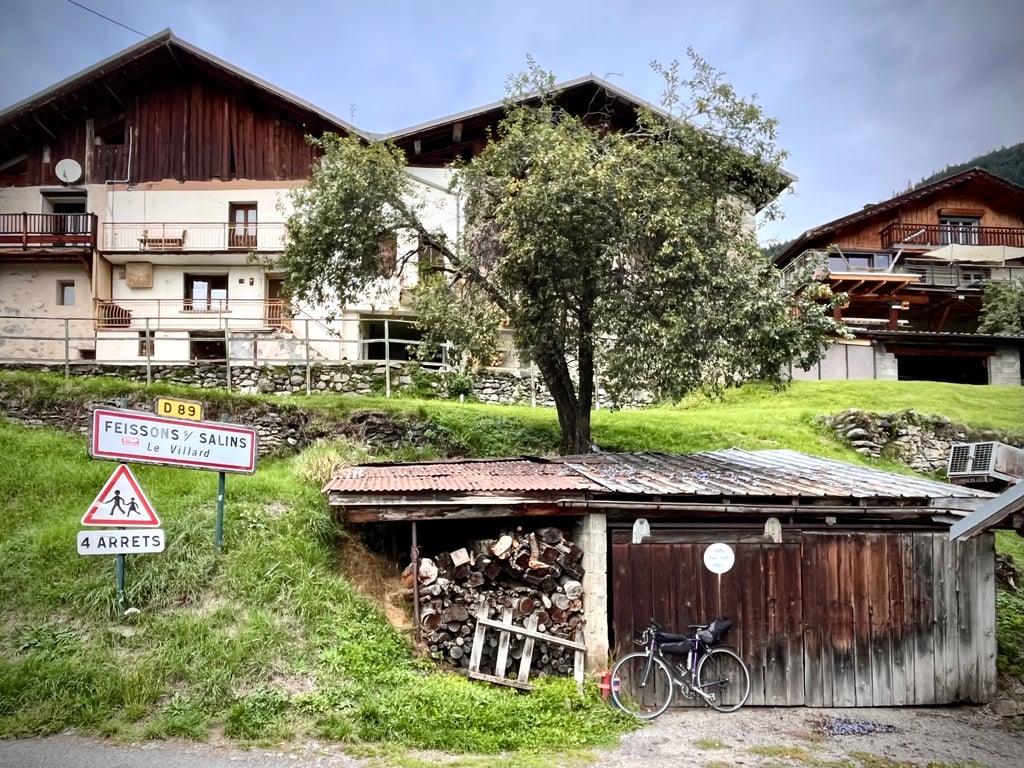
Road names: D89 & D89B
4.0 by CromagnonThis is an automatic translation, the original language is: French.I discovered that this coast has been awarded the "hidden gem" label. Yes, it's well deserved. A very pretty little road that climbs and winds gently without ever hurting the calves. With the exception of the first 500 metres, which are pretty tough. Graceful rock faces, delightful hairpin bends, soothing landscapes, remarkable villages - it's an entertaining spectacle. Good surface, moderate traffic. An easy and enjoyable climb.... read more
Welcome! Please activate your account if you would like to share something. Look for the verification email in your inbox.
If you want to upload your photos, you need to create an account. It only takes 1 minute and it's completely free.
I discovered that this coast has been awarded the "hidden gem" label. Yes, it's well deserved.
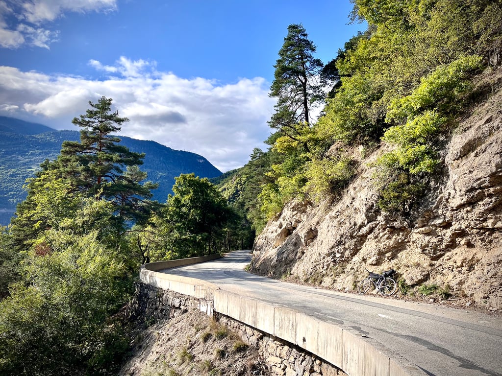
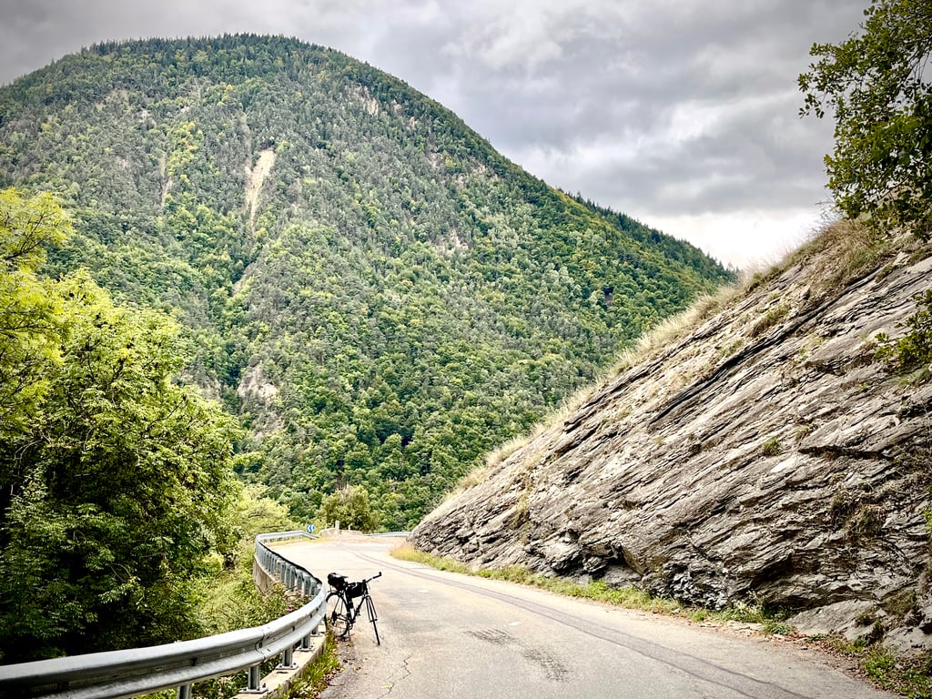
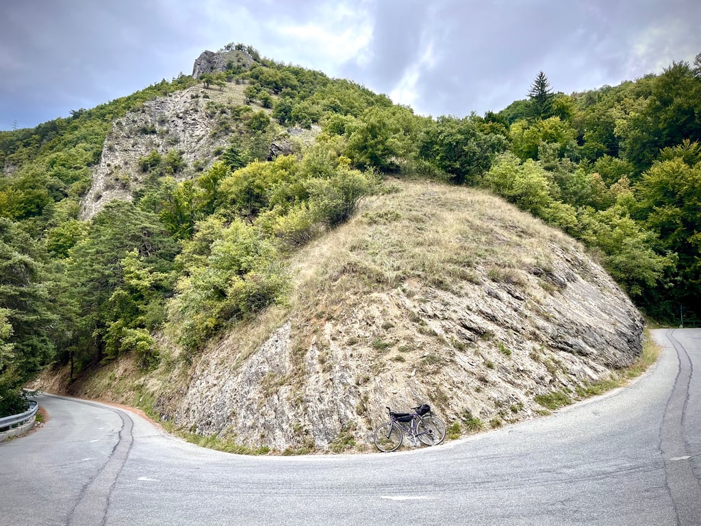
A very pretty little road that climbs and winds gently without ever hurting the calves. With the exception of the first 500 metres, which are pretty tough.
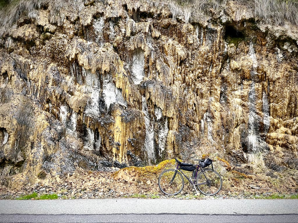
Graceful rock faces, delightful hairpin bends, soothing landscapes, remarkable villages - it's an entertaining spectacle.
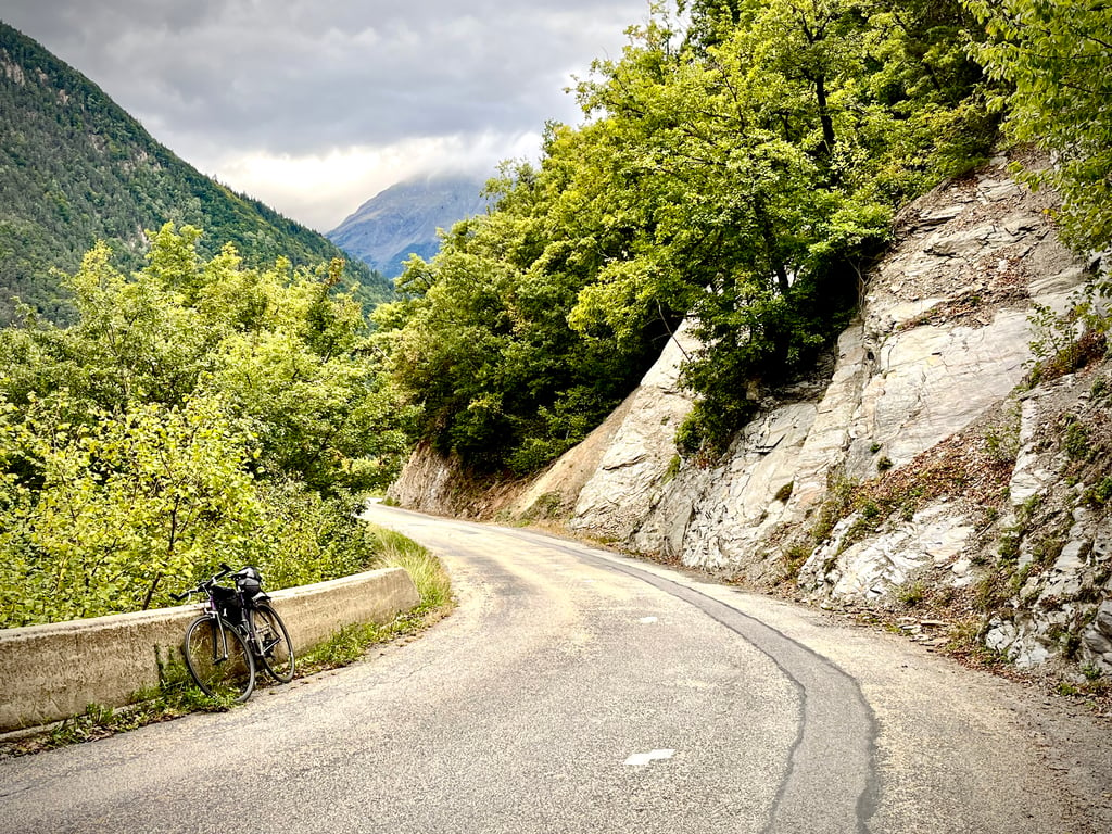
Good surface, moderate traffic.
An easy and enjoyable climb.
Je découvre que cette côte bénéficie du label « joyau caché ». Oui, c’est plutôt mérité.
Une très jolie petite route qui grimpe et serpente doucement sans jamais faire mal aux mollets. À l’exception des 500 premiers mètres qui sont assez costauds.
Parois rocheuses gracieuses, épingles délicieuses, paysages apaisants, villages remarquables, le spectacle est distrayant.
Revêtement correct, circulation modérée.
Une montée facile et bien agréable.
In August 2024 between 2 de and 3 de km. ended up on this route because I left from Brides les Bains where, after the bridge over the Doron de Bozel river, there was also a steep climb to make the connection.
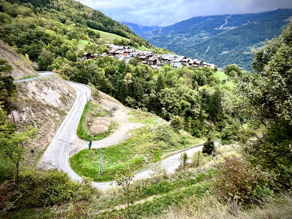
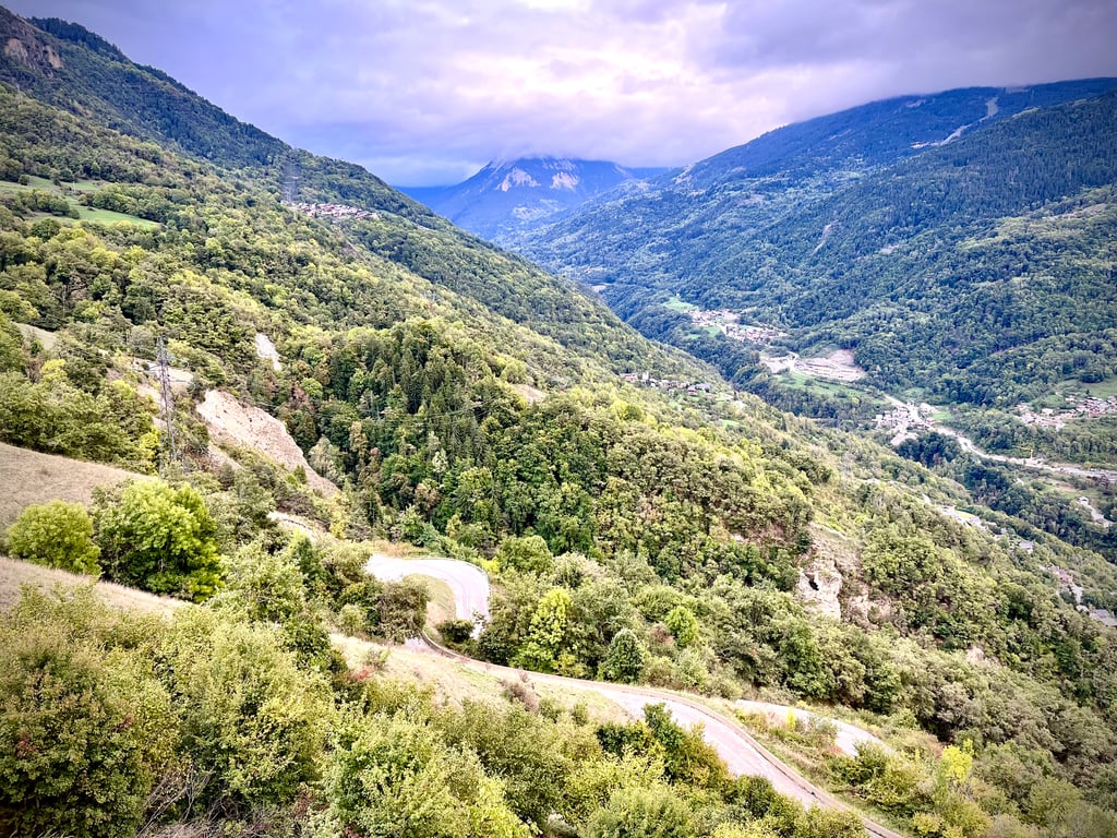
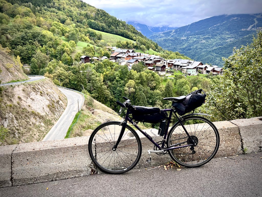
Through hairpin bends and along rock walls it then goes
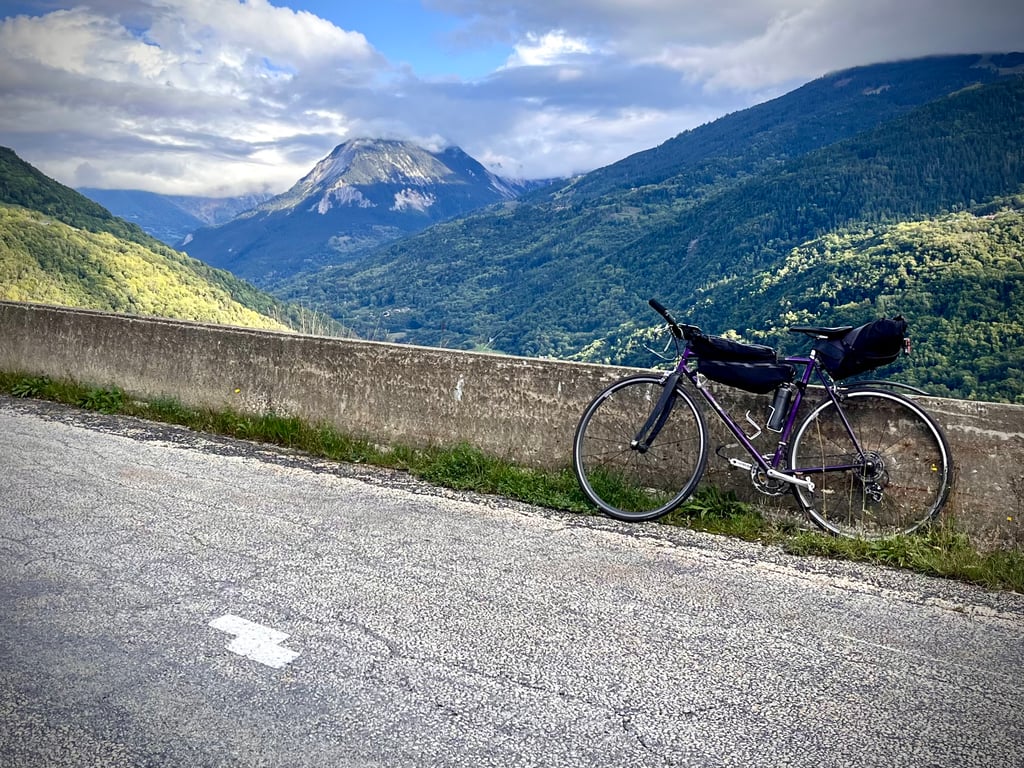
up the uninhabited valley flank with deep below you Brides les Bains sinking and on the other side the panoramic view of the various villages of the Méribel flank.
Just before village of La Thuile, turn left down the D89 followed by another long right-hand section to the water source at the start of Feissons sur Salins.
End point is far from touristy, apart from a few gites, where you climb all the way up to the highest reaches of the village where the tarmac stops with the last 5 hairpin turns past farms and a church.
Reasonable road surface,little shade,no catering, hardly any traffic.
Beautifully hidden climbing gem.
In augustus 2024 tussen 2 de en 3 de km. terecht gekomen op deze route omdat ik vertrok uit Brides les Bains waar, na de brug over de Doron de Bozel rivier, ook al stevig moest geklommen worden om de aansluiting te maken.
Via haarspeldbochten en langs rotsmuren gaat het dan
de onbewoonde valleiflank op met diep onder jou Brides les Bains dat wegzinkt en aan de overzijde het panoramisch zicht op de verschillende dorpjes van de Méribel flank.
Vlak voor dorpje La Thuile de D89 links afdraaien gevolgd door nog een lang rechtsdraaiend deel tot de waterbron bij het begin van Feissons sur Salins.
Eindpunt is verre van toeristisch, op enkele gites na, waar je met de laatste 5 haarspeldbochten langs boerderijen en een kerkje helemaal door klimt tot de hoogste regionen van het dorp waar het asfalt stopt.
Redelijk wegdek,weinig schaduw,geen horeca,amper verkeer.
Prachtig verborgen klimparel.
Because my route went via Bozel and La Thuille, I only experienced part of this climb as a descent. The surroundings are beautiful, but the road surface from Moutiers to La Thuille is poor to bad. As a climb, it will not bother you much, but be alert when you whiz down here. Anything but pleasant.
Omdat mijn route via Bozel en La Thuille voerde heb ik deze klim maar voor een deel als afdaling ervaren. De omgeving is prachtig, maar het wegdek vanaf Moutiers tot La Thuille is matig tot slecht. Als klim zal je dat weinig last geven, maar wees alert als je hier naar beneden suist. Allesbehalve prettig.
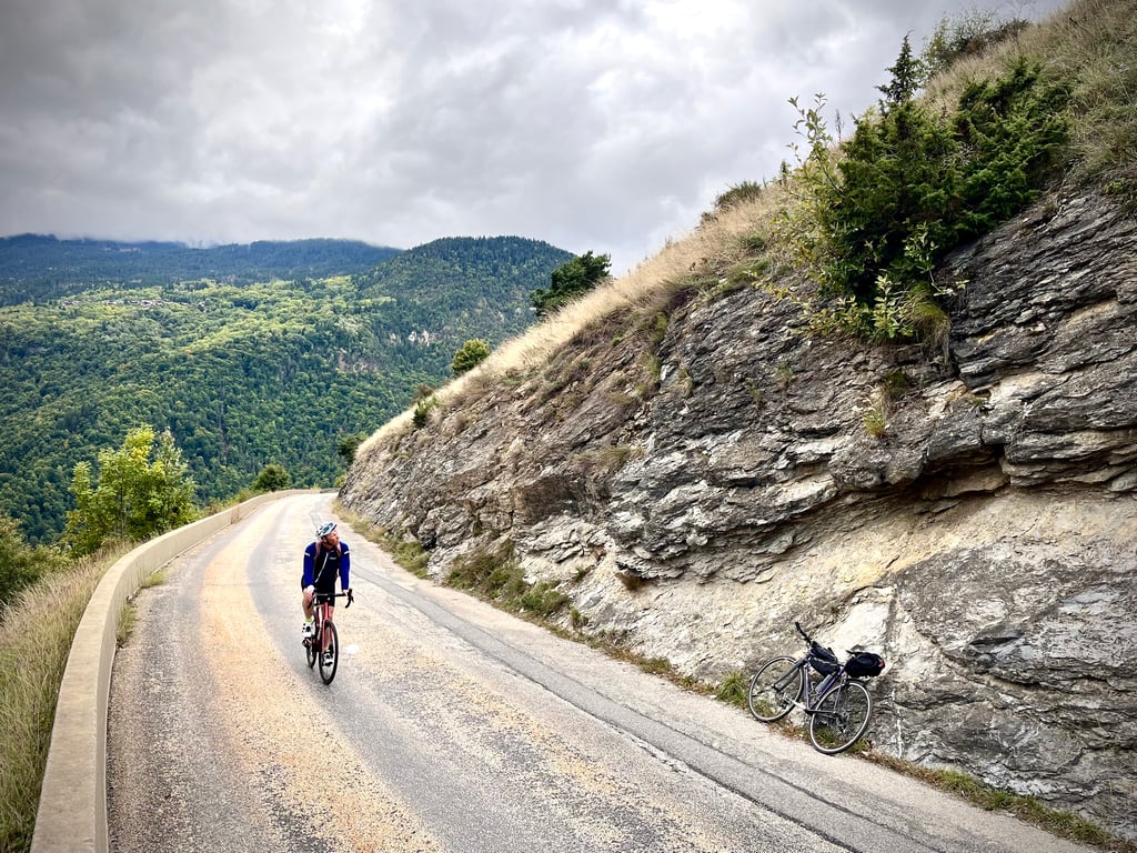
Nice climb sheltered from the main traffic, done on Tuesday 19 April 2022 with Eric " I am proud of him because he has just started cycling again for his retirement and he didn't put his foot down despite the little training"
The profile corresponds quite closely to the terrain, the start from Moutiers is very steep for about 500M with a gradient that is sometimes close to 14% and then it is very regular all the way to the top.
The road is quite bad on the first part until the crossing with the Feissons road, then good until the top but with quite a lot of rocks, you will have to be careful on the descent.
South facing, so not recommended on hot summer afternoons.
Beautiful views with the Méribel resorts just in front and a view over Bride les Bains.
Note that you can't climb up to the spot as shown on the Climbfinder map because at the end of the village at the end of the yellow road it's a dirt track.
If you are on holiday in the area and are looking for peace and quiet, this is the climb for you.
Belle ascension à l'abri de la grande circulation, effectuée le mardi 19 avril 2022 avec Eric " je suis fier de lui car il vient de se remettre au vélo pour sa retraite et il n'a pas posé pied à terre malgré le peu d'entrainement"
Le profil correspond assez fidèlement au terrain, le départ de Moutiers est très raide sur environ 500M avec une pente qui avoisine parfois les 14% et ensuite c'est très régulier jusqu'au sommet.
La route est assez mauvaise sur la première partie jusqu'au croisement de la route de Feissons, puis bonne jusqu'au sommet mais avec pas mal de cailloux, il faudra être prudent lors de la descente.
Exposition plein sud, donc à déconseiller les chaudes après-midi d'été.
Beaux points de vue avec les stations des Méribel juste en face est vue plongeante sur Bride les Bains.
A noter qu'on ne peut pas monter jusqu'à l'endroit comme sur la carte Climbfinder car à la sortie du village à la fin de la Rte en jaune c'est un chemin de terre.
Si vous êtes en vacances dans le coin et que vous recherchez la tranquillité, cette ascension est faites pour vous.
| 5 mph | 01:24:55 |
| 7 mph | 01:00:07 |
| 9 mph | 00:46:51 |
| 12 mph | 00:35:12 |
This page is better in the app