View on map
© MapLibre | OpenStreetMap contributors
1%
2%
4%
6%
8%
10%
12%
15%
20%

Eurener Höhe from Euren

3.0
1 review/story | Elevation profile | 1 photo
Tips nearby
Eurener Höhe from Euren
transparant thumb
transparant thumb
transparant thumb
transparant thumb
transparant thumb
transparant thumb
transparant thumb
Your achievable time
Calculating based on your best performances...
Relaxed
Maximum
W/kg
W/kg
W/kg
Analyze your climbing performance
Detailed insight into your climbing performance & automatically check off climbs
Based on your best performances.
Your best attempt:
Number of attempts:
Elevation profile Eurener Höhe from Euren

Statistics

Difficulty points 193
Length 1.9 mi
Average gradient 7.2%
Steepest segment 14.3%
Total ascent 728 ft

Short recap

3 hairpin turns
#64 toughest climb of Eifel
Feedback about this climb?
Show climbs nearby Export to GPS device

Eurener Höhe from Euren is a climb in the region Eifel. It is 1.9 mi long and bridges 728 ft of vertical ascent with an average gradient of 7.2%, resulting in a difficulty score of 193. The top of the ascent is located at 1224 ft above sea level. Climbfinder users shared 1 review/story of this climb and uploaded 1 photo.

Road names: Herrmannstraße & K 3

3.0 by Friz1983
This is an automatic translation, the original language is: English.
Eurener Höhe from Euren — Short, Steep & Punchy Climb near Trier The Eurener Höhe climb from Euren might not have the fame of Alpine or Dolomitic giants, but this little climb just outside Trier (Germany) delivers a surprising punch in a very short distance. It’s a classic local test-piece — short, steep, and over before you know it… but not without a fight! Road Conditions Good overall. Typical urban-to-hill transition road — smooth enough for a good effort, with little tra... read more

Photos (1)

Eurener Höhe from Euren
transparant thumb
transparant thumb
transparant thumb
transparant thumb
transparant thumb

Your uploads (max 4)

Welcome! Please activate your account if you would like to share something. Look for the verification email in your inbox.

If you want to upload your photos, you need to create an account. It only takes 1 minute and it's completely free.

  • Receive free climbfinder goodies for your reviews & photos.
  • Create a bucket list and check off conquered climbs.
  • Add missing climbs.
Continue with GoogleContinue with Google Continue with FacebookContinue with Facebook Continue with AppleContinue with Apple Sign up with email
By signing up you agree to our terms of service and confirm that you have read our privacy & content policy.

Reviews (1)

5.0
4.0
3.0
2.0
1.0
Friz1983
1 y 3.0 00:13:29 (8.5 mph)

Eurener Höhe from Euren — Short, Steep & Punchy Climb near Trier
The Eurener Höhe climb from Euren might not have the fame of Alpine or Dolomitic giants, but this little climb just outside Trier (Germany) delivers a surprising punch in a very short distance. It’s a classic local test-piece — short, steep, and over before you know it… but not without a fight!

Road Conditions
Good overall. Typical urban-to-hill transition road — smooth enough for a good effort, with little traffic especially outside peak hours.

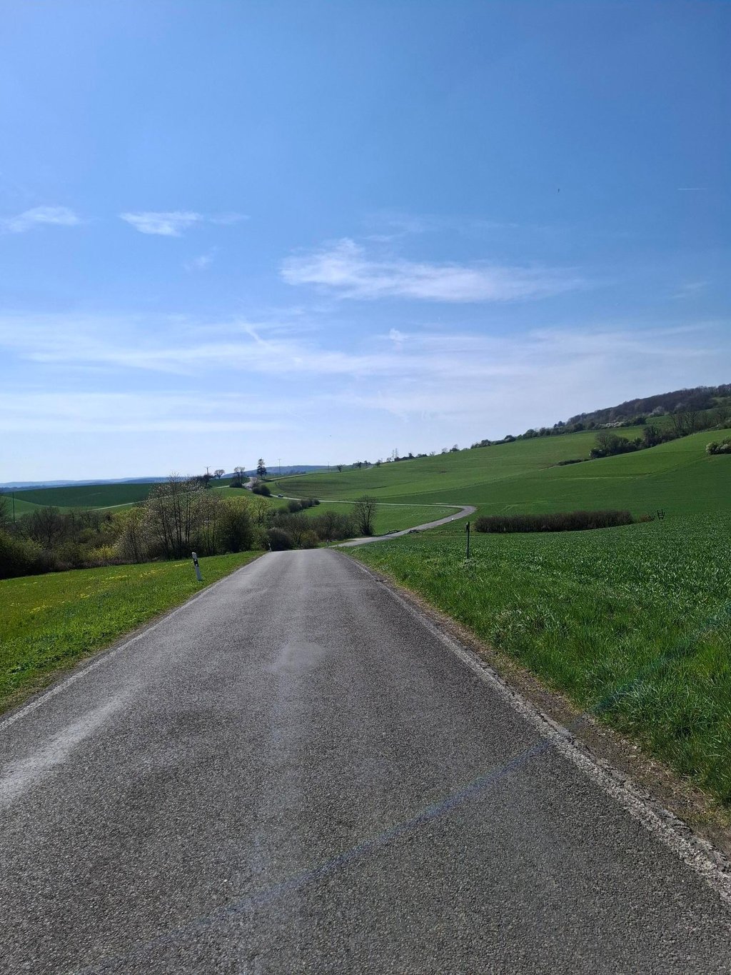
Scenery & Atmosphere
Not the wild mountain scenery here — this is more urban-to-forest climbing. Leaving Euren, you quickly transition from residential roads to a more open view near the top. Once over the crest, you’re rewarded with nice views over the surrounding countryside and vineyards typical of the Trier area.

Video of the climb that I make: https://youtu.be/AmcDQOu2sX4

Eurener Höhe from Euren
Dashboard

Climbing times

5 mph 00:22:57
7 mph 00:16:15
9 mph 00:12:40
12 mph 00:09:31

Road surface condition

0% 100% 0%
Based on 3 votes
Share your knowledge. What was the road condition during your ascent?

Traffic

67% 0% 33%
Based on 3 votes
Your experience counts. How much traffic did you encounter during the climb?

Frequently Asked Questions

Eurener Höhe can be cycled from 2 sides. Eurener Höhe from Euren is the most popular side, but the summit can also be reached via Eurener Höhe from Mesenich.

Eurener Höhe from Euren is a challenging ascent. For this type of climbing, we recommend mountain gearing, specifically a compact system. This means a small front chainring of 34 teeth, combined with a rear cassette where, depending on your level, strength, and experience, you choose a sprocket with 30, 32, or even 34 teeth. Remember that a smooth cadence is always more efficient!

Eurener Höhe from Euren is a 3rd-category climb. Almost anyone can handle this climb, as long as you have a bike with climbing gears. If you have little training, you will probably need to shift down significantly. For experienced riders, Eurener Höhe from Euren is not a problem.

Eurener Höhe from Euren is 1.9 mi long.

The average gradient of Eurener Höhe from Euren is 7.2%.

Eurener Höhe from Euren has a steepest segment with an average gradient of 14.3%.

The summit of Eurener Höhe from Euren is at 1224 ft.

At a slow pace of 5 mph, it takes about 00:22:57 to climb Eurener Höhe from Euren. At 7 mph the time is 00:16:15, and at 9 mph 00:12:40. For the fastest cyclists, 00:09:31 is an achievable time.

Eurener Höhe from Euren is located in the region Rhineland-Palatinate in Germany.

This page is better in the app

Climbfinder app
Climbfinder
(Free)
Open